Tag Archives: TRT

Granite Chief 2026-06 PCT

My second backpack of the mountain season was not for trail maintenance, though I did a bit of winter debris removal. Rather, it was to see what condition the PCT (Pacific Crest Trail) and others were in.

My trip got delayed a bit, so I ended up taking the Amtrak bus rather than California Zephyr, to Truckee, then TART to Tahoe City. A short walk from the Tahoe City Transit Center is the Tahoe City trailhead for the Tahoe Rim Trail (TRT). I headed south on the TRT, through Page Meadows, and up Ward Creek to Stanford Ridge where I camped for the night. The trail to that point has been logged out and is mostly in good condition.

The next day I headed the rest of the way to the crest where the TRT joins the PCT. They are coterminous to the south. There were some snow banks but nothing difficult, and four down trees, moderate winter debris and no brush issues.

I dropped my pack near the junction, and headed south on the PCT to Barker Pass. There are 59 down trees on this section (which I call PCTf, though this is just my terminology, and unrelated to the PCT lettered sections), up to 24 inches diameter but most in the 15 to 18 inch range. Debris light to heavy, some snow patches but none difficult (the wall of snow just south of the wilderness boundary was not difficult, as it is many years). A lot of seasonal creeklets were flowing. Barker Pass Road is now open, and there were a few cars at the Barker Pass trailhead. I passed about 12 people, a few PCT thru hikers and some day hikers.

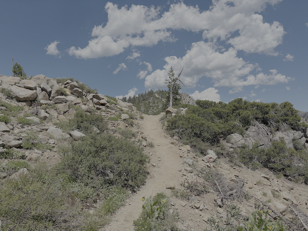
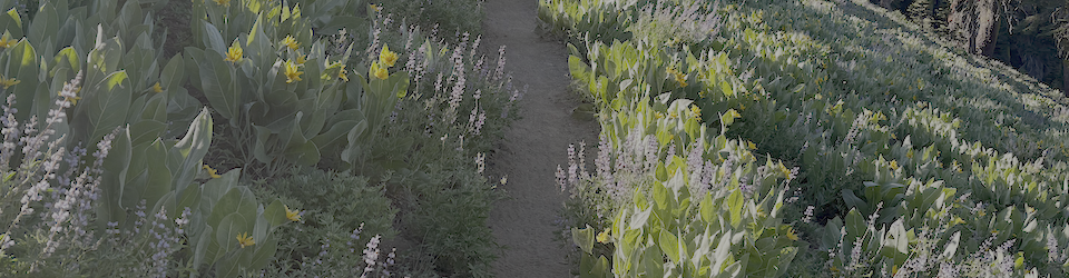
Returning to my pack, I headed north on the PCT. The brushy ridge section north of Twin Peaks is starting to close in but should be OK until next year. This section has the greatest number and diversity of flowers at this time. Safebrush is freeze burned, from not being covered with snow during very cold temperatures, and other plants lesser so. I camped at a small flat beside the trail, one of the few spots on the ridge. In the late afternoon there was warm air coming up out of Bear Pen drainage, from the high temperatures in the foothills and valley, but the wind shifted from the north and that was chilly.
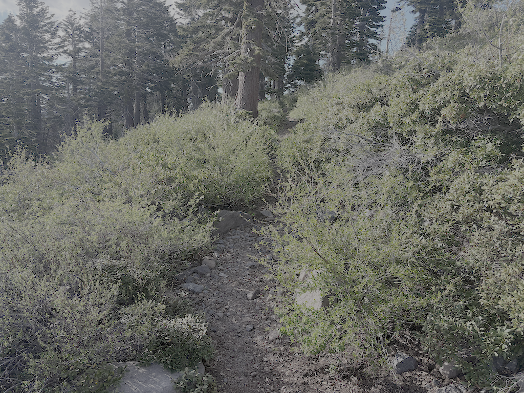
photo of PCT brushy ridge section, starting to be overgrown
PCT brushy ridge section, starting to be overgrown

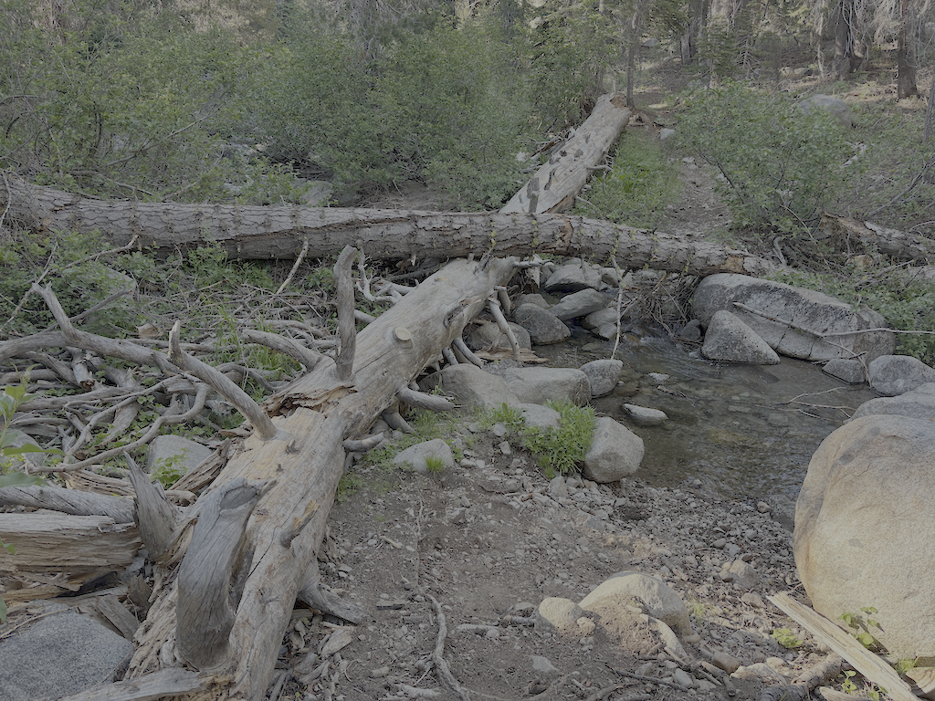
There is only one tree down before the switchbacks down to Five Lakes Creek, but on the lower switchbacks there were 29 trees down, the largest 21 inches. From the Five Lakes Trail to Whiskey Creek Trail, there is one tree down. The Whiskey Creek Trail has 16 down trees, most small. The crossing of Whiskey Creek has been further complicated by two new down trees which caused a log jam and moved the large down tree that had previously made an easy crossing. The creek is low enough for an almost dry jump, but steep banks and alder thickets make that crossing awkward.

Continuing north on the PCT, there are 34 down trees to the ‘Tevis Connector’ (this trail will be renamed but I don’t know what to). It was finally cooler in the upper Whiskey Creek basin, with the gully creek and Whiskey Creek still flowing but low. From there to the Tevis Trail / Western States Trail crossing, 5 down trees. The Middle Fork American River is flowing well.
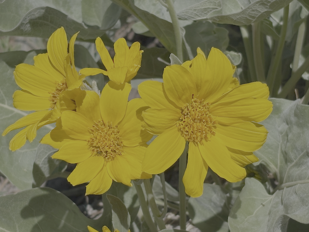
photo of arrowleaf balsamroot flowers
arrowleaf balsamroot flowers

The north slope of the Granite Chief saddle still has snow, but less than many years. The trail can mostly be followed, particularly with close reference to the mapped route. Seven trees down. I camped at the sand flat north of the meadow and Washeshu Creek, good spot for sunset and sunrise.

The next day I headed to the Granite Chief Trail, and then down to Olympic Valley. This trail is maintained by Truckee Trails, and is in good condition.

Overall, the condition of these trails surveyed is poor due to down trees. Brush is mostly OK but will need maintenance next year. Winter debris is mostly moderate, but very heavy in a few places. There are snow patches, but nothing difficult to manage. Creeks and creeklets are flowing well, though creeklets will dry out quickly. It doesn’t look like a great flower year, but that is alway uncertain. Trail use is low so far, but of course the PCT will be heavily used shortly.

Granite Chief 2025-07-12 trail survey

My third trip of the season was intended to be a trail maintenance trip, continuing on the Western States Trail, but I got a day-late start and decided to do another trail survey trip instead.

I walked in from Sunnyside on the road and Tahoe Rim Trail, and camped near the junction of the PCT and TRT. As previously reported, the TRT is in good condition, better than any of the other trails. After a mosquito filled night, I headed south on the PCT to Barker Pass. All of the springs and creeklets in North Fork Blackwood Creek and Blackwood Creek are flowing well. The trail has been logged out (TRTA?) and both brush and winter debris are pretty good. There were a few patches of snow, but nothing hard to cross. Some PCT thru-hikers I passed mentioned that there was a trail angel setup at Barker Pass, so I was envisioning the massive take-over of the trailhead area from two years ago, but fortunately it was small. I headed west on Barker Pass Rd/Forest Road 3 to the Powderhorn Trailhead.

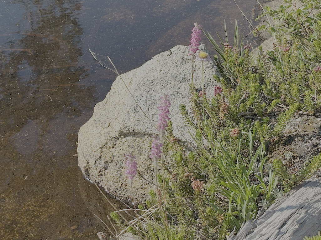
photo of mountain heather
mountain heather

Powderhorn has 16 new down trees, joining the existing ones, for a total of 52. And a lot of winter debris, which surprised me given that I had cleared it last year. It is going to be difficult to keep Powderhorn open and useable over the next few years. Someone horse-mounted chainsawed a few down trees, and established a long but fairly safe bypass (to the creek side) at the slide-under tree. Though chainsaw use in the wilderness is illegal, I can’t fault people for doing this, as the trails would otherwise become unusable with the Forest Service absence of trail maintenance.

In the afternoon I hiked most of the Bear Pen Trail. The sign at the junction is on the ground. There are many down trees, and heavy winter debris in areas. The trail can be followed with a close eye, but a few riparian areas with willow and dogwood were challenging. I had not been on this trail since 2008, and it is not really that much worse than then. It is not much used by anyone. The trail route and distance shown on GaiaGPS maps, which are based on Open Street Map, are incorrect. The distance is not 2.2km, but about 4.4km, until the trail fades in the meadow.

I camped at Five Lakes Creek below Diamond Crossing, one of my favorite camp spots. Heading up Five Lakes Creek Trail north, and counted trees for the first time, using a clicker. 219 from Diamond Crossing to the north junction with Big Spring Trail, and 38 more from there to Whiskey Creek Camp. The tread is deeply eroded in several sections, as there has never been any water control installed on this part. The section between the south and north junctions with Big Spring Trail is now hard to find, and I lost it repeatedly. The few people who use this area seem to be using Big Spring Trail, not Five Lakes Creek Trail. At the junction with Shanks Cove Trail, the sign is on the ground.

Big Spring Trail has 18 down trees, but overall is in acceptable condition, and easy to follow except in one dry meadow where you have to search for it when it goes back into the trees, in either direction. At the crossing of the dry or nearly dry creekbed just above the Big Spring, the trail into the meadow jogs up creek, and if you miss this, you’ll be ankle-deep in the spring marshy area. I hung out in the meadow, another of my favorite places.

The trail crossings of Five Lakes Creek are probably still wet. One could find rock-hop crossings, but you get tangled up in brush and debris piles along the creek, so it is probably easiest to just wade across the creek.

The rest of the trail to Whiskey Creek Camp is somewhat better, probably mostly because it gets more use. I think a lot more people go just to Big Spring Meadow and not south from there, so the trail is more evident. This section of trail could be brought back, unlike the section to the south which is probably a lost cause.

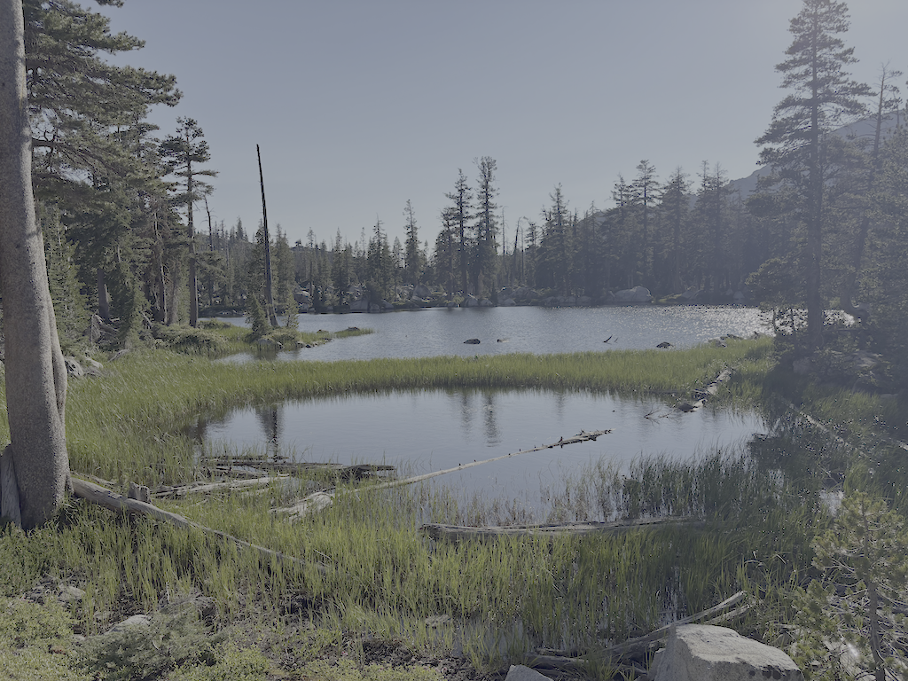
I camped at the cliff edge beyond the Five Lakes (which two are large lakes, the western one of which breaks into two with lower water, and a large number of small ponds), windy, but a nice place to watch the end of one day and the beginning of the next.

photo of Five Lakes second lake
Five Lakes second lake

Next morning out to River Ranch, TART bus to Truckee, morning at Dark Horse Coffee, and Amtrak bus home.

I’ve updated the Trail Conditions page with this survey trip. I am also gradually converting GPS tracks I’ve made over the years to routes, and providing links to them.

The trails I’ve not been on this season are Shanks Cove, Greyhorse, and Hell Hole. Maybe I’ll get there, maybe not, but as always, an invitation to anyone who does to submit a trip and trail conditions report.

Granite Chief 2025-07 WS trail work

Second trip of the season, July 1 to 6, 2025. As always, I got to and from the wilderness using Amtrak train or bus from home in Sacramento, and the TART bus south from Truckee to Tahoe City. No need to drive!

I started at the Western States trailhead on Hwy 89 at the Truckee River bridge. I’m calling this the Western States (Olympic Valley) Trail to distinguish it from the Western States Trail through Picayune Valley. Both parts have the same trail number, 16E10. There is parking on the east side of the bridge, and a sidewalk on the bridge to the west side, where the trail starts. The first part of the trail is very well maintained, by Truckee Trails Foundation, and includes some new signing. As the trail crosses into Palisades Tahoe ski area, the trail is not as well maintained, and there is almost no signing for the trail, making it hard to follow. There were actually more signs when I last hiked it in 2021. Some parts are trail, some parts are on ski area roads. Nevertheless, I made it to Watson Monument on the ridgeline, and then descended to the PCT at the PCT/Tevis Cup Trail/Western States Trail junction.

photo of Western States Trail (Olympic Valley) in Tahoe Palisades
Western States Trail (Olympic Valley) in Tahoe Palisades

I proceeded south on the PCT to Whiskey Creek Trail and then camped near but not at Whiskey Creek Camp. The PCT has not been maintained this year, so has down trees, light to heavy winter debris, and brush in some areas.

The primary purpose of this trip was to do trail maintenance on the Western States Trail. I had done a little last year, and continued, working west from the camp. There were two very thick brush areas, one of whitethorn and aspen, and the other of whitethorn. Whitethorn is much softer at the beginning of the season, but gets harder and sharper as the season goes on. It is not too hard to cut now, but later will exact a revenge in blood. I also cut a number of small down trees. Ten larger ones remain, but now with bypasses or step-overs. I worked as far as the creek crossing, which is a tributary to Five Lakes Creek, and the only water on the the trail before it drops into Picayune Valley. Only 1.4km of progress, but satisfying. I’ll likely continue on Western States next trip. I continue to be very happy with my Silky Big Boy folding saw and Fiskars nippers.

photo of down trees at Whiskey Creek crossing
down trees at Whiskey Creek crossing

After completing as much as I could, I returned to the PCT and headed south, camping on the ridgeline at one of the few flat spots. The tread has a lot of loose rock, particularly from Ward Peak south for a mile, and has some brushy spots. The section where I have spent many trail work trips keeping brushed out is starting to close in again, but should be OK until next year.

At the Tahoe Rim Trail (TRT), I headed out through Ward Creek to the road, and thence to Sunnyside. Lunch at the store, and bus to Tahoe City, for shower, pizza, concert, and sleep.

I have been buying a few things at Alpenglow Sports in Tahoe City. I can get the same, often less expensive, at REI, but since I’m in Tahoe City at the beginning or end of every backpack trip, it is actually more convenient to go there than the Sacramento REI which is in a car-infested part of Sacramento. And they are good, knowledgable people.

Check the Trail Conditions page for specific info on each of the trails that I walked.