Tag Archives: Five Lakes Trail

Granite Chief 2026-06-24 maintenance

My third Granite Chief Wilderness trip was for trail maintenance. My original intent was to work on either the Five Lakes Creek Trail or the Western States Trail, but on my way in, found that the ‘Squaw’ Saddle Trail, PCT-d segment (my term, not related to PCT segments), and Whiskey Creek Trail needed work, so spent my time on those.

‘Squaw’ Saddle Trail (needs to be renamed by apparently has not been renamed by Forest Service) is now in good condition. Open Street Map shows Five Lakes Trail going by the largest lake and then reconnecting with the ‘Squaw’ Saddle Trail, but signing indicates this is not an official trail. I’m calling this ‘Squaw’ Saddle Trail all the way to junction with PCT.

PCT-d, the segment between ‘Squaw’ Saddle Trail and PCT is in good condition except for one down tree that intrudes into the trail but can be stepped around. I did a lot of spot brushing on this trail, as brush was starting to encroach.

Whiskey Creek Trail was a mess. Four down trees remain, one a slide under and three with good bypasses. At the crossing of Whiskey Creek, there is a log jam where the trail once crossed. You can cross below the jam, going down the bank, using a rock hop (at current water level), and then climbing up beside boulders and willows. I removed or modified several down trees.

Five Lakes Trail is maintained by Truckee Trails Foundation, and it is in good condition. It does not maintain the section west of the largest lake, which is no longer an official trail.

Though this work was not my original intent, at least it will be easier and quicker to get to Whiskey Camp next time. One family was camped at the camp on Saturday night, but I saw no one else there. In times past, it was rare that there was not a group, or many groups, at Whiskey Camp, but use seems to have tapered off.

I spend a lot of time pulling creeping honeysuckle or creeping snowberry (Symphoricarpos mollis) out by the roots. The hiker name for this plant is tripwire, as the vines root, creating segments that harden into a black, very strong trip wire. If it crosses the trail and roots, it is a clear hazard to hikers. I have been tripped up a few times, even though I am quite aware of the plant. Cutting the vines simply produces more vines, so taking it out by the roots is the only solution that lasts more than one year. Strangely, I don’t have a photo of the trip wires. The snowberry shrub (Symphoricarpos albus) also has tough stems, but doesn’t grow low to the ground. On the PCT section, huckleberry oak, whitethorn, and sagebrush were the most common plants crowding the trail.

Mosquitos are present, but not abundant. There are probably as many flies, but I did not see the large one with green eyes that bites a chunk out of you.

It rained for a half hour or so on Thursday morning

Sunday morning was a magical cloud day, a great one for lying on the back and making animal shapes of the clouds. It eventually thickened, and there was a smattering of rain on my way out.

creeping snowberry, Steve Matson 2003

Granite Chief 2025-06

My first Sierra backpack of the season! Rode to Truckee on the California Zephyr, and then Olympic Valley on the TART 89 bus. I enjoyed Palisades Tahoe Bluesday, then hit the trail to sleep out. Went up the Granite Chief Trail, which is largely in good condition. I took a side trip north on the PCT to North Fork American River, and then a short way down the Painted Rock Trail. A reader had asked me about that trail, so I wanted to at least know if it was still there and findable. It is, though hard to follow and not used so far this year. I’ve not used that trail in many years, but the challenge was the wet areas with alder and willow thickets where is was hard to follow the trail.

Then headed south on the PCT, I was intending to traverse north to south as a survey trip. But my attention was grabbed by the Tevis Cup Trail reroute, which I’d written about last year in Granite Chief 2024-08 trail survey. There is no evidence of trail crews there this year, and information on Western States Endurance Run indicate that funding was canceled or held as part of the Trump destruction of the Forest Service. I walked the east end, which is more or less as it was last year, though one blast area has been reconstructed. The middle part is a bit more polished than last year, and extends a little further west though a meadow. I had been told last year that the flagging extended all the way west, but I was not able to follow it past a alder and willow riparian area, so it may or may not exist. I gradually descended through open forest and small meadows to rejoin the existing trail near the switchbacks (the nearly-flat switchbacks). I headed out to the trailhead at Forest Hill Divide (as I call it, it doesn’t seem to have an official name) where the Tevis Cup Trail continues west along the ridge, heading eventually to Auburn.

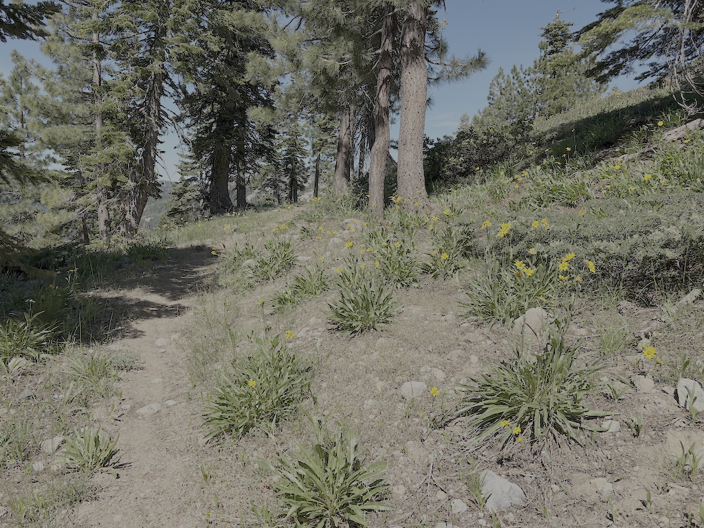
photo of Tevis Cup Trail and flowers
Tevis Cup Trail and flowers

Walked down the Talbot Creek Trail, which was constructed a few years ago, some following an old logging road and some newly constructed. It has a nearly-flat switchback section as well, probably the same designer. The trail is not much used. The southern end trailhead is not marked by any signage, nor is the junction of Forest Road 51 with French Meadows Road, which leads to the trailhead.

After a rest at Talbot Campground, I headed back into the wilderness on the Western States Trail, my favorite trail and location in the wilderness. There are a lot of trees down, joining those already down from previous years. And a lot of winter debris, heavy in some areas. Crossing Middle Fork American River is close to a rock-hop, but still wet. I used a log downstream. The wet areas beyond, particularly in the aspen grove areas, have dense growth that obscures the tread, though your feet can find it, and branches hidden away to trip you. Other than an area on the switchbacks to the saddle, and descending to Whiskey Creek, brush is not bad.

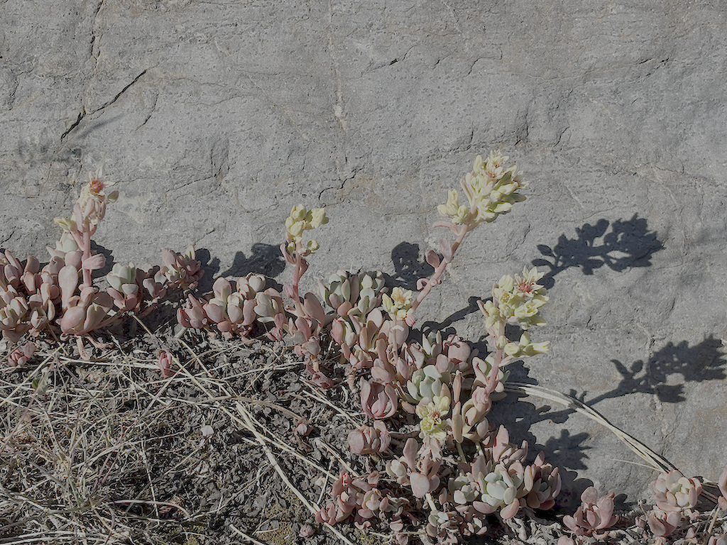
photo of Sierra stonecrop
Sierra stonecrop

I passed a group of eight backpackers headed along the Western States trip from Whiskey Creek, which is about as many as I usually see in a year. The crossing of Whiskey Creek has another tree down, blocking the rock-hop, but the large tree that has been down for several years makes a good crossing. Whiskey Creek Trail has a few rotted down trees, and one new small, otherwise in good condition. I camped north of the ‘Squaw’ Saddle Trail, at the divide between Five Lakes and Olympic Valley. With runners in the area for three events, including the Western States Endurance Run the next day, there were runners all over the place. Most place names have been changed away from ‘squaw’ but I don’t know if the trail name has been. This trail descended into Olympic Valley, and is the original trail route before the Five Lakes Trail was constructed.

Walked out the Five Lakes Trail, which is in good condition, caught the bus to Tahoe City, grabbed some items at Alpenglow Sports, best in the area, then back to Truckee on the TART bus, to Word After Word for a book, to Dark Horse Coffee in Truckee for tea, reading and writing, and then the Amtrak bus home to Sacramento. Whew!

Though plans are never certain, and I often change my mind, I think my next two trips are going to be for trail maintenance on the Western States Trail. Survey trips on the other trails will have to wait. It was hot enough at Talbot Campground/Trailhead, 1722m, that I think my trip on the Hell Hole Trail to the end at 1439m will get delayed until September, though I’m always looking for cooler stretches of weather.