Tag Archives: Five Lakes Creek

Granite Chief Wilderness additions: Steamboat

This is the fourth of a series of posts recommending additions to the Granite Chief Wilderness. The first was Granite Chief Wilderness additions: Barker Creek, the second was Granite Chief Wilderness additions: Blackwood & Ward, the third was Granite Chief Wilderness additions: north area. See the first for background information on the wilderness and the idea of additions.

Steamboat

This area contains some pristine areas that were left out of the original wilderness, but also areas in the Five Lakes Creek watershed that were logged and roaded at one time. It is 1,311 acres.

The area includes upper Steamboat Creek, and upper Buckskin Creek. Though it has been several years since I walked this complex of logging roads, at the time they were all seldom used and rapidly deteriorating. It is probable that stabilization work should be done before inclusion in the wilderness. The north and west boundaries would be the watershed boundary of Five Lakes Creek. This addition, along with the Barker addition, would protect the entire watershed of Five Lakes Creek, critically important to maintaining water quality for the entire watershed. None of these lands should ever be logged again.

It includes the lower part of lower Hell Hole Trail, and the poorly defined route west along the north shore of Hell Hole Reservoir, and east along the north side of Five Lakes Creek. Note that maps do not show the correct location of these trails, and the road along the north and east sides of the reservoir was someone’s imagination – it was never there. The Buckskin Trail, shown on some maps, has not been maintained in over 40 years, and is very hard to follow even for experienced backcountry people. It should not be shown on current maps.

Land ownership is mostly Tahoe National Forest, with some Placer County Water Agency (PCWA), which is the agency that owns and administers Hell Hole Reservoir and associated plumbing.

The map below shows the adjacent designated wilderness and the proposed addition. (pdf) Note that I have not added these proposed additions to my GaiaGPS public maps. After all five posts have been made, along with a summary post, I will add them.
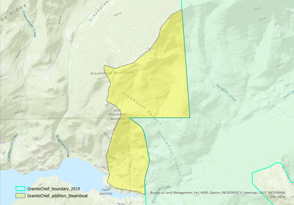
map of Granite Chief Wilderness proposed addition - Steamboat
Granite Chief Wilderness proposed addition – Steamboat

upper Hell Hole Trail 2024-10

Yes, I did one last mountain backpack of the season in October, and no, I didn’t get around to posting until today.

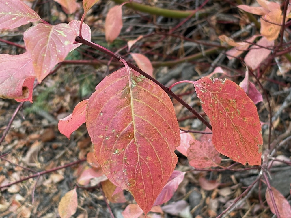
photo of creek dogwood, Cornus sericea
Cornus sericia

I went up on the Amtrak bus, because I’d missed the California Zephyr, TART to Tahoe City, and then walked to Kaspian Campground (TART west shore ends earlier in the day) and slept there (closed after Labor Day). I missed the Zephyr because I was looking over possible trans-Sierra routes that might have been used by a horseback break-off from the Stephens-Townsend-Murphy party in 1844. A person named Bob Crowley is investigating, and it captured my attention. Apparently they ended up on the Middle Fork American on the west side, which reduces likely routes.

Up Blackwood Canyon the cottonwoods were a brilliant yellow. I think Blackwood might be named for these black cottonwoods (Populus trichocarpa). The aspens were beginning to turn, but not bright, and I suspect this will be a mild color year for aspens. Creek dogwoods (Cornus sericea) were pale red to bright red. Forest thinning has been going on all summer and still in Blackwood Canyon, and the buzz of chain saws is constant.

Most creeks are still flowing. I’ve noticed that if a creek makes it through the end of the summer, it will continue, whereas if it does not, it will not recover in the fall. Shorter and cooler days, and lessened evapotranspiration free more water to the creeks.

I crossed Barker Pass and walked to the Powderhorn trailhead, then down Powderhorn to Diamond Crossing. There are some new trees down on Powderhorn since my last trailwork September, and more debris. This will be a constant for years. There was a light dusting of snow in shady areas, from a storm a few days before.

I camped at my common spot along Five Lakes Creek below Diamond Crossing.

I intended to walk the whole Hell Hole Trail to the bottom, but short days and a late start meant that I only did the upper trail, a bit beyond Steamboat Creek. The creek is dry, as it almost always is in the fall; it is an early season creek only in most years. Both forks of Buckskin Creek were flowing, though low. The trail has a lot of debris, which surprised me until I remembered that it had been four years since I’d done work including debris clearing on this trail. There are a few new trees down, and a lot of leaners and spars, which I can take care of next year with a folding saw. It will take at least two trips to clear debris again and the small cutting. Though not as bad as the red fir forest, this forest will continue to need maintenance. There is relatively little brush on this trail, compared to many. As with most trails in the Granite Chief, there is more maintenance by bears and deer than by people.

The black oaks (Quercus kelloggii) fall colors were mostly yellow, but with spots of red and orange. A wonderful time of year at this elevation (1800 m, 5900 feet).

GaiaGPS Gaia Topo layer shows two trails descending to the Rubicon, neither of which are on the alignment of the trail I’ve been maintaining. They may or may not exist, I’ll check on a future trip. Also shown is a road from the current end at Grayhorse Creek all the way around the head of Hell Hole Reservoir. I doubt that it exists, or ever existed, but again, will check it out. All of the ‘trails’ in the Hell Hole area a old non-maintained trails or use routes, except for the trail along the south side of the reservoir to the campground, which has been constructed though not much maintained. Most people access the campground by boat, not trail.

The next day I hike out, same route as in, up Powderhorn, over Barker Pass, down Blackwood Canyon, out to Kaspian Campground. The forecast was for a very cold night that night, particularly in Truckee which is often colder than Tahoe City, so I caught the TART bus and took Greyhound home. The Greyhound is the last bus of the day westbound, after the Amtrak buses.

That’s it for this year! I’ll be back to the Granite Chief in June or July, depending on snow melt.

PCT Richardson to Five Lakes 2023-07

I realized that I never posted on my third trip last season, in early September. My season was interrupted by COVID and smoke, and I never got back up to the mountains. I may or may not get to posting that trip, but here is my first trip of the 2023 season. A late start to the season, in mid-July, but there was still plenty of snow, so it was really early season.

I went in at Sugar Pine Point State Park, which is where the TART west shore bus route ends, and walked up the General Creek Trail. That trail is well maintained to the junction with Lost Lake Trail, but not thereafter. I crossed over to the old road and jeep road which leads up to Richardson Lake. There were quite a number of backpackers at Richardson, PCT thru-hikers I imagine, but I didn’t talk to them. I stayed at Ludlow Cabin because the mosquitos were thick and I would not have gotten to sleep, not having any of my tent with me. Mosquitos have been scarce the last few years of drought, and so I had stopped planning for them, but this year they seem to be back in former numbers.

From Richardson I headed north on the PCT. There are quite a number of down trees and, in places, a considerable amount of winter debris. I waded Miller Creek, as there is no dry crossing at the current water levels. The junction of the PCT with Rubicon jeep trail is now signed well, as it has not been for years. The Bear Creek Lake outlet creek was flowing well, and I waded it because my feet were already wet, but two backpackers managed a rock hop crossing.

There were no vehicles at Barker Pass TH, so I think most hikers have decided the trail north is not open yet. And that is sort of true. From the lake overlook north there are a lot of snow banks along the trail, including a continuous part in the headwaters of North Fork Blackwood Canyon. At the point where the trail crosses a steep north facing slope just before the wilderness boundary, a steep snowbank blocks the trail, but it is easy to head up to the ridge and bypass this. All of the sections of trail north of here in the trees had snow banks. The trail is not hard to follow, but involves a lot of clambering up one side and sliding down the other side of snowbanks.

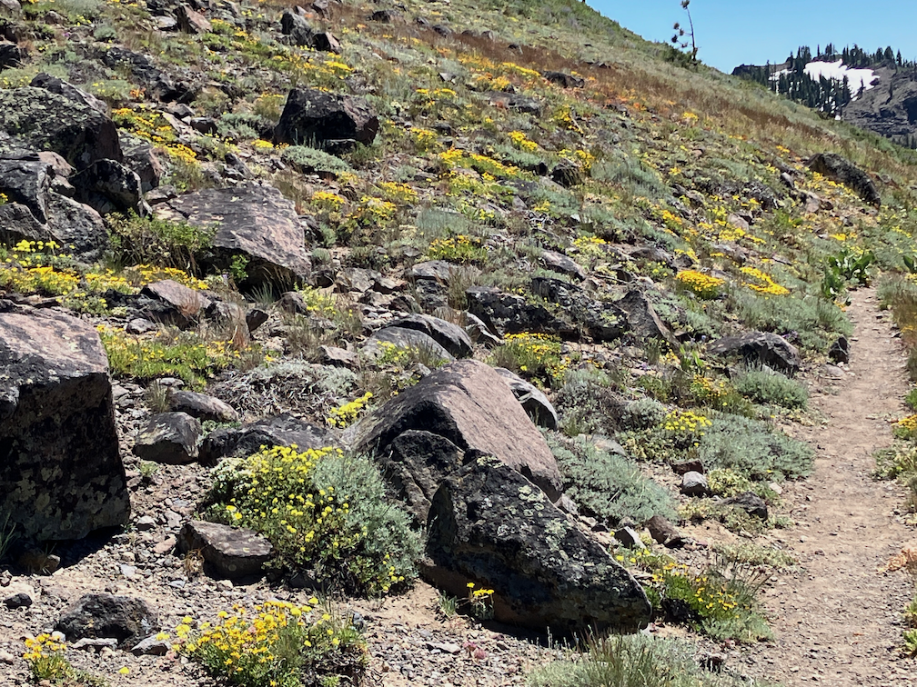
yellow flower hillside, PCT near Ward Peak

The worst part of the day for snow is mid-day, when there is a few inches of slush on top to hard packed snow, impossible to keep footing. Earlier, the snow is hard and steps can be kicked, and late afternoon, it is all slush. Some of the backpackers have step crampons, though those are only useful in the early morning before the slush layer develops, and most of them have hiking poles, which help, but I can tell from the slides down the far sides of snowbanks that these were not keeping everyone from falling. I fell more times on this day than I have fallen in the last ten years, so rather than continuing north on the PCT, I decided to go out at Five Lakes. The north facing switchbacks from Five Lake Creek to the ridge actually had less snow than many other sections, a surprise to me after the snow beforehand.

I camped at Squaw Saddle (so far as I know, this has not been renamed yet, but several other Squaw names such as the peak and creek are now Washeshu), and explored around Five Lakes basin in the morning. The main lake of the Five Lakes basin is full, so the two lakes are one, and the ponds are all full. There are probably about 10 lakes at the moment.

I walked out Five Lakes Trail to Alpine Meadows TH, and then followed the Bear Creek Trail out to near River Ranch. This trail climbs a great deal, but the surroundings and view are good, so worthwhile. From there, bus to Olympic Valley so I could catch music in the evening, slept out near there, and walked the bikeway to Tahoe City. A shower, and pizza and a movie, and slept out again. I caught the last bus on Sunday from Truckee back home to Sacramento, delayed as much as possible to miss the 100 degree days in Sacramento.

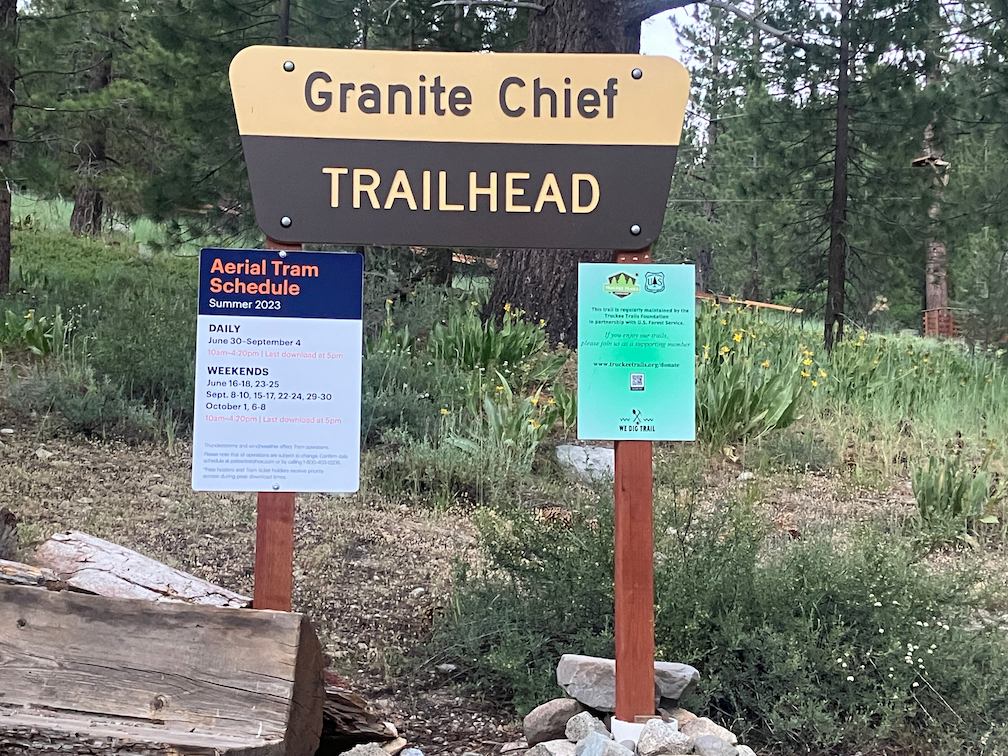
The trailhead for the Granite Chief Trail is no longer beside the fire station, but further up the road where there is a parking lot of the ropes challenge course.

Granite Chief Trailhead, new location and sign

Rubicon & Desolation 2014-08

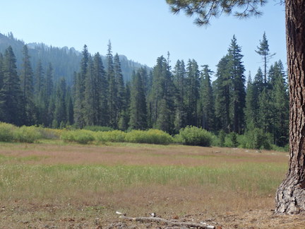
Big Meadow

Big Meadow

I missed posting about a trip last summer, so here it is. I did not notice until I was catching up on posting photos to my Flickr site that I had an entire trip not yet labeled and uploaded. I must have been waiting until the photos were up before I wrote a post, and then forgot about both.

I went in at Alpine Meadows trailhead, walking up from the TART bus on the highway. There had been thunderstorms during the day, but nothing by the time I got in. There were footprints and a few people between the trailhead and Whiskey Creek Camp, but nothing and no one past there. I camped the first night at Big Meadow, always a favorite campsite.

Continue reading →

A lost trip

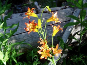
Tiger Lily along Five Lakes Creek

I thought that I’d wrapped everything up this morning, and then this afternoon I was going through photos of other trips to upload them, and discovered set of photos I’d not labeled or uploaded. They were named TRT, but it was actually a much bigger trip, from Donner Summit to Spooner Summit. Once I found the photos, I also found the section of my journal, where I’d taken fairly detailed notes on the trip.

For the Granite Chief Wilderness portion, I came in on the north side from the PCT, went to Whiskey Creek Camp, walked out to the head of Picayune Valley but didn’t go down, explored Five Lakes, went down Five Lakes Creek to Diamond Crossing, and then out Powderhorn Canyon to Barker Pass. I backtracked to Twin Peaks and went out Stanford Rock Trail to Tahoe.

So THIS was my first trip of 2011 into the Granite Chief. Or maybe there are more yet to discover!

photos on Flickr

Powderhorn 2009-09-23

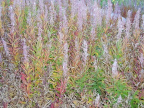
fireweed in fall color

I finally got back into the Granite Chief this week for three days, going in at Powderhorn Trailhead which is just west of Barker Pass. Fall colors are coming, but the aspen trees which are often the brightest are just starting, and the vine maple seems subdued this year, as likely to be pale white or pale yellow as bright yellow. I don’t think there have been any freezes since August, and though the calendar says fall, the days were still summer, quite warm. And the mornings refreshingly cool. I did quite a bit of exploring, checking out Little Powderhorn and Laddie’s Cove, the lower end of the Five Lakes Creek gorge, and the mesa between Powderhorn and Little Powderhorn canyons.

Continue reading →

Powderhorn to Shanks Cove 2008-08-31

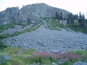
columnar lava “postpile” in Powderhorn Canyon

I had an enjoyable four day backpack from Powderhorn Trailhead, through Powderhorn Valley, to Shanks Cove and Grayhorse Valley to Whiskey Creek Camp and return. I was planning on getting into Picayune Valley, where I’ve not been yet, but lost a day off the trip and couldn’t fit it in. Next time! Continue reading →