This was my last trip of the 2025 Granite Chief backpacking season. I had another trip scheduled for this week, but the snow, and life elsewhere, got in the way.
I did not actually enter the wilderness this trip. Instead, I explored the mesas and rims south of Five Lakes Creek. Every time I head into the wilderness on the Powderhorn Trail, I also think that I should explore the mesas and rims above the wilderness. So this time I did.
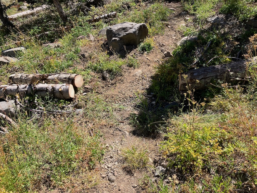
I walked up Barker Pass Rd from Hwy 89, then the 4WD road toward Barker Pass. I slept on a ridge with a clear view of the sky. It must have rained quite a bit in the preceding days, as my sleeping bag was quit wet in the morning. I went the rest of the way to Barker Pass, and then along Forest Road 3 to the Powderhorn trailhead, and up to the saddle, doing some clean-up work on the trail, particularly the dense patch of whitethorn. There is one down tree larger than I could cut that makes the first part of the trail sketchy for hikers and impossible for horses, but one can use the old logging road to the saddle.
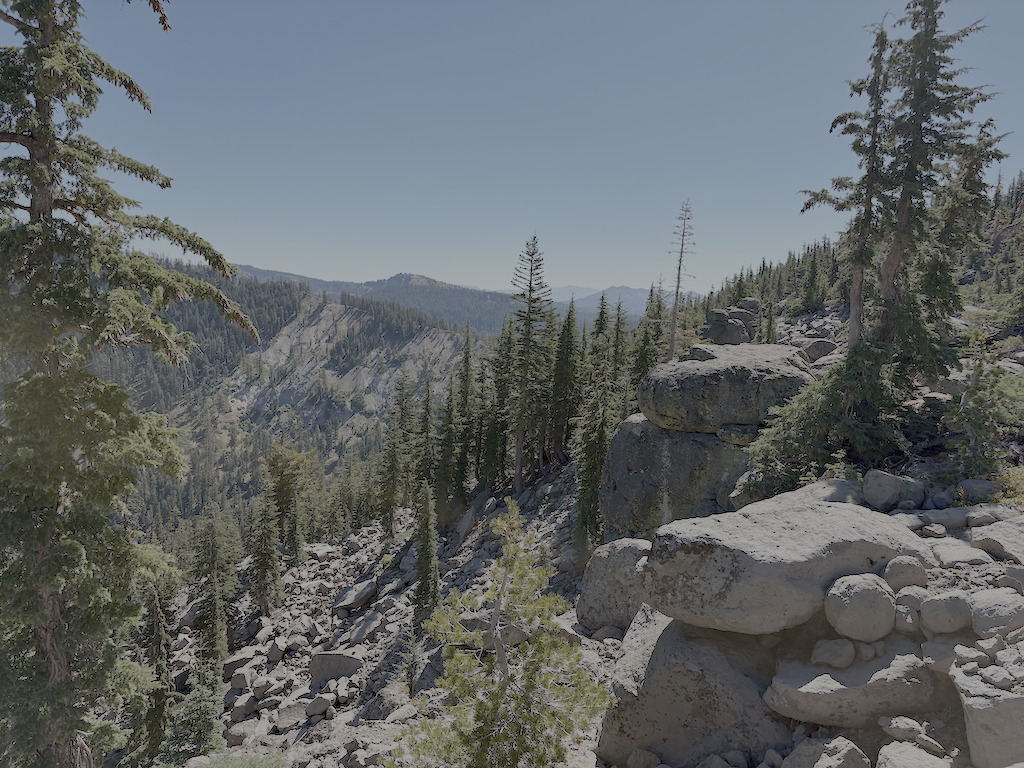
The second night I camped at an overlook to the south, on the old logging road that goes from Powderhorn saddle. Last time I walked this road, it was closed by many large down trees, and I had hopes that it would be closed forever. But the 4WD people apparently have large chain saws. But it doesn’t get much use. The flat area above cliffs had a great view of the night sky. Unfortunately, the morning revealed animal chewing on my almost new backpack, probably a chipmunk. The morning light also highlighted what a deep defile the Rubicon River makes to the south. This is a dry camp, so I gathered water from the unnamed creek that crosses Barker Pass Rd at the end of travel.
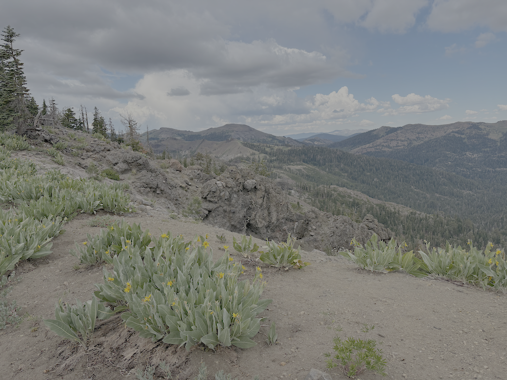
In the morning, I walked out one of the old logging roads, and then along the rim of Powderhorn canyon. The trees on the mesa are mostly mountain hemlock, but also red fir, lodgepole pine, yellow pine, and sparse but huge western white pines. I dropped off that ridge and walked out another logging road, fortunately closed at one point by large boulders, to another view into the canyon, above the postpile section.
Returning to Powderhorn saddle, I did some work on the uppermost trail, mostly cutting conifers that have encroached on the trail, and trimming back manzanita. Some of the conifers are too large to cut, a result of my neglecting to cut them when they were young.
I have been beginning and ending my trips at Dark Horse Coffee in Truckee, waiting for the next TART bus south, and for the next bus or train back home. Good people there, and a nice funky atmosphere. I recommend it!
My seventh trip of the season was a trail survey, to pick up the major trails that I had not yet visited this season.
My first day up in the mountains I went to Bluesday at Palisades Tahoe, then to Tahoe City to sleep. It rained a lot in the afternoon, but tapered off by mid-evening. I went in at Five Lakes Trailhead. It rained and hailed hard on my way down Five Lakes Creek, and I sheltered under some trees for the heaviest part. By late afternoon, it had stopped, and I made camp near Diamond Crossing at a campsite that I often use. A few red clouds at sunset. This campsite is next to Five Lakes Creek, and up against the high ridge on the north side of the creek, so the sun goes away very early, but shows on the canyon rim to the east for quite some while after.
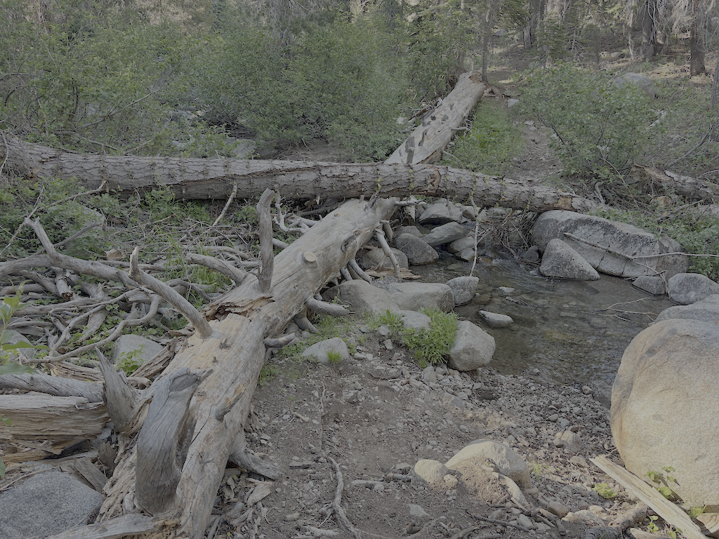
Next day I headed down the Hell Hole Trail, from Diamond Crossing. I last used this trail, as far as Steamboat Creek, last year, but it has been since 2020 going further than Steamboat, and longer since doing any maintenance on the trail. There are more down trees than before, but most noticeable change is the thick layer of winter debris, particularly before Steamboat but throughout. It was hard to see the trail in several locations, and I found myself off the route several times. Steamboat Creek is seasonal, always dry at this time of year. The trail route which I had defined and maintained from Steamboat down to the bottom was still OK in some places, but thick with debris on many, and I lost the route here and there. Having my earlier GPS track helped. I had previously edited the Open Street Map route to combine upper and lower Hell Hole Trail, but realized on this trip that was a mistake. Upper was once maintained, and though hard to follow due to lack of maintenance, it is still accessible to horses. Lower is steeper, narrower, not at all safe for horses, and though it was constructed in a few spots, there are sections that either were not or have disappeared. Though bears are largely responsible for keeping these trails open and visible, they don’t always stay on the ‘official’ trail, and their network of trails can be confusing.
From the bottom of the Hell Hole Trail, I headed west on a trail that traverses along the north side of the reservoir, to a trailhead on the jeep road. Neither end of the trail is signed. The trail was probably constructed when the reservoir drowned the historical trail closer to the Rubicon River, but two short sections were never finished. Greyhorse Creek does not have a bridge, and the crossing is not safe for horses, nor is it safe for anyone during high water. So far as I can tell, the trail was never assigned a trail number or official name.
Greyhorse Creek at trail crossing
With the reservoir way down, as it always is this time of year, I opted to hike across the bottom, much of which was a large meadow before being drowned, to Upper Hell Hole Campground. This developed campsite, with tables, grills, and port-a-potties, is mostly used by people boating in when the reservoir is up.
The next day I walked the ‘other’ Hell Hole Trail (14E02) to Hell Hole Dam. The trail has been logged out this year, though there were two down trees since the log-out, one of which is a mess to get through or bypass. But overall, good condition. There are a number of tipped-over trees with root balls intact (firs tend to snap off above the roots), mostly Jeffery pine but some others, all tipped down canyon. I wonder if there are major wind events blowing down canyon. With the same name, though different number, one might presume that the two Hell Hole Trails connected, but there is no constructed trail between the two. There are a variety of use trails, some fairly easy to follow, others not.
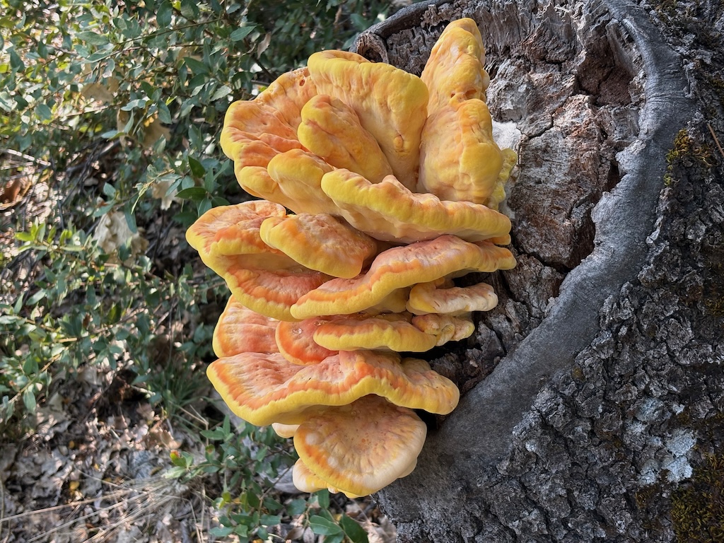
shelf fungus Laetiporus
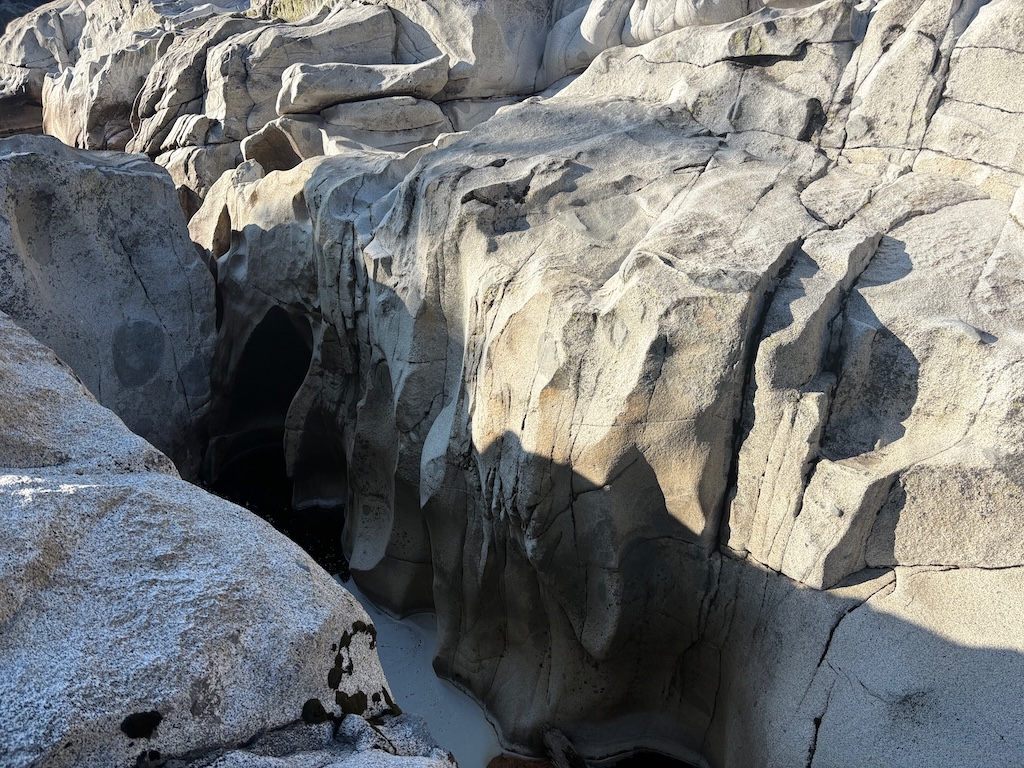
I had already decided to move my next camp up the Rubicon River a ways, and my choice was solidified when a group of jeeps arrived in the campground. I would have guessed that the campground was inaccessible by vehicle, but true jeeps (as in old and the Jeep brand), modified with crawler gears and large tires, can go almost anywhere. I camped on a bluff above the pothole section of the Rubicon, where it drops through several waterfalls and eventually down to the reservoir floor. This is all underwater when the reservoir is up.
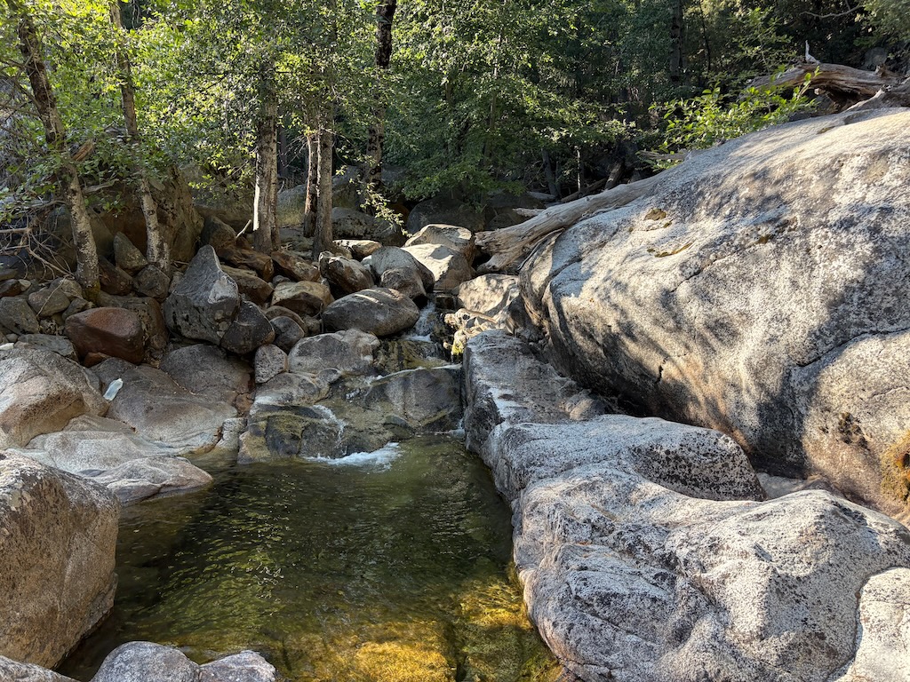
Rubicon River sculpting of granite
Next day, I made my way on use trails to the waterfall on Five Lakes Creek, then along a trail or route that I have partially maintained, and back to the bottom of the Hell Hole Trail. Though nothing like a constructed trail, the route can be followed, except closest to Hell Hole Trail, where I have not been able to find or define a trail through the logged area. This area was helicopter logged.
I headed back up the Hell Hole Trail, able to find it a bit more often for having walked it, and then the Five Lakes Trail, and camped at Big Spring Meadow. There were other campers there. Big Spring Meadow used to be a popular destination for both hikers and horse riders, but has been seldom used the last few years. In part due to the deteriorated trails. Next day, out at Five Lakes Trailhead, hitched a ride to River Ranch, and then again to Truckee, as the TART bus was nowhere to be found.
Note on gear
I have a pair of Altra waterproof mid-height boots. This is my last time every buying waterproof boots. They work fine if water never gets in the top, but once water does, from creek crossings or rain running down legs, they do not dry. My boots were still wet five days after the earlier rainstorms, despite often stopping to try to dry them out. As a result, my feet suffered, severely, rubbed raw in a number of places, painful to walk. Altra trail shoes are the only brand that fits my distorted feet, so I will buy them again, but never waterproof versions.
I have been hiking the last few years in convertible pants, with zip-off legs. I like them, but wanted to try again wearing Patagonia baggie shorts, as I used to do. Much more comfortable hiking. The unmaintained trails on which I spent about half of this trip are not the place to be wearing shorts. Debris kept flipping up and scratching my legs. So, love them baggies, but only for maintained trails.
Note on Hell Hole area trails
The GaiaGPS maps show a 4WD road from Greyhorse Creek to the east and around the Rubicon. This is fabricated. There never was not could be a road here. There is an old road that goes up to a mine prospect, but it is no longer usable. I asked GaiaGPS about this road, and they blamed it on Open Street Map (OSM). It is not and has never been in open street map. It is a relict from some earlier map. Several areas along the Rubicon River were logged, but it was helicopter logging, not road logging.
I have looked for two trails shown parallel to lower Hell Hole Trail, 15E17 and 15E18, but have not found them. I think they were entered by someone sitting at a desk, not from someone in the field.
Though GaiaGPS claims that they load from OSM, thereby correcting these errors, this is a lie. Apparently they add new data from OSM without removing old data. So fabrications and relicts remain, year after year after year. The Buckskin Trail, two branches off of Hell Hole Trail, are another example. Not in OSM in years, and not followable on the ground, yet it remains on GaiaGPS maps. GaiaGPS has always had some problems, but since it was acquired by Outside, it has really gone downhill. So to speak.
For the trails I have created in GaiaGPS, trails that are or were recently maintained are shown in red. Trails that may have been constructed, but have not been maintained in a long while and may be difficult to follow are orange. Use routes, never constructed, and of various ease of use and visibility, are yellow.
I have a thought that someday I’ll figure out all the trails and routes in the Hell Hole and Rubicon River area, and map them correctly. I’m probably fooling myself.
My sixth trip of the season was for trail work and trail survey.
Five Lakes Creek Trail
I completed trail work on the Five Lakes Creek Trail, from the creeklet crossing where I’d stopped last trip, to the Five Lakes Creek Trail & Big Spring Trail north junction, and then on the Big Springs Trail down to the crossing of Five Lakes Creek. There remain about 14 down trees, too big for me to cut, but I created either good climb-overs or bypasses, and in one case, a duck-under of a hanging tree. Also removed winter debris and brushed several sections, though there was less debris and brush on this second part. The trail on the west side of the crossing of Five Lakes Creek was brushed in with alder and willow, and I cleared that. At current creek levels, there is a rock-hop crossing, but at higher levels one must go upstream or downstream, which means fighting alder thickets. I was expecting the work to take two days, but it only took one, so I had a free day, and used it to re-survey the Western States Trail in Olympic Valley.
Western States Trail (Olympic Valley)
I realized after looking at my old trail track for the Western States Trail, that I had been off-route for much of my survey trip in early June. So I backpacked from Whiskey Creek where I’d camped north on the PCT, and then the Western States Trail to Watson Monument on the ridge above Olympic Valley. From that point, the trail goes south a short distance along the ridge, and then down a trail across the ski area. None of these upper trails are signed, including where it uses a short distance of road. The trail stays as high along the north-facing slope of the valley as is possible. I have no idea where the original, historic Western States trail went, if it was even in the Olympic Valley at all, but the existing designated trail is quite nice, and avoids as much of the ski area infrastructure as it can. Before Alterra bought ‘Squaw’, the old Ski Corp groomed slopes with bulldozers and dynamite, built roads wherever a bulldozer could, and maximized disturbance of the natural environment. It was a terrible company. Alterra is not perfect, but it is far better.
Where the trail crosses ski area roads, of which there are an abundance, it is usually not signed at all. There are signs, here and there, but not at every crossing or junction, and they are often not obvious, sometimes small signs high up in trees, or very old wood signs. Every time you get to a trail junction or road crossing, it is worth pausing and orienting, or you will likely end up on the wrong route.
The most confusing location, for me, was where the correct trail stays high under a cliff, and does not descend on the more used and obvious trails. On my GaiaGPS maps, I’ve marked this waypoint as ‘Jct WS stay high’. A side trail, from the marked junction ‘Jct WS access’ is signed as Western States Trail, but it is not.
When I got above Palisades Tahoe village, I broke off the trail and descended to the village, for Friday music and some rest. I was tired! The remained of the trail east to the trailhead on Hwy 89 is correct and not very confusing. And better maintained.
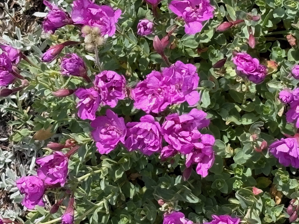
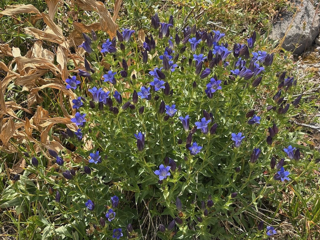
So, is this trail worth the challenge of following? Absolutely. The north-facing slope of the valley is sometimes bare rock or scree slopes, but it is also host to beautiful flower fields and clusters of trees. There are whole fields of brilliant pink rock fringe (Epilobium obcordatum, Onagraceae), which are fairly rare in this part of the Sierra crest. Gentian, probably explorer’s gentian (Gentiana calycosa, Gentianaceae), with its bright blue flowers is common, and again rare in this part of the crest.
There is only one water source along this entire trail, at this time of year, a spring that may or may not be year-round. When I passed it, a dog was luxuriating in the cool shallow water, so I passed it up as a water source. Earlier in the year, there are many creeklets that cross the trail.
GaiaGPS and Open Street Map
Part way through my effort to make sure I had an accurate route for the Western States Trail through Olympic Valley, I realized why I was having a hard time. GaiaGPS has mis-labeled other trails as the Western States Trail, though they are not.
Which led to a closer look at GaiaGPS. The company, now owned by Outside, claims that they update from Open Street Map (OSM) on a regular basis, and if there are errors that have been corrected in OSM, they will be corrected in GaiaGPS. This is false. There are trails in GaiaGPS that have not been in OSM in years, if ever. I’m sure some of the trails are remnants from Forest Service maps, which include mistakes 20 or more years old. It may be that new information is added, but old, incorrect information is not deleted. Though I selected GaiaGPS over a number of other field mapping apps, years ago now, I’m becoming increasingly unhappy with it. Since it was bought by Outside, it has noticeable deteriorated.
I’m at work correctly labeling the Western States Trail (Olympic Valley) in OSM, but it is going slowly because I have a lot to learn about OSM and how to make edits. When I get the segments right, I’ll combine them into what is called a ‘relation’, for the whole trail from the trailhead on Hwy 89 to the junction with the Pacific Crest Trail.
My fifth trip of the season was primarily for trail work. As I do when I can, I attended Palisades Tahoe Bluesday on Tuesday evening, camped out on the Granite Chief Trail, and next morning headed up the trail, south on the PCT, and into the wilderness. I’ve been walking a lot on the PCT, and have ignored the needed trail maintenance. I realized that I don’t consider it my responsibility any more. There are plenty of other trails that no one else would work, and the PCT should really be maintained by people who have done the PCT, to give back to the trail that provided them their experience. The wave of PCT thru hikers has passed, but a few are still struggling northward.
Wooley Mules Ears are starting to yellow- and brown-out for the fall, while the less common Arrowleaf Balsamroot turns a brighter yellow. Here and there are touches of fall color.
I checked out the route to Little Needle Lake and basin. This trail was partly maintained and heavily used by the CCC trail crew last summer, so is now easy to follow. The junction with PCT is just south of the Middle Fork Trail junction, and is not obvious. It is not an official trail, so probably won’t ever have a trail sign. Passing the Whiskey Creek meadow, a blond and brown black bear was tearing up a dead log, apparently finding morsels to eat, but ran off when it noticed me. I’ve seen quite a number of grouse, and some quail, in addition to the ubiquitous juncos.
I camped at Whiskey Creek camp. Two other backpackers were in, using my favorite camp site. I talked a while with them, and noted that this area used to get a lot more use. I would almost always see families camped there on weekends, and others during the week. No more.
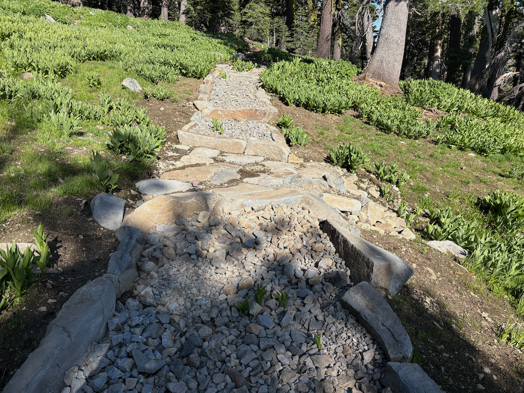
I spent the next two days working on the Five Lakes Creek Trail, south from Whiskey Creek. I brushed, removed winter debris, defined bypasses or climb-overs of large down trees, and cut a few smaller down trees and leaners. I did 1.4km, to the creeklet crossing, about 2/3 of the way to the Big Spring trail junction. My objective was to the junction, but the work was slow, particularly working snowberry which has to be taken out by the roots to keep it from bushing out the next year and blocking the trail, and gooseberry with its sharp prickles on stems and seeds. Whitethorn is past its gentle early summer phase and extract blood. The photo below is approaching the creeklet crossing. Doesn’t look like much, but it was an impenetrable thicket of alder and yearly growth before.
cleared Five Lakes Creek Trail creeklet crossing
A dirt bike has been ridden on the Five Lakes Creek Trail, damaging the trail tread and scarring some meadow areas. I don’t know who this is, it has happened at times I’m not in the wilderness. It may have even been a Forest Service person, as there are rogue employees who do this sort of thing. I was a wilderness ranger for years, and this deeply offends me. If I ever catch them, there will be hell to pay. The linear tracks of a dirt bike become conduits for water erosion during thunderstorms and snow melt.
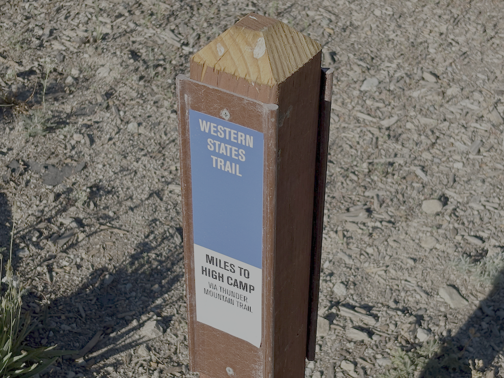
I camped at ‘Squaw’ Saddle above the ‘Squaw’ Saddle Trail, overlooking Olympic Valley so I had cell phone reception to prepare for a Saturday Zoom meeting. I decided to go out through Olympic Valley to avoid walking Alpine Meadows Road from the Five Lakes Trailhead to the bus stop at River Ranch. In the morning, I followed the old ‘Squaw’ Saddle Trail down the hill. It is steep and severely eroded most of the way down to the Western States (Olympic Valley) Trail, but that trail is in good condition. I realized that on my 2025-07-01 trip, I veered off the Western States Trail, missed a trail junction, so my description of the upper part of that trail is in error. Once on the trail, I began to remember having walked this section years before. It is still not signed, but is clearly the correct trail. My route on GaiaGPS is correct, more or less. Ironically, the one Western States Trail sign provided by the ski area is incorrect, it is NOT on the WS Trail, but on an access trail to the WS. Shown below.
I have surveyed all the significant trails of the wilderness this season, except Hell Hole Trail and the related complex of paths at the bottom of the Hell Hole Trail, along Five Lakes Creek and the Rubicon River. This survey awaits a stretch of cooler weather. It was uncomfortably warm along the Five Lakes Creek Trail, 600 meters higher than Hell Hole.
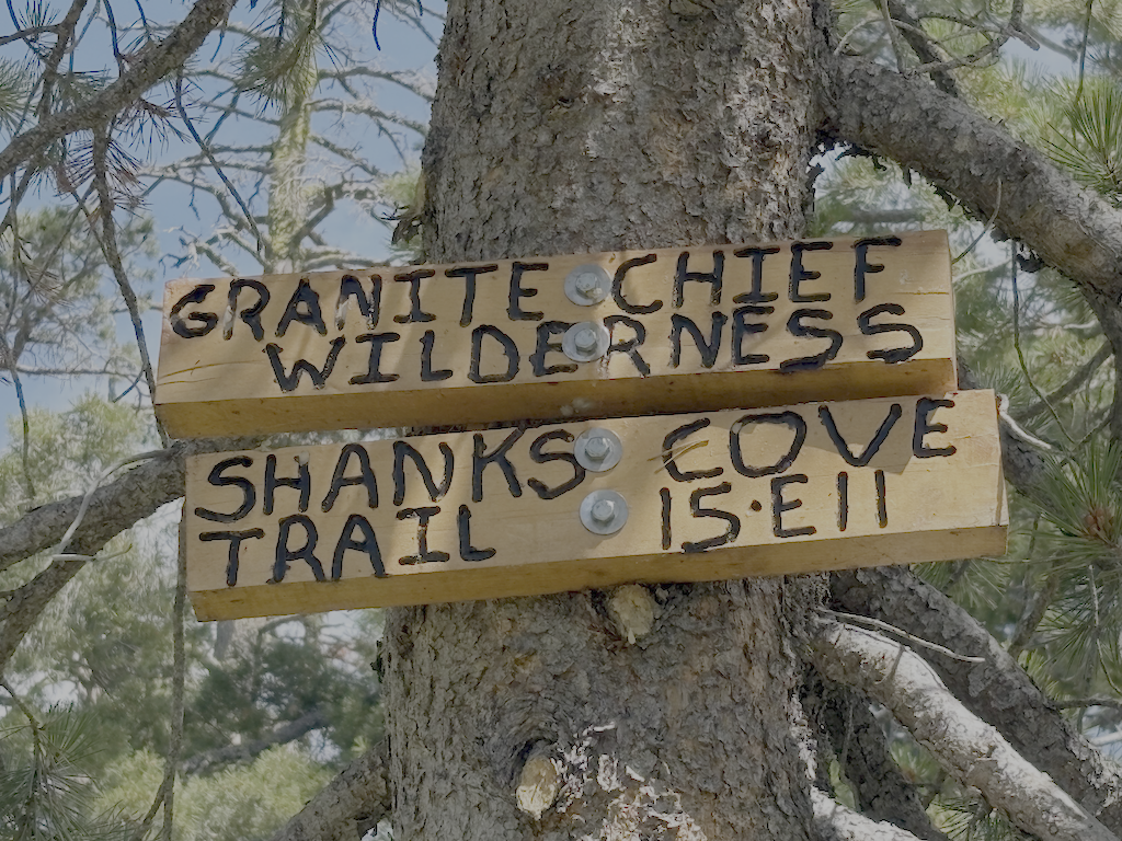
My fourth Granite Chief trip of the season was a trail condition survey, and then work with a trail reroute group. I surveyed three of the trails which I had not done this season, the Greyhorse Trail and Shanks Cove Trail. And then joined a Western States Endurance Run trail work crew working on the Tevis Cup reroute.
I entered the wilderness from Five Lakes Trailhead (formerly Alpine Meadows Trailhead) and camped at Whiskey Creek Camp. Heading down Five Lakes Creek Trail the next day, I was able to follow the trail from north Big Spring Trail to Shanks Cove Trail, which I’d lost on my previous trip. 38 down trees, and heavy debris in many areas, but the trail can be followed with a close eye.
The southern leg of the Shanks Cove Trail, from the Five Lakes Creek Trail to the junction with Greyhorse Trail on the ridge, has not been maintained since 2009, and it shows. Many, many down trees, dating from those 16 years. Since the trail is seldom used, the lower crossing of Shanks Cove Creek is completely filled in with alder and willow, so you’ll have to find your own way. Across the creek is a deep pile of down trees and debris, obscuring the trail. It is hard to find where it starts up the rocky slope through brush, but once found, is not hard to follow. After the upper crossing of the creek, the trail climbs up the headwall to the ridge, sometimes steeply and sometimes switchbacks. Again, many down trees and areas of heavy debris. At the top of the ridge, the junction with Greyhorse Trail is signed and obvious. Enjoy the views!
I descended the Greyhorse Trail to the trailhead, which seems to have been renamed the Shanks Cove Trailhead. The trail is not too hard to follow, no worse then when I last walked it in 2008. About one-third of the down trees have been chainsawed. I’ve come to terms with accepting chain sawing by private individuals since the Forest Service has long given up on trail maintenance, but it looks as though the person who cut was riding a dirt bike, sometimes on the trail and sometimes off. More about chain saw use in a future post. The official trailhead signing is gone, but there is a user-made trailhead sign. I think the trail name is still Greyhorse, and the number 15E13, but the trailhead has apparently been renamed to Shanks Cove Trailhead on the Forest Service and other maps.
Back on the ridge, I headed on the north leg of the Shanks Cove Trail, going to the Western States Trail. There are a few down trees on the ridge, but other than one stretch through a dry meadow where the trail starts to head off the side of the ridge, easy to follow. And great views into Picayune Valley. The trail down across the volcanic bedrock is sketchy but acceptable. It drops steeply down a gully to the valley where an early season creek runs. Then up the other side, though down trees and brush fields, but the trail can be followed with care.
view east from Shanks Cove Trail north section
I walked back on Western States to Whiskey Creek Camp, and slept. A long day, 27km on unmaintained trails.
The next day I went up Whiskey Creek Trail and north along the PCT. Sadly, there were bicycles ridden on the PCT the day before. At the junction with what I formerly called the Tevis Connector, and am for now calling the Middle Fork Trail, I headed down to the dry meadow beside Middle Fork American River, and set camp. With time left in the day, I explored the Tevis Cup reroute. The Middle Fork trail was worked last year and is in good condition, with two down trees. Where is meets the existing Tevis Cup Trail, there is no sign, just some ribbon. When the reroute is complete, the Middle Fork Trail will follow the old trail eastward, to a completed but hidden switchback to connect to the reroute.
I walked west on the reroute to the end of work, where the Great Basin Institute (GBI) trail crew was building switchbacks down through a mules ear meadow to eventual connection with the old Tevis Cup Trail, west of the difficult riparian and bog areas. My thought was that the Forest Service had given up on ever completing the full reroute, and was connecting to the old trail short of that, but got clarification from the WSER leaders on Saturday.
WSER Tevis Cup Reroute Project
I had signed up for a trail crew session with the Western State Endurance Run (WSER) organization. This is the lead private organization working on the reroute. I met the group of 14 at the PCT-Tevis Cup junction, and went to the work site, which is primarily the rock causeway through a wet area. Photo below, from an earlier trip. I worked on a pan through to carry a tiny creeklet, which turned out to be just the surface part of a considerable below-ground flow. A muddy mess, but the pan was build, and the beginning of the causeway extension beyond. Early afternoon the thunder boomed, it got very dark, and it rained and hailed for about two hours. The work crew set tents on tiny pieces of flat ground and waited it out, but my tent was on the Middle Fork, so I head back there. The sun came out, and I had four hours of sun to dry things, and the crew got more work done. Next morning I headed up to rejoin them and continued the work. Most of the crew was finding large rocks for the causeway, breaking up rocks into small pieces to fill the causeway and gaps, and sawing logs along the trail.
In the middle afternoon we hiked east on the unfinished reroute, then up to Watson Monument, down to High Camp, rode the tram down to the village, and ate dinner together.
I quite enjoyed working with this group of people. I had last worked with a trail crew on the Tahoe Rim Trail, about 15 years ago, and was nervous about working with people instead of by myself, but the group was welcoming and fun. They are all runners, both on the Western State and other runs, so they live in a different world than I, but are good people, and the crew supervisors were great, low key but with high expectations.
Some info about the reroute:
A Forest Service crew has drilled both the roughly blasted area at the east end of the reroute and many other spots to the west, and will blast sometime this season.
There will be two trails, the switchbacks down to the old trail, being worked by GBI, will be the horse route. The hope is that it will be complete for use next year.
A runner reroute will stay high all the way to Lyon Saddle, where Road 51 comes up to a trailhead. I formerly called this Foresthill Saddle, and it is on Foresthill Divide, but Lyon Saddle makes much more sense. It will take at least two more years to complete the runner route.
California Conservation Corps is not working this year, which will slow down the project.
When the reroute is complete, the trails may receive different names, hopefully less confusing.
My third trip of the season was intended to be a trail maintenance trip, continuing on the Western States Trail, but I got a day-late start and decided to do another trail survey trip instead.
I walked in from Sunnyside on the road and Tahoe Rim Trail, and camped near the junction of the PCT and TRT. As previously reported, the TRT is in good condition, better than any of the other trails. After a mosquito filled night, I headed south on the PCT to Barker Pass. All of the springs and creeklets in North Fork Blackwood Creek and Blackwood Creek are flowing well. The trail has been logged out (TRTA?) and both brush and winter debris are pretty good. There were a few patches of snow, but nothing hard to cross. Some PCT thru-hikers I passed mentioned that there was a trail angel setup at Barker Pass, so I was envisioning the massive take-over of the trailhead area from two years ago, but fortunately it was small. I headed west on Barker Pass Rd/Forest Road 3 to the Powderhorn Trailhead.
mountain heather
Powderhorn has 16 new down trees, joining the existing ones, for a total of 52. And a lot of winter debris, which surprised me given that I had cleared it last year. It is going to be difficult to keep Powderhorn open and useable over the next few years. Someone horse-mounted chainsawed a few down trees, and established a long but fairly safe bypass (to the creek side) at the slide-under tree. Though chainsaw use in the wilderness is illegal, I can’t fault people for doing this, as the trails would otherwise become unusable with the Forest Service absence of trail maintenance.
In the afternoon I hiked most of the Bear Pen Trail. The sign at the junction is on the ground. There are many down trees, and heavy winter debris in areas. The trail can be followed with a close eye, but a few riparian areas with willow and dogwood were challenging. I had not been on this trail since 2008, and it is not really that much worse than then. It is not much used by anyone. The trail route and distance shown on GaiaGPS maps, which are based on Open Street Map, are incorrect. The distance is not 2.2km, but about 4.4km, until the trail fades in the meadow.
I camped at Five Lakes Creek below Diamond Crossing, one of my favorite camp spots. Heading up Five Lakes Creek Trail north, and counted trees for the first time, using a clicker. 219 from Diamond Crossing to the north junction with Big Spring Trail, and 38 more from there to Whiskey Creek Camp. The tread is deeply eroded in several sections, as there has never been any water control installed on this part. The section between the south and north junctions with Big Spring Trail is now hard to find, and I lost it repeatedly. The few people who use this area seem to be using Big Spring Trail, not Five Lakes Creek Trail. At the junction with Shanks Cove Trail, the sign is on the ground.
Big Spring Trail has 18 down trees, but overall is in acceptable condition, and easy to follow except in one dry meadow where you have to search for it when it goes back into the trees, in either direction. At the crossing of the dry or nearly dry creekbed just above the Big Spring, the trail into the meadow jogs up creek, and if you miss this, you’ll be ankle-deep in the spring marshy area. I hung out in the meadow, another of my favorite places.
The trail crossings of Five Lakes Creek are probably still wet. One could find rock-hop crossings, but you get tangled up in brush and debris piles along the creek, so it is probably easiest to just wade across the creek.
The rest of the trail to Whiskey Creek Camp is somewhat better, probably mostly because it gets more use. I think a lot more people go just to Big Spring Meadow and not south from there, so the trail is more evident. This section of trail could be brought back, unlike the section to the south which is probably a lost cause.
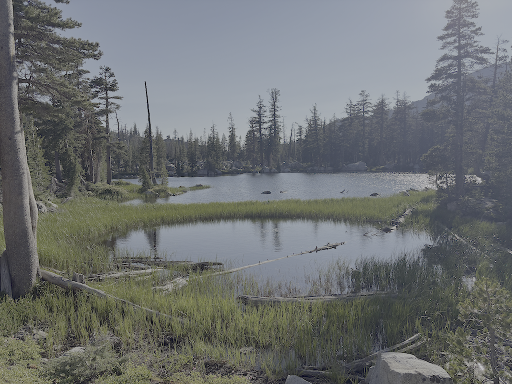
I camped at the cliff edge beyond the Five Lakes (which two are large lakes, the western one of which breaks into two with lower water, and a large number of small ponds), windy, but a nice place to watch the end of one day and the beginning of the next.
Five Lakes second lake
Next morning out to River Ranch, TART bus to Truckee, morning at Dark Horse Coffee, and Amtrak bus home.
I’ve updated the Trail Conditions page with this survey trip. I am also gradually converting GPS tracks I’ve made over the years to routes, and providing links to them.
The trails I’ve not been on this season are Shanks Cove, Greyhorse, and Hell Hole. Maybe I’ll get there, maybe not, but as always, an invitation to anyone who does to submit a trip and trail conditions report.
Second trip of the season, July 1 to 6, 2025. As always, I got to and from the wilderness using Amtrak train or bus from home in Sacramento, and the TART bus south from Truckee to Tahoe City. No need to drive!
I started at the Western States trailhead on Hwy 89 at the Truckee River bridge. I’m calling this the Western States (Olympic Valley) Trail to distinguish it from the Western States Trail through Picayune Valley. Both parts have the same trail number, 16E10. There is parking on the east side of the bridge, and a sidewalk on the bridge to the west side, where the trail starts. The first part of the trail is very well maintained, by Truckee Trails Foundation, and includes some new signing. As the trail crosses into Palisades Tahoe ski area, the trail is not as well maintained, and there is almost no signing for the trail, making it hard to follow. There were actually more signs when I last hiked it in 2021. Some parts are trail, some parts are on ski area roads. Nevertheless, I made it to Watson Monument on the ridgeline, and then descended to the PCT at the PCT/Tevis Cup Trail/Western States Trail junction.
Western States Trail (Olympic Valley) in Tahoe Palisades
I proceeded south on the PCT to Whiskey Creek Trail and then camped near but not at Whiskey Creek Camp. The PCT has not been maintained this year, so has down trees, light to heavy winter debris, and brush in some areas.
The primary purpose of this trip was to do trail maintenance on the Western States Trail. I had done a little last year, and continued, working west from the camp. There were two very thick brush areas, one of whitethorn and aspen, and the other of whitethorn. Whitethorn is much softer at the beginning of the season, but gets harder and sharper as the season goes on. It is not too hard to cut now, but later will exact a revenge in blood. I also cut a number of small down trees. Ten larger ones remain, but now with bypasses or step-overs. I worked as far as the creek crossing, which is a tributary to Five Lakes Creek, and the only water on the the trail before it drops into Picayune Valley. Only 1.4km of progress, but satisfying. I’ll likely continue on Western States next trip. I continue to be very happy with my Silky Big Boy folding saw and Fiskars nippers.
down trees at Whiskey Creek crossing
After completing as much as I could, I returned to the PCT and headed south, camping on the ridgeline at one of the few flat spots. The tread has a lot of loose rock, particularly from Ward Peak south for a mile, and has some brushy spots. The section where I have spent many trail work trips keeping brushed out is starting to close in again, but should be OK until next year.
At the Tahoe Rim Trail (TRT), I headed out through Ward Creek to the road, and thence to Sunnyside. Lunch at the store, and bus to Tahoe City, for shower, pizza, concert, and sleep.
I have been buying a few things at Alpenglow Sports in Tahoe City. I can get the same, often less expensive, at REI, but since I’m in Tahoe City at the beginning or end of every backpack trip, it is actually more convenient to go there than the Sacramento REI which is in a car-infested part of Sacramento. And they are good, knowledgable people.
Check the Trail Conditions page for specific info on each of the trails that I walked.
My first Sierra backpack of the season! Rode to Truckee on the California Zephyr, and then Olympic Valley on the TART 89 bus. I enjoyed Palisades Tahoe Bluesday, then hit the trail to sleep out. Went up the Granite Chief Trail, which is largely in good condition. I took a side trip north on the PCT to North Fork American River, and then a short way down the Painted Rock Trail. A reader had asked me about that trail, so I wanted to at least know if it was still there and findable. It is, though hard to follow and not used so far this year. I’ve not used that trail in many years, but the challenge was the wet areas with alder and willow thickets where is was hard to follow the trail.
Then headed south on the PCT, I was intending to traverse north to south as a survey trip. But my attention was grabbed by the Tevis Cup Trail reroute, which I’d written about last year in Granite Chief 2024-08 trail survey. There is no evidence of trail crews there this year, and information on Western States Endurance Run indicate that funding was canceled or held as part of the Trump destruction of the Forest Service. I walked the east end, which is more or less as it was last year, though one blast area has been reconstructed. The middle part is a bit more polished than last year, and extends a little further west though a meadow. I had been told last year that the flagging extended all the way west, but I was not able to follow it past a alder and willow riparian area, so it may or may not exist. I gradually descended through open forest and small meadows to rejoin the existing trail near the switchbacks (the nearly-flat switchbacks). I headed out to the trailhead at Forest Hill Divide (as I call it, it doesn’t seem to have an official name) where the Tevis Cup Trail continues west along the ridge, heading eventually to Auburn.
Tevis Cup Trail and flowers
Walked down the Talbot Creek Trail, which was constructed a few years ago, some following an old logging road and some newly constructed. It has a nearly-flat switchback section as well, probably the same designer. The trail is not much used. The southern end trailhead is not marked by any signage, nor is the junction of Forest Road 51 with French Meadows Road, which leads to the trailhead.
After a rest at Talbot Campground, I headed back into the wilderness on the Western States Trail, my favorite trail and location in the wilderness. There are a lot of trees down, joining those already down from previous years. And a lot of winter debris, heavy in some areas. Crossing Middle Fork American River is close to a rock-hop, but still wet. I used a log downstream. The wet areas beyond, particularly in the aspen grove areas, have dense growth that obscures the tread, though your feet can find it, and branches hidden away to trip you. Other than an area on the switchbacks to the saddle, and descending to Whiskey Creek, brush is not bad.
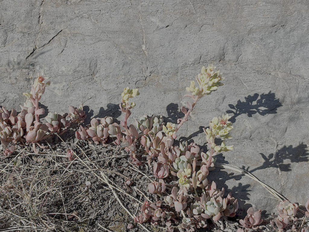
Sierra stonecrop
I passed a group of eight backpackers headed along the Western States trip from Whiskey Creek, which is about as many as I usually see in a year. The crossing of Whiskey Creek has another tree down, blocking the rock-hop, but the large tree that has been down for several years makes a good crossing. Whiskey Creek Trail has a few rotted down trees, and one new small, otherwise in good condition. I camped north of the ‘Squaw’ Saddle Trail, at the divide between Five Lakes and Olympic Valley. With runners in the area for three events, including the Western States Endurance Run the next day, there were runners all over the place. Most place names have been changed away from ‘squaw’ but I don’t know if the trail name has been. This trail descended into Olympic Valley, and is the original trail route before the Five Lakes Trail was constructed.
Walked out the Five Lakes Trail, which is in good condition, caught the bus to Tahoe City, grabbed some items at Alpenglow Sports, best in the area, then back to Truckee on the TART bus, to Word After Word for a book, to Dark Horse Coffee in Truckee for tea, reading and writing, and then the Amtrak bus home to Sacramento. Whew!
Though plans are never certain, and I often change my mind, I think my next two trips are going to be for trail maintenance on the Western States Trail. Survey trips on the other trails will have to wait. It was hot enough at Talbot Campground/Trailhead, 1722m, that I think my trip on the Hell Hole Trail to the end at 1439m will get delayed until September, though I’m always looking for cooler stretches of weather.
I have created a Trail Conditions page, available in the menu under Trails. The most common request I get from readers of the blog are about trail conditions for a trip they have planned. Rather than having to sift through multiple blog posts to find the information, this new page intends to pull it to one place. This page is just started, and only contains information about my most recent trip (and first trip of the season), but I will gradually add additional information.
Some of the trail entries will be quite old. Despite my desire, I don’t get to every trail every year. For older entries, the primary usefulness is about the number of down trees. For the unmaintained trails, the number of down trees only increases year to year. Part of my trail maintenance work is cutting smaller trees, but I have no ability to cut anything over 12 inches, nor do I do trail maintenance on every trail every year. On the trails that are maintained by others, often larger down trees are cut, but it can be late in the season before that happens.
Trails noted as ‘unmaintained’ are ones that I rarely get to, and are not maintained by any other organizations. There are a few trails that I do focus on, including Powderhorn, Whiskey Creek, Western States, and brushy parts of the PCT.
The conditions recorded include tread condition, number of large and smaller down trees, winter debris (see below), brush encroachment on the trail (brush grows rapidly!), trail junction and trailhead signing, and water conditions, which of course varies greatly during the season.
To quote from the page: “With the die-off of red firs, and to a lesser degree white firs and western white pines, there will be a continually increasing number of down trees on the trails. The term ‘winter debris’ used to mean branches that came down during the winter, but now includes an almost continuous rain of debris from dead trees, year-round.”
Yes, I did one last mountain backpack of the season in October, and no, I didn’t get around to posting until today.
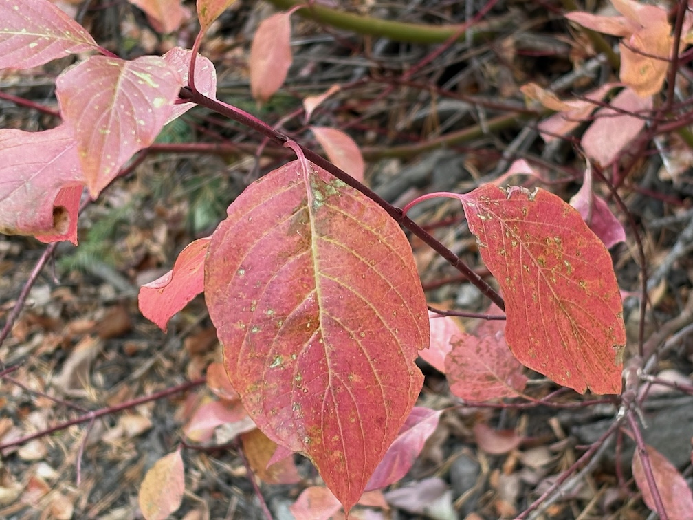
Cornus sericia
I went up on the Amtrak bus, because I’d missed the California Zephyr, TART to Tahoe City, and then walked to Kaspian Campground (TART west shore ends earlier in the day) and slept there (closed after Labor Day). I missed the Zephyr because I was looking over possible trans-Sierra routes that might have been used by a horseback break-off from the Stephens-Townsend-Murphy party in 1844. A person named Bob Crowley is investigating, and it captured my attention. Apparently they ended up on the Middle Fork American on the west side, which reduces likely routes.
Up Blackwood Canyon the cottonwoods were a brilliant yellow. I think Blackwood might be named for these black cottonwoods (Populus trichocarpa). The aspens were beginning to turn, but not bright, and I suspect this will be a mild color year for aspens. Creek dogwoods (Cornus sericea) were pale red to bright red. Forest thinning has been going on all summer and still in Blackwood Canyon, and the buzz of chain saws is constant.
Most creeks are still flowing. I’ve noticed that if a creek makes it through the end of the summer, it will continue, whereas if it does not, it will not recover in the fall. Shorter and cooler days, and lessened evapotranspiration free more water to the creeks.
I crossed Barker Pass and walked to the Powderhorn trailhead, then down Powderhorn to Diamond Crossing. There are some new trees down on Powderhorn since my last trailwork September, and more debris. This will be a constant for years. There was a light dusting of snow in shady areas, from a storm a few days before.
I camped at my common spot along Five Lakes Creek below Diamond Crossing.
I intended to walk the whole Hell Hole Trail to the bottom, but short days and a late start meant that I only did the upper trail, a bit beyond Steamboat Creek. The creek is dry, as it almost always is in the fall; it is an early season creek only in most years. Both forks of Buckskin Creek were flowing, though low. The trail has a lot of debris, which surprised me until I remembered that it had been four years since I’d done work including debris clearing on this trail. There are a few new trees down, and a lot of leaners and spars, which I can take care of next year with a folding saw. It will take at least two trips to clear debris again and the small cutting. Though not as bad as the red fir forest, this forest will continue to need maintenance. There is relatively little brush on this trail, compared to many. As with most trails in the Granite Chief, there is more maintenance by bears and deer than by people.
The black oaks (Quercus kelloggii) fall colors were mostly yellow, but with spots of red and orange. A wonderful time of year at this elevation (1800 m, 5900 feet).
GaiaGPS Gaia Topo layer shows two trails descending to the Rubicon, neither of which are on the alignment of the trail I’ve been maintaining. They may or may not exist, I’ll check on a future trip. Also shown is a road from the current end at Grayhorse Creek all the way around the head of Hell Hole Reservoir. I doubt that it exists, or ever existed, but again, will check it out. All of the ‘trails’ in the Hell Hole area a old non-maintained trails or use routes, except for the trail along the south side of the reservoir to the campground, which has been constructed though not much maintained. Most people access the campground by boat, not trail.
The next day I hike out, same route as in, up Powderhorn, over Barker Pass, down Blackwood Canyon, out to Kaspian Campground. The forecast was for a very cold night that night, particularly in Truckee which is often colder than Tahoe City, so I caught the TART bus and took Greyhound home. The Greyhound is the last bus of the day westbound, after the Amtrak buses.
That’s it for this year! I’ll be back to the Granite Chief in June or July, depending on snow melt.