My last backpack was cut short by rain, again. As mentioned, I discovered on my last trip that my tent is no longer waterproof, and had ordered a new tent. It came after I had headed out on this trip. I wasn’t worried because the forecast was for a few times of light rain, and my old tent was up for that.
It started raining as I left the Granite Chief trailhead, at 2:00PM, and it continued for 14 hours, through 4:00AM the next morning. I continued hiking in hopes of a break to set up camp, but there was never a break and I finally stopped at Whiskey Creek Camp and set up in light rain. I had my rain jacket, so my upper body was not soaked, but my lower body was drenched and cold the entire time. Though the section of PCT from Tevis Cup Trail to Whiskey Creek junction is not terribly brushy, every bit of brush holds water to shed on me as I walk by. Whitethorn seems better at holding water than any other shrub. The willow thicket along the trail was like a rain storm on the spot.
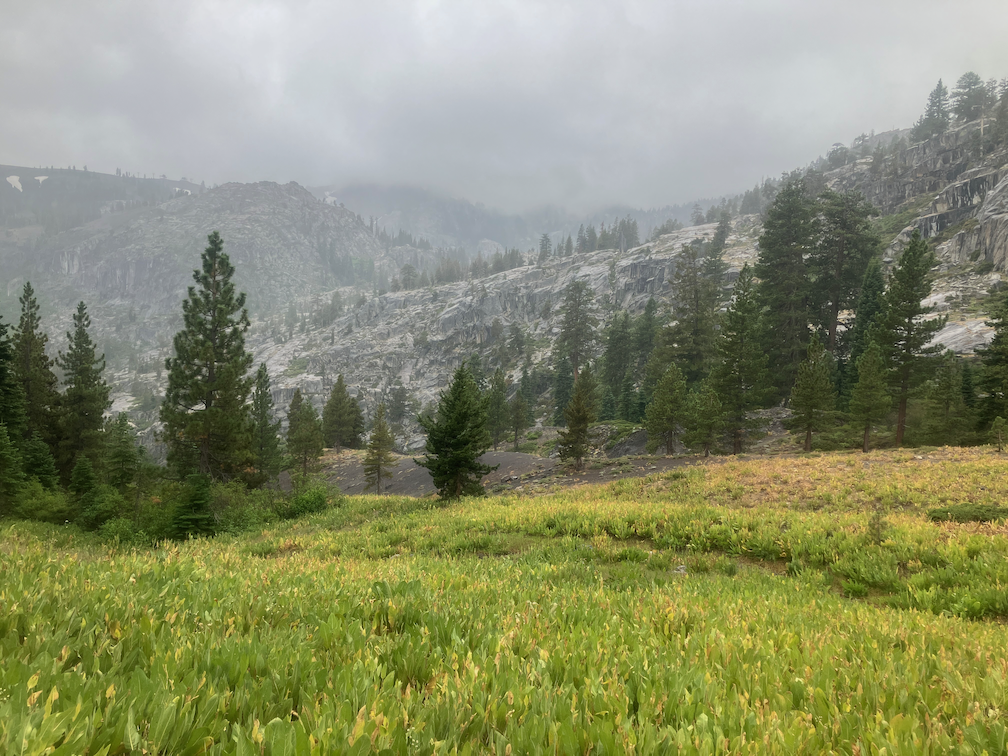
upper Washeshu Creek in rain
During the night, the rain was never heavy, light most of time and moderate in the thunderstorms from about midnight to 2:00AM. But nightlong rain and saturated ground was too much for my tent. My sleeping bag was quite wet, and some of my other gear.
The next morning was another one uncertain whether the sun would come out. It did for a few minutes, but by late morning I realized that even if it came out it would not be enough to dry my bag. So I hiked out to River Ranch. The sun was out for a while there, and I managed to dry all my gear except sleeping bag, which would have taken several hours of direct sunlight. I had decided to take the bus into Tahoe City and dry my bag at the laundry, but then I looked at the weather forecast. It was another night of rain, never heavy, but light to moderate, for hours. So I took the bus to Truckee and went home!
Extensive rain at night is not characteristic of the Sierra Nevada. Summer thunderstorm season it often rains in the afternoon, and often clears by sunset but sometimes goes into the early evening. But all night? Not the way it used to be. I check my weather apps before heading into the backcountry, and in those few places where there is cell reception, while out hiking. Though at home in Sacramento, they tend to give similar forecasts and be reasonably accurate, no so for the mountains. The Apple Weather app continually underestimates the amount and duration of rain. Accuweather comes closest to what actually happens. Weather Underground is mixed.
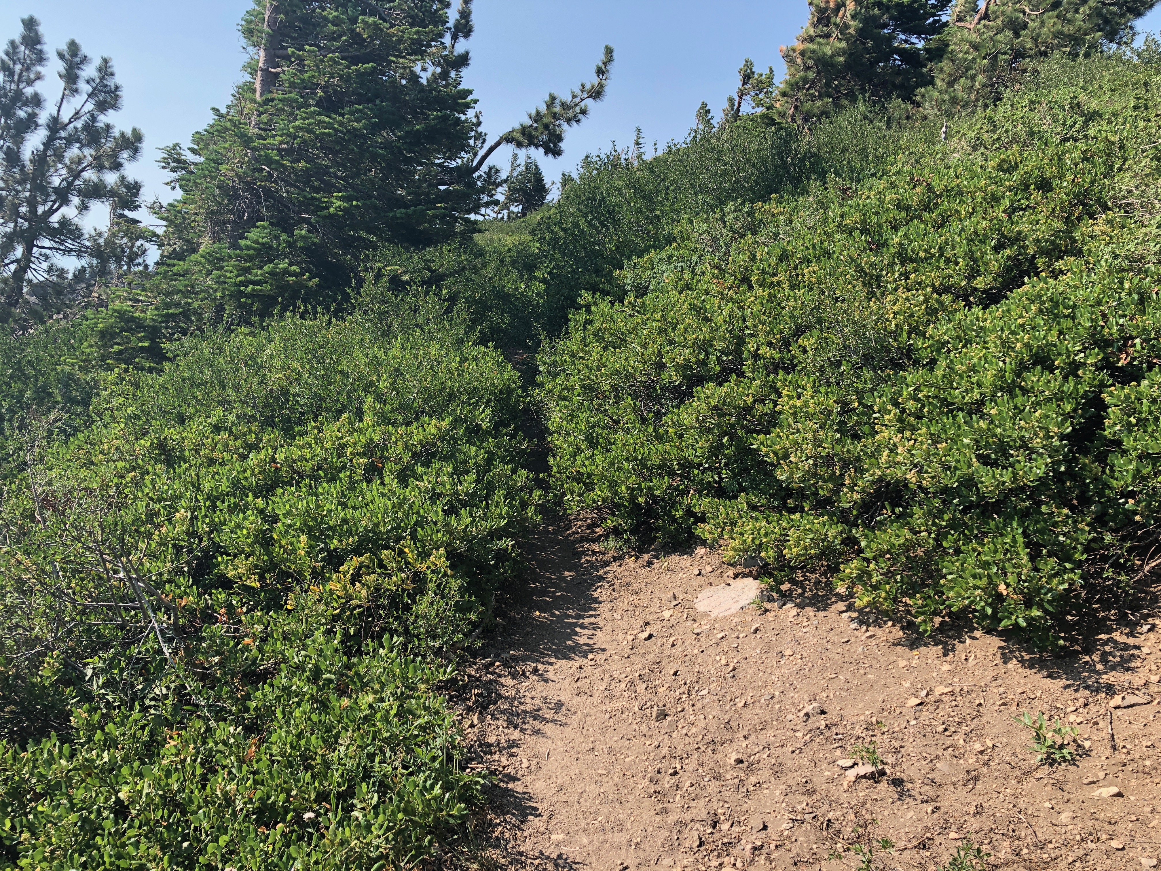
Trail conditions, for the section of the PCT from Tevis Connector to Whiskey Creek junction: Getting brushy and needs brushing by next year. A few small trees down and one medium tree. A fair number of spars (the dead conifers that lean into the trail and rip at skin and clothing). Winter debris light to moderate.
There is a large tree down across the crossing of Whiskey Creek. The rock hop is still available, but requires climbing through or around branches. You can also walk the log itself, but the bark is still sloughing off, and it is a little hard to get up onto down off the tree.
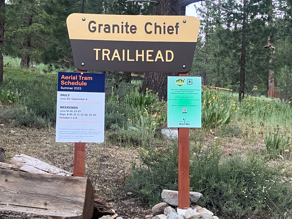
For my third Granite Chief backpack of the season, I went in at Granite Chief trailhead in Olympic Valley. Since I get to trailheads by transit and walking, this is the most convenient one of all, with the trailhead about 200 feet from the bus stop. I headed up the Granite Chief trail, which is in pretty good condition, with maintenance by Truckee Trails Foundation. I used to do brushing on this trail, and I’m glad for one less trail to take care of, particularly since I can’t come close to keeping up with the others. On my way up, I saw a Western Tanager, the first I’ve seen in a while, and am amazed as always at how bright they are.
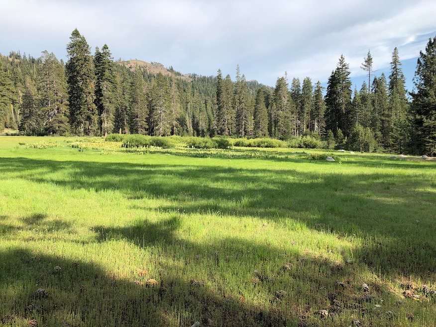
Heading south along the PCT, I stopped for the night just south of the meadow that is the headwaters of Washeshu Creek. It had been raining lightly off and on through the afternoon, but mostly cleared by sunset, with a rainbow. However, it rained lightly for several hours during the night. It is unusual for it to rain during the night in the Sierra, as most thunderstorms are afternoon and then clear by evening. In the morning, under mostly clear skies, I explored around the meadow beyond Granite Chief that is the source of Washeshu Creek.
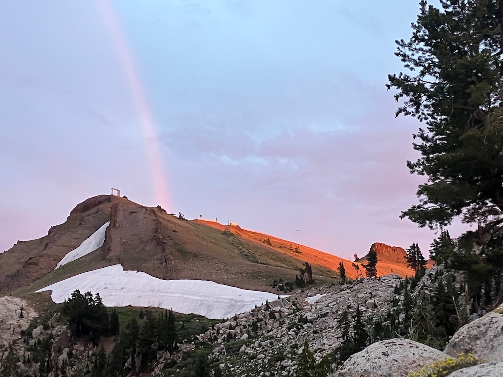
rainbow at sunset over Washeshu Peak
In the morning I walked up to the top of Granite Chief (this is the full name of the peak, no peak or mountain qualifier). The rain had compacted the loose granitic soil enough that the walking was easy, despite the climb. From the top, spectacular views in all directions. I noticed a large camp in the dry meadow along the Middle Fork American River, and was curious about who and why, so I walked down the trail that I call Tevis Connector, to see what was up. The camp was for a large crew of Forest Service and California Conservation Corps (CCC) members. I talked for a while to the trail crew foreman. The project is to reroute the Tevis Cup trail out of the boggy areas to higher up the slope. Tevis Cup is the worst trail in the Granite Chief Wilderness, and one of the worst trails I’ve been on, so I am very happy to see it being addressed. He said this is a multi-year project. The project is based out of the American River Ranger District of Tahoe National Forest (Foresthill), which this area is on, though in the past the management of the wilderness has been the responsibility of the Truckee Ranger District.
This is the first trail crew I have noticed in the Granite Chief since 2009. The Forest Service has largely stopped doing routine trail maintenance, so trails, not just here, are declining rapidly. So I am glad to see the work being started, and glad that they picked the worst of the trails to address.
I found an old WS Trail sign along the Tevis Connector trail. The alignment of the Western States has changed many times over the years. The trail down PIcayune Valley is now the named route. I had found another sign years ago, but have not been able to find it again, so I presume someone took it as a souvenir. I have found these signs at a few obscure locations all the way from Galena Creek on the Nevada side to the Mosquito Ridge road.
I left the PCT to walk up to Little Needle Lake. This old trail is easier to follow now as the trail crew did some light work on it. From the lake (pond), I went up onto the ridge, which is a steep climb but not too hard, and headed south along the ridge. Some parts of the ridge show a vague use trail, some parts to do. The ridge is centrally located in the wilderness and therefore has some of the best views. I rejoined the Western States Trail near the saddle at the head of Picayune Valley, and headed down into the valley to my favorite campsite area.
Again, there were thunderstorms in the afternoon, which cleared, and then hours of light rain during the night.
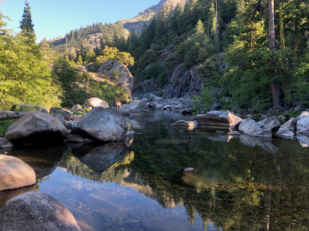
I walked down to the junction with Middle Fork American River, exploring along the way, finding some old trails, and waterfalls along the creek, and visiting the reflecting pond near the Middle Fork – Picayune junction. Flowers are very thick in the wet meadow areas along the trail, with mountain larkspur more common than most years. Hundreds of hummingbird moths (white-lined sphinx moth Hyles lineata) were nectaring on the larkspur. In the wet areas, the growth is so lush it completely obscures the trail, and one has to feel the tread with your feet. Which has its risks, at it can conceal step ups and holes and branches and down trees and standing water.
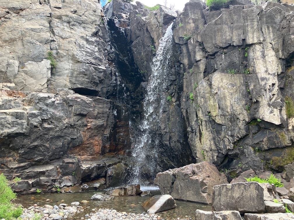
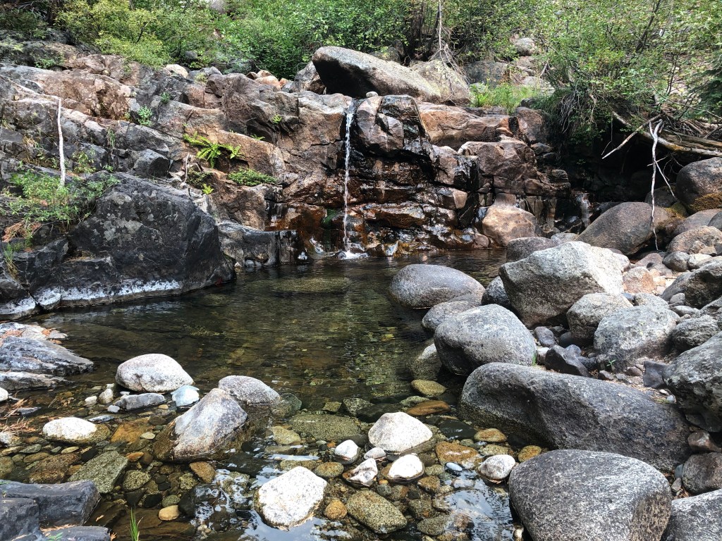
I found several waterfalls that I did not know existed. Travel along the creek is difficult to impossible, but there are many opportunities to drop down to the creek. I was of course also in search of the petroglyph panels, but again, did not find them. The success in finding them is about one-third, even though I have a clear picture in my mind of the setting.
The second night in Picayune was very similar, afternoon thunderstorms and then light rain during the early night.
I headed up out of Picayune Valley the next day, and ran into other people. Todd is a horseman who volunteers to cut trees on trails that otherwise are not getting any maintenance. We talked for a while about the history of some of the trails. Also met two backpackers from Grass Valley, and we were surprised to see each other. I was the first they had seen on their trip, and they were the first I’d seen, other than the trail crew. They had come in Greyhorse, and said the trail was very hard to find. I had done some spot brushing on this trail not too long ago (but can’t locate the date), but those areas may have brushed in again, and maybe been joined by other areas. They had come to the saddle from the Shanks Cove trail northern section, and said it was better though still had snow patches.
I headed towards camp at Whiskey Creek Camp, and as I came down from the ridge, the skies southeast were darkening to black, the main crest completely obscured. With just brief showers, I made it almost all the way, but then the skies opened. It rained hard for 30 minutes, and by hard, I mean visibility was about 50 feet. I partly sheltered under a leaning red fir. This is the most intense thunderstorm I have ever experienced in this wilderness. Perhaps more in the Carson Range, and certainly more in the desert southwest, but not here. After the storm I proceeded to camp and set up my tent. That is the point at which I discovered that my tent footprint and bottom are no longer waterproof. There was standing water everywhere, and it soaked through. I fortunately have a water resistant down sleeping bag, so was able to stay warm through the night, but everything was wet. And it rained again for three of hours during the night.
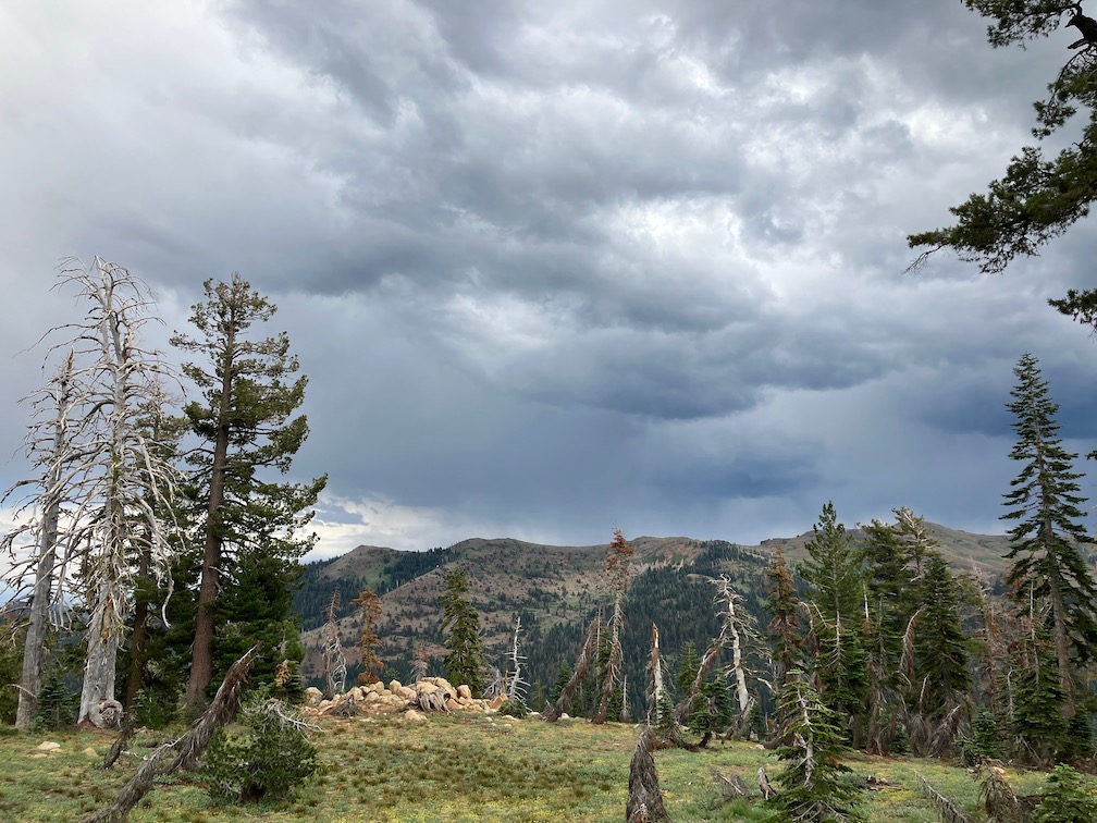
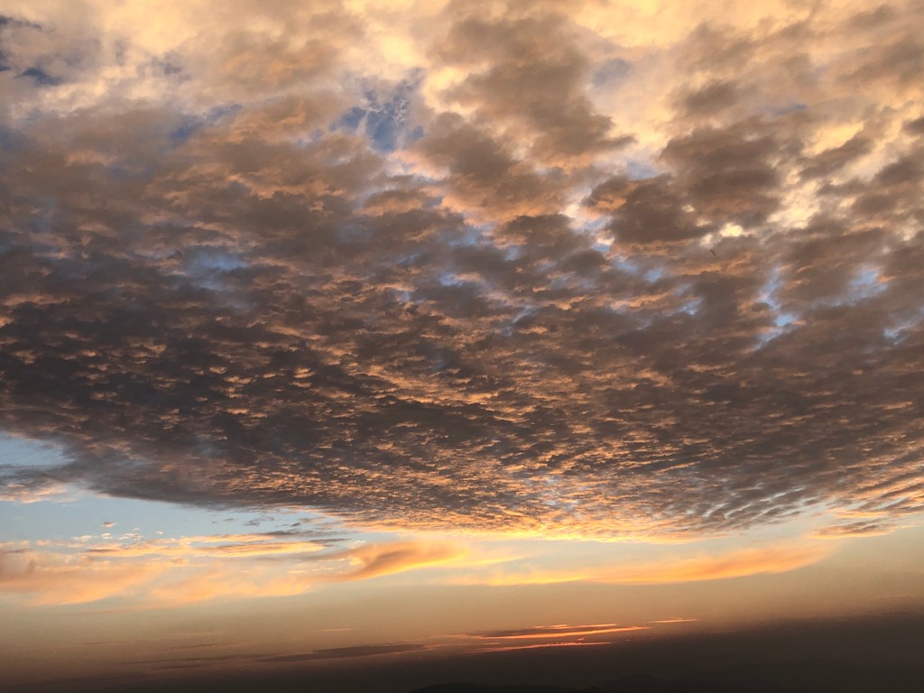
dark clouds over Sierra crest
At dawn, the sky was dark with clouds, and I assumed, correctly, that the sun was not going to come out, so I hiked out to Alpine Meadows trailhead, walked to Olympic Valley, caught the TART bus to Truckee, and the Amtrak bus home.
I do not know whether all the rain I experienced was part of the Hilary storm. Maybe not, because it didn’t really hit northern California until Sunday. I do know that different weather apps gave very different forecasts for those days. Accuweather was the most accurate.
Trail conditions:
Granite Chief Trail: Good condition, down trees already cut, very little brush.
PCT from Granite Chief Trail to Tevis Connection Trail: Good condition, one down tree, very little brush. Note that I did not hike the PCT from Tevis Connection Trail to Whiskey Creek Camp Trail, so nothing to report.
Western States Trail, Middle Fork American River to Whiskey Creek Camp: Many trees down, all easy to step over or bypass for hikers, but one tree on the switchbacks that probably cannot be safely passed by equestrians. Some areas need brushing, particularly towards Whiskey Creek Camp where the whitethorn is growing like crazy.
Five Lakes Trail: Good condition, very little brush.
I realized that I never posted on my third trip last season, in early September. My season was interrupted by COVID and smoke, and I never got back up to the mountains. I may or may not get to posting that trip, but here is my first trip of the 2023 season. A late start to the season, in mid-July, but there was still plenty of snow, so it was really early season.
I went in at Sugar Pine Point State Park, which is where the TART west shore bus route ends, and walked up the General Creek Trail. That trail is well maintained to the junction with Lost Lake Trail, but not thereafter. I crossed over to the old road and jeep road which leads up to Richardson Lake. There were quite a number of backpackers at Richardson, PCT thru-hikers I imagine, but I didn’t talk to them. I stayed at Ludlow Cabin because the mosquitos were thick and I would not have gotten to sleep, not having any of my tent with me. Mosquitos have been scarce the last few years of drought, and so I had stopped planning for them, but this year they seem to be back in former numbers.
From Richardson I headed north on the PCT. There are quite a number of down trees and, in places, a considerable amount of winter debris. I waded Miller Creek, as there is no dry crossing at the current water levels. The junction of the PCT with Rubicon jeep trail is now signed well, as it has not been for years. The Bear Creek Lake outlet creek was flowing well, and I waded it because my feet were already wet, but two backpackers managed a rock hop crossing.
There were no vehicles at Barker Pass TH, so I think most hikers have decided the trail north is not open yet. And that is sort of true. From the lake overlook north there are a lot of snow banks along the trail, including a continuous part in the headwaters of North Fork Blackwood Canyon. At the point where the trail crosses a steep north facing slope just before the wilderness boundary, a steep snowbank blocks the trail, but it is easy to head up to the ridge and bypass this. All of the sections of trail north of here in the trees had snow banks. The trail is not hard to follow, but involves a lot of clambering up one side and sliding down the other side of snowbanks.
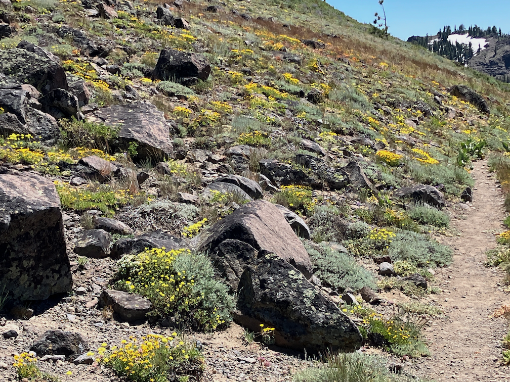
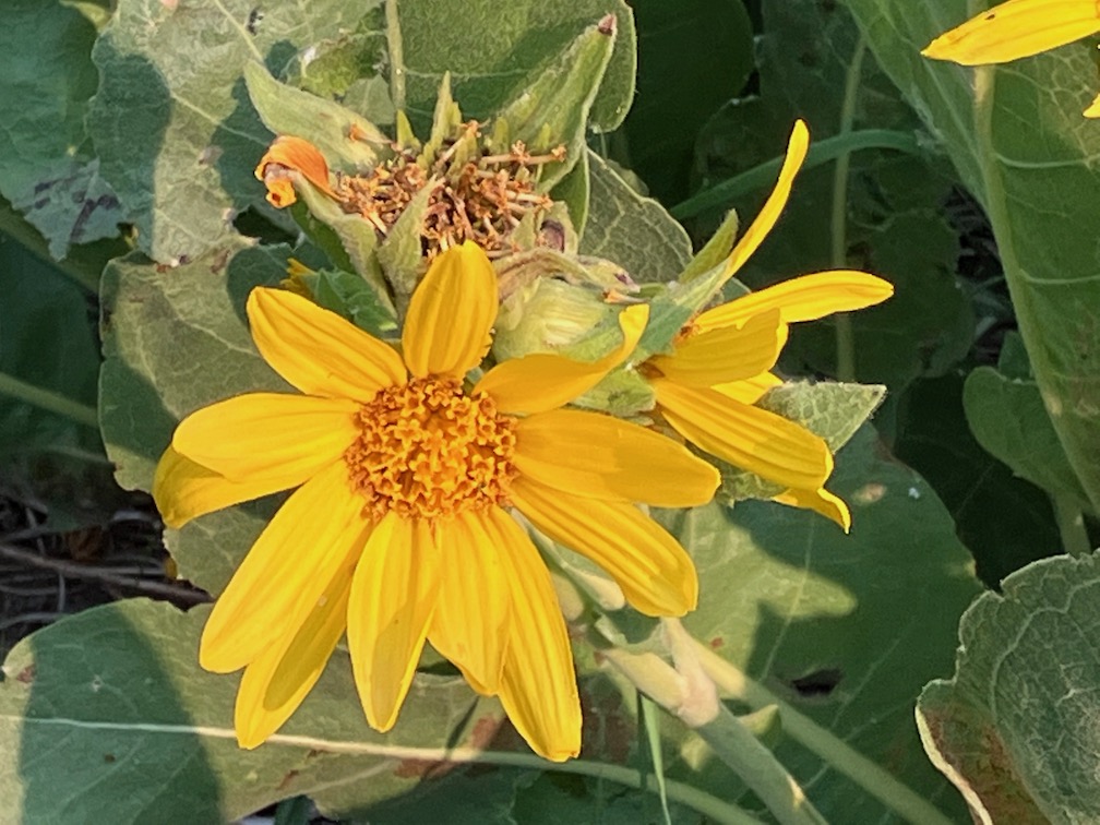
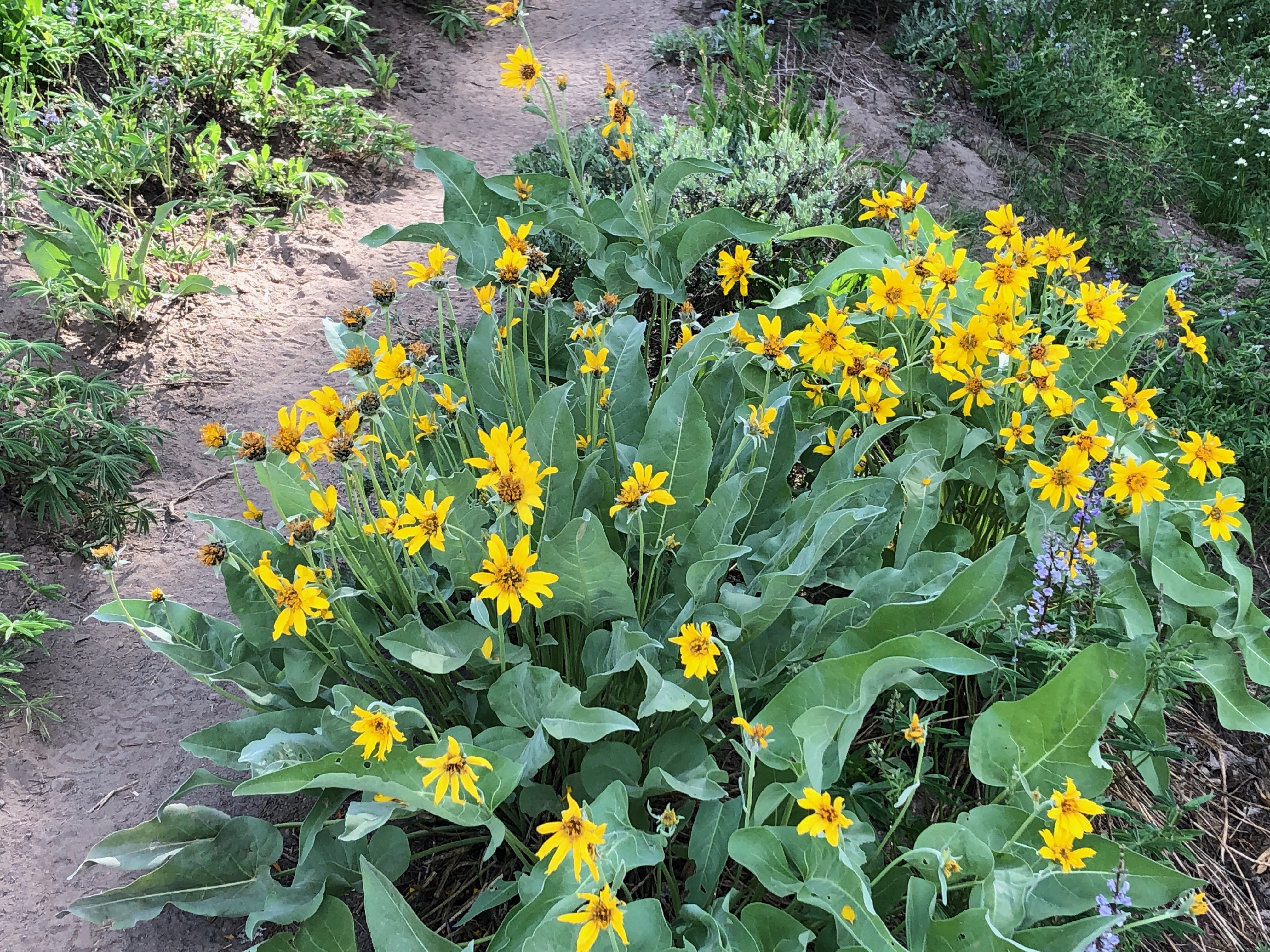
yellow flower hillside, PCT near Ward Peak
The worst part of the day for snow is mid-day, when there is a few inches of slush on top to hard packed snow, impossible to keep footing. Earlier, the snow is hard and steps can be kicked, and late afternoon, it is all slush. Some of the backpackers have step crampons, though those are only useful in the early morning before the slush layer develops, and most of them have hiking poles, which help, but I can tell from the slides down the far sides of snowbanks that these were not keeping everyone from falling. I fell more times on this day than I have fallen in the last ten years, so rather than continuing north on the PCT, I decided to go out at Five Lakes. The north facing switchbacks from Five Lake Creek to the ridge actually had less snow than many other sections, a surprise to me after the snow beforehand.
I camped at Squaw Saddle (so far as I know, this has not been renamed yet, but several other Squaw names such as the peak and creek are now Washeshu), and explored around Five Lakes basin in the morning. The main lake of the Five Lakes basin is full, so the two lakes are one, and the ponds are all full. There are probably about 10 lakes at the moment.
I walked out Five Lakes Trail to Alpine Meadows TH, and then followed the Bear Creek Trail out to near River Ranch. This trail climbs a great deal, but the surroundings and view are good, so worthwhile. From there, bus to Olympic Valley so I could catch music in the evening, slept out near there, and walked the bikeway to Tahoe City. A shower, and pizza and a movie, and slept out again. I caught the last bus on Sunday from Truckee back home to Sacramento, delayed as much as possible to miss the 100 degree days in Sacramento.
The trailhead for the Granite Chief Trail is no longer beside the fire station, but further up the road where there is a parking lot of the ropes challenge course.
This was my first trip of the season, probably the latest I’ve ever started. I had been doing a lot of short backpack trips along the Bay Area Ridge Trail, intending to complete that trail in a single year, but now taking a break because it is just too hot there. And I’ve been traveling and dancing a bit, which left shorter periods of few days for backpacking in the Sierra.
I went in at Palisades Tahoe on the Granite Chief Trail. This trail has been adopted by Truckee Trails, and is being appropriately maintained, so I’m scratching that one off my list of trails that I need to maintain. I headed south along the Pacific Crest Trail (PCT), over Granite Chief saddle and down Whiskey Creek drainage. I camped near Whiskey Creek Camp, and had a nice long conversation with five people camped there, parents, two children on their first backpack trip, and a friend from Chicago.
The next morning it was a little smokey, so I hung out and it didn’t seem to be getting worse, so I headed out the Western States Trail toward Picayune Valley. And then the smoke really came in! The Five Lakes Creek drainage was completely filled with dense smoke, and the ridgelines barely visible. So I sat it out for quite a while. When it thinned a little, I headed to Picayune Valley, wearing my N-95 mask, to one of my favorite camp spots.
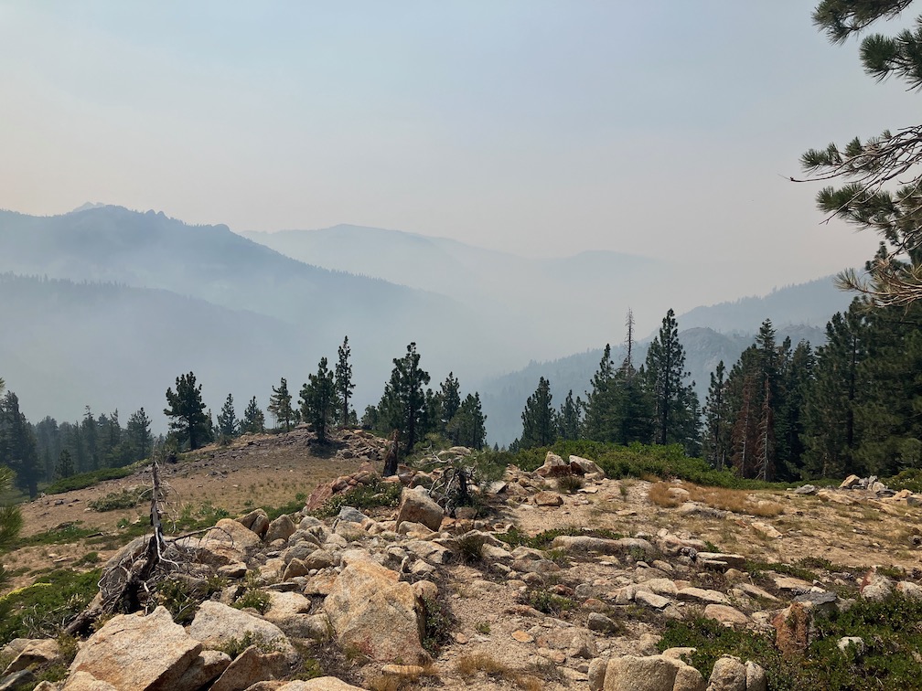
smoke in Five Lakes Creek basin
The smoke mostly cleared in the evening, and the stars were good. Next morning I walked the rest of the trail down to Talbot trailhead. The wet meadows and seep areas along the trail were chock-full of flowers. Because the trail is not getting much use, the soft vegetation crowds in and obscures the trail tread, but is easy to push through.
I had partly headed to Picayune in an effort to get away from the smoke, which I figured might be less further west, if the smoke plume location was correct. But the next day was mostly clear, so I went back out and back to Whiskey Creek Camp area. The smoke was from the Oak Fire in Mariposa County.
Next day I continued my way south on the PCT to Barker Pass. Though I’d seen very few PCT thru hikers previously, that day there were a more ‘normal’ number, about 70. I headed down the Blackwood Canyon jeep trail and camped near Blackwood Campground. The campground is no longer free ($17/night for a campground without water and trash service!), and the Lake Tahoe Basin has outlawed backcountry camping. Not sure what the rationale is, but the effect is to discriminate against people of low and moderate income. Of course I believe that people have a right to travel over the earth, and to camp where they need to camp, and that is what I do no matter what the bureaucrat bean-counters think.
There are alot of red firs (Abies magnifica) dead, sometimes in clusters, and sometimes individuals. They seem to die branch by branch until they are completely dead. It looks as though middle aged trees and the most susceptible, not so much young trees and very old ones. Though there are also dead white firs, the red firs are particularly noticeable because of the intense reddish brown of the needles. The primary cause seems to be prolonged drought and over-abundance of trees (due to fire suppression). Once weakened by drought, they are susceptible to root rot, mistletoe, fungus, and bark beetles.
Small and seasonal creeks are dry. Medium creeks are low but still flowing well. Wet meadow and seep areas are still green and wet, but drier ridge areas and crispy dry. Flowers are abundant in wet or moist areas, but long gone in drier areas. The two most common species of flowers are pennyroyal and yampah.
The trails I walked on this trip are in pretty good condition. Light to moderate winter debris. A few down trees, almost all easy to step over or bypass. The one tree that might not be able to be bypassed by equestrians is on the switchback down from the saddle into Picayune Valley. There are a few places that could use spot brushing, though the alder wet area on the PCT at the crossing of the Middle Fork really needs brushing.
I did something on this trip that I’d not done in years – I took a paperback novel to read. I’ve listened to books, with Audible, but my iPhone battery runs down pretty quickly. I rather enjoyed hold a book in my hands!
I’ve had for a couple of years the idea of creating a digital presentation or book on the flowers of the wilderness. So I took a lot of flower photos on this trip. Not everything, and of course missed the early season flowers. I’m better labeling them than I have before, with common name (if I can figure it out), species name, and plant family. I’m hoping that when I get to the project, that will make it easier. I’m using primarily Sierra Nevada Wildflowers, Karen Wiese, Falcon Press (Kindle edition); and Wildflowers of Nevada and Placer Counties, California, Redbud Chapter of California Native Plant Society. macOS Photos app now makes suggestions for photos that contain one flower. Sometimes the suggestion are exactly right, sometimes they are good to the genus level, and sometimes they are completely wrong. It is interesting to check, but the lookup is rather slow.
This is a trip from last year, that I forgot to post. It turned out to be the last backpack of the season for me, as fires closed the national forests and the two or more trips were not made. The trip from Monday, August 9 through Friday, August 14, 2021.
Duck Lake
I went in at Barker Pass, coming up to Truckee on the train, then bus to Tahoe City and down the west shore to Kaspian Campground, then walked up the paved and dirt road to the pass, and camped a bit north of the pass. The air was clearer both up on the ridge and down in the Tahoe basin than it had been.
The main purpose of my trip was to finish off a section of the PCT that needs brushing, and had last been worked about five years ago. It was not brushed closed, but was approaching that. Cutting brush usually goes fast, but hauling he cut brush off the trail take up more than half the time, depending on how long I have to carry or drag it to a good location. Many people who do light trail brushing just drop the cutting where they are, but over time that results in a wall of cut brush along the edge of the trail, which looks bad and blocks views. I haul the brush so that it is at least six feet off the trail, often more, and out of sight. It is interested when my brush stashes evolve over time as the brush gradually breaks down. The air was clearer up on the crest, but seemed to be getting worse down below.
Doing trail work on the ridge, I have to haul up water for my trip from one of the sources below. In this case, the springs in the north fork of Blackwood Canyon, down the switchbacks and back up, with about seven liters of water. Though the air was clear, there is a layer of smoke aloft and it seems to be descending towards the ridge. I finished the section of brushing late in the day, with a few drops of rain from increasing clouds. With this section, there are no places between Barker Pass and Granite Chief that really need brushing, though there are locations that could use some attention.
Next day I headed south along the PCT. The smoke is thick now, and I’m hiking with my KN-95 mask, and walking more slowly than usual. The smoke seems to be regional now, not just plumes from the fires. Water at the springs, and more water at the creek south of Barker Pass which is flowing cold and well, though everything else including Miller Creek is dry now. I continued on to Richardson Lake, where I camped along with eight other backpackers. I’ve noticed that all along the PCT there are more campsites, and the campsites are bigger, the result of the huge increase in the number of PCT thru hikers. I see about 40 thru hikers a day now, whereas in the pre-Wild (the book and movie) days, it was about 5. I took an afternoon walk to General Creek, tip-toeing carefully through abundant tiny frogs. Tree frogs, I think.
While around the lake, I saw a mustelidae that was moving too fast to clearly identify, many grouse, dragonflies with green and blue bodies and bright blue banded tails, bright green frogs in the grass at lake edge.
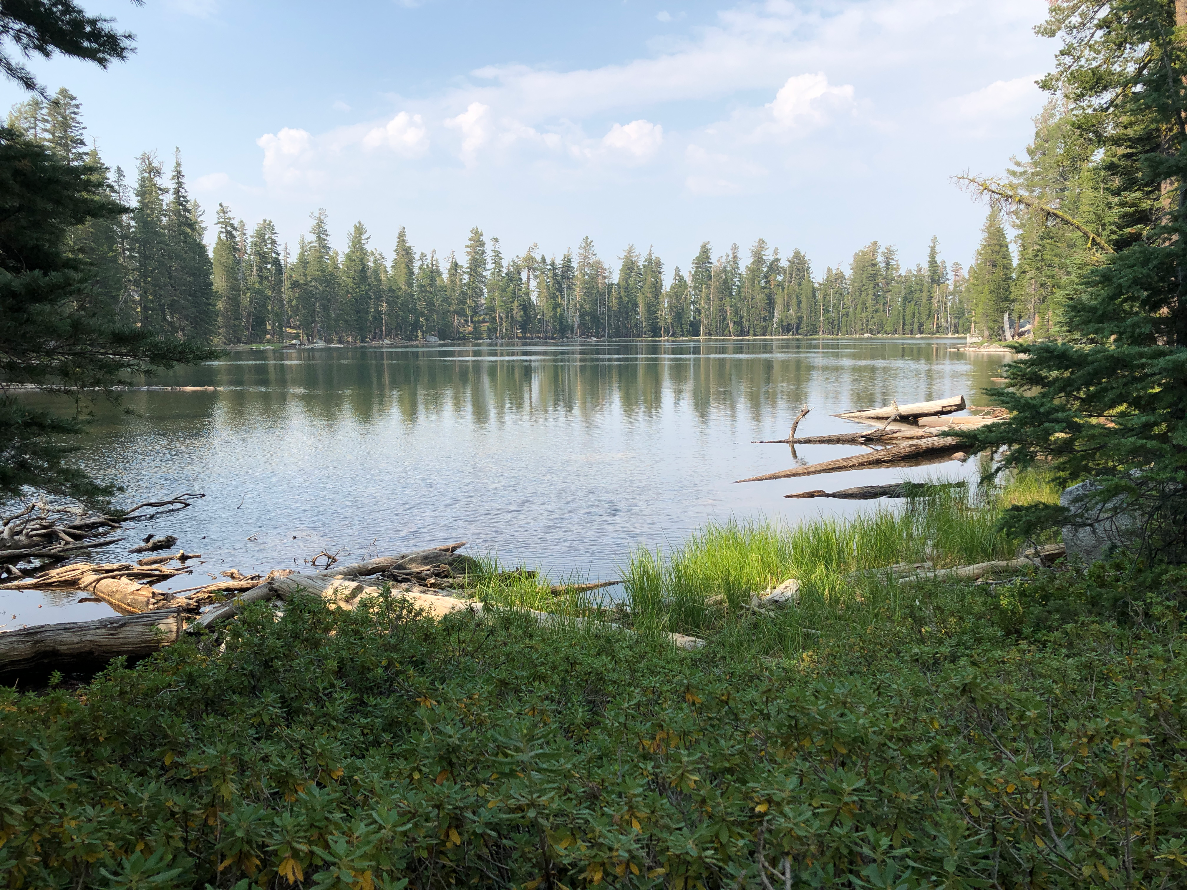
The next day I hiked on to Lost Lake, which is south of General Creek. There is a new trail, constructed by TAMBA, replacing the old road. The road had problems, but so does the new trail. It loses elevation for no good reason, and then climbs very steeply to make up for it, and winds almost a mile out of the way for a so-so view. I have never been fond of trails laid out by mountain bikers, too much like pump tracks and too little like trails, but this one is particularly bad. Trees were cut off at waist height rather than the ground, brush piles right beside the trail, very steep tread with no attempt at erosion control. But once reaching the lake, it is nice. I took a swim, walked around the lake, and watched the end of the day cloud color. I took a walk around Duck Lake, which is really a pond, shallow, but an interesting place not much visited except by ducks.
Last day I walked out the General Creek trail to Sugar Pine Point SP, and took the bus back to Tahoe City and then Truckee, and the train home.
The Caldor Fire started that day, though I was not aware of it on that day. The Tamarack Fire, southeast of Tahoe, was still going but not producing much smoke, and the Dixie fire was still going and contributing to a regional smoke.
Here in February 2022, I’m wondering when the snow will melt enough to head into the Granite Chief again. The fall storms brought deep snow, and it was looking like a very late year, but it hasn’t done much since, so who knows. I have started backpacking again, but in the bay area and Sierra foothills.
This trip was mostly a trail maintenance trip, continuing the brushing between Twin Peaks and Ward Peak, particularly the very brushy section in the middle.
I went in at Barker Pass, walking up from Kaspian Campground to the ridge. Not the short way into the wilderness, but useful because the closest spring to my work area is along the PCT/TRT in North Fork Blackwood Canyon. Other springs are nearly dry, and streams are very low, but this one is still doing well, cold snowmelt water out of the talus slope below the ridge line.
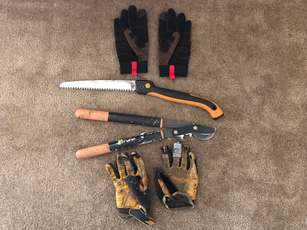
I made progress on the brushing last trip, and this trip was able to fill the gaps between other short segments I’d done, leaving only the hardest part to do, the brushed-in ridge line switchback. So I feel good about the work accomplished, everything to the south done. But more to do. I replaced the cutting blade on my nippers before this trip, and it made a big difference. Below, the tools of the trade: nippers, folding saw, worn out gloves, and new gloves. The nippers and folding saw are both Fiskars, which make the best lightweight tools, about a pound each.
The majority of the brush I’m cutting is tobacco brush, Ceanothus velutinous, it grows faster than the others. Bitter cherry also crows fast, but the stems are easy to get to and cut easily. But even the slow growing pinemat manzanita and sagebrush do eventually encroach on the trail. The photos on Flickr (link below) show several of the brush species that I’m cutting, though not the most common tobacco brush. Huckleberry oak and white thorn are very common brush at somewhat lower elevations.
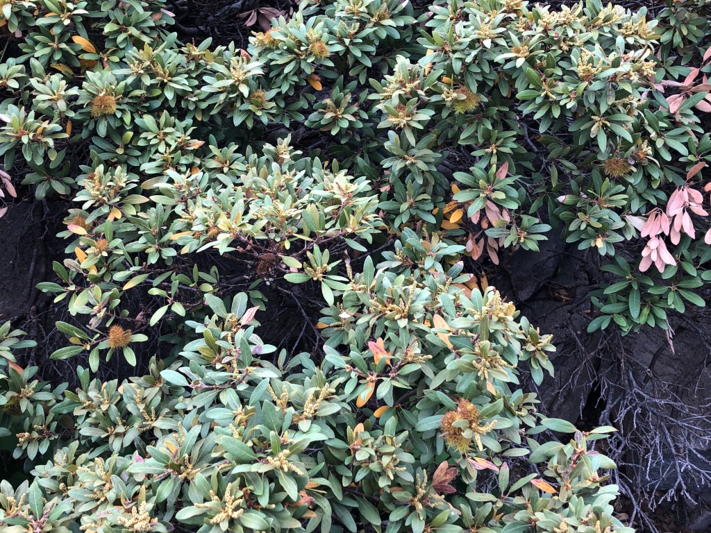
Chinquapin
With all the time up on the ridge, I of course had ample opportunities to watch the sunsets, and this section of the ridge is one of the best places. I also watched the patterns of smoke from the fires. Last trip was mostly smoke from the Tamarack Fire to the southeast, with the smoke mostly heading north well to the east. This trip was mostly smoke from the Dixie Fire, well to the north but producing a lot of smoke. Sometimes the Tahoe basin, to the east, was socked in with smoke, sometimes clear. Less often the west slope of the Sierra was smoked in. Fortunately, at least during these weather and fire conditions, the crest is free of smoke most of the time, just a hint of smoke smell from time to time. The smoke does produce some spectacular orange sunsets. Though there are good sunsets any time there are layered clouds to the west, not just layers of smoke.
The weather was also unusual. Monday night it rained off and on throughout and into the next morning. Never heavy, but still enough to require my tarp. This kind of weather is common summertime in some other mountain ranges, but not common in the Sierra. The rest of the week it rained at least once a day, but light rain from the edges of the thunderstorms. The storms were forming over the crest before moving east to the Carson Range, a reversal of the usual pattern. It has been a while since the forest smelled largely of dampness and humus, and it was enjoyable. But the rain was never enough to thoroughly wet the soil, and it is still dry below.
The woolly mules ears are drying to yellow and brown, but not quite dry enough to rattle in the wind, that sure sound of fall. The less common arrowleaf balsamroot, however, is dry and rattling.
Early one morning when walking through a mules ear meadow to my work site, a dark sleek animal dashed across the trail, going downhill and moving very fast. The glimpse was so brief I’m not certain what it was. Probably a weasel, but could also have been a marten or fisher (all are in the same family Mustelidae). I also saw a Clark’s Nutcracker hanging out on the ground. I usually only see them in flight between trees, or in trees, but this one provided a close up view.
Tomorrow I’m headed up to finish off the brushing, probably two solid days of work. Depends on the smoke, however. The crest is often free of smoke, but the hike into the crest from Lake Tahoe level is in the thick of smoke, at least today.
This trip was primarily for trail work. I had noticed on my previous trip that the section of the PCT trail between roughly Twin Peaks and Ward Peak (actually, only part of that), was beginning to be brushed in again. Looking at past posts, it appears that I did some work here in 2014, but didn’t finish, and then finished in 2016. So it has been five years, at least, since this section was brushed. Most of my brushing I think of as ‘five-year’ brushing, cutting things back enough that the work will last about five years, so this works out.
As always, the tobacco brush (Ceanothus velutinus) is the fastest growing of the brush and the most likely to brush a section of trail closed. As with most plants, cutting it leads to it producing multiple stems, so the result of my 2014-2016 work is that a lot of the tobacco brush has multiple younger stems, which take much longer to cut. Sometimes I can get down to the root of the plant, and get it all out, but that is unusual, and doing this effectively would require different tools than I take, a pulaski or similar. I discovered, to my surprise, that at the oldest root wad of the tobacco brush, there is a large, deep taproot. Bitter cherry also spouts from the cut base and sends its stems into the trail, but it is easier to get out by the roots. Even manzanita, though slow growing, will encroach on the trail over time. Several other brush species, less common at least in this area, also encroach on the trail, but the fast growing whitethorn is not common along here.
The photo below shows a brushed-in section of the trail, the ridgeline switchback. And it still looks like that, because I did not get to this part in my work. In fact, I only accomplished about one-quarter of what needs to be done. My excuse is that it was hot in the afternoons and I could just not accomplish much. And it was hot – the rocks get almost skin-burning hot. The temperatures are funny. Up above the bridge the wind is often blowing, and was blowing the entire time of this trip, and it is comfortable. But when I squat down or sit down to cut brush, I’m out of the wind and it is very hot.
PCT brushed in
There are no water sources on the ridge between the springs in North Fork Blackwood Canyon and Five Lakes Creek, so I have to pack in water. I resupplied, from the springs, once during my trip, and when I ran out of water the second time, headed out. The three springs close together are very low, and I’m sure will dry up this summer. Another single spring further south is still flowing well. And of course North Fork Blackwood Creek is likely to have water all season. In years with more snow, I’ve been able to melt snow from the snowbanks that last on the east side of the ridge, but this year those snowbanks were gone back in June.
I primarily use two campsites on the ridge, the one heavily used by PCT thru hikers near the PCT/TRT junction, and a small one north of Twin Peaks that is not much used. I discovered that a wood rat lives nearby. It stole my plastic spoon, so I have to make a sort of workable one out of a stick, and also chewed on my pack straps and work gloves. After that night, I put everything away and hung my pack up in a tree.
On my way out the last day, a new fire southeast was popping up, the Tamarack Fire, which is still going as I write (Sunday, July 25), now about 66,000 acres and only a quarter contained. During my time on the ridge and then down at Tahoe, the smoke was all going north, along the east side of the Carson Range, so not affecting my area, but I understand that now some smoke is coming over to Tahoe and the crest.
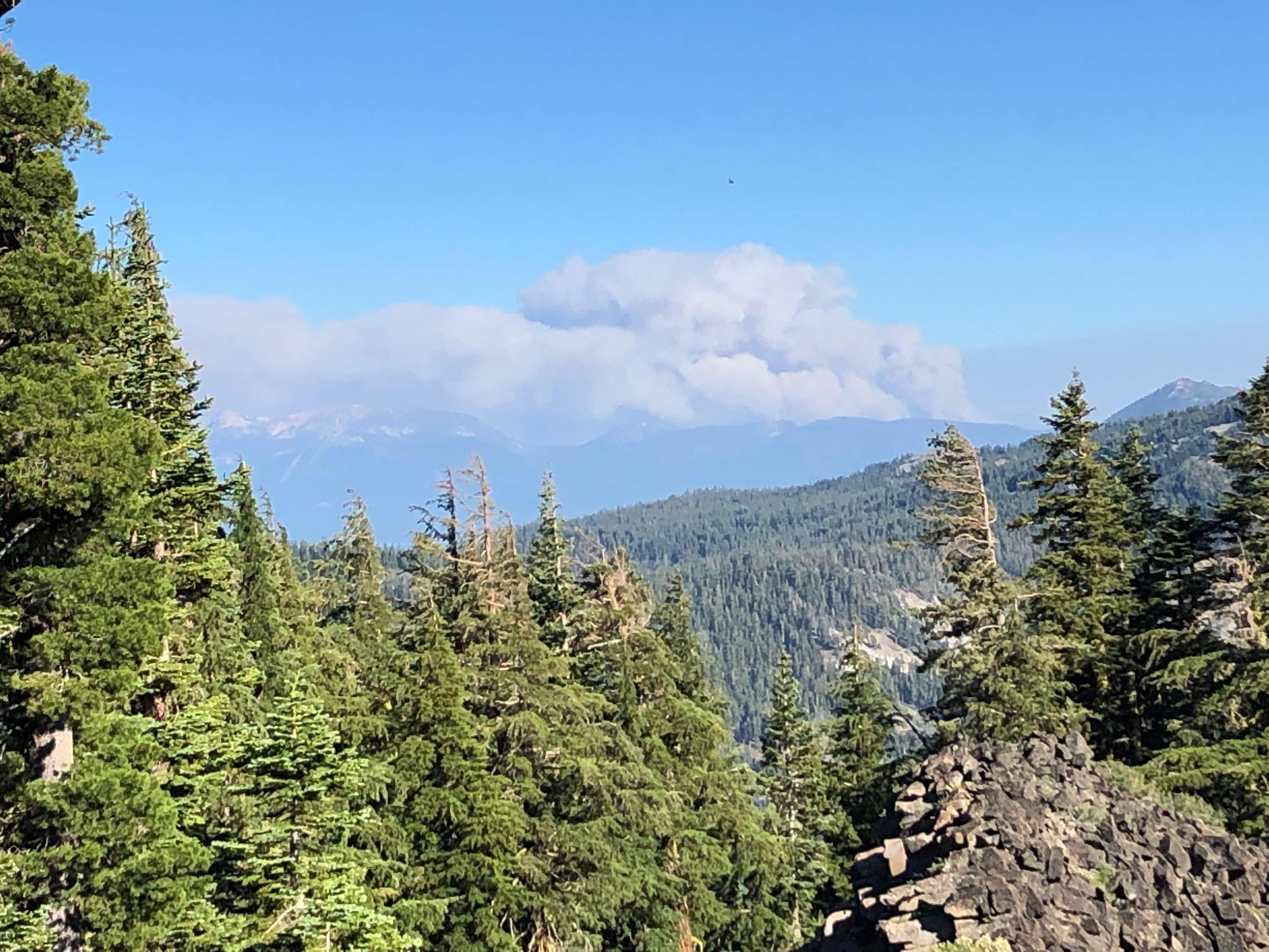
Tamarack Fire
On this trip, I took both insect repellent and my inner netting tent. Ironically, there were far fewer mosquitoes than there had been two weeks before, but it was still nice to go to sleep without the buzzing.
For this trip, I walked from Tahoe City to Kaspian Campground, which is where Barker Pass Road leaves the highway, walked up the road and then the jeep road past Blackwood Campground to the crest. Blackwood Campground now charges a fee – it was the last of the campground in the entire Tahoe basin that was free. As a result, it was empty. I headed north on the PCT from Barker Pass to my work area. Going out, I took the TRT trail down to Ward Creek, where I camped the night, and then on through Paige Meadows to Tahoe City.
I’m falling into a pattern of wanting to hear music after my backpack trips, so I went to the Saturday afternoon music in Squaw Village, blues by Mike Schermer, which was fun. It seems it is mostly locals, people who have homes or shares in the village, who attend these. There were a lot of kids dancing, having a good time.
And then home on the Amtrak bus from Truckee.
Tomorrow, in for more trail work. Maybe I’ll get to half or 3/4 done.
The Granite Chief Trail, up from Squaw Valley to the PCT, is in good condition. A sign indicates it has been adopted by the Truckee Trails Association, so this is one trail I probably won’t have to maintain again. Yay!
I camped just off the PCT, looking down the North Fork American River canyon, with a good sunset and sunrise, probably in part due to some fire smoke from fires to the north. There are still some patches of snow on the north side of Lyon Peak ridge (Foresthill Divide), but not much left. I walked the PCT south to the junction of the PCT and TRT, where there is a campsite well used by thru hikers and others. I’m seeing about 40 thru hikers a day, mostly in bunches but some solo. As is typical, about half look happy to be there and the other half clearly does not. It is a strange thing that people do.
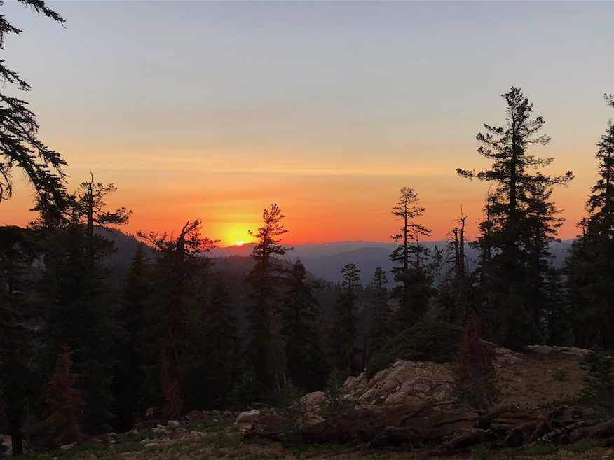
sunset over North Fork American River
I headed south on the PCT to Barker Pass, then along Forest Highway 3 to Powderhorn trailhead, and down to Diamond Crossing. There are a number of trees down on this trail, though all but one were easy to go over or around, and it could definitely use brushing and cutting back of the doghair firs that crowd the trail.
I helped two dayhikers, in from Powderhorn, to find the pools along Five Lakes Creek near Diamond Crossing, which they would not likely have found on their own. The Five Lakes Creek Trail is in poor condition, many trees down, many of them down now for years. The Forest Service has not maintained this trail in at least six years, and it was being somewhat maintained by a horse group that headed into Big Spring meadow every year, but seems to have given up on using the trail, it is so bad.
I camped at Big Spring meadow, one of my favorite spots, a great place to watch the beginning of the day and the end of the day, and enjoy the huge pines. The meadow is drier than usual for this time of year, but not fall dry. The spring is flowing well, and I don’t think it ever dries up. I explored up the east side of Five Lakes Creek, finding the old trail which used to be on that side. Some parts are easy to see, in the wet areas with willow alder and willow thickets, not, and I did not find the place where it crosses over to the west side. I’ve also explored down from the PCT/Five Lakes junction, but haven’t yet connected the two.
Big Spring meadow
I hung out at Whiskey Creek Camp to meet Paul Vandervoort, who I’ve been emailing for several years but never met. He was leading a dayhiking group from Reno, going over into Picayune Valley and then climbing out to the Tevis Cup Trail, and back out.
I headed out the Five Lakes Creek Trail, PCT, and Five Lakes Trail, with some exploring around the Five Lakes area, which I usually zoom by on my way elsewhere. The lakes were low but most still had water. There are anywhere from three lakes to fifteen lakes, depending on the time of year. The largest lake, the one to the west, breaks into two lakes as the water level drops, and the one I call third lake gets smaller but I’ve not seen it dry.
From there I went up over the old Squaw Saddle Trail, no longer maintained, and into Squaw Valley. It joins the Western States Trail (one of the many alignments) and heads east along the south side of the valley. Where the trail is closed for construction of the new Alpine to Squaw gondola, I dropped down to Squaw Village and hung out there for a while.
I took the bus into Tahoe City, where I camp out for the night before going to Truckee in the morning to catch the train. It is far too noisy in Truckee to sleep out, due to Interstate 80 with its constant roar of truck traffic. Tahoe City is much quieter. While charging my phone at the plaza overlook, a band came and set up to play, so I stayed to enjoy there semi-reggae and talk to people.
I was wondering how the flowers would be in the drought year. At higher elevations, they actually don’t seem much different, except that they are about half the stature of a ‘normal’ year. Their abundance is about the same, though.
Arrowleaf Balsamroot (Balsamhoriza)
On this trip I did not take insect repellent, and did not take my inner tent with insect netting, so was quite bothered by mosquitoes. If it were cooler, I’d just hide in my sleeping bag and go to sleep, but the evenings were too warm to do that. They are not as thick as they used to be, but still…
I have some new hiking shoes. For years my toes have been turning, and as a result, I need a wider toe box, but my heel is not widening, so wide shoes don’t do it for me. I’m trying out Altra Lone Peak trail runner shoes. They have a wide toe box but normal width elsewhere. They aren’t really heavy enough for hiking shoes, so I probably won’t be doing any off-trail hiking in them, but I have to say, my toes were happy.
My September trip into the Granite Chief was to Picayune Valley, my favorite, and then north along the PCT to Donner Summit, and Truckee, running from the smoke.
Middle Fork American River, at Picayune (Western States) Trail
I went in at Squaw Valley on the Granite Chief Trail, and camped just a bit north of the junction with the PCT. The air was reasonably clear up high, but very smoky below and in the Tahoe basin. The creeks crossed on the way up were either dry or very nearly dry.
Next day I headed south on the PCT, and took a side trip to the top of Granite Chief, which I’ve not done in a while. The smoke was thick in the valleys, and there were streaks of smoke aloft, but at this level the air was quite clear and I could see Sierra Buttes to the northwest. Also took a side trip to Little Needle Lake, which has a vague use trial leading from the junction of the Tevis Connector. The meadow has been grazed down, probably by bears, but the lake is still pretty full, sitting in a granite basin surrounded by volcanics.
I went by Whiskey Creek Camp, where there were a LOT of people, not surprising for Labor Day weekend. I headed over the Western States Trail to Picayune Valley. Late in the afternoon, a huge dark red smoke cloud towered overhead from the south, I assumed then from a nearby fire. But later found out it was just the smoke from the Creek Fire way south. The smoke in the valley came and went, but was mostly overhead and not ground level.
I explored all the way down Picayune to Talbot campground, and a ways up the Talbot Creek Trail, looking for possible shortcuts from that trail to the Middle Fork, rather than the long way around down the road. I followed out several old logging roads, but none went through. There is one more significant logging road to check, but for another time. Some maps show a trail paralleling Talbot Creek, but I was unable to find even traces of a trail going up along the creek, so I think this is false.
In Picayune, I also explored the benches between the trail and Picayune Creek, looking for petroglyphs that I’d been shown several years before on a American River Conservancy backpack. I found some of them, but not all. The trail is in good condition the entire way, someone has been maintaining it. Both Picayune Creek and the Middle Fork are quite low but still flowing. I camped near my usual spot, just above the creek in the area where the trail first switchbacks down toward the upper waterfall.
I spent the morning exploring the ledges south of the creek, fascinated as always by the micro variety of the metamorphic rock pattens and textures, but the air quality got worse and worse during the day, so I decided to head north in an attempt to get away from the smoke. So, back out of Picayune, to Whiskey Creek Camp, and north on the PCT. I camped at Granite Chief saddle, initially in a cold breeze that ascended through the night to a howling wind, and shifted from west to east.
In the morning, the crest was clear, and by mid-morning, it was completely clear to the east, all of the smoke being blown back into California. The wind increased with gusts to about 60 mph, and it was very hard to walk the ridge between Tinkers Knob and Anderson Peak, taking tiny steps and re-balancing after each one. The air east became the clearest I’ve ever seen during the summer, revealing mountain ranges across Nevada, which were later obscured by dust rather than smoke.
Seeking shelter from the wind, which I knew would not allow me to sleep that night if I were out in the open, I stayed at Benson Hut, a Sierra Club sponsored hut on the PCT that is supposed to be for winter use and emergencies, but I decided that gusts of 60 were sort of an emergency. The high winds also blew up existing fires, and the Bear Fire to the northwest produced huge streaks of smoke and cumulus clouds, and the winds aloft blew that south, initially missing the crest but eventually coming back eastward.
I continued north to Donner Summit (Hwy 80), and then west on the Donner Lake Rim Trail. To be honest, I hate this trail, at least the newer part of it. It was clearly laid out by bicyclists. There are looping switchbacks that lose maybe 10 feet over a quarter mile, adding unnecessary length to the trail. Ack! I am so tired of trails designed to keep bicyclists entertained, with no consideration for hikers. The switchback turns are deep dust pits as the bikers swoop around them and pulverize the tread. I am one of those people who believe we can’t “all just get along” on the trails. Mountain bikers need to have their own trails, which they build and pay for.
At any rate, I camped along the trail, and saw good stars for part of the night, but then the smoke descended and I was in heavy smoke the rest of the way into Truckee. Headed home on the Amtrak bus, as the train was more than five hours late, and seeming likely to lose more time before it got to Truckee.
My trip July 2-9 was mostly into the Hell Hole Trail area. I went in at Alpine Meadows trailhead, down Five Lakes Creek, to Hell Hole Trail and McKinstry Trail, and then back out via Powderhorn Trail, north along the PCT, and out at Alpine Meadows ski area.
The Five Lakes Creek Trail is in gradually deteriorating condition, with more down trees added to the existing ones, and more issues with tread erosion. The Hell Hole Trail is in decent shape though there are downed trees that have now been there for years, and a few more are added every year. I have been working on defining the tread, so the trail is becoming somewhat easier to follow, though some sections still have a lot of winter debris accumulation. The trail from Diamond Crossing down disappears as it approaches Five Lakes Creek, due to thick willows and downfall, but it is not too hard to find a way through. The trail from there to below Steamboat Creek (which was still flowing well) is in decent condition, though it requires close attention to follow. There are a large number of oak trees down over the trail switchbacks about 2/3 of the way down the hill to the lower end of the trail, but you can bypass them by paying close attention.
I did some more work on what I’ll call the McKinstry Trail, from the junction at the bottom of the Hell Hole Trail, so it is now defined from the point near Five Lakes Creek crossing to about a third the distance back to the junction. But the 2/3 closer to the junction is very hard to find, and I have not yet identified what the best route is. I’m sure the original trail just headed across the forested flats, but the helicopter logging that left all the debris, and a weakened forest generating downfall, has completely obscured these sections. Eventually I’ll figure and and define the best route, but for now, one just has to head in the right directly and hope to pick up the trail again.
After crossing lower Five Lakes Creek, the route again is lost in the forested flats. It shows up again where it climbs up on the ridge separating Five Lakes Creek drainage from the Rubicon River, and is marked with rock ducks to where it comes back down to the river. I have not been past the crossing of the Rubicon in years, so the condition of the rest of the McKinstry Trail is unknown to me. There are also use trails that follow the ridge between the two drainages down towards the reservoir, but I haven’t been on those in years either.
Heading back out, I took the Powderhorn Trail, which has more downed trees but is not in bad condition, walked the road to Barker Pass, and headed back north on the PCT. The PCT is in good condition from Barker to the PCT/TRT junction. After all these years, it seems the the Tahoe Rim Trail Association has finally reached the desired state of good repair: no downed trees, no brushy sections, tread in good condition. Thank you! North of that junction there are a few downed trees, and some areas needing brushing (which apparently only I do, but I haven’t done in about three years). I intended to go out through Five Lakes back to the trailhead, but realized there were going to be hundreds of people on that trail, so I went out through the Alpine Meadows ski area, which is no shorter than the trail, but I only saw one person.
Rubicon River near McKinstry Trail
I’m just about to head back into the same area, to do a little more trail work and a little more exploring.