Category Archives: Trip Reports

Granite Chief 2025-07-22 trail survey and trail work

My fourth Granite Chief trip of the season was a trail condition survey, and then work with a trail reroute group. I surveyed three of the trails which I had not done this season, the Greyhorse Trail and Shanks Cove Trail. And then joined a Western States Endurance Run trail work crew working on the Tevis Cup reroute.

I entered the wilderness from Five Lakes Trailhead (formerly Alpine Meadows Trailhead) and camped at Whiskey Creek Camp. Heading down Five Lakes Creek Trail the next day, I was able to follow the trail from north Big Spring Trail to Shanks Cove Trail, which I’d lost on my previous trip. 38 down trees, and heavy debris in many areas, but the trail can be followed with a close eye.

The southern leg of the Shanks Cove Trail, from the Five Lakes Creek Trail to the junction with Greyhorse Trail on the ridge, has not been maintained since 2009, and it shows. Many, many down trees, dating from those 16 years. Since the trail is seldom used, the lower crossing of Shanks Cove Creek is completely filled in with alder and willow, so you’ll have to find your own way. Across the creek is a deep pile of down trees and debris, obscuring the trail. It is hard to find where it starts up the rocky slope through brush, but once found, is not hard to follow. After the upper crossing of the creek, the trail climbs up the headwall to the ridge, sometimes steeply and sometimes switchbacks. Again, many down trees and areas of heavy debris. At the top of the ridge, the junction with Greyhorse Trail is signed and obvious. Enjoy the views!

I descended the Greyhorse Trail to the trailhead, which seems to have been renamed the Shanks Cove Trailhead. The trail is not too hard to follow, no worse then when I last walked it in 2008. About one-third of the down trees have been chainsawed. I’ve come to terms with accepting chain sawing by private individuals since the Forest Service has long given up on trail maintenance, but it looks as though the person who cut was riding a dirt bike, sometimes on the trail and sometimes off. More about chain saw use in a future post. The official trailhead signing is gone, but there is a user-made trailhead sign. I think the trail name is still Greyhorse, and the number 15E13, but the trailhead has apparently been renamed to Shanks Cove Trailhead on the Forest Service and other maps.
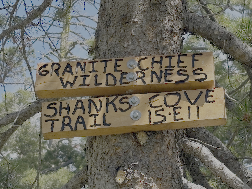
Back on the ridge, I headed on the north leg of the Shanks Cove Trail, going to the Western States Trail. There are a few down trees on the ridge, but other than one stretch through a dry meadow where the trail starts to head off the side of the ridge, easy to follow. And great views into Picayune Valley. The trail down across the volcanic bedrock is sketchy but acceptable. It drops steeply down a gully to the valley where an early season creek runs. Then up the other side, though down trees and brush fields, but the trail can be followed with care.
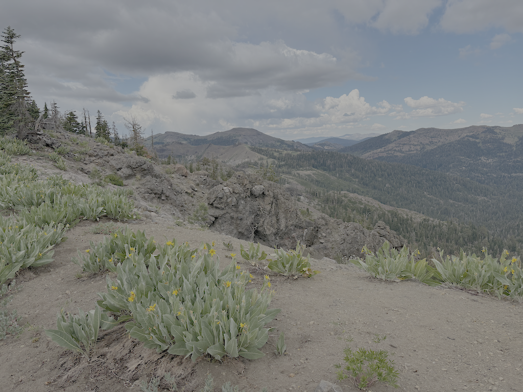
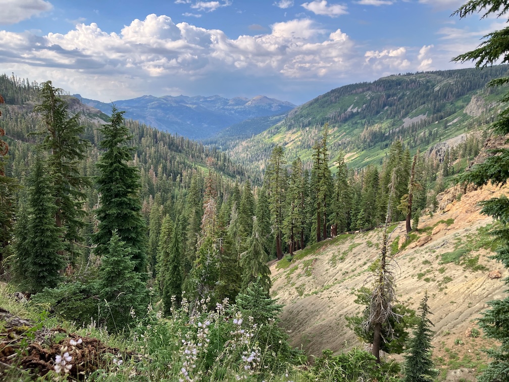
photo of view east from Shanks Cove Trail north section
view east from Shanks Cove Trail north section

I walked back on Western States to Whiskey Creek Camp, and slept. A long day, 27km on unmaintained trails.

The next day I went up Whiskey Creek Trail and north along the PCT. Sadly, there were bicycles ridden on the PCT the day before. At the junction with what I formerly called the Tevis Connector, and am for now calling the Middle Fork Trail, I headed down to the dry meadow beside Middle Fork American River, and set camp. With time left in the day, I explored the Tevis Cup reroute. The Middle Fork trail was worked last year and is in good condition, with two down trees. Where is meets the existing Tevis Cup Trail, there is no sign, just some ribbon. When the reroute is complete, the Middle Fork Trail will follow the old trail eastward, to a completed but hidden switchback to connect to the reroute.

I walked west on the reroute to the end of work, where the Great Basin Institute (GBI) trail crew was building switchbacks down through a mules ear meadow to eventual connection with the old Tevis Cup Trail, west of the difficult riparian and bog areas. My thought was that the Forest Service had given up on ever completing the full reroute, and was connecting to the old trail short of that, but got clarification from the WSER leaders on Saturday.

WSER Tevis Cup Reroute Project

I had signed up for a trail crew session with the Western State Endurance Run (WSER) organization. This is the lead private organization working on the reroute. I met the group of 14 at the PCT-Tevis Cup junction, and went to the work site, which is primarily the rock causeway through a wet area. Photo below, from an earlier trip. I worked on a pan through to carry a tiny creeklet, which turned out to be just the surface part of a considerable below-ground flow. A muddy mess, but the pan was build, and the beginning of the causeway extension beyond. Early afternoon the thunder boomed, it got very dark, and it rained and hailed for about two hours. The work crew set tents on tiny pieces of flat ground and waited it out, but my tent was on the Middle Fork, so I head back there. The sun came out, and I had four hours of sun to dry things, and the crew got more work done. Next morning I headed up to rejoin them and continued the work. Most of the crew was finding large rocks for the causeway, breaking up rocks into small pieces to fill the causeway and gaps, and sawing logs along the trail.

In the middle afternoon we hiked east on the unfinished reroute, then up to Watson Monument, down to High Camp, rode the tram down to the village, and ate dinner together.

I quite enjoyed working with this group of people. I had last worked with a trail crew on the Tahoe Rim Trail, about 15 years ago, and was nervous about working with people instead of by myself, but the group was welcoming and fun. They are all runners, both on the Western State and other runs, so they live in a different world than I, but are good people, and the crew supervisors were great, low key but with high expectations.

Some info about the reroute:

  • A Forest Service crew has drilled both the roughly blasted area at the east end of the reroute and many other spots to the west, and will blast sometime this season.
  • There will be two trails, the switchbacks down to the old trail, being worked by GBI, will be the horse route. The hope is that it will be complete for use next year.
  • A runner reroute will stay high all the way to Lyon Saddle, where Road 51 comes up to a trailhead. I formerly called this Foresthill Saddle, and it is on Foresthill Divide, but Lyon Saddle makes much more sense. It will take at least two more years to complete the runner route.
  • California Conservation Corps is not working this year, which will slow down the project.
  • When the reroute is complete, the trails may receive different names, hopefully less confusing.
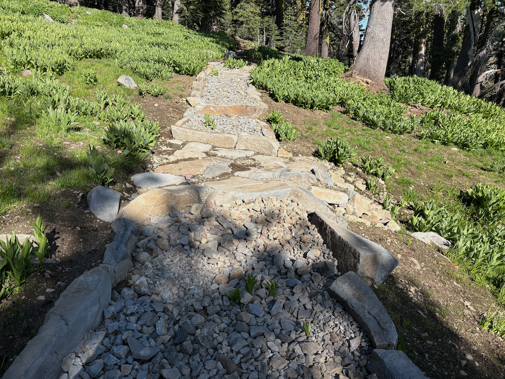
photo of Tevis Cup reroute rock causeway

Granite Chief 2025-07-12 trail survey

My third trip of the season was intended to be a trail maintenance trip, continuing on the Western States Trail, but I got a day-late start and decided to do another trail survey trip instead.

I walked in from Sunnyside on the road and Tahoe Rim Trail, and camped near the junction of the PCT and TRT. As previously reported, the TRT is in good condition, better than any of the other trails. After a mosquito filled night, I headed south on the PCT to Barker Pass. All of the springs and creeklets in North Fork Blackwood Creek and Blackwood Creek are flowing well. The trail has been logged out (TRTA?) and both brush and winter debris are pretty good. There were a few patches of snow, but nothing hard to cross. Some PCT thru-hikers I passed mentioned that there was a trail angel setup at Barker Pass, so I was envisioning the massive take-over of the trailhead area from two years ago, but fortunately it was small. I headed west on Barker Pass Rd/Forest Road 3 to the Powderhorn Trailhead.

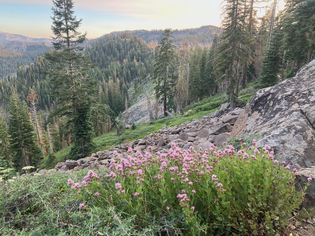
photo of mountain heather
mountain heather

Powderhorn has 16 new down trees, joining the existing ones, for a total of 52. And a lot of winter debris, which surprised me given that I had cleared it last year. It is going to be difficult to keep Powderhorn open and useable over the next few years. Someone horse-mounted chainsawed a few down trees, and established a long but fairly safe bypass (to the creek side) at the slide-under tree. Though chainsaw use in the wilderness is illegal, I can’t fault people for doing this, as the trails would otherwise become unusable with the Forest Service absence of trail maintenance.

In the afternoon I hiked most of the Bear Pen Trail. The sign at the junction is on the ground. There are many down trees, and heavy winter debris in areas. The trail can be followed with a close eye, but a few riparian areas with willow and dogwood were challenging. I had not been on this trail since 2008, and it is not really that much worse than then. It is not much used by anyone. The trail route and distance shown on GaiaGPS maps, which are based on Open Street Map, are incorrect. The distance is not 2.2km, but about 4.4km, until the trail fades in the meadow.

I camped at Five Lakes Creek below Diamond Crossing, one of my favorite camp spots. Heading up Five Lakes Creek Trail north, and counted trees for the first time, using a clicker. 219 from Diamond Crossing to the north junction with Big Spring Trail, and 38 more from there to Whiskey Creek Camp. The tread is deeply eroded in several sections, as there has never been any water control installed on this part. The section between the south and north junctions with Big Spring Trail is now hard to find, and I lost it repeatedly. The few people who use this area seem to be using Big Spring Trail, not Five Lakes Creek Trail. At the junction with Shanks Cove Trail, the sign is on the ground.

Big Spring Trail has 18 down trees, but overall is in acceptable condition, and easy to follow except in one dry meadow where you have to search for it when it goes back into the trees, in either direction. At the crossing of the dry or nearly dry creekbed just above the Big Spring, the trail into the meadow jogs up creek, and if you miss this, you’ll be ankle-deep in the spring marshy area. I hung out in the meadow, another of my favorite places.

The trail crossings of Five Lakes Creek are probably still wet. One could find rock-hop crossings, but you get tangled up in brush and debris piles along the creek, so it is probably easiest to just wade across the creek.

The rest of the trail to Whiskey Creek Camp is somewhat better, probably mostly because it gets more use. I think a lot more people go just to Big Spring Meadow and not south from there, so the trail is more evident. This section of trail could be brought back, unlike the section to the south which is probably a lost cause.

I camped at the cliff edge beyond the Five Lakes (which two are large lakes, the western one of which breaks into two with lower water, and a large number of small ponds), windy, but a nice place to watch the end of one day and the beginning of the next.

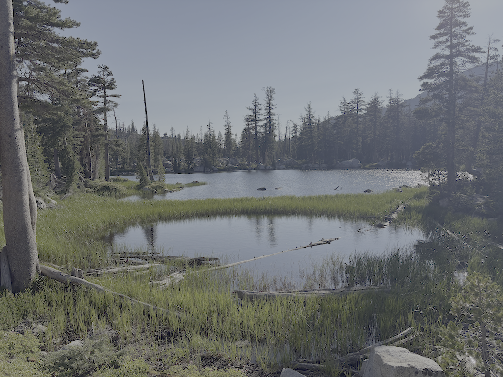
photo of Five Lakes second lake
Five Lakes second lake

Next morning out to River Ranch, TART bus to Truckee, morning at Dark Horse Coffee, and Amtrak bus home.

I’ve updated the Trail Conditions page with this survey trip. I am also gradually converting GPS tracks I’ve made over the years to routes, and providing links to them.

The trails I’ve not been on this season are Shanks Cove, Greyhorse, and Hell Hole. Maybe I’ll get there, maybe not, but as always, an invitation to anyone who does to submit a trip and trail conditions report.

Granite Chief 2025-07 WS trail work

Second trip of the season, July 1 to 6, 2025. As always, I got to and from the wilderness using Amtrak train or bus from home in Sacramento, and the TART bus south from Truckee to Tahoe City. No need to drive!

I started at the Western States trailhead on Hwy 89 at the Truckee River bridge. I’m calling this the Western States (Olympic Valley) Trail to distinguish it from the Western States Trail through Picayune Valley. Both parts have the same trail number, 16E10. There is parking on the east side of the bridge, and a sidewalk on the bridge to the west side, where the trail starts. The first part of the trail is very well maintained, by Truckee Trails Foundation, and includes some new signing. As the trail crosses into Palisades Tahoe ski area, the trail is not as well maintained, and there is almost no signing for the trail, making it hard to follow. There were actually more signs when I last hiked it in 2021. Some parts are trail, some parts are on ski area roads. Nevertheless, I made it to Watson Monument on the ridgeline, and then descended to the PCT at the PCT/Tevis Cup Trail/Western States Trail junction.

photo of Western States Trail (Olympic Valley) in Tahoe Palisades
Western States Trail (Olympic Valley) in Tahoe Palisades

I proceeded south on the PCT to Whiskey Creek Trail and then camped near but not at Whiskey Creek Camp. The PCT has not been maintained this year, so has down trees, light to heavy winter debris, and brush in some areas.

The primary purpose of this trip was to do trail maintenance on the Western States Trail. I had done a little last year, and continued, working west from the camp. There were two very thick brush areas, one of whitethorn and aspen, and the other of whitethorn. Whitethorn is much softer at the beginning of the season, but gets harder and sharper as the season goes on. It is not too hard to cut now, but later will exact a revenge in blood. I also cut a number of small down trees. Ten larger ones remain, but now with bypasses or step-overs. I worked as far as the creek crossing, which is a tributary to Five Lakes Creek, and the only water on the the trail before it drops into Picayune Valley. Only 1.4km of progress, but satisfying. I’ll likely continue on Western States next trip. I continue to be very happy with my Silky Big Boy folding saw and Fiskars nippers.

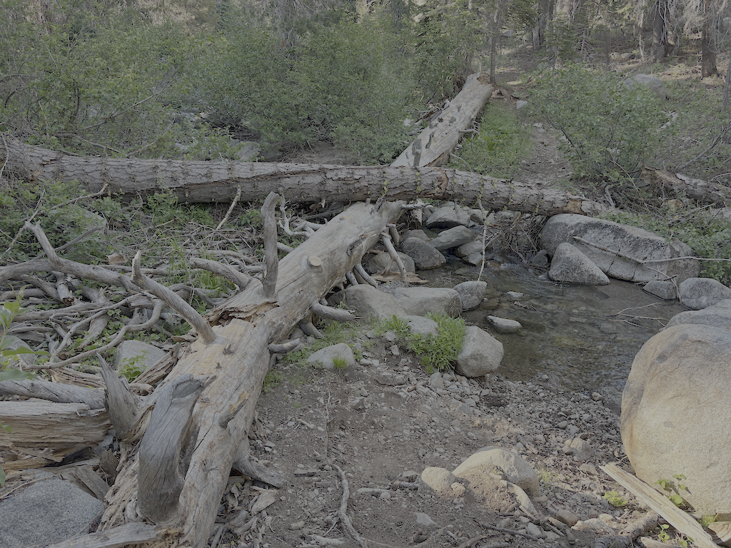
photo of down trees at Whiskey Creek crossing
down trees at Whiskey Creek crossing

After completing as much as I could, I returned to the PCT and headed south, camping on the ridgeline at one of the few flat spots. The tread has a lot of loose rock, particularly from Ward Peak south for a mile, and has some brushy spots. The section where I have spent many trail work trips keeping brushed out is starting to close in again, but should be OK until next year.

At the Tahoe Rim Trail (TRT), I headed out through Ward Creek to the road, and thence to Sunnyside. Lunch at the store, and bus to Tahoe City, for shower, pizza, concert, and sleep.

I have been buying a few things at Alpenglow Sports in Tahoe City. I can get the same, often less expensive, at REI, but since I’m in Tahoe City at the beginning or end of every backpack trip, it is actually more convenient to go there than the Sacramento REI which is in a car-infested part of Sacramento. And they are good, knowledgable people.

Check the Trail Conditions page for specific info on each of the trails that I walked.

Granite Chief 2025-06

My first Sierra backpack of the season! Rode to Truckee on the California Zephyr, and then Olympic Valley on the TART 89 bus. I enjoyed Palisades Tahoe Bluesday, then hit the trail to sleep out. Went up the Granite Chief Trail, which is largely in good condition. I took a side trip north on the PCT to North Fork American River, and then a short way down the Painted Rock Trail. A reader had asked me about that trail, so I wanted to at least know if it was still there and findable. It is, though hard to follow and not used so far this year. I’ve not used that trail in many years, but the challenge was the wet areas with alder and willow thickets where is was hard to follow the trail.

Then headed south on the PCT, I was intending to traverse north to south as a survey trip. But my attention was grabbed by the Tevis Cup Trail reroute, which I’d written about last year in Granite Chief 2024-08 trail survey. There is no evidence of trail crews there this year, and information on Western States Endurance Run indicate that funding was canceled or held as part of the Trump destruction of the Forest Service. I walked the east end, which is more or less as it was last year, though one blast area has been reconstructed. The middle part is a bit more polished than last year, and extends a little further west though a meadow. I had been told last year that the flagging extended all the way west, but I was not able to follow it past a alder and willow riparian area, so it may or may not exist. I gradually descended through open forest and small meadows to rejoin the existing trail near the switchbacks (the nearly-flat switchbacks). I headed out to the trailhead at Forest Hill Divide (as I call it, it doesn’t seem to have an official name) where the Tevis Cup Trail continues west along the ridge, heading eventually to Auburn.

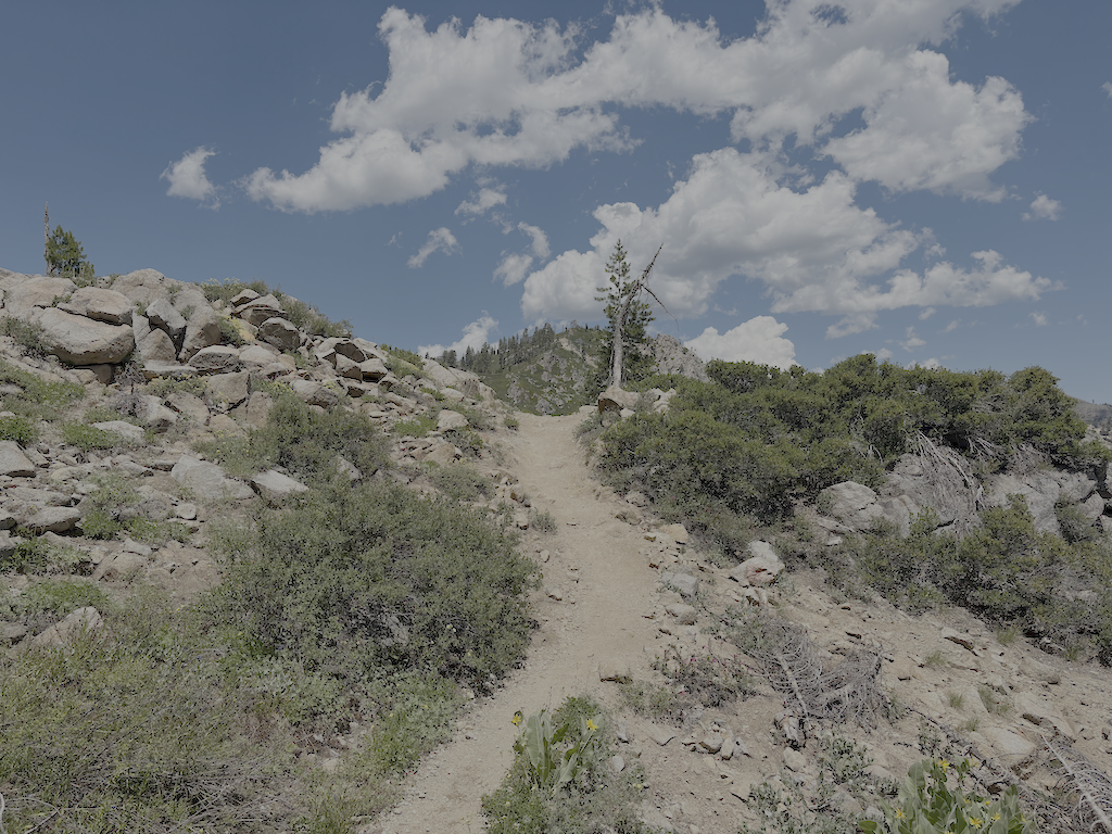
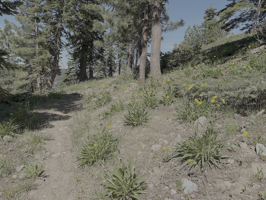
photo of Tevis Cup Trail and flowers
Tevis Cup Trail and flowers

Walked down the Talbot Creek Trail, which was constructed a few years ago, some following an old logging road and some newly constructed. It has a nearly-flat switchback section as well, probably the same designer. The trail is not much used. The southern end trailhead is not marked by any signage, nor is the junction of Forest Road 51 with French Meadows Road, which leads to the trailhead.

After a rest at Talbot Campground, I headed back into the wilderness on the Western States Trail, my favorite trail and location in the wilderness. There are a lot of trees down, joining those already down from previous years. And a lot of winter debris, heavy in some areas. Crossing Middle Fork American River is close to a rock-hop, but still wet. I used a log downstream. The wet areas beyond, particularly in the aspen grove areas, have dense growth that obscures the tread, though your feet can find it, and branches hidden away to trip you. Other than an area on the switchbacks to the saddle, and descending to Whiskey Creek, brush is not bad.

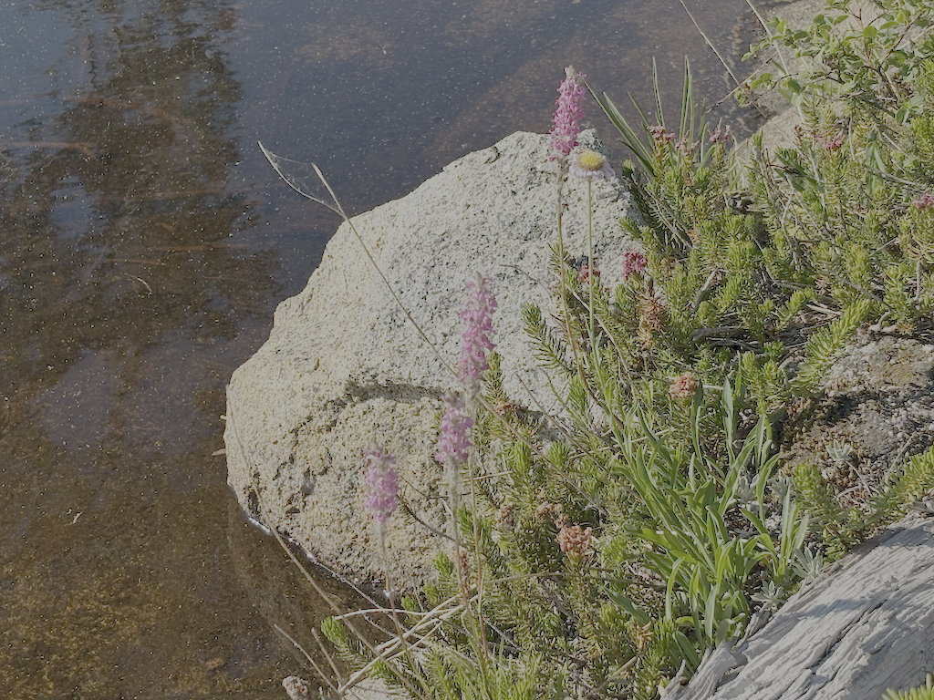
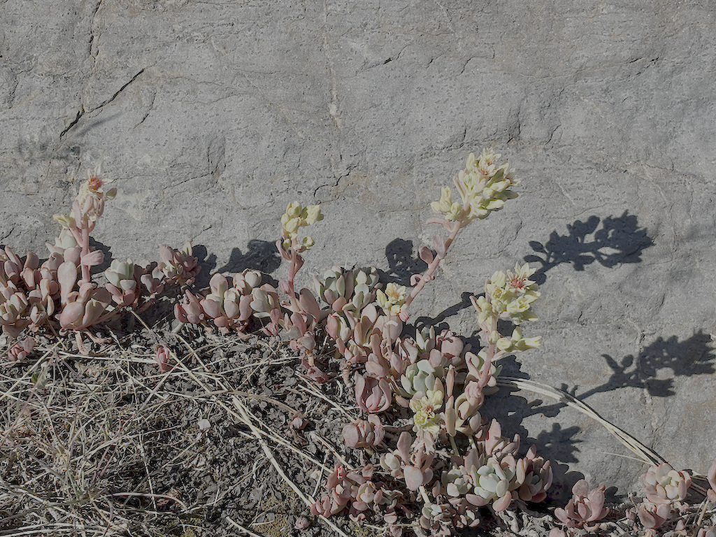
photo of Sierra stonecrop
Sierra stonecrop

I passed a group of eight backpackers headed along the Western States trip from Whiskey Creek, which is about as many as I usually see in a year. The crossing of Whiskey Creek has another tree down, blocking the rock-hop, but the large tree that has been down for several years makes a good crossing. Whiskey Creek Trail has a few rotted down trees, and one new small, otherwise in good condition. I camped north of the ‘Squaw’ Saddle Trail, at the divide between Five Lakes and Olympic Valley. With runners in the area for three events, including the Western States Endurance Run the next day, there were runners all over the place. Most place names have been changed away from ‘squaw’ but I don’t know if the trail name has been. This trail descended into Olympic Valley, and is the original trail route before the Five Lakes Trail was constructed.

Walked out the Five Lakes Trail, which is in good condition, caught the bus to Tahoe City, grabbed some items at Alpenglow Sports, best in the area, then back to Truckee on the TART bus, to Word After Word for a book, to Dark Horse Coffee in Truckee for tea, reading and writing, and then the Amtrak bus home to Sacramento. Whew!

Though plans are never certain, and I often change my mind, I think my next two trips are going to be for trail maintenance on the Western States Trail. Survey trips on the other trails will have to wait. It was hot enough at Talbot Campground/Trailhead, 1722m, that I think my trip on the Hell Hole Trail to the end at 1439m will get delayed until September, though I’m always looking for cooler stretches of weather.

upper Hell Hole Trail 2024-10

Yes, I did one last mountain backpack of the season in October, and no, I didn’t get around to posting until today.

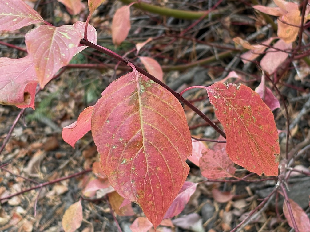
photo of creek dogwood, Cornus sericea
Cornus sericia

I went up on the Amtrak bus, because I’d missed the California Zephyr, TART to Tahoe City, and then walked to Kaspian Campground (TART west shore ends earlier in the day) and slept there (closed after Labor Day). I missed the Zephyr because I was looking over possible trans-Sierra routes that might have been used by a horseback break-off from the Stephens-Townsend-Murphy party in 1844. A person named Bob Crowley is investigating, and it captured my attention. Apparently they ended up on the Middle Fork American on the west side, which reduces likely routes.

Up Blackwood Canyon the cottonwoods were a brilliant yellow. I think Blackwood might be named for these black cottonwoods (Populus trichocarpa). The aspens were beginning to turn, but not bright, and I suspect this will be a mild color year for aspens. Creek dogwoods (Cornus sericea) were pale red to bright red. Forest thinning has been going on all summer and still in Blackwood Canyon, and the buzz of chain saws is constant.

Most creeks are still flowing. I’ve noticed that if a creek makes it through the end of the summer, it will continue, whereas if it does not, it will not recover in the fall. Shorter and cooler days, and lessened evapotranspiration free more water to the creeks.

I crossed Barker Pass and walked to the Powderhorn trailhead, then down Powderhorn to Diamond Crossing. There are some new trees down on Powderhorn since my last trailwork September, and more debris. This will be a constant for years. There was a light dusting of snow in shady areas, from a storm a few days before.

I camped at my common spot along Five Lakes Creek below Diamond Crossing.

I intended to walk the whole Hell Hole Trail to the bottom, but short days and a late start meant that I only did the upper trail, a bit beyond Steamboat Creek. The creek is dry, as it almost always is in the fall; it is an early season creek only in most years. Both forks of Buckskin Creek were flowing, though low. The trail has a lot of debris, which surprised me until I remembered that it had been four years since I’d done work including debris clearing on this trail. There are a few new trees down, and a lot of leaners and spars, which I can take care of next year with a folding saw. It will take at least two trips to clear debris again and the small cutting. Though not as bad as the red fir forest, this forest will continue to need maintenance. There is relatively little brush on this trail, compared to many. As with most trails in the Granite Chief, there is more maintenance by bears and deer than by people.

The black oaks (Quercus kelloggii) fall colors were mostly yellow, but with spots of red and orange. A wonderful time of year at this elevation (1800 m, 5900 feet).

GaiaGPS Gaia Topo layer shows two trails descending to the Rubicon, neither of which are on the alignment of the trail I’ve been maintaining. They may or may not exist, I’ll check on a future trip. Also shown is a road from the current end at Grayhorse Creek all the way around the head of Hell Hole Reservoir. I doubt that it exists, or ever existed, but again, will check it out. All of the ‘trails’ in the Hell Hole area a old non-maintained trails or use routes, except for the trail along the south side of the reservoir to the campground, which has been constructed though not much maintained. Most people access the campground by boat, not trail.

The next day I hike out, same route as in, up Powderhorn, over Barker Pass, down Blackwood Canyon, out to Kaspian Campground. The forecast was for a very cold night that night, particularly in Truckee which is often colder than Tahoe City, so I caught the TART bus and took Greyhound home. The Greyhound is the last bus of the day westbound, after the Amtrak buses.

That’s it for this year! I’ll be back to the Granite Chief in June or July, depending on snow melt.

trail work and Shanks Cove 2024-09

This backpack was September 10 to 14. More than a month ago, but when out of the wilderness, it is out of mind, and I forget that I haven’t posted trips. I’m planning one last backpack trip tomorrow (October 21), for Granite Chief. I backpack in the foothills and Bay Area during the winter.

My. trip up to Truckee on the California Zephyr was much delayed. A person was smoking in the bathroom and started a fire that smoked out that car and caused much consternation. My view of people who are so addicted to smoking that they can’t go without it, ought to try some other drug that ends their misery. He was hauled away in handcuffs by the county sheriff, but would be facing federal charges since Amtrak is a quasi-federal agency.

I went in at Five Lakes or Alpine Meadows trailhead (it gets referred to as both), and camped at Whiskey Creek Camp. I ran into a couple who had been doing light trailwork on the Five Lakes Creek Trail, and said they had been coming to the area since the 1970s, which was long before it was designated wilderness. I neglected to get their contact info, but it would be interesting to talk to them about their experience over the years. I don’t often run into people who have been going there longer than I have, but my first trip was 2002, I think.

I did trailwork on the Western States Trail, from Whiskey Creek Camp, but accomplished less than a kilometer of brushing, mostly whitethorn, which quickly encroaches on the trail. Early season whitethorn is pliable and doesn’t draw blood, but late in the season it is quite stiff and does draw blood.

Fall colors were well underway, casting a yellowish light, but the aspens had only just begun to turn, mostly a few branches but not whole trees. The air feels different, and sound carries differently. At twilight, two great horned owls were calling, for quite some while.

I hiked the Shanks Cove TraIl as far as Shanks Cove, which is an alder and willow filled wet area, which used to have some open meadow but has been filled in. The trail has at least 94 down trees, but the bigger challenge is following the trail through some patches of brush or alders, and I lost it four times. The crossing of Shanks Cove Creek is not obvious. There was a little maintenance here about ten years ago, but many of the down trees have been here far longer. The brush is not thick, except in a few places, but it would take a lot of work to clear. The creek was low except in bedrock sections. It’s a pretty canyon to hike, even if the trail is poor. I did not continue beyond Shanks Cove, so don’t know trail conditions for the climb to the ridge, and the other section that descends to the Western States Trail.

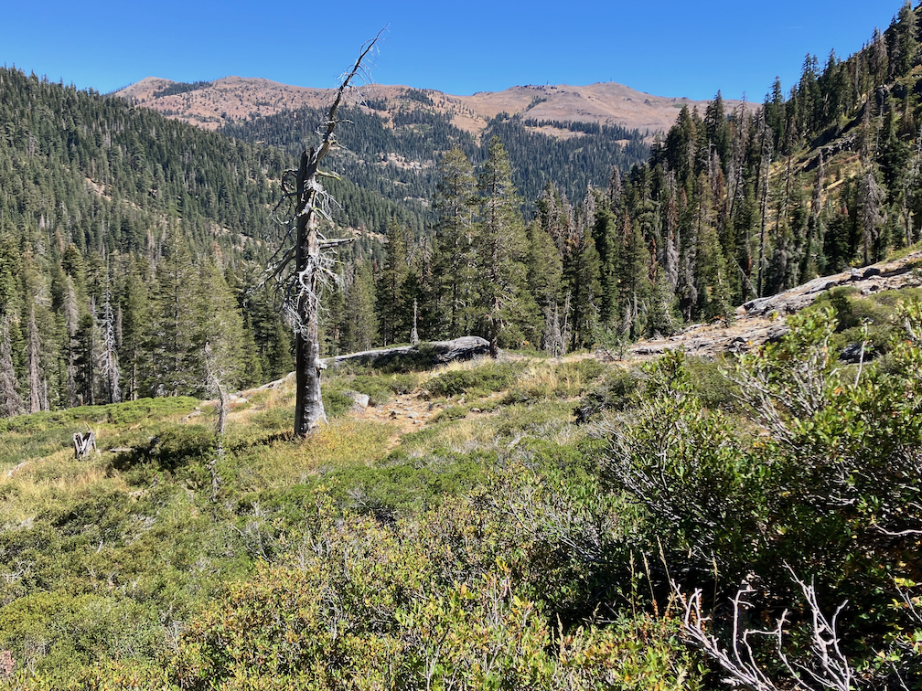
photo of crest from Shanks Cove Trail
crest from Shanks Cove Trail

I hiked the PCT north to Middle Fork American River and camps the night there, great stars. The creek is low but flowing. I continued north to the Granite Chief Trail and out to Palisades Tahoe. TART bus to Truckee. I’ve started going to Dark Horse Coffee, on River Street in Truckee. Used to go to CoffeeBar, but their service deteriorated, and Dark Horse still has good service. As always, a tea drinker and not a coffee drinker.

Overall, all the creeks were still flowing, but noticeable low with the fall season. As the creeks drop, it is more challenging to gather water from them. Of the creeklets which cross the trails in several places, most were dry, but surprisingly, some were flowing quite well. It was a strange year for water, very wet early in the season, particularly at higher elevations where there was above average snow, but the lower elevations where there was almost no snow were dry early.

Photos on Flickr:

Granite Chief 2024-08 trail survey

With this trip, I retired my old hiking boots and started with new. My boots are Altra Lone Peak, which is the only brand I’ve found that offers a wide toebox that my feet require. The old lasted a little over three years, since June 2021, not bad. The soles were more worn that the tops, but both were done. Altra has saved my hiking, as any boot without a wide toebox causes me great pain, and the one other common brand with wide toebox just doesn’t work for my feet.

The purpose of the trip was mainly trail condition survey. I often do that early in the season, but didn’t get to it this summer. Conditions for the trails I did are listed below. I went in at Granite Chief Trail (after enjoying Bluesday at Palisades Tahoe), then south on the PCT. The number of PCT hikers has dropped off, but there are still some going, either late starts or flip-flopping.

I was curious about rerouting of the Tevis Cup Trail, a project which started last summer and will continue through next summer. A CCC (California Conservation Corps) trail crew is base-camped at Little Needle Lake, and working from near the PCT to the west. The reroute is in varying stages, ranging from just sketched out enough to follow from being walked on by the trail crew repeatedly, to essentially complete. Several rock outcrops near the east end had just been blasted the day before, leaving a mess that requires a lot of reconstruction. The crew has worked as far west as a small seasonal creek, which will probably be the only water source on the rerouted trail. Though the trail route has been flagged through to its connection with the old trail, somewhere, I did not follow beyond the existing work, but I’m guessing a little more than half of the reroute has at least been started. This will be a very nice trail when completed! As I’ve written before, the Tevis Cup Trail design was horrible, gaining and losing altitude repeatedly, often for no apparent reason. I don’t recommend that you try to follow the new trail until the end of next summer, I do encourage you to enjoy it when finished.

A Great Basin Institute trail crew was working on the cross-trail between the PCT and Tevis Cup, which I call the Tevis connector though it is not clear what its official name and number is. They are camped at the flats beside the Middle Fork. Because the reroute crosses the slope of Lyon Ridge much higher than the old trail, several new switchbacks are being worked to bring it up to that level. If you follow the old trail west from the PCT, the obvious worked trail will take you all the way down to the Middle Fork. The junction with the old trail is marked by a rock wrapped with flagging, but could be easy to miss.

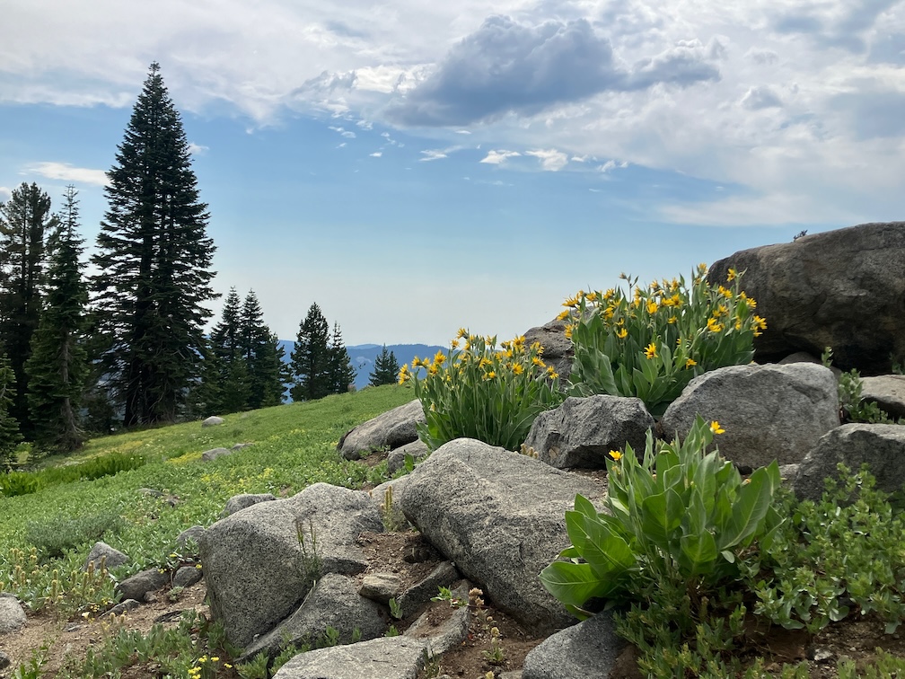
Knotweed is brilliant fall color right now, bright to pale red, and occasionally yellow and orange. It paints the west slopes below Wa-she-shu Peak with color, mixed in with other plants of fall color. Some of the wooley mules ears fields are browned out, while others are mix of green and yellow. Though few things are still flowering, the California fuschia at lower elevations are striking red.

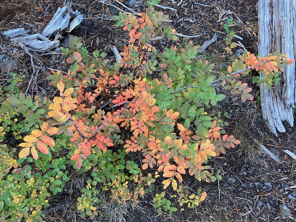
photo of mountain ash in fall color
mountain ash in fall color

All my previous trips I had been sleeping under clouds, or smoke, or trees, but I had a full view of the sky with only a crescent moon to obscure. I have to admit I’ve forgotten a lot of constellations, but the night starts with the summer triangle overhead, and ends with Orion up in the east, and Jupiter.

I was going to do a loop out the Tevis Cup Trail to Talbot Creek Trail and back in on the Western States Trail in Picayune Valley, but realized I really didn’t want to deal with the old trail, and never will have to again. So I headed south on the PCT to Whiskey Creek Camp, and then west on the Western States Trail (which is called the Historical Western States Trail on some maps, I guess to distinguish it from the Western States Trail run on the Tevis Cup trail. Picayune is one of my favorite places in the wilderness, and I spent two nights there. Hiked out the trailhead one day, recording trail conditions, and lolled by the creek as much as possible.

The rain last week, while I was home, perked up three ferns that grow among the metamorphic rocks in Picayune Valley: cliff-brake, lace, and indian dream.

My ambition was to come back and do the Shanks Cove loop up the ridge and back down to Five Lakes Creek below Big Spring Meadows. But ambition failed me, and I stayed a night at Whiskey Creek Camp.

I hiked out Squaw Saddle Trail (has it been renamed?) and Five Lakes Trail to the trailhead. I walked the Bear Creek Trail towards River Ranch, planning to sleep part way along. But there are only two flat spots along the entire trail, one by the water tank and another on a bald hillock. But I noticed the hillock was covered with bicycle tracks, and I suddenly had a vision of being run over by night-riding bicyclists (which has become popular in the Tahoe area), and I had already passed the tank, so I walked all the way out to the stables and then bottom of Alpine Meadows road and camped by the river. I was surprised to see how many creeklets cross this trail, including at least three that are probably year-round. But the creeklets are all east of the water tank sleeping area.

While on this trip I finally identified the low shrub that I had been working on the Powderhorn Trail. It is snowberry, Symphoricarpos. It spreads by sending out runners that root. Sometimes across the trail, and those runners age to an almost unbreakable trip-wire, which is part of the reason I try to get it out by the roots, and cut it back if I can’t. On my earlier trip, the white berries were not there, but now they are, so I was able to identify. On the plus side, there was a patch of the gooseberry without spiny fruits around the old wilderness info sign at the beginning of the Tevis Cup Trail. Hmm, delicious.

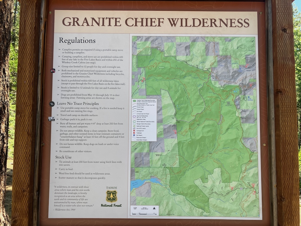
There is a new trailhead map at the Talbot trailhead. It has the extended wilderness boundary on the northwest (lands purchased by the American River Conservancy), the new name Wa-she-shu, and a few other details. Unfortunately, it still shows the Buckeye Trail, off the Hell Hole Trail, which is essentially unfindable.

photo of Granite Chief Wilderness trailhead map at Talbot trailhead
Granite Chief Wilderness trailhead map at Talbot trailhead

I finally figured out why my hips have been hurting this entire season. The waist belt on my Osprey Atmos 50 AG backpack has velcro attachments between the hip belt and the waist belt. On one side, the velcro no longer holds where it is supposed to, so the waist belt no longer cinches as tight as it should. So the pack was riding low on my hips and causing pressure with every stride. It also explains why I was more and more holding onto and pulling in on the shoulder straps, trying to pull the pack up off my hips. Though these are called hip belts, they are meant to go above the hips, to ride on top of the pelvis and not on the hips. I will have to get that fixed during my late fall slow backpacking time.

Trail Conditions

  • Granite Chief Trail (15E23): good condition, one 9 inch down tree, could use spot brushing; adopted by Truckee Trails
  • PCT south to Tevis: good condition, one 6 inch, some debris*
  • Tevis Cup Trail (16E04): see notes above, old trail unacceptable, new reroute not complete
  • Tevis Connector: good condition
  • Little Needle Trail: This is not marked on maps and was formerly just a seldom used and hard to follow hunters trail, but with the CCC trail crew camps at the lake, it is now easy to follow.
  • PCT south to Whiskey Creek Trail: good condition, five down but all easy to step over or bypass, some debris
  • Whiskey Creek Trail: good condition, except broken tree fragments at the bottom
  • Western States Trail (16E10): to Shanks Trail, 16 down trees, some very brushy areas, moderate debris; to Talbot trailhead, about 30 down (forgot to record), some brushy areas, some areas of moderate debris; most of the down trees have established bypasses or can be stepped over/climbed over, but some newly fallen are difficult; though there are a lot of down trees on this trail, it is still worth walking or backpacking; the trail sign at the junction of Western States and Shanks is broken and down, but still readable
  • PCT south to Squaw Saddle Trail: good condition, one down tree, well brushed
  • Squaw Saddle Trail (if it is still called that): good condition
  • Five Lakes Trail to Alpine Meadows Trailhead: good condition, could use spot brushing

Trails not checked so far this season:

  • Shanks Trail
  • Greyhorse Taril
  • Hell Hole Trail
  • Talbot Creek Trail

*debris: I used to call this winter debris, the branches and cones that fall out of the trees during the winter, but since if falls year-round now from dead trees, I’m calling it debris.

Photos on Flickr:

Granite Chief 2024-08 smoked out!

This was a ‘didn’t go as planned’ trip. My plan was to do a lot of trail work on the Powderhorn Trail.

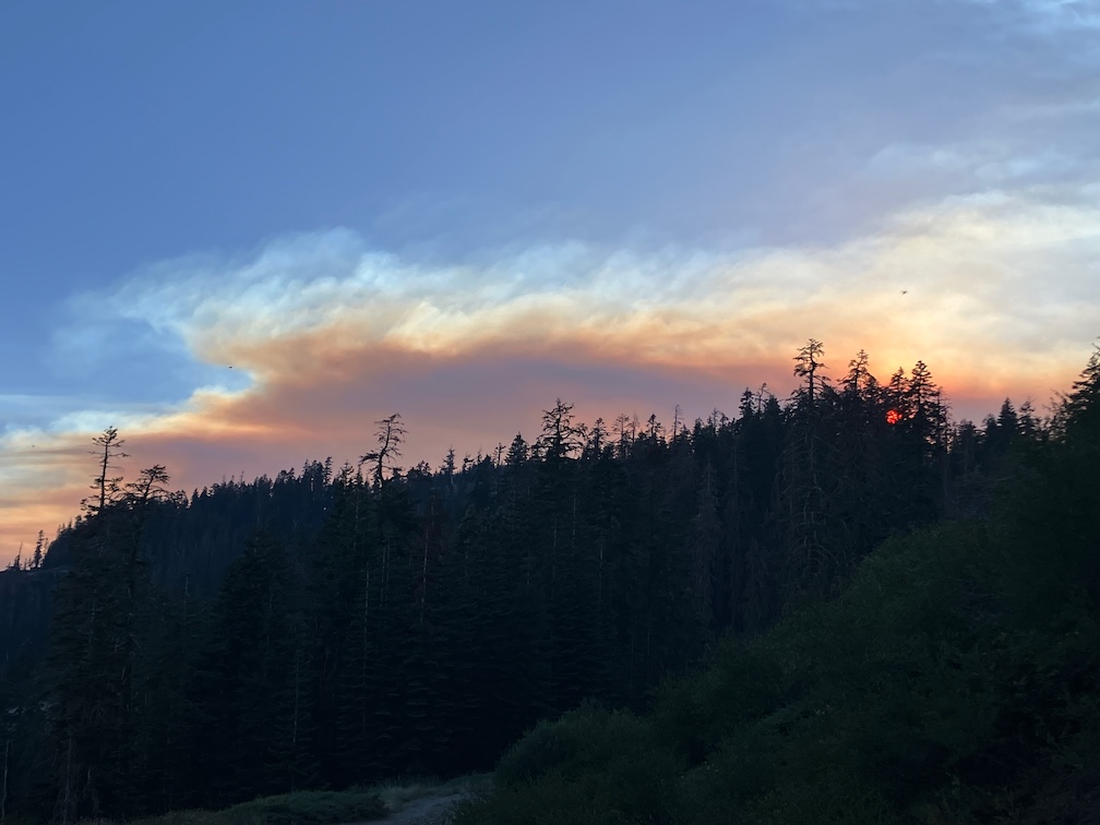
Train to Truckee, bus to Tahoe City and then Barker Pass Rd. I had hoped to hitch-hike to Barker Pass, but it was a weekday in the afternoon, and all the vehicles were going out, not up, so after a short hitch to the campground, I walked up the jeep road to the pass and then to Powderhorn trailhead. On my way up on the train, people were commenting on the smoke plume to the south, which turned out to be the Crozier fire north of Placerville. When I got to Powderhorn saddle, the plume was quite visible and spectacular, overhead. I started down into the canyon, but in short order the smoke descended into the canyon, reducing visibility to less than a quarter of a mile. I went back up to the saddle and camped there, where the air quality was a little better.

Crozier fire smoke plume

In the morning, smoke was filling Powderhorn, so I waited, and walked west on the old logging road to the creek, refilled water, and then back along the Barker Pass Rd to the saddle. The air cleared mid-morning, so I headed down and started my trail work. I have a new folding saw, which I’ll say more about next post, that allowed me to cut some down trees that I’ve always had to bypass, plus a little spot brushing. And then the smoke descended again, worse than before. So I headed out, and went to Barker Pass where the air was better, camped, and waited to see what would happen. Both the Rubicon drainage to the west and the Tahoe basin to the east were socked in with smoke in the morning. I realized that the only thing to do was head south on the PCT, away from the smoke plume. I was surprised by the number of PCT thru-hikers I saw, seems late in the season for them to be here.

By Richardson Lake, the air was good, and continued to get better on the PCT south. Looking back north, I could see that the smoke had descended into the valleys again, so if I’d tried again, I would have gotten smoked out again. There are a few patches of snow in the Crystal Range, but much less than two weeks ago. I spent time at my favorite juniper along the PCT, and then headed down into the General Creek drainage.

The connecting trail from PCT down to Genevieve Trail (which used to be called the General Creek Trail) is not really a trail. It was never constructed, has a lot of down trees, and is very hard to follow in places. This time of the season General Creek is just large pools with no flow, so is easy to cross, but I’ve had problems with that earlier in the season. I camped near the trail junction. This is a seldom used area. In the morning I headed over to Genevieve Lake, on a trail in decent shape with some down trees but easy to follow.

The Meeks Creek Trail (also called Tahoe Yosemite Trail on many maps, but it is a relict name) is a different world, only wilderness in name. Suddenly a whole lot of people, and more and more heading down Meeks Creek and out to the trailhead near Meeks Bay Resort. After iced tea, to Sugar Pine Point SP for a shower, then on to Tahoe City and Truckee, and the Amtrak bus home.

Photos on Flickr:

Powderhorn trail work 2024-07

I started this trip at Granite Chief Trail in Olympic Valley, as it is the most convenient trailhead. The evening before I attended the Palisades Tahoe Bluesday concert in the village. A lot of people there, many from the Reno area, and the Reno blues group is one of the event sponsors. Camped out at a favorite spot part way up and off of the trail after the concert, and then headed up the trail early morning. My break was at a juniper tree about half way up, where I have often stopped, but someone has made a nice bench out of a dead juniper trunk, just below the tree. There have been helicopters up all morning, but over the ridge south, in the Alpine Meadows / Bear Creek valley. Probably a lightning strike tree.

Thunderstorms were building over the Mt Rose area northeast of Tahoe, but I don’t know if rain came of it. Someone at the concert was mentioning heavy rain that afternoon, but I didn’t catch where. As with last trip, there is zero precipitation in the forecast, but the reality is different. But I had no rain on this trip, and one full day of completely clear skies.

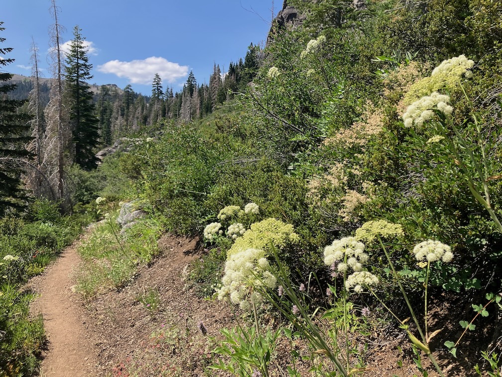
photo of 
Angelica lineariloba, Apiaceae

I headed south on the PCT and then to Whiskey Creek Camp. There are a lot more PCT thru hikers than I would expect at the end of July. A few of them may make Canada. Then down Five Lakes Creek Trail, which raises my frustration level, climbing over down trees for long stretches. I took the main trail, not through Big Spring Meadow, and it appears to be unused until it rejoins the meadow trail. I lost it several times before and after the junction with Shanks Cove Trail. I walked a short distance on Shanks Cove, at it also appears unused. The few people who use Five Lakes Creek Trail go through Big Spring Meadow, which is understandable, it is a beautiful place. And the spring, though hard to access, is wonderful water. I camped at my common site beside Five Lakes Creek, off the trail near Diamond Crossing.

I did two and a half days of work on Powderhorn Trail. Though I had done the lower one-third last year, there were new down trees and winter debris, so I re-worked that section. I had laboriously cleared a bypass of the slide-under tree, safe for at least backcountry-wise horses. But a tree came down on the bypass, so the Powderhorn is again not accessible for equestrians. I then tackled the part I’ve not maintained in many years, the middle third. I made good though slow progress, completing up through the postpile meadow to the creeklet. This is about another 1/6, leaving 1/6 yet to do. And that 1/6 is largely a mess, about 1 km of down trees and winter debris, including one tree fallen directly on the trail.

I saw eight backpackers and two day hikers on the Powderhorn, which is a little surprising for a difficult trail that seems to be not much used. So maybe my work is worthwhile. It is certainly a pleasant experience on some parts of the trail, and if I can make is so, it is worthwhile.

photo of Ageratina occidentalis, Asteraceae
Ageratina occidentalis, Asteraceae

I explored the Hell Hole Trail from the Diamond Crossing junction to Five Lakes Creek. It is hard to follow through the seasonal growth and dry grass. There are duck markers but they aren’t all inter-visible. The most recent trail alignment is very hard to follow as it approaches Five Lakes Creek, though the alder thickets. Someone has partly ducked an alternative route that stays north of the dry drainage and comes out on the gravel bar just upstream of the crossing. It is also not well marked, but may be a better alignment. The ducks/cairins that I had set up two years ago are all gone, washed away or fallen over, but the crossing is upstream of the log jam across the creek. It may be a little hard to find the trail on the west side of the creek, but once found, it should be pretty easy to follow. I’ve spent a lot of time finding and clearing this trail, all the way to the bottom near Hell Hole Reservoir. Of course, as with every trail, it has a lot of down trees.

After a half day of trail work, I headed out Powderhorn Trail, FR 3 to Barker Pass, north to the PCT-TRT trail junction, and then down the TRT into Ward Creek, and camped at a small site beside a creeklet. Though I hadn’t really needed my inner tent for mosquitos on this trip, I did here, ample mosquitos. All day there had been a strange overcast, which turned out to be smoke aloft from the Park Fire. Nothing at ground level, where the smoke is going north and east, but smoke aloft was coming south.

Next day I walk out to the road and down Ward Creek to Sunnyside, and caught the bus into Tahoe City. Went to the Commons Beach concert, and camped in the forest nearby, then morning TART bus to Truckee and the Amtrak bus home.

An update on my inflatable sleeping pad. After patching some small leaks, it was still deflating during the night at an accelerated rate. So after seven years of good use, it is retired. I bought a Nemo Tensor inflatable sleeping pad as a replacement. Slightly more weight and slightly bigger, but in the same range.

Photos on Flickr:

Granite Chief 2024-07

For my second trip to the Granite Chief, I took the Amtrak bus up to Truckee, then TART to Palisades Tahoe. Attended Bluesday, the weekly blues music. The band was Mark Hummel, famous, so the event was packed. I camped off the old Granite Chief Trail at a place that I’ve settled in on for sleeping out after the music. In response to getting chewed by mosquitos on my last trip, I brought my inner tent with mosquito netting, though the mosquito clouds had fallen off to some degree.

As always, I checked the weather forecast for Tahoe City when deciding what to take. The forecast was zero percent chance of rain. But while going from Granite Chief Trail to Whiskey Creek Camp, it rained for about two hours, moderate rain, from a thunderstorm with lightning and thunder. It stopped late afternoon, and I was able to stay somewhat dry by sheltering in a hollow dead tree. There was a preview when it rained lightly for a short time the night before. In fact, it rained a bit every night on the trip, while every day the forecast was the same, zero percent chance of rain. Either these thunderstorms were happening just over the ridges, not over weather stations, or the weather forecasting has failed.

On this trip I had several negative interactions with trail runners. The rule, though not the law, is that downhill people yield to uphill people. But runners seem to think they have the right of way over everyone else. One runner actually ran into me and knocked me off the trail. Several other runners said I should get out of their way. So I’ve adopted a new policy for myself: I don’t yield to trail runners. If they insist on having a negative physical interaction with me, I’ll knock them off the trail.

The morning after the thunderstorm, there were helicopters up with water buckets, first a small helicopter, and then a heavy-lift dual rotor helicopter. I’m not sure whether they were fighting a single location or more than one, because the fire was over the ridge from me.

The Forest Service, with this suppression-at-all-costs policy, is harming the wilderness ecosystem. Every fire that gets put out the same day is a fire that cannot reduce the fuel build=up. The wilderness will burn, that is inevitable, and when it burns, it will be a catastrophic, forest-clearing fire. Why? Because the Forest Service has suppressed fire and allowed fuel to build up to a completely unnatural level. Fire is part of the natural environment. I realize that it may be necessary for fires close to towns to be suppressed, and the fuel reduction function replaced by mechanical reduction, but the fire being suppressed was in the middle of the wilderness, not close to any human habitation. There have been trends over the years towards letting wilderness fires burn, and away from that, and the last few years there was a trend toward fire, but for some reason this year, all that progress has reversed and we are back to suppression-at-all-costs. The Forest Service, and the wilderness, will regret that.

Wyethia mollis, Asteraceae

I worked the Whiskey Creek Camp trail, the short segment between the PCT and the camp, brushing and removing winter debris. This is the time of year to be cutting whitethorn, as it is soft with winter moisture. When it dries out more later in the season, it becomes hard and stiff, and draws a lot of blood from trail workers.

I still call the branches on the trail winter debris because it used to fall almost entirely during the winter and show up at snow melt, but in a sense it is a misnomer now, because dead red firs are coming down year-round now. In the Granite Chief, there are areas where more than half the red firs are dead, and other areas in which only a few are. Though not current, and focused on the northwest, the article Massive die-off hits fir trees across Pacific Northwest has some information. Apparently the die-off is not from a single cause, but a variety of factors. In any case, red firs are falling and will continue to fall, the trunks laying across trails and the dead branches scattered everywhere. Fire is not common in the red fir forest, so I can’t say whether suppression is contributing the the die-off or not.

I headed down Five Lakes Creek Trail to Diamond Crossing. This trail is worse every time I use it. It has not been logged out in more than 12 years, and there are more down trees every year, in some places I have to scramble up and down over several trees in a row, and the tread in between is covered with branches from the fallen trees. I get very frustrated by this trail and every time I use it, I wonder why I even try. I’ve not counted down trees recently, but it must be over 100. Use of this trail has dropped off over the years as other people abandon it as well. There are some footprints, but fewer every year.

I camped at my favorite spot beside Five Lakes Creek.

Powderhorn Canyon
Powderhorn Canyon

Next day I did a half day of trail maintenance on the Powderhorn Trail. I’d planned on more, but ran out of motivation and energy. As I said last year, the upper third and lower third of the trail are in decent shape, but the middle third is in poor condition and getting worse. My tool set is nippers and a fanno saw, but by Fiskars, so quality and fairly lightweight. But I have no tools to tackle down trees larger than about four inches, so anything large gets ignored. Sometimes I can clear a path to and from the down tree, so at least it is easy to step over without getting feet tangled in debris. One large tree, that has been down for years, is a slide-under tree. I had built a bypass of this tree last year, useable by trail-wise stock, but a red fir fell directly on the bypass and it is beyond me to clear it again. So the trail is yet again closed to equestrian use.

I hiked out to the Powderhorn Trailhead, then to Barker Pass, down the jeep road to Blackwood Canyon, and out the next morning to catch the TART bus to the Amtrak bus to home.

Water is abundant so far this year. In addition to the larger creeks, many smaller creeks and creeklets that are not year-round are still carrying water.

My Thermarest NeoAir sleeping pad has been deflating during the night for quite a while. I’ve got to find the leak and fix it.

Photos on Flickr: