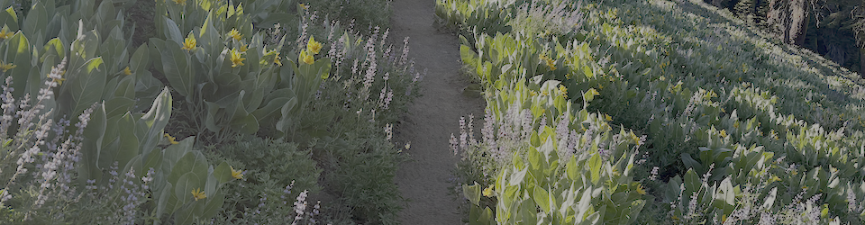
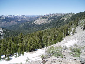
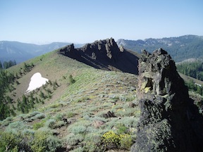
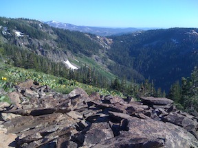
My first trip into the Granite Chief was in 2006, but the adventure started several years earlier when I was walking the Tahoe Rim Trail. There is a little overlook just off the trail as the TRT climbs out of North Fork Blackwood Canyon, south of Twin Peaks, where there is a view north down a valley. I was intrigued, and started looking at maps to see where this might be and how I could get there. This canyon is Bear Pen, with the Five Lakes Creek and Whiskey Creek basins beyond. Continue reading →
I have some strong feelings about cairns and ducks along trails. Cairns are large piles of rocks, and ducks are small piles of rock (three or so), both meant to mark trails or routes that may be difficult to follow without them. The problem is, they are often put in place by people who are either partially or completely lost. I don’t understand the psychology of building rock piles just at the time when you are becoming unsure that you know where you are, but I have years of experience with rock piles to say that is exactly what happens.
I had a great six day trip through the Granite Chief Wilderness, plus some additional country to the north. I went in at Alpine Meadows Trailhead, and out at Squaw Valley Trailhead, with at least 67 miles in between.
Since some people read this blog for trail conditions: Five Lakes Creek cannot be crossed anywhere downstream of the PCT trail crossing, except on logs. The Middle Fork of the American River cannot be crossed at the Picayune Valley trail crossing, but can on a log downstream. The Five Lakes Creek Trail is mostly clear of snow. Upper Grayhorse Trail, upper Picayune Valley Trail, and upper Granite Chief Trail are largely under snow, but the trails can be followed with attention.
Had another wonderful five day backpack in the Granite Chief last week. A lot of the trip was just re-visiting places I’d been before, some of them not in several years though.
As a new trip I went to Little Needle Lake which I’d heard other people mention but not been to. It is a shallow, alder and willow bordered lake in the volcanic rock below Little Needle Peak. It is a pretty setting, with soggy wet meadows surrounding the lake and a spectacular cliff above. The route is is a vague trail, and there are some seldom used campsites at the lake. To avoid the thick mosquitos at the lake, I camped to the north on a granite bench, where there were some really cool trees and a great view of the end of the day down the Middle Fork American River canyon. The next day I headed up onto the ridge and south, following the divide between Picayune Valley and Five Lake Creek, eventually reconnecting to the Picayune Valley trail a little east of where it climbs out of Picayune Valley. The ridge does not have a trail, but the going was pretty easy, with great views and a different perspective than I’ve gotten elsewhere.
I had a wonderful five day trip, one of my non-driving trips on which I took the Amtrak to and from Truckee. I walked from Truckee up to and along the Donner Lake Rim Trail, then headed south on the PCT past Donner Pass, Mt. Anderson, the North Fork of the American River (which becomes the Royal Gorge downstream), and into the Granite Chief.
I did some brushing work on the PCT, particularly the section between Five Lakes Creek and Twin Peaks that was completely brushed in four years ago and got me into doing maintenance on the PCT. So the trail is now reasonably clear again, though it needs brushing every year.
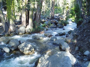
Middle Fork of the American River at Picayune Trail crossing
I finally got back into the Granite Chief Wilderness this last week, doing a four day trip out from the Barker Pass Trailhead. The remarkable thing is how much snow there still is in the dense forests and north facing slopes. I spent a lot of time kicking steps in grungy snow, varying from sloppy to rock hard, and got tired of it!
I headed north from Barker Pass to the saddle at Granite Chief Peak, the northern boundary of the wilderness, doing a trail condition survey. There are some trees down here and there, but nothing that can’t be gone over or around. There is light to moderate winter debris. In several places the trail cannot be followed across the snow, though the general trend is clear and it isn’t that hard to pick it up again if you are paying close attention.
Ed Hopkins of Baltimore provided me a link to photos of a five day trip in September. The photos have captions that tell much of the story of his trip. He camped two nights at Little Needle Lake, which I’ve not been to yet, and explored that northern area. Thanks, Ed, for sharing.
I finally got back into the Granite Chief this week for three days, going in at Powderhorn Trailhead which is just west of Barker Pass. Fall colors are coming, but the aspen trees which are often the brightest are just starting, and the vine maple seems subdued this year, as likely to be pale white or pale yellow as bright yellow. I don’t think there have been any freezes since August, and though the calendar says fall, the days were still summer, quite warm. And the mornings refreshingly cool. I did quite a bit of exploring, checking out Little Powderhorn and Laddie’s Cove, the lower end of the Five Lakes Creek gorge, and the mesa between Powderhorn and Little Powderhorn canyons.
I’ve finally transferred the information in a National Geographic Topo! file to Topo! Explorer online. I was waiting for National Geographic to update the Topo! Explorer desktop software to solve a number of usability and accuracy problems, but this has not happened in many months, and I suspect they have abandoned software development. Nevertheless, the interactive online version may be of some use to you, so I’ve shared it through Topo! Explorer online, at http://www.topo.com/trips/2364-granitechief.
Dan Lutz, Assistant Recreation Officer for Trails and Wilderness for the Truckee Ranger District of Tahoe National Forest, sent this trail maintenance information on August 4:
Glad to hear you were out in the wilderness and noticed the hard work the crews have put in there so far. We have had a couple crews go in there – one was a fire crew we try to go in there together annually. They help us out logging out the trails as they work on some training exercises. We get alot of work completed with this 10-person crew for 4 days. They were in Big Springs area and working north-south and then also the Shanks Cove trail. Additionally, we had a volunteer group spiked at Diamond Crossing and they worked on the Hellhole trail for about 5-6 days. Lots of maintenance needed there. Then we had our regular trails crew on the northern portion of the PCT from Squaw to Five Lakes.