Author Archives: Dan Allison

Unknown's avatar

About Dan Allison

Dan Allison is a transportation advocate in Sacramento, CA. Dan dances and backpacks, as much as possible.

Tevis & Talbot Trails 2019-07

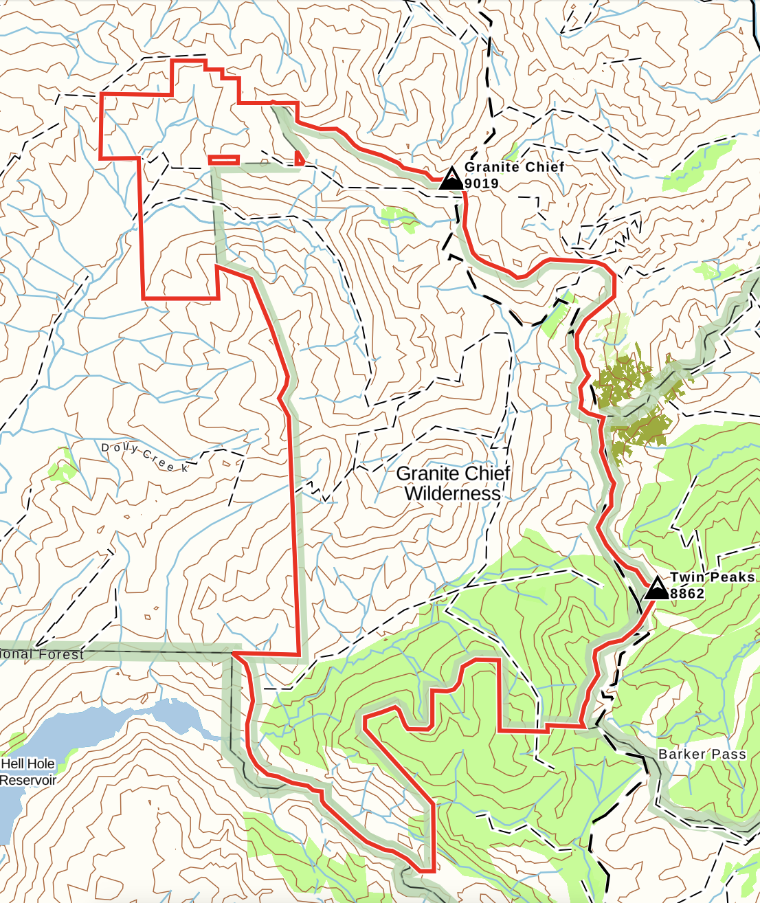
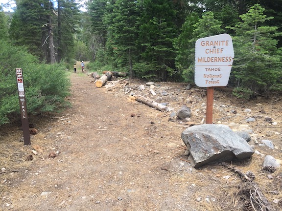
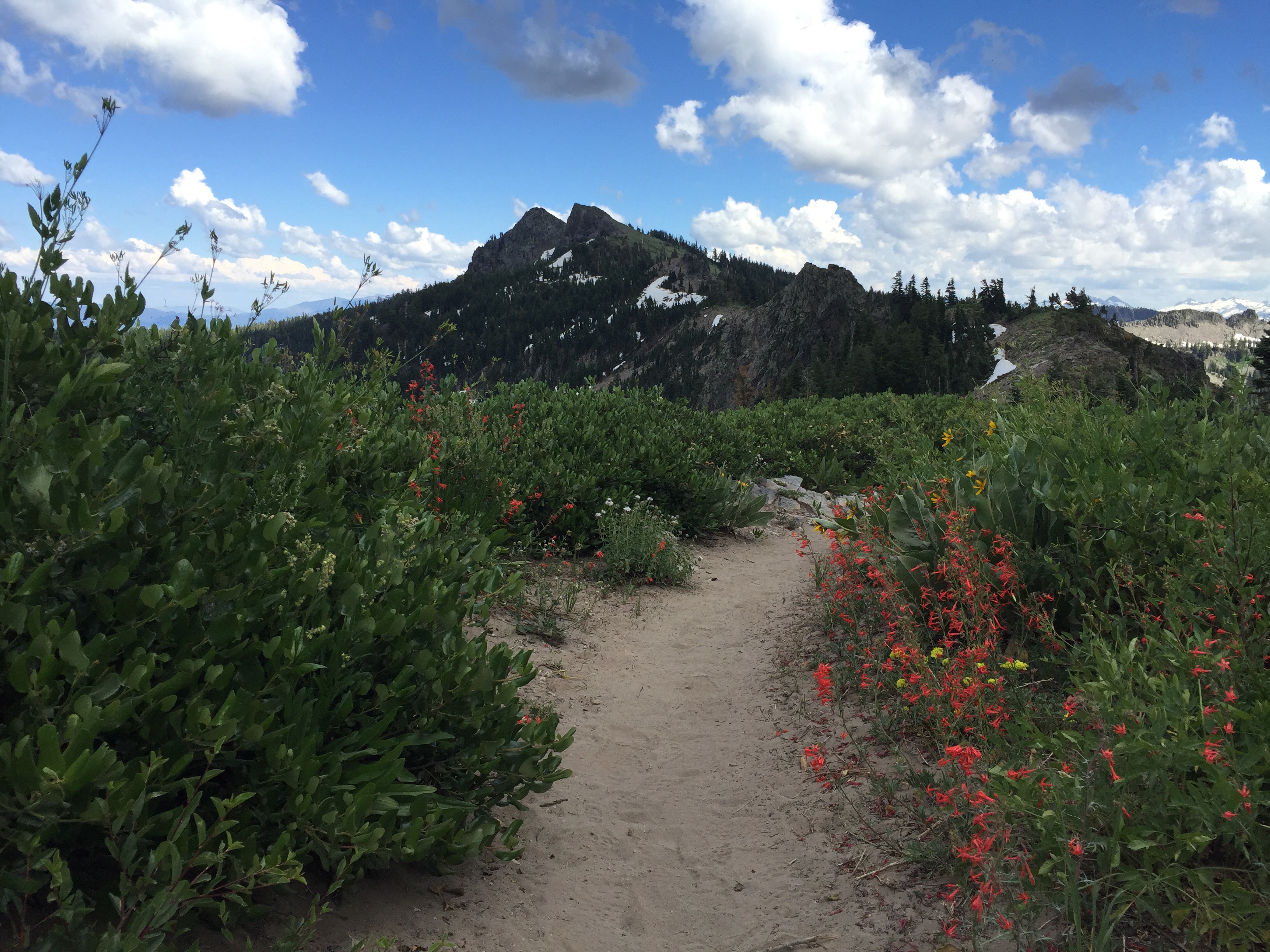
The American River Conservancy purchased about 10,000 acres of private land in 2015, and some of these lands were added to the Granite Chief Wilderness. As a stewardship project before the lands were turned over to the Forest Service, old logging roads in the new area were put to sleep or rehabilitated. Drainage and creek crossings were returned to their natural contours, and the road edge was removed in many places, leaving only space for a trail.

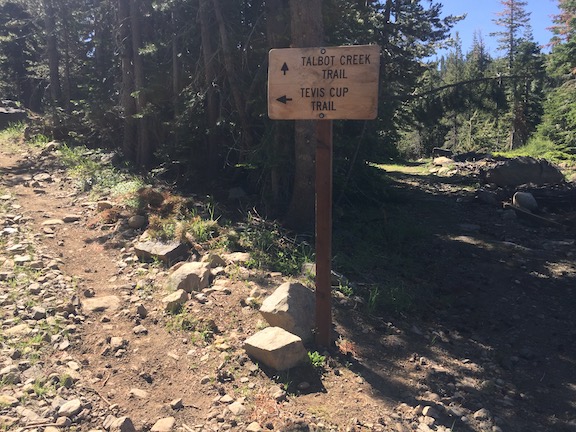
The Tevis Trail (also called the Tevis Cup Trail, and incorrectly, the Western States Trail – though the Western States trail run occurs on this trail, it never was the historic Western States Trail, which went through Picayune Valley) was realigned in the western portion, removing it from the heavily eroded logging roads to create an actual trail. The logging road from the Forest Hill Divide saddle to the trail (where the green gate used to be, if you remember) was turned into a trail. The trailhead for this trail is now the saddle, where a road comes up from the Soda Springs side of the divide, the North Fork of the American River. I created a track for the new trail alignment, available at http://bit.ly/GCW_TevisTrail. The old alignment is shown on a jpeg map.

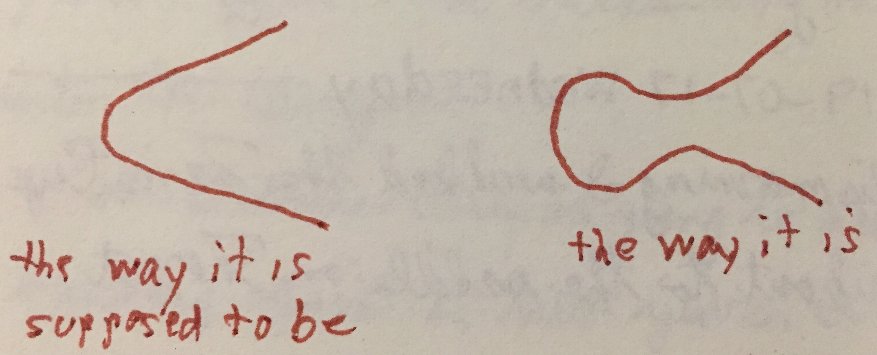
I’m disappointed at the design of the new trail that is not on the old logging road alignment. There are lazy looping switchbacks, at many of which the trail actually descends into the turn and then descends out of it (from the perspective of going up hill). See the diagram below, from my journal. Each of these locations will end up as a user cut-across of the switchback. Switchbacks should have climbing turns, where the trail is at no point closer to the other trail leg than at the turn. In addition, several stretches of trail are completely flat, which is remarkable given the elevation the trail must gain. I don’t know who is responsible for the trail design, but it was not done correctly. I was a trail crew foreman and trail construction instructor for the Forest Service for a number of years, and I know my trail construction techniques. Ah well, it will get corrected some day, and in the meanwhile it is much better than it was before, which was steep, eroded, rocky logging roads.

The new Talbot Trail mostly follows the alignment of the old logging road that used to connect the saddle to Talbot Campground area. Again, the roadbed was rehabilitated to a trail. Unfortunately, a lower segment that was pulled off the logging road has the same issue of lazy looping switchbacks that the Tevis Trail has. The trail comes out onto Forest Road 51 in a still open but very rough road section, where there is a Granite Chief Wilderness sign but no trail sign, then goes to the still maintained part of FR 51, which connects with the French Meadows Road going to Talbot Campground. It is unfortunate that trail energy was expended on the switchbacks when it could have been expended getting the trail closer to Talbot Campground. Again, someday, the trail will get to the campground without having to walk on hot ugly roads. The Talbot Trail track is available at http://bit.ly/GCW_TalbotTrail. This includes the portion on FR 51, which starts about where the last crossing of Talbot Creek is shown.

The cabin that used to be along the Tevis Trail is gone, with almost no trace of it remaining. I wasn’t even sure I was looking at the right place before I was able to compare photos after the trip. I understand why the Forest Service would want it gone, as it is an attractive nuisance and fire hazard, but it is still sad to see old cabins go, and the history they represent along with it. I do not know how old the cabin was.

I am making progress on my project to put all the trails, trailheads, and junctions into GaiaGPS for easier use, but it won’t be until after the summer backpacking season that I finish that and post on it.

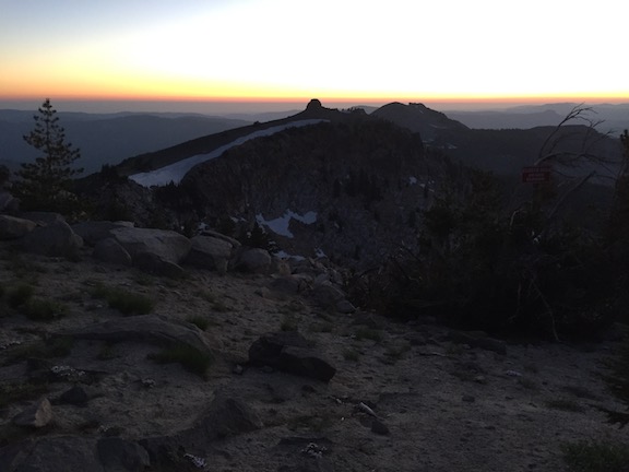
Photos on Flickr (includes the entire 10 day backpack, not just the Tevis and Talbot trails): https://www.flickr.com/photos/allisondan/albums/72157710021027427.

Trail Conditions 2019 Update

This is a summary of the comments that I made to the original blog post while in the field, and a bit additional from the second part of my trip. These observations were made 2019-07-15 through 2019-07-24, so snow conditions and creek crossings will have changed by now. Peak snow melt is definitely past, and all the creeks are dropping.

Granite Chief Trail: good condition, one 42 inch tree tangle and a few smaller; first snow 2370m, more towards top but all passable.

PCT Granite Chief Trail to Granite Chief saddle: 20% snow coverage overall, but complete coverage up the north side of saddle. Thru hikers have beat out a reasonable route. Steep north slope requires snow spikes, or tedious step kicking.

Tevis Cup Trail: some snow at beginning and in trees west of old boundary. Several muddy areas and water running on trail, a few erosion problems. West part from old boundary rerouted and now a trail rather than logging roads.

Talbot Trail: no issues, other than it is boring and comes out onto FR51 way too early. No water past the creek near the north end.

Western States Trail (Picayune): overall good condition; a few medium trees, one large, several small; tangle of downed trees just below ridge is now cleared; some snow patches. Crossing of Talbot Creek rock hop or log. Crossing of Middle Fork, knee deep wade with poles for stability, or logs down below, rock hop not possible yet.

Five Lakes Creek Trail: about 30 down trees, all but one large easy to step over or go around. Crossing Five Lakes Creek, knee deep wade in moderately fast water; Bear Pen Creek, shallow wade; no rock hop for either yet. Grouse Creek is a rock-hop (Grouse Creek will dry completely at some point during the summer). Moderate winter debris on the trail.

Whiskey Creek Trail: one medium tree down at beginning. Whiskey Creek now a rock-hop (updated 2019-07-24).

from Alpine Meadows TH: Five Lakes Trail good condition; Squaw Saddle trail good condition; PCT Five Lakes jct to Whiskey Creek jct good condition, one small tree.

Powderhorn Trail: about 25 trees down, most small but one medium and two large; two might not be passible for horses. A lot of winter debris on the trail. All watercourses flowing. Snow from boundary up to ridge 40%, trail can be followed with a close eye.

PCT from Barker Pass to TRT: snow patches on east side of ridge after trail reaches ridge; multiple patches on the east/north side of ridge approaching the wilderness boundary, though the steep snowbank that stops people in many years is easy to navigate this year; snow patches through the trees to the PCT/TRT junction.

Hell Hole Trail: I did sufficient trail maintenance that the trail can now be followed from Diamond Crossing to Steamboat Creek, including through the downfall tangle past Buckeye Creek where the trail was lost. There are hundreds of trees down (really!), but almost all can be stepped over, climbed over, or bypassed on well established use paths. There is thick winter debris on the trail in many sections, only a small part of which was removed. The trail past Steamboat Creek has become more vague with time, and I’m not sure it can be followed anymore, but I did not explore extensively. Five Lakes Creek is a shallow wade, both forks of Buckeye Creek are rock hops, and Steamboat Creek is a rock hop. Though Steamboat Creek was flowing well 2019-07-24, it always dries at the trail crossing at some point during the summer, though water might be found upstream or downstream.

Trails not checked: Shanks Cove Trail (it was reported to me by hikers that they were unable to follow the trail from the junction with Western States to the ridgeline, probably in the downfall area climbing out of the little valley). Lower Hell Hole Trail. Greyhorse Trail. Bear Pen Trail. Most of the PCT. I figure information about the PCT is more widely available, so I did not do trail condition observations on the majority of the PCT through the wilderness.

Tevis to Picayune

Paul VanderVoort shared with me last year a post from his blog, which I’ve linked to here: https://paulvandervoort.wordpress.com/2018/10/05/tevis-cup-trail-to-picayune-valley-x-c-path/. I have not followed this route, so how you use the information is entirely up to you. I have heard for years rumors of both a route, and an actual constructed trail (from long ago, not maintained) between the Tevis Cup Trail at the south-extending point, and a point near the crossing of the Picayune Valley (Western States) Trail and the Middle Fork of the American River, and have looked to see if I could see such, but did not find anything. I’ll try it out next time I have some off-trail yearning.

new wilderness boundary

The Granite Chief Wilderness was expanded in the northwest by a purchase of both logged and unlogged watershed lands by the American River Conservancy. Some of these lands were added to the wilderness, some are undergoing restoration. The wilderness is now about 115 km2 ( about 28,374 acres), an addition of 11 km2 (about 2800 acres) to the original 104 km2 (25,680 acres). These areal measurements are approximate.

The map below shows this new boundary, which can be accessed at https://www.gaiagps.com/datasummary/area/860a1d85-93c5-4fc9-b2e3-dfd6c82f1a53/. The outline came from an official USDA Forest Service geodatabase. This area and map is part of my long term project of getting all the trails mapped via tracing or tracks, and providing that info to you.

Trail Conditions 2019

With the deep snows of winter still lingering, I have been spending my backpacking time on the Bay Area Ridge Trail, which generally follows the ridge lines around the San Francisco Bay. There are 375 miles completed of an eventual 550 or so, and I’ve done about 64%.

My first trip to the Granite Chief will be July 15, and I’ll have some information on trail conditions at the end of that trip. The best source of trail conditions I could find is the Tahoe Rim Trail Association’s Current Trail Conditions page. Though the TRT only edges the Granite Chief Wilderness, the elevations are similar and trail conditions might therefore be similar.

If you, dear readers, have anything to report, please either comment on this post or send me an email (allisondan52@gmail.com). Since I’m out backpacking elsewhere, I might not get to posting for you for a few days, so better to comment directly, but whatever works for you works for me.

Good travels!

Trail conditions 2018

I have not been on all the trails yet this season, but will report on ones I have been. The PCT is in good condition; the Granite Chief Trail is in good condition; Five Lakes Creek Trail is in decent condition, some down trees but nothing that can’t be bypassed; the Powderhorn Trail is becoming quite brushy and though I did some work here, there are many days left to do, and there is a tangle of down trees about 2/3 of the way from the top that could not be bypassed by horses due to the terrain; Western States Trail is in decent condition from Whiskey Creek Camp to the saddle, with some brushy sections and some down trees, but the section just below the saddle dropping into Picayune Vally is a mess of down trees and the trail hard to follow; the lower section of Western States in Picayune Valley has had some trail maintenance and is in good condition.

Dan McGee commented on the Shanks Cove Trail on the Trails and Maps post. I think I had reported the issues with that trail, but now can’t find it, and it certainly was not on the Trails page. A number of years ago there was a significant downfall of huge red fir trees in the gully just past the small seasonal drainage south of the Western States Trail junction. This has never been cleared, and has gotten worse by the year. As a result, the whole trail is becoming less used, and is brushy and obscure in other places. I don’t have anything to report about the south section of the trail, from Greyhorse Trail down to Five Lakes Creek Trail, but will after my next trip. Unless you are good at route finding and enjoy clambering up and down over huge trees, this is a section to avoid until the Forest Service clears the trail again.

Water is still moderately plentiful at the normal spots in the backcountry, however, the lower elevations are getting really dry and the higher elevations will dry soon. By the end of the season, I’d expect only the largest and most reliable sources to be running.

As always, your trip reports and trail condition comments are welcome. I no longer am able to get in early in the season and review all the trails, so I and others depend on YOU passing along information.

Picayune 2018-07

Last week I went in to the Granite Chief Wilderness at Granite Chief Trail, from Squaw Valley, and camped on top of Granite Chief (9018 feet). The wind howled all night, probably 30-40 mph, so I didn’t sleep much, but the stars were brilliant and the sunset and sunrise worthwhile.

Several times in the days leading up to the trip and even on the trip, I changed my plans about where I was going to go. I headed to Whiskey Creek Camp and on towards Picayune Valley, on the Western States Trail. The trail is in general in good condition, though I did brushing of whitethorn on about 30 feet of trail that was brushed in. Whitethorn requires a sacrifice of blood, as the thorn inevitably find their way to bare skin no matter how careful I am.

The section just below PIcayune saddle as the trail drops into the valley, however, is a total mess of downed trees. It took me quite a while to figure out where the trail even went. And below that it is pretty brushy for a ways. And below that, in good condition again. Some group has been doing trail work in the valley, light brushing and some tread work, and that is appreciated.

I camped at my favorite Picayune Valley campsite, right beside the creek on a sandy patch, with all the sky open to stars at night. Though it clouded up and there were fewer stars than the night before. The next day I walked out to the trailhead, so see what trail conditions are. Good. Talked to several day hikers, as this trail gets more day hike use than overnight use. The wilderness boundary sign has been moved to the new location, just east of the Talbot Trailhead. These lands were purchased by the American River Conservancy and have been added to the wilderness, so there is now a mile of additional wilderness trail here. Of course the lands have been logged and it will be years before it looks like wilderness again, but this is the first step to restoration.

While on the dayhike, it occurred to me that maybe now, with relatively cool weather for the summer, and no specific plans, I should hike the ADT-CA-3 section of the American Discovery Trail, which is the extension of the Western States Trail  westward. So I grabbed my pack and hiked out, to Lewis Campground, from which my trip continues at https://allisondan.blog/2018/07/10/adt-ca-3-2018-07/.

Photos on Flickr: https://www.flickr.com/photos/allisondan/albums/72157698464067794


Powderhorn trail work 2018-06

For my first trip of the season I mostly did trail work on the Powderhorn Trail. Working down from the top, I cleared brush, of which there is not all that much, and cleared or thinned young conifer trees, of which there is an infinite supply. The conifer trees seem nice, but if they are within four feet of the trail, and grow up, their branches always encroach on the trail. When there is dense conifer seedlings on both sides, it often essentially closes the trail. And of course as a natural process of thinning, most of these would eventually die on their own, but that leaves a tearing dead tree that is much harder to cut and remove than it was when it was alive. When it is clear that one tree is growing faster than the others, therefore quicker to reach the point where branches are above trail level, I leave that one and remove all the shorter ones around it.

I completed the work from the top to the postpile meadow, about 1/3 of the 3.5 miles, and did a minor amount of work below that. There are many days of work left to go, so unless a trail crew goes in, it will be several years before the trail is in good condition again. But it is usable, if not for downed trees.

There were eight down trees, six of which an be bypassed easily, and two of which hikers can clambered over or around but horses cannot pass. There is a moderate amount of winter debris, the branches that fall during the winter and can be stepped over, but when removed make a much nicer walk.

On the Five Lakes Trail, there were about five downed trees, none hazardous and all easy to go around.

I walked in from Kaspian Campground on Hwy 89 (a nearby bus stop), up Barker Pass road and then the old jeep trail to Barker Pass (steep but quiet and beautiful), then along Forest Road 3 to Powderhorn trailhead, and in. From Diamond Crossing, the junction of the Powderhorn, Hell Hole, and Five Lakes Creek trails, I walked up Five Lakes Creek trail to Whiskey Camp and then out at Alpine Meadows trailhead and down to River Ranch on Hwy 89 (a nearby bus stop).

There are patches of snow along the ridges, but most snow is gone. Many of the tributary creeks and creeklets are still flowing, but low, and will probably dry by mid-July. The flowers are moderate, in some places it is still early season and flowers have not developed, and in other places they are fading already.

finally! 2017-07

My latest trip was primarily for trail maintenance on the PCT, and after  11 years, I feel caught up. I removed the last brushed-in section, between what I call Two Towers (Lord of the Rings reference) and Twin Peaks. Of course in order to get done, I had to accept many places that could use brushing, and leave them for the future. In particular, the pine mat manzanita and sagebrush is pushing into the trail and narrowing the tread. It isn’t hard to clear, but is a lot of detailed work that I’ve often put off “for next year.”

The reason I pick this part of the PCT to work on every year is not just that it needs brushing, but that I so love spending time on this ridge. The views east are spectacular, over Lake Tahoe and the weather over the Carson Range, often thunderstorms developing when the main crest is clear. The views west are intriguing, down into the wilderness, where the real wilderness is, and beyond, to the coast ranges. When the valley air is clear, not often, the details of the coast range and Bay Area are clear, and at night the lights in the valley, kind of neat at a distance. Usually thunderstorms develop over Nevada, the Carson Range, and sometimes move west to the crest, but on Wednesday moisture coming from the west developed some thunderheads, thunder, and light rain for a half hour, while the Carson Range was mostly clear. 

When there is snow on the ridge, usually in banks on the east just below the ridge where it gets blown during the winter in strong winds, I can melt snow and stay up here for many days. I use my black Jetboil pot to melt, and I can keep up with my daily use if I stay on top of the melting. 

I went in on the Granite Chief Trail from Squaw Valley, which has a few trees down but easy to get around, then south along the PCT. Granite Chief saddle has a lot of snow on the north side, but the route is not hard to find. People southbound rarely have problems here, but many northbound hikers drop too far down into Shirley Canyon and have a hard time finding the trail again. The trail from the saddle south to the TRT/PCT junction is in good condition, a few tress down but surprisingly few, some trail erosion but not bad. 

I hiked out the TRT to Tahoe City, so don’t have anything to report about the TRT/PCT south to Barker Pass, but I’d guess many snow banks but no big issues. Other than snow banks on the upper portion, the TRT trail down into Ward Creek and Tahoe City is in good condition, having been logged out already by a TRTA trail crew. 

The PCT thru hikers are out in force, but interestingly, about half were going south, having skipped over the high Sierra to Donner or even Ashland and now heading south to pick up the section with somewhat less snow. Looking into the Desolation Wilderness, however, snow there is still deep and must be much deeper at high elevations to the south. Dicks Pass is 9400, but the highest pass on the PCT is 13,143, Forester Pass. There were people who had come through the high Sierra headed north, but I have to say that they all looked beat and not very happy. I think the route flippers were much happier. 

The next big project on my list, for next year, is to work on the Powderhorn Trail. If anyone hikes that and has conditions to report, please do so. I think the middle section is in horrible condition, brushed closed in spots, but I haven’t been there in two years, so I’m guessing. 

Photos on Flickr (more later, these are ones from my iPhone which are easy to upload, but I also used my regular camera)

Granite Chief 2016-08

Note: this trip is LAST year, 2016, which I never got around to finishing, but here it is now. I like to post on every trip, in part so that I myself can keep track of trips and where I went. 

A dry year, dogbane turns color early

I went in at Squaw Valley (bus stop) and up Granite Chief Trail to Granite Chief saddle  where I camped for the night. The next day I walked out the Tevis Cup Trail and what I call the Tevis Cup Connector, one of the old Western States Trail alignments. Tevis Cup is easy to follow and has great views, but the trail itself is unpleasant,  climbing and descending repeatedly for no good reason, and poorly maintained. The end of the trail has been re-aligned off a gravel road onto a trail that goes past old ranch or FS buildings (not sure which), but ends at the same green gate as the old route. The Tevis Cup Connector is faded and jhard to follow in some places, as it descends and crosses the Middle Fork American River and then climbs to join the Tevis Cup. 

I headed south on the PCT, doing some spot brushing along the way, and continued to Barker Pass, to Powderhorn Trail and back into the wilderness. Powderhorn is in decent shape on the upper third and lower third, but almost completely brushed in in the middle third, with whitethorn and doghair fir. I camped at Diamond Crossing, explored Bear Pen trail which I’d not beeen on in several years. It is in decent shape, not too hard to follow, but where it crosses Bear Pen Creek before the meadow, eroded banks make it necessary to climb down and back up, awkward with a pack. 

Some sort of bee or wasp is incredible abundant, everywhere but particularly along the edges of creeks. Yellow and black striped body, but no fuzziness and no constriction between the thorax and abdomen. Not sure what it is. Also saw a lot of grouse on this trip, at least 40. 

I went out Five Lakes Creek Trail, which has received some logging out, perhaps by the horse trip that comes in once a year to a Big Spring meadow, and then out to the Five Lakes trailhead. And back to Truckee by bus and back home on the train. 

Photos on Flickr; Granite Chief collection