Tag Archives: Picayune Valley

Granite Chief 2025-06

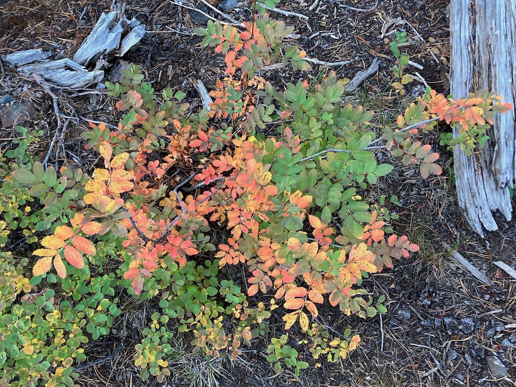
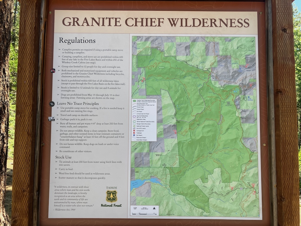
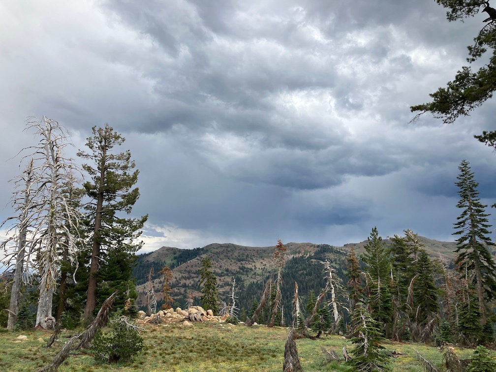
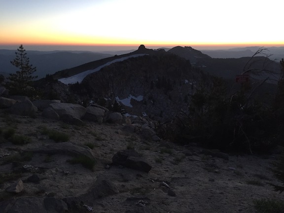
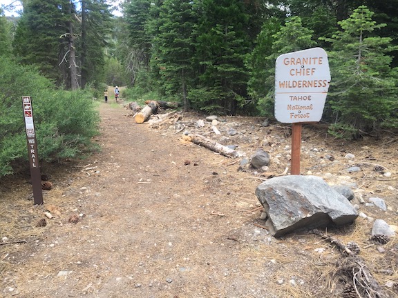
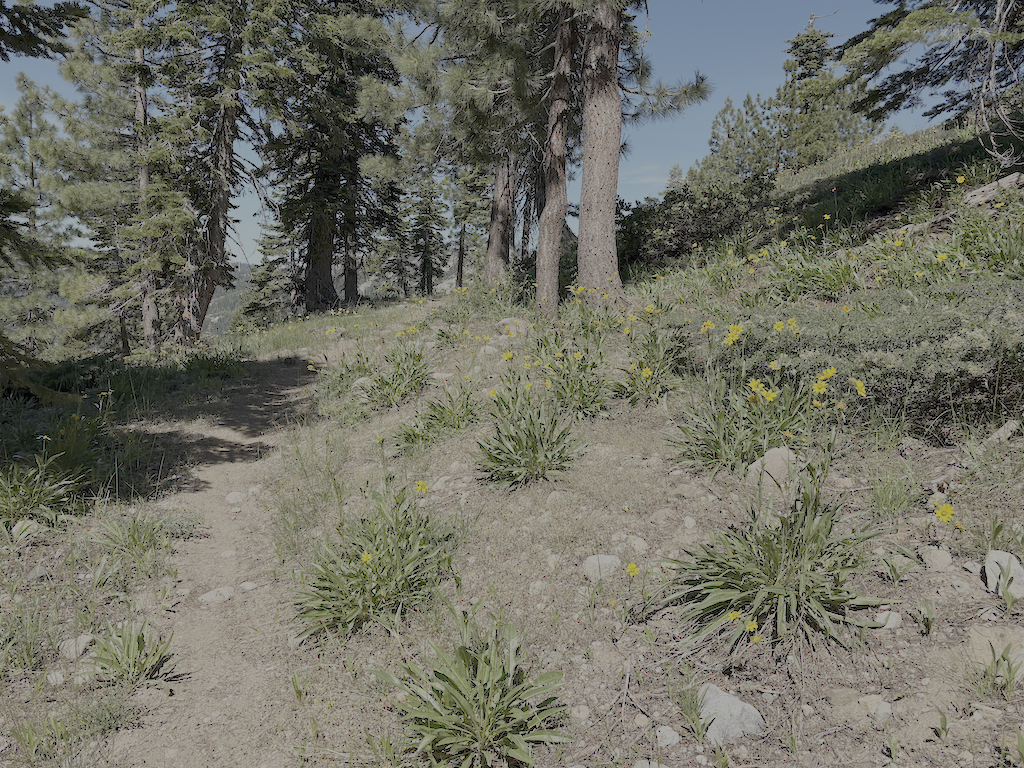
My first Sierra backpack of the season! Rode to Truckee on the California Zephyr, and then Olympic Valley on the TART 89 bus. I enjoyed Palisades Tahoe Bluesday, then hit the trail to sleep out. Went up the Granite Chief Trail, which is largely in good condition. I took a side trip north on the PCT to North Fork American River, and then a short way down the Painted Rock Trail. A reader had asked me about that trail, so I wanted to at least know if it was still there and findable. It is, though hard to follow and not used so far this year. I’ve not used that trail in many years, but the challenge was the wet areas with alder and willow thickets where is was hard to follow the trail.

Then headed south on the PCT, I was intending to traverse north to south as a survey trip. But my attention was grabbed by the Tevis Cup Trail reroute, which I’d written about last year in Granite Chief 2024-08 trail survey. There is no evidence of trail crews there this year, and information on Western States Endurance Run indicate that funding was canceled or held as part of the Trump destruction of the Forest Service. I walked the east end, which is more or less as it was last year, though one blast area has been reconstructed. The middle part is a bit more polished than last year, and extends a little further west though a meadow. I had been told last year that the flagging extended all the way west, but I was not able to follow it past a alder and willow riparian area, so it may or may not exist. I gradually descended through open forest and small meadows to rejoin the existing trail near the switchbacks (the nearly-flat switchbacks). I headed out to the trailhead at Forest Hill Divide (as I call it, it doesn’t seem to have an official name) where the Tevis Cup Trail continues west along the ridge, heading eventually to Auburn.

photo of Tevis Cup Trail and flowers
Tevis Cup Trail and flowers

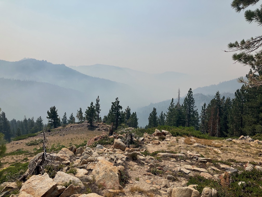
Walked down the Talbot Creek Trail, which was constructed a few years ago, some following an old logging road and some newly constructed. It has a nearly-flat switchback section as well, probably the same designer. The trail is not much used. The southern end trailhead is not marked by any signage, nor is the junction of Forest Road 51 with French Meadows Road, which leads to the trailhead.

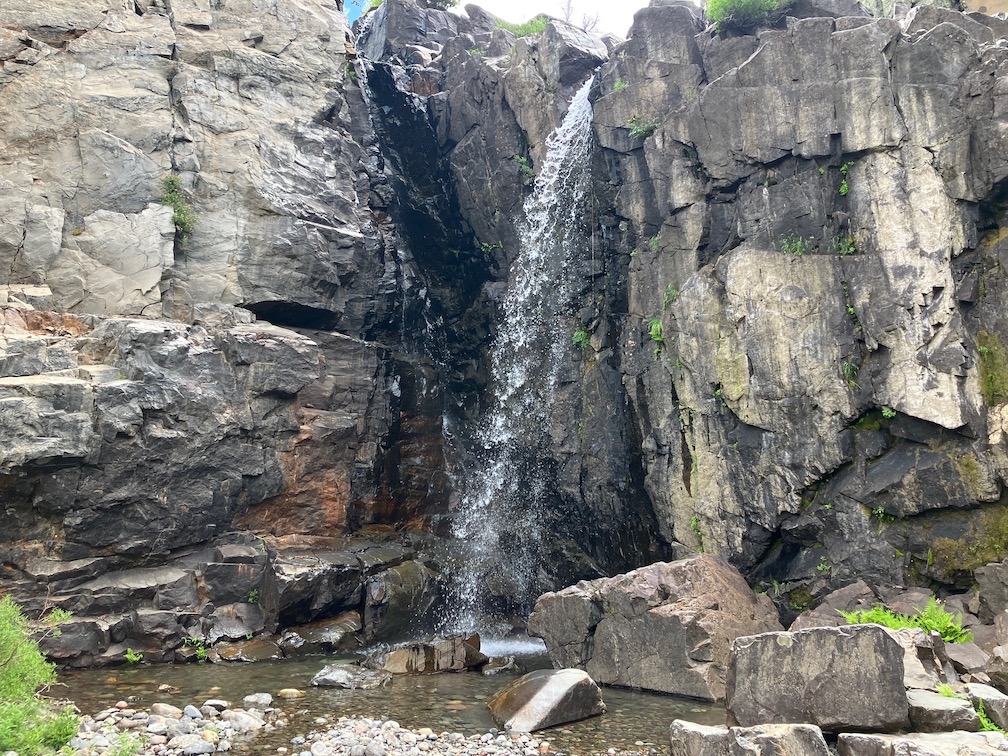
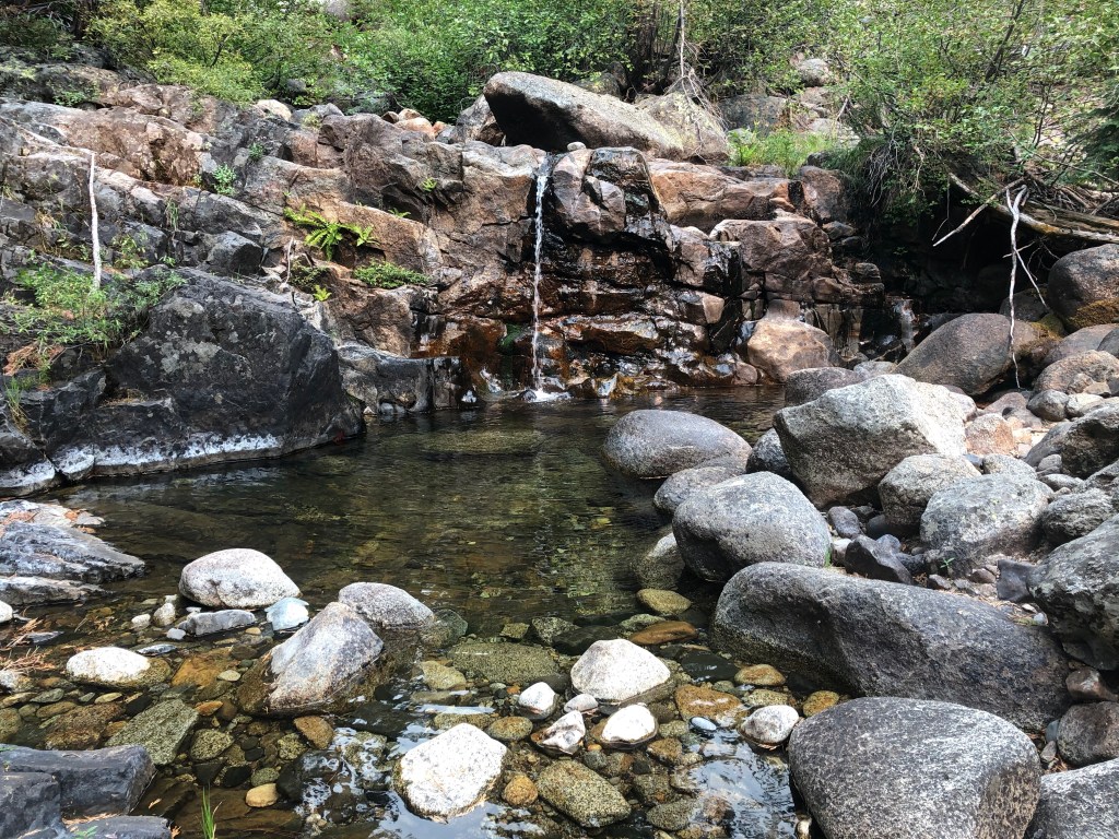
After a rest at Talbot Campground, I headed back into the wilderness on the Western States Trail, my favorite trail and location in the wilderness. There are a lot of trees down, joining those already down from previous years. And a lot of winter debris, heavy in some areas. Crossing Middle Fork American River is close to a rock-hop, but still wet. I used a log downstream. The wet areas beyond, particularly in the aspen grove areas, have dense growth that obscures the tread, though your feet can find it, and branches hidden away to trip you. Other than an area on the switchbacks to the saddle, and descending to Whiskey Creek, brush is not bad.

photo of Sierra stonecrop
Sierra stonecrop

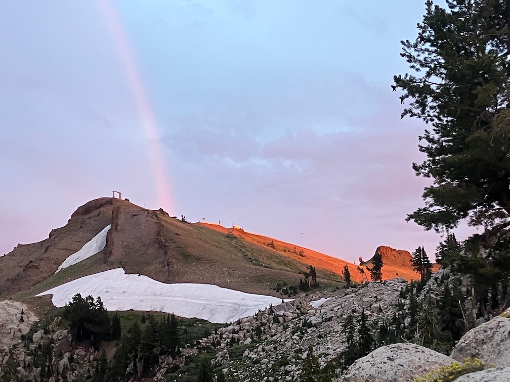
I passed a group of eight backpackers headed along the Western States trip from Whiskey Creek, which is about as many as I usually see in a year. The crossing of Whiskey Creek has another tree down, blocking the rock-hop, but the large tree that has been down for several years makes a good crossing. Whiskey Creek Trail has a few rotted down trees, and one new small, otherwise in good condition. I camped north of the ‘Squaw’ Saddle Trail, at the divide between Five Lakes and Olympic Valley. With runners in the area for three events, including the Western States Endurance Run the next day, there were runners all over the place. Most place names have been changed away from ‘squaw’ but I don’t know if the trail name has been. This trail descended into Olympic Valley, and is the original trail route before the Five Lakes Trail was constructed.

Walked out the Five Lakes Trail, which is in good condition, caught the bus to Tahoe City, grabbed some items at Alpenglow Sports, best in the area, then back to Truckee on the TART bus, to Word After Word for a book, to Dark Horse Coffee in Truckee for tea, reading and writing, and then the Amtrak bus home to Sacramento. Whew!

Though plans are never certain, and I often change my mind, I think my next two trips are going to be for trail maintenance on the Western States Trail. Survey trips on the other trails will have to wait. It was hot enough at Talbot Campground/Trailhead, 1722m, that I think my trip on the Hell Hole Trail to the end at 1439m will get delayed until September, though I’m always looking for cooler stretches of weather.

Granite Chief 2024-08 trail survey

With this trip, I retired my old hiking boots and started with new. My boots are Altra Lone Peak, which is the only brand I’ve found that offers a wide toebox that my feet require. The old lasted a little over three years, since June 2021, not bad. The soles were more worn that the tops, but both were done. Altra has saved my hiking, as any boot without a wide toebox causes me great pain, and the one other common brand with wide toebox just doesn’t work for my feet.

The purpose of the trip was mainly trail condition survey. I often do that early in the season, but didn’t get to it this summer. Conditions for the trails I did are listed below. I went in at Granite Chief Trail (after enjoying Bluesday at Palisades Tahoe), then south on the PCT. The number of PCT hikers has dropped off, but there are still some going, either late starts or flip-flopping.

I was curious about rerouting of the Tevis Cup Trail, a project which started last summer and will continue through next summer. A CCC (California Conservation Corps) trail crew is base-camped at Little Needle Lake, and working from near the PCT to the west. The reroute is in varying stages, ranging from just sketched out enough to follow from being walked on by the trail crew repeatedly, to essentially complete. Several rock outcrops near the east end had just been blasted the day before, leaving a mess that requires a lot of reconstruction. The crew has worked as far west as a small seasonal creek, which will probably be the only water source on the rerouted trail. Though the trail route has been flagged through to its connection with the old trail, somewhere, I did not follow beyond the existing work, but I’m guessing a little more than half of the reroute has at least been started. This will be a very nice trail when completed! As I’ve written before, the Tevis Cup Trail design was horrible, gaining and losing altitude repeatedly, often for no apparent reason. I don’t recommend that you try to follow the new trail until the end of next summer, I do encourage you to enjoy it when finished.

A Great Basin Institute trail crew was working on the cross-trail between the PCT and Tevis Cup, which I call the Tevis connector though it is not clear what its official name and number is. They are camped at the flats beside the Middle Fork. Because the reroute crosses the slope of Lyon Ridge much higher than the old trail, several new switchbacks are being worked to bring it up to that level. If you follow the old trail west from the PCT, the obvious worked trail will take you all the way down to the Middle Fork. The junction with the old trail is marked by a rock wrapped with flagging, but could be easy to miss.

Knotweed is brilliant fall color right now, bright to pale red, and occasionally yellow and orange. It paints the west slopes below Wa-she-shu Peak with color, mixed in with other plants of fall color. Some of the wooley mules ears fields are browned out, while others are mix of green and yellow. Though few things are still flowering, the California fuschia at lower elevations are striking red.

photo of mountain ash in fall color
mountain ash in fall color

All my previous trips I had been sleeping under clouds, or smoke, or trees, but I had a full view of the sky with only a crescent moon to obscure. I have to admit I’ve forgotten a lot of constellations, but the night starts with the summer triangle overhead, and ends with Orion up in the east, and Jupiter.

I was going to do a loop out the Tevis Cup Trail to Talbot Creek Trail and back in on the Western States Trail in Picayune Valley, but realized I really didn’t want to deal with the old trail, and never will have to again. So I headed south on the PCT to Whiskey Creek Camp, and then west on the Western States Trail (which is called the Historical Western States Trail on some maps, I guess to distinguish it from the Western States Trail run on the Tevis Cup trail. Picayune is one of my favorite places in the wilderness, and I spent two nights there. Hiked out the trailhead one day, recording trail conditions, and lolled by the creek as much as possible.

The rain last week, while I was home, perked up three ferns that grow among the metamorphic rocks in Picayune Valley: cliff-brake, lace, and indian dream.

My ambition was to come back and do the Shanks Cove loop up the ridge and back down to Five Lakes Creek below Big Spring Meadows. But ambition failed me, and I stayed a night at Whiskey Creek Camp.

I hiked out Squaw Saddle Trail (has it been renamed?) and Five Lakes Trail to the trailhead. I walked the Bear Creek Trail towards River Ranch, planning to sleep part way along. But there are only two flat spots along the entire trail, one by the water tank and another on a bald hillock. But I noticed the hillock was covered with bicycle tracks, and I suddenly had a vision of being run over by night-riding bicyclists (which has become popular in the Tahoe area), and I had already passed the tank, so I walked all the way out to the stables and then bottom of Alpine Meadows road and camped by the river. I was surprised to see how many creeklets cross this trail, including at least three that are probably year-round. But the creeklets are all east of the water tank sleeping area.

While on this trip I finally identified the low shrub that I had been working on the Powderhorn Trail. It is snowberry, Symphoricarpos. It spreads by sending out runners that root. Sometimes across the trail, and those runners age to an almost unbreakable trip-wire, which is part of the reason I try to get it out by the roots, and cut it back if I can’t. On my earlier trip, the white berries were not there, but now they are, so I was able to identify. On the plus side, there was a patch of the gooseberry without spiny fruits around the old wilderness info sign at the beginning of the Tevis Cup Trail. Hmm, delicious.

There is a new trailhead map at the Talbot trailhead. It has the extended wilderness boundary on the northwest (lands purchased by the American River Conservancy), the new name Wa-she-shu, and a few other details. Unfortunately, it still shows the Buckeye Trail, off the Hell Hole Trail, which is essentially unfindable.

photo of Granite Chief Wilderness trailhead map at Talbot trailhead
Granite Chief Wilderness trailhead map at Talbot trailhead

I finally figured out why my hips have been hurting this entire season. The waist belt on my Osprey Atmos 50 AG backpack has velcro attachments between the hip belt and the waist belt. On one side, the velcro no longer holds where it is supposed to, so the waist belt no longer cinches as tight as it should. So the pack was riding low on my hips and causing pressure with every stride. It also explains why I was more and more holding onto and pulling in on the shoulder straps, trying to pull the pack up off my hips. Though these are called hip belts, they are meant to go above the hips, to ride on top of the pelvis and not on the hips. I will have to get that fixed during my late fall slow backpacking time.

Trail Conditions

  • Granite Chief Trail (15E23): good condition, one 9 inch down tree, could use spot brushing; adopted by Truckee Trails
  • PCT south to Tevis: good condition, one 6 inch, some debris*
  • Tevis Cup Trail (16E04): see notes above, old trail unacceptable, new reroute not complete
  • Tevis Connector: good condition
  • Little Needle Trail: This is not marked on maps and was formerly just a seldom used and hard to follow hunters trail, but with the CCC trail crew camps at the lake, it is now easy to follow.
  • PCT south to Whiskey Creek Trail: good condition, five down but all easy to step over or bypass, some debris
  • Whiskey Creek Trail: good condition, except broken tree fragments at the bottom
  • Western States Trail (16E10): to Shanks Trail, 16 down trees, some very brushy areas, moderate debris; to Talbot trailhead, about 30 down (forgot to record), some brushy areas, some areas of moderate debris; most of the down trees have established bypasses or can be stepped over/climbed over, but some newly fallen are difficult; though there are a lot of down trees on this trail, it is still worth walking or backpacking; the trail sign at the junction of Western States and Shanks is broken and down, but still readable
  • PCT south to Squaw Saddle Trail: good condition, one down tree, well brushed
  • Squaw Saddle Trail (if it is still called that): good condition
  • Five Lakes Trail to Alpine Meadows Trailhead: good condition, could use spot brushing

Trails not checked so far this season:

  • Shanks Trail
  • Greyhorse Taril
  • Hell Hole Trail
  • Talbot Creek Trail

*debris: I used to call this winter debris, the branches and cones that fall out of the trees during the winter, but since if falls year-round now from dead trees, I’m calling it debris.

Photos on Flickr:

PIcayune Valley, and rain, 2023-08

For my third Granite Chief backpack of the season, I went in at Granite Chief trailhead in Olympic Valley. Since I get to trailheads by transit and walking, this is the most convenient one of all, with the trailhead about 200 feet from the bus stop. I headed up the Granite Chief trail, which is in pretty good condition, with maintenance by Truckee Trails Foundation. I used to do brushing on this trail, and I’m glad for one less trail to take care of, particularly since I can’t come close to keeping up with the others. On my way up, I saw a Western Tanager, the first I’ve seen in a while, and am amazed as always at how bright they are.

Heading south along the PCT, I stopped for the night just south of the meadow that is the headwaters of Washeshu Creek. It had been raining lightly off and on through the afternoon, but mostly cleared by sunset, with a rainbow. However, it rained lightly for several hours during the night. It is unusual for it to rain during the night in the Sierra, as most thunderstorms are afternoon and then clear by evening. In the morning, under mostly clear skies, I explored around the meadow beyond Granite Chief that is the source of Washeshu Creek.

rainbow at sunset over Washeshu Peak

In the morning I walked up to the top of Granite Chief (this is the full name of the peak, no peak or mountain qualifier). The rain had compacted the loose granitic soil enough that the walking was easy, despite the climb. From the top, spectacular views in all directions. I noticed a large camp in the dry meadow along the Middle Fork American River, and was curious about who and why, so I walked down the trail that I call Tevis Connector, to see what was up. The camp was for a large crew of Forest Service and California Conservation Corps (CCC) members. I talked for a while to the trail crew foreman. The project is to reroute the Tevis Cup trail out of the boggy areas to higher up the slope. Tevis Cup is the worst trail in the Granite Chief Wilderness, and one of the worst trails I’ve been on, so I am very happy to see it being addressed. He said this is a multi-year project. The project is based out of the American River Ranger District of Tahoe National Forest (Foresthill), which this area is on, though in the past the management of the wilderness has been the responsibility of the Truckee Ranger District.

This is the first trail crew I have noticed in the Granite Chief since 2009. The Forest Service has largely stopped doing routine trail maintenance, so trails, not just here, are declining rapidly. So I am glad to see the work being started, and glad that they picked the worst of the trails to address.

I found an old WS Trail sign along the Tevis Connector trail. The alignment of the Western States has changed many times over the years. The trail down PIcayune Valley is now the named route. I had found another sign years ago, but have not been able to find it again, so I presume someone took it as a souvenir. I have found these signs at a few obscure locations all the way from Galena Creek on the Nevada side to the Mosquito Ridge road.

I left the PCT to walk up to Little Needle Lake. This old trail is easier to follow now as the trail crew did some light work on it. From the lake (pond), I went up onto the ridge, which is a steep climb but not too hard, and headed south along the ridge. Some parts of the ridge show a vague use trail, some parts to do. The ridge is centrally located in the wilderness and therefore has some of the best views. I rejoined the Western States Trail near the saddle at the head of Picayune Valley, and headed down into the valley to my favorite campsite area.

Again, there were thunderstorms in the afternoon, which cleared, and then hours of light rain during the night.

I walked down to the junction with Middle Fork American River, exploring along the way, finding some old trails, and waterfalls along the creek, and visiting the reflecting pond near the Middle Fork – Picayune junction. Flowers are very thick in the wet meadow areas along the trail, with mountain larkspur more common than most years. Hundreds of hummingbird moths (white-lined sphinx moth Hyles lineata) were nectaring on the larkspur. In the wet areas, the growth is so lush it completely obscures the trail, and one has to feel the tread with your feet. Which has its risks, at it can conceal step ups and holes and branches and down trees and standing water.

I found several waterfalls that I did not know existed. Travel along the creek is difficult to impossible, but there are many opportunities to drop down to the creek. I was of course also in search of the petroglyph panels, but again, did not find them. The success in finding them is about one-third, even though I have a clear picture in my mind of the setting.

The second night in Picayune was very similar, afternoon thunderstorms and then light rain during the early night.

I headed up out of Picayune Valley the next day, and ran into other people. Todd is a horseman who volunteers to cut trees on trails that otherwise are not getting any maintenance. We talked for a while about the history of some of the trails. Also met two backpackers from Grass Valley, and we were surprised to see each other. I was the first they had seen on their trip, and they were the first I’d seen, other than the trail crew. They had come in Greyhorse, and said the trail was very hard to find. I had done some spot brushing on this trail not too long ago (but can’t locate the date), but those areas may have brushed in again, and maybe been joined by other areas. They had come to the saddle from the Shanks Cove trail northern section, and said it was better though still had snow patches.

I headed towards camp at Whiskey Creek Camp, and as I came down from the ridge, the skies southeast were darkening to black, the main crest completely obscured. With just brief showers, I made it almost all the way, but then the skies opened. It rained hard for 30 minutes, and by hard, I mean visibility was about 50 feet. I partly sheltered under a leaning red fir. This is the most intense thunderstorm I have ever experienced in this wilderness. Perhaps more in the Carson Range, and certainly more in the desert southwest, but not here. After the storm I proceeded to camp and set up my tent. That is the point at which I discovered that my tent footprint and bottom are no longer waterproof. There was standing water everywhere, and it soaked through. I fortunately have a water resistant down sleeping bag, so was able to stay warm through the night, but everything was wet. And it rained again for three of hours during the night.

dark clouds over Sierra crest

At dawn, the sky was dark with clouds, and I assumed, correctly, that the sun was not going to come out, so I hiked out to Alpine Meadows trailhead, walked to Olympic Valley, caught the TART bus to Truckee, and the Amtrak bus home.

I do not know whether all the rain I experienced was part of the Hilary storm. Maybe not, because it didn’t really hit northern California until Sunday. I do know that different weather apps gave very different forecasts for those days. Accuweather was the most accurate.

Trail conditions:

  • Granite Chief Trail: Good condition, down trees already cut, very little brush.
  • PCT from Granite Chief Trail to Tevis Connection Trail: Good condition, one down tree, very little brush. Note that I did not hike the PCT from Tevis Connection Trail to Whiskey Creek Camp Trail, so nothing to report.
  • Western States Trail, Middle Fork American River to Whiskey Creek Camp: Many trees down, all easy to step over or bypass for hikers, but one tree on the switchbacks that probably cannot be safely passed by equestrians. Some areas need brushing, particularly towards Whiskey Creek Camp where the whitethorn is growing like crazy.
  • Five Lakes Trail: Good condition, very little brush.

PCT & Picayune 2022-07

This was my first trip of the season, probably the latest I’ve ever started. I had been doing a lot of short backpack trips along the Bay Area Ridge Trail, intending to complete that trail in a single year, but now taking a break because it is just too hot there. And I’ve been traveling and dancing a bit, which left shorter periods of few days for backpacking in the Sierra.

I went in at Palisades Tahoe on the Granite Chief Trail. This trail has been adopted by Truckee Trails, and is being appropriately maintained, so I’m scratching that one off my list of trails that I need to maintain. I headed south along the Pacific Crest Trail (PCT), over Granite Chief saddle and down Whiskey Creek drainage. I camped near Whiskey Creek Camp, and had a nice long conversation with five people camped there, parents, two children on their first backpack trip, and a friend from Chicago.

The next morning it was a little smokey, so I hung out and it didn’t seem to be getting worse, so I headed out the Western States Trail toward Picayune Valley. And then the smoke really came in! The Five Lakes Creek drainage was completely filled with dense smoke, and the ridgelines barely visible. So I sat it out for quite a while. When it thinned a little, I headed to Picayune Valley, wearing my N-95 mask, to one of my favorite camp spots.

smoke in Five Lakes Creek basin

The smoke mostly cleared in the evening, and the stars were good. Next morning I walked the rest of the trail down to Talbot trailhead. The wet meadows and seep areas along the trail were chock-full of flowers. Because the trail is not getting much use, the soft vegetation crowds in and obscures the trail tread, but is easy to push through.

I had partly headed to Picayune in an effort to get away from the smoke, which I figured might be less further west, if the smoke plume location was correct. But the next day was mostly clear, so I went back out and back to Whiskey Creek Camp area. The smoke was from the Oak Fire in Mariposa County.

Next day I continued my way south on the PCT to Barker Pass. Though I’d seen very few PCT thru hikers previously, that day there were a more ‘normal’ number, about 70. I headed down the Blackwood Canyon jeep trail and camped near Blackwood Campground. The campground is no longer free ($17/night for a campground without water and trash service!), and the Lake Tahoe Basin has outlawed backcountry camping. Not sure what the rationale is, but the effect is to discriminate against people of low and moderate income. Of course I believe that people have a right to travel over the earth, and to camp where they need to camp, and that is what I do no matter what the bureaucrat bean-counters think.

There are alot of red firs (Abies magnifica) dead, sometimes in clusters, and sometimes individuals. They seem to die branch by branch until they are completely dead. It looks as though middle aged trees and the most susceptible, not so much young trees and very old ones. Though there are also dead white firs, the red firs are particularly noticeable because of the intense reddish brown of the needles. The primary cause seems to be prolonged drought and over-abundance of trees (due to fire suppression). Once weakened by drought, they are susceptible to root rot, mistletoe, fungus, and bark beetles.

Small and seasonal creeks are dry. Medium creeks are low but still flowing well. Wet meadow and seep areas are still green and wet, but drier ridge areas and crispy dry. Flowers are abundant in wet or moist areas, but long gone in drier areas. The two most common species of flowers are pennyroyal and yampah.

The trails I walked on this trip are in pretty good condition. Light to moderate winter debris. A few down trees, almost all easy to step over or bypass. The one tree that might not be able to be bypassed by equestrians is on the switchback down from the saddle into Picayune Valley. There are a few places that could use spot brushing, though the alder wet area on the PCT at the crossing of the Middle Fork really needs brushing.

I did something on this trip that I’d not done in years – I took a paperback novel to read. I’ve listened to books, with Audible, but my iPhone battery runs down pretty quickly. I rather enjoyed hold a book in my hands!

I’ve had for a couple of years the idea of creating a digital presentation or book on the flowers of the wilderness. So I took a lot of flower photos on this trip. Not everything, and of course missed the early season flowers. I’m better labeling them than I have before, with common name (if I can figure it out), species name, and plant family. I’m hoping that when I get to the project, that will make it easier. I’m using primarily Sierra Nevada Wildflowers, Karen Wiese, Falcon Press (Kindle edition); and Wildflowers of Nevada and Placer Counties, California, Redbud Chapter of California Native Plant Society. macOS Photos app now makes suggestions for photos that contain one flower. Sometimes the suggestion are exactly right, sometimes they are good to the genus level, and sometimes they are completely wrong. It is interesting to check, but the lookup is rather slow.

Mule Ears, Wyethia mollis, Asteraceae

Back in tomorrow!

Picayune Valley and smoke 2020-09

My September trip into the Granite Chief was to Picayune Valley, my favorite, and then north along the PCT to Donner Summit, and Truckee, running from the smoke.

Middle Fork American River, at Picayune (Western States) Trail

I went in at Squaw Valley on the Granite Chief Trail, and camped just a bit north of the junction with the PCT. The air was reasonably clear up high, but very smoky below and in the Tahoe basin. The creeks crossed on the way up were either dry or very nearly dry.

Next day I headed south on the PCT, and took a side trip to the top of Granite Chief, which I’ve not done in a while. The smoke was thick in the valleys, and there were streaks of smoke aloft, but at this level the air was quite clear and I could see Sierra Buttes to the northwest. Also took a side trip to Little Needle Lake, which has a vague use trial leading from the junction of the Tevis Connector. The meadow has been grazed down, probably by bears, but the lake is still pretty full, sitting in a granite basin surrounded by volcanics.

I went by Whiskey Creek Camp, where there were a LOT of people, not surprising for Labor Day weekend. I headed over the Western States Trail to Picayune Valley. Late in the afternoon, a huge dark red smoke cloud towered overhead from the south, I assumed then from a nearby fire. But later found out it was just the smoke from the Creek Fire way south. The smoke in the valley came and went, but was mostly overhead and not ground level.

I explored all the way down Picayune to Talbot campground, and a ways up the Talbot Creek Trail, looking for possible shortcuts from that trail to the Middle Fork, rather than the long way around down the road. I followed out several old logging roads, but none went through. There is one more significant logging road to check, but for another time. Some maps show a trail paralleling Talbot Creek, but I was unable to find even traces of a trail going up along the creek, so I think this is false.

In Picayune, I also explored the benches between the trail and Picayune Creek, looking for petroglyphs that I’d been shown several years before on a American River Conservancy backpack. I found some of them, but not all. The trail is in good condition the entire way, someone has been maintaining it. Both Picayune Creek and the Middle Fork are quite low but still flowing. I camped near my usual spot, just above the creek in the area where the trail first switchbacks down toward the upper waterfall.

I spent the morning exploring the ledges south of the creek, fascinated as always by the micro variety of the metamorphic rock pattens and textures, but the air quality got worse and worse during the day, so I decided to head north in an attempt to get away from the smoke. So, back out of Picayune, to Whiskey Creek Camp, and north on the PCT. I camped at Granite Chief saddle, initially in a cold breeze that ascended through the night to a howling wind, and shifted from west to east.

In the morning, the crest was clear, and by mid-morning, it was completely clear to the east, all of the smoke being blown back into California. The wind increased with gusts to about 60 mph, and it was very hard to walk the ridge between Tinkers Knob and Anderson Peak, taking tiny steps and re-balancing after each one. The air east became the clearest I’ve ever seen during the summer, revealing mountain ranges across Nevada, which were later obscured by dust rather than smoke.

Seeking shelter from the wind, which I knew would not allow me to sleep that night if I were out in the open, I stayed at Benson Hut, a Sierra Club sponsored hut on the PCT that is supposed to be for winter use and emergencies, but I decided that gusts of 60 were sort of an emergency. The high winds also blew up existing fires, and the Bear Fire to the northwest produced huge streaks of smoke and cumulus clouds, and the winds aloft blew that south, initially missing the crest but eventually coming back eastward.

I continued north to Donner Summit (Hwy 80), and then west on the Donner Lake Rim Trail. To be honest, I hate this trail, at least the newer part of it. It was clearly laid out by bicyclists. There are looping switchbacks that lose maybe 10 feet over a quarter mile, adding unnecessary length to the trail. Ack! I am so tired of trails designed to keep bicyclists entertained, with no consideration for hikers. The switchback turns are deep dust pits as the bikers swoop around them and pulverize the tread. I am one of those people who believe we can’t “all just get along” on the trails. Mountain bikers need to have their own trails, which they build and pay for.

At any rate, I camped along the trail, and saw good stars for part of the night, but then the smoke descended and I was in heavy smoke the rest of the way into Truckee. Headed home on the Amtrak bus, as the train was more than five hours late, and seeming likely to lose more time before it got to Truckee.

Photos on Flickr: https://www.flickr.com/photos/allisondan/albums/72157715976003121

Tevis to Picayune

Paul VanderVoort shared with me last year a post from his blog, which I’ve linked to here: https://paulvandervoort.wordpress.com/2018/10/05/tevis-cup-trail-to-picayune-valley-x-c-path/. I have not followed this route, so how you use the information is entirely up to you. I have heard for years rumors of both a route, and an actual constructed trail (from long ago, not maintained) between the Tevis Cup Trail at the south-extending point, and a point near the crossing of the Picayune Valley (Western States) Trail and the Middle Fork of the American River, and have looked to see if I could see such, but did not find anything. I’ll try it out next time I have some off-trail yearning.

Picayune 2018-07

Last week I went in to the Granite Chief Wilderness at Granite Chief Trail, from Squaw Valley, and camped on top of Granite Chief (9018 feet). The wind howled all night, probably 30-40 mph, so I didn’t sleep much, but the stars were brilliant and the sunset and sunrise worthwhile.

Several times in the days leading up to the trip and even on the trip, I changed my plans about where I was going to go. I headed to Whiskey Creek Camp and on towards Picayune Valley, on the Western States Trail. The trail is in general in good condition, though I did brushing of whitethorn on about 30 feet of trail that was brushed in. Whitethorn requires a sacrifice of blood, as the thorn inevitably find their way to bare skin no matter how careful I am.

The section just below PIcayune saddle as the trail drops into the valley, however, is a total mess of downed trees. It took me quite a while to figure out where the trail even went. And below that it is pretty brushy for a ways. And below that, in good condition again. Some group has been doing trail work in the valley, light brushing and some tread work, and that is appreciated.

I camped at my favorite Picayune Valley campsite, right beside the creek on a sandy patch, with all the sky open to stars at night. Though it clouded up and there were fewer stars than the night before. The next day I walked out to the trailhead, so see what trail conditions are. Good. Talked to several day hikers, as this trail gets more day hike use than overnight use. The wilderness boundary sign has been moved to the new location, just east of the Talbot Trailhead. These lands were purchased by the American River Conservancy and have been added to the wilderness, so there is now a mile of additional wilderness trail here. Of course the lands have been logged and it will be years before it looks like wilderness again, but this is the first step to restoration.

While on the dayhike, it occurred to me that maybe now, with relatively cool weather for the summer, and no specific plans, I should hike the ADT-CA-3 section of the American Discovery Trail, which is the extension of the Western States Trail  westward. So I grabbed my pack and hiked out, to Lewis Campground, from which my trip continues at https://allisondan.blog/2018/07/10/adt-ca-3-2018-07/.

Photos on Flickr: https://www.flickr.com/photos/allisondan/albums/72157698464067794


Greyhorse Valley report

head of Greyhorse Valley

head of Greyhorse Valley

A trip report and photos from Keith Wootton on the Greyhorse TH and trail.

Like your website, and love granite chief wilderness. Here is the latest on Greyhorse Creek.  Rode motorcycle in, 10 miles of dirt road, no road markers and it is possible to take some wrong turns.  Seven miles of the road have water bars about every 100 yards, and some trees and large rocks on road. Lots of rock up to baby head size, and the water bars are high, not something to take a car on.  High clearance vehicle, bike, horse, or motorcycle are good. It took me about an hour to get to the trailhead, from French Meadows, which has a Granite Chief map but no other designation. Road beyond trailhead gets worse, and steeper, and I decided I really didn’t need to go to roads-end and another trailhead, although i could have made it, just slow going. Any other method of travel would take more time than motorcycle (i rode up from Foresthill).

Shanks Cove and towards Five Lake Creek

Shanks Cove and towards Five Lake Creek

Trail starts out faint for the first 100 yards, then runs into a sprawling mass of large uprooted  trees that make the trail hard to follow, as you cross a melt water creek and push your way thru a willow thicket. Trees are recently blown over and all from the north, some have root balls 15 feet tall!  I dont think there is any way a horse is going to make it thru. After that trail becomes much better as it switchbacks up between two meltwater creeks. About 2/3 way up hill, trail gets faint, then lost. Working up and to north towards bare rock outcrop with out crossing creek until you get close to rock will reward you with an easy to follow trail tread to the trail fork at the saddle. I continued north, and trail was easy to follow as it climbs, then drops down into Picayune Valley, though there were many more blown down trees.  All with drying needles, and all from the north.

I gave up before reaching the valley, I got a late start, travel time was more than I thought, and it took some time to find my way thru all the down trees. I did do some exploring around, and think next time I will cross the saddle at the top of Greyhorse Valley, get a better look at the Johnson monument, and continue towards Mildred Peak and lakes.

Trails and Maps

One of my purposes of my Picayune Valley and Shanks Cove trip earlier this year was to create GPS tracks for the Western States and Shanks Cove trails. In the area of the saddle between the Five Lakes Creek basin and Picayune Valley, the trail alignment shown on the National Geographic Trails Illustrated maps is incorrect. It turns out, now that Trimble Outdoors has added National Forest roads and trails as an available overlay in MyTopo Maps, that the Forest Service base maps are incorrect.

Continue reading