
My last backpack was cut short by rain, again. As mentioned, I discovered on my last trip that my tent is no longer waterproof, and had ordered a new tent. It came after I had headed out on this trip. I wasn’t worried because the forecast was for a few times of light rain, and my old tent was up for that.
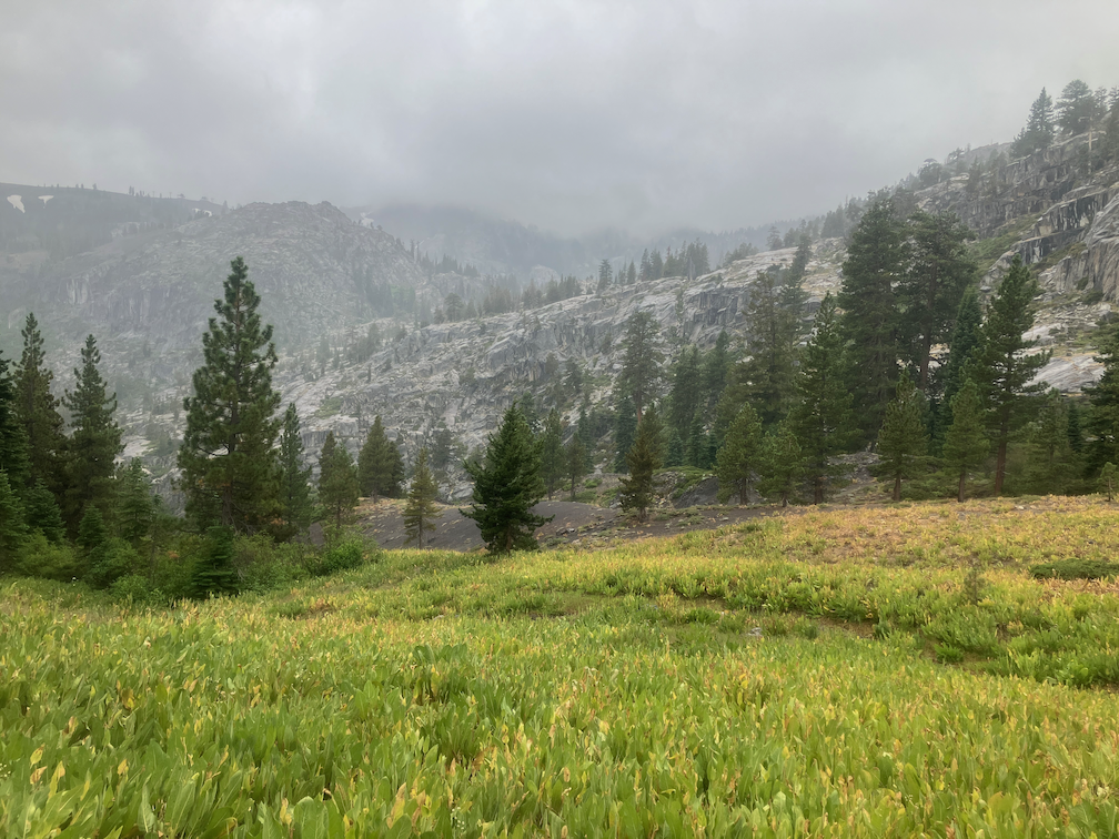
It started raining as I left the Granite Chief trailhead, at 2:00PM, and it continued for 14 hours, through 4:00AM the next morning. I continued hiking in hopes of a break to set up camp, but there was never a break and I finally stopped at Whiskey Creek Camp and set up in light rain. I had my rain jacket, so my upper body was not soaked, but my lower body was drenched and cold the entire time. Though the section of PCT from Tevis Cup Trail to Whiskey Creek junction is not terribly brushy, every bit of brush holds water to shed on me as I walk by. Whitethorn seems better at holding water than any other shrub. The willow thicket along the trail was like a rain storm on the spot.
During the night, the rain was never heavy, light most of time and moderate in the thunderstorms from about midnight to 2:00AM. But nightlong rain and saturated ground was too much for my tent. My sleeping bag was quite wet, and some of my other gear.
The next morning was another one uncertain whether the sun would come out. It did for a few minutes, but by late morning I realized that even if it came out it would not be enough to dry my bag. So I hiked out to River Ranch. The sun was out for a while there, and I managed to dry all my gear except sleeping bag, which would have taken several hours of direct sunlight. I had decided to take the bus into Tahoe City and dry my bag at the laundry, but then I looked at the weather forecast. It was another night of rain, never heavy, but light to moderate, for hours. So I took the bus to Truckee and went home!
Extensive rain at night is not characteristic of the Sierra Nevada. Summer thunderstorm season it often rains in the afternoon, and often clears by sunset but sometimes goes into the early evening. But all night? Not the way it used to be. I check my weather apps before heading into the backcountry, and in those few places where there is cell reception, while out hiking. Though at home in Sacramento, they tend to give similar forecasts and be reasonably accurate, no so for the mountains. The Apple Weather app continually underestimates the amount and duration of rain. Accuweather comes closest to what actually happens. Weather Underground is mixed.
Trail conditions, for the section of the PCT from Tevis Connector to Whiskey Creek junction: Getting brushy and needs brushing by next year. A few small trees down and one medium tree. A fair number of spars (the dead conifers that lean into the trail and rip at skin and clothing). Winter debris light to moderate.
There is a large tree down across the crossing of Whiskey Creek. The rock hop is still available, but requires climbing through or around branches. You can also walk the log itself, but the bark is still sloughing off, and it is a little hard to get up onto down off the tree.
- Photos on Flickr (only two): https://www.flickr.com/photos/allisondan/albums/72177720311005460
- Granite Chief collection on Flickr: https://www.flickr.com/photos/allisondan/collections/72157637640215275
- Granite Chief map on GaiaGPS: https://tinyurl.com/GaiaGPS-GraniteChief

