Tag Archives: trail maintenance

PCT trailwork 2021-07

This trip was primarily for trail work. I had noticed on my previous trip that the section of the PCT trail between roughly Twin Peaks and Ward Peak (actually, only part of that), was beginning to be brushed in again. Looking at past posts, it appears that I did some work here in 2014, but didn’t finish, and then finished in 2016. So it has been five years, at least, since this section was brushed. Most of my brushing I think of as ‘five-year’ brushing, cutting things back enough that the work will last about five years, so this works out.

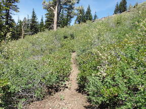
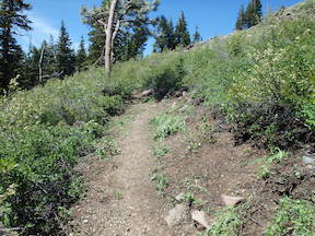
As always, the tobacco brush (Ceanothus velutinus) is the fastest growing of the brush and the most likely to brush a section of trail closed. As with most plants, cutting it leads to it producing multiple stems, so the result of my 2014-2016 work is that a lot of the tobacco brush has multiple younger stems, which take much longer to cut. Sometimes I can get down to the root of the plant, and get it all out, but that is unusual, and doing this effectively would require different tools than I take, a pulaski or similar. I discovered, to my surprise, that at the oldest root wad of the tobacco brush, there is a large, deep taproot. Bitter cherry also spouts from the cut base and sends its stems into the trail, but it is easier to get out by the roots. Even manzanita, though slow growing, will encroach on the trail over time. Several other brush species, less common at least in this area, also encroach on the trail, but the fast growing whitethorn is not common along here.

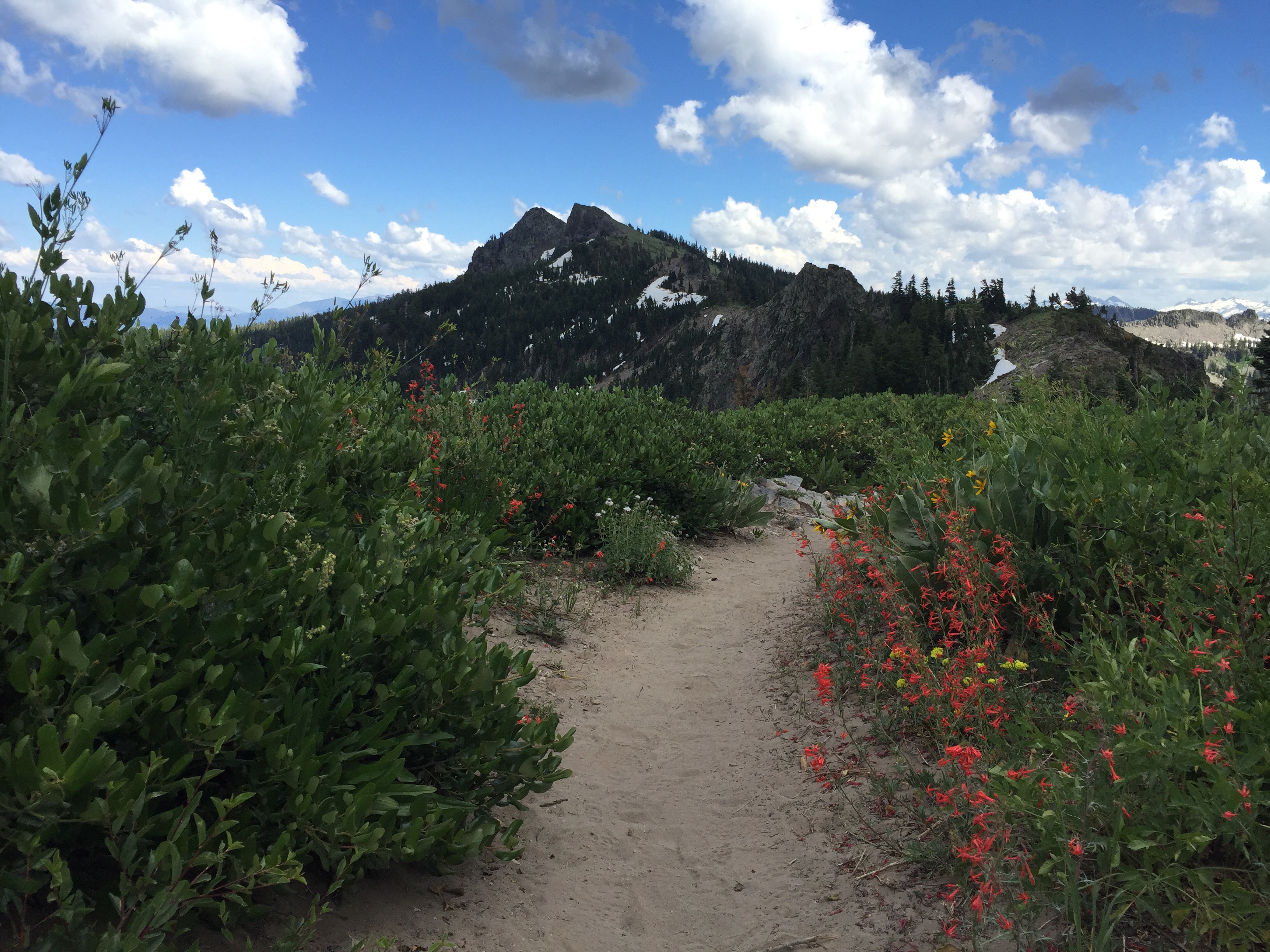
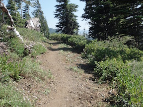
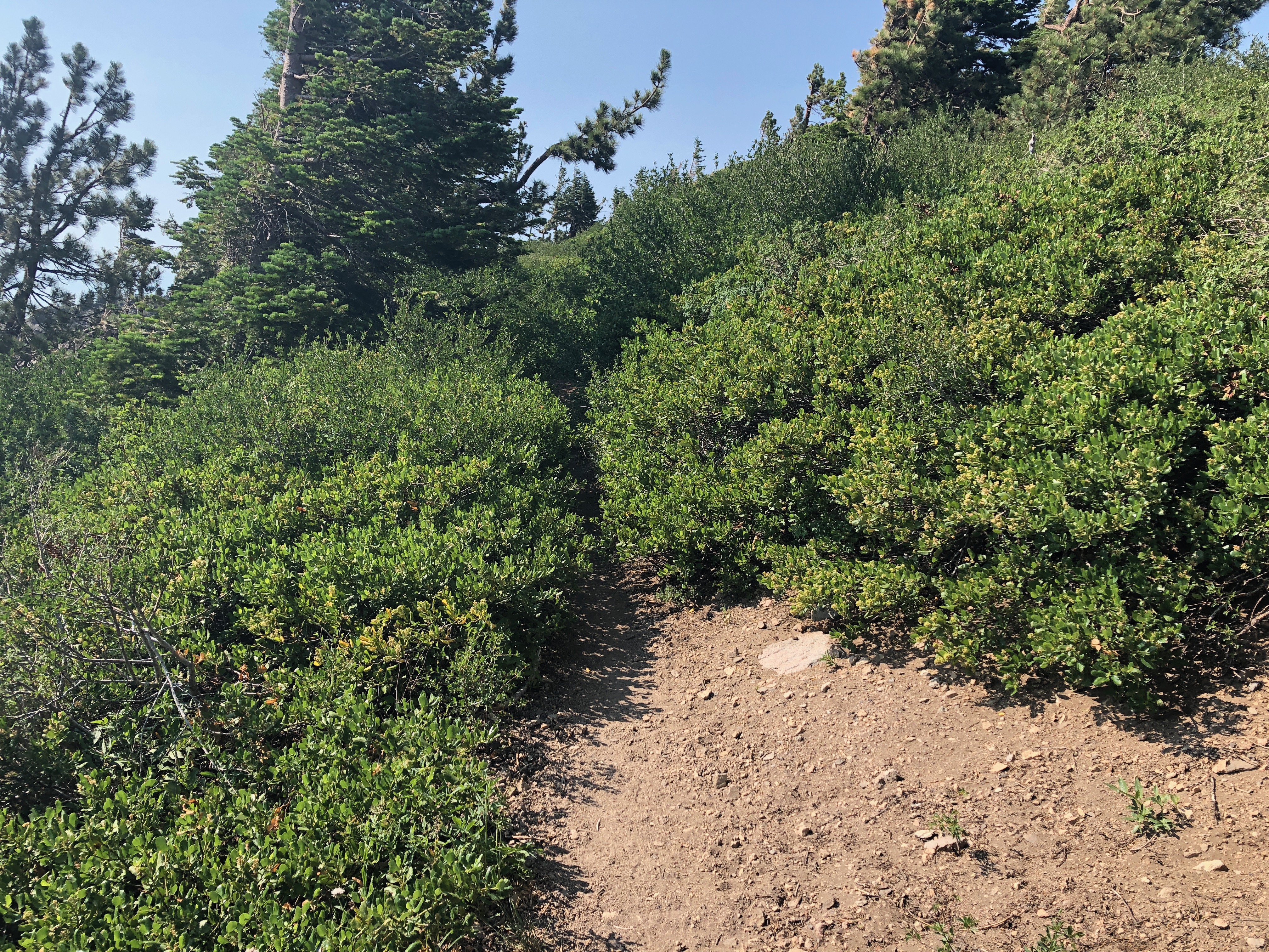
The photo below shows a brushed-in section of the trail, the ridgeline switchback. And it still looks like that, because I did not get to this part in my work. In fact, I only accomplished about one-quarter of what needs to be done. My excuse is that it was hot in the afternoons and I could just not accomplish much. And it was hot – the rocks get almost skin-burning hot. The temperatures are funny. Up above the bridge the wind is often blowing, and was blowing the entire time of this trip, and it is comfortable. But when I squat down or sit down to cut brush, I’m out of the wind and it is very hot.

PCT brushed in

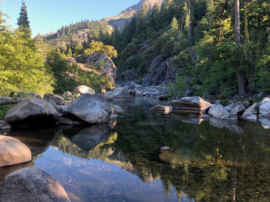
There are no water sources on the ridge between the springs in North Fork Blackwood Canyon and Five Lakes Creek, so I have to pack in water. I resupplied, from the springs, once during my trip, and when I ran out of water the second time, headed out. The three springs close together are very low, and I’m sure will dry up this summer. Another single spring further south is still flowing well. And of course North Fork Blackwood Creek is likely to have water all season. In years with more snow, I’ve been able to melt snow from the snowbanks that last on the east side of the ridge, but this year those snowbanks were gone back in June.

I primarily use two campsites on the ridge, the one heavily used by PCT thru hikers near the PCT/TRT junction, and a small one north of Twin Peaks that is not much used. I discovered that a wood rat lives nearby. It stole my plastic spoon, so I have to make a sort of workable one out of a stick, and also chewed on my pack straps and work gloves. After that night, I put everything away and hung my pack up in a tree.

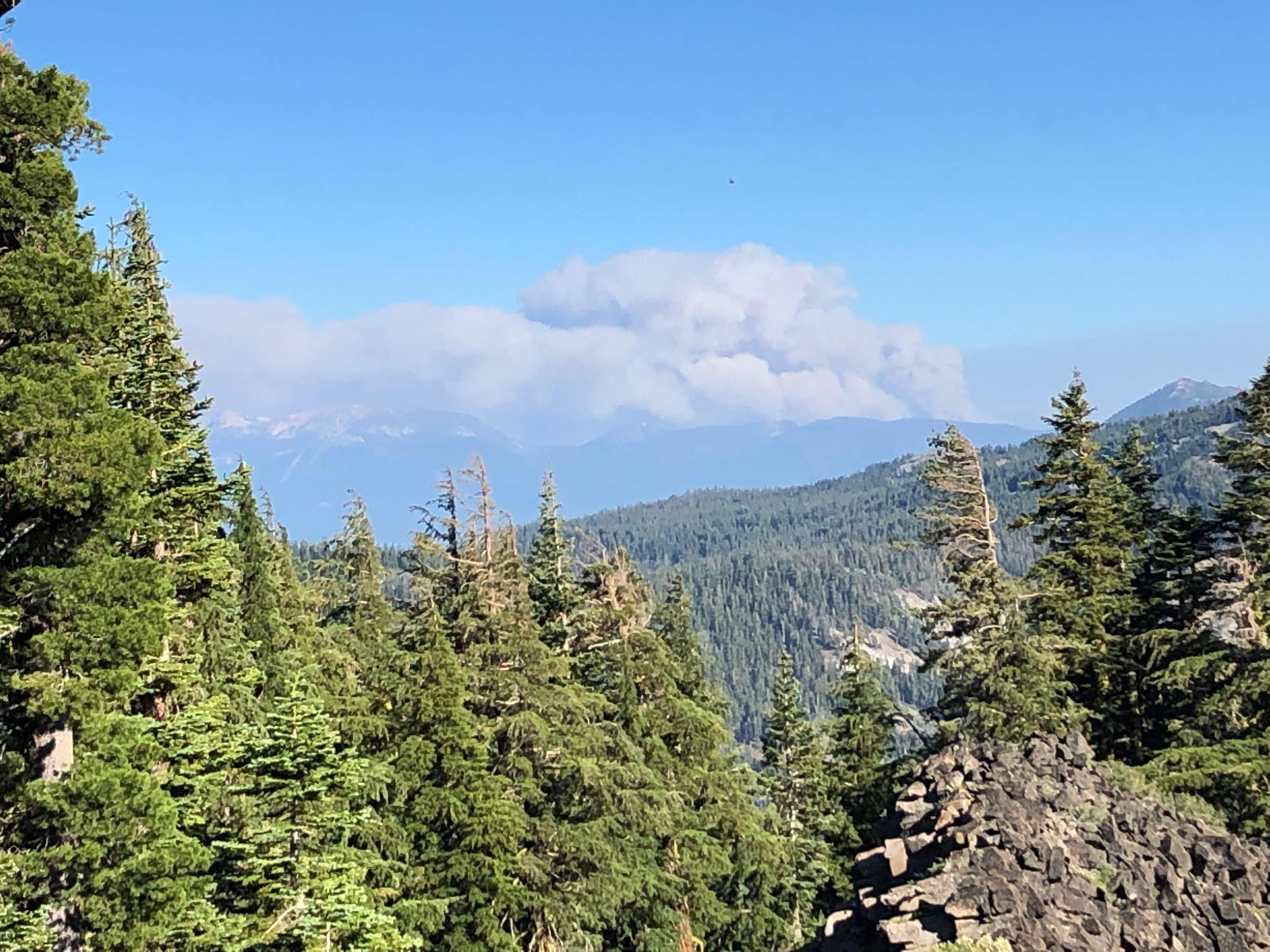
On my way out the last day, a new fire southeast was popping up, the Tamarack Fire, which is still going as I write (Sunday, July 25), now about 66,000 acres and only a quarter contained. During my time on the ridge and then down at Tahoe, the smoke was all going north, along the east side of the Carson Range, so not affecting my area, but I understand that now some smoke is coming over to Tahoe and the crest.

Tamarack Fire

On this trip, I took both insect repellent and my inner netting tent. Ironically, there were far fewer mosquitoes than there had been two weeks before, but it was still nice to go to sleep without the buzzing.

For this trip, I walked from Tahoe City to Kaspian Campground, which is where Barker Pass Road leaves the highway, walked up the road and then the jeep road past Blackwood Campground to the crest. Blackwood Campground now charges a fee – it was the last of the campground in the entire Tahoe basin that was free. As a result, it was empty. I headed north on the PCT from Barker Pass to my work area. Going out, I took the TRT trail down to Ward Creek, where I camped the night, and then on through Paige Meadows to Tahoe City.

I’m falling into a pattern of wanting to hear music after my backpack trips, so I went to the Saturday afternoon music in Squaw Village, blues by Mike Schermer, which was fun. It seems it is mostly locals, people who have homes or shares in the village, who attend these. There were a lot of kids dancing, having a good time.

And then home on the Amtrak bus from Truckee.

Tomorrow, in for more trail work. Maybe I’ll get to half or 3/4 done.

Photos on Flickr: https://www.flickr.com/photos/allisondan/albums/72157719601232047; Granite Chief Wilderness collection on Flickr: https://www.flickr.com/photos/allisondan/collections/72157637640215275/

trail work 2020-07

My trip July 2-9 was mostly into the Hell Hole Trail area. I went in at Alpine Meadows trailhead, down Five Lakes Creek, to Hell Hole Trail and McKinstry Trail, and then back out via Powderhorn Trail, north along the PCT, and out at Alpine Meadows ski area.

The Five Lakes Creek Trail is in gradually deteriorating condition, with more down trees added to the existing ones, and more issues with tread erosion. The Hell Hole Trail is in decent shape though there are downed trees that have now been there for years, and a few more are added every year. I have been working on defining the tread, so the trail is becoming somewhat easier to follow, though some sections still have a lot of winter debris accumulation. The trail from Diamond Crossing down disappears as it approaches Five Lakes Creek, due to thick willows and downfall, but it is not too hard to find a way through. The trail from there to below Steamboat Creek (which was still flowing well) is in decent condition, though it requires close attention to follow. There are a large number of oak trees down over the trail switchbacks about 2/3 of the way down the hill to the lower end of the trail, but you can bypass them by paying close attention.

I did some more work on what I’ll call the McKinstry Trail, from the junction at the bottom of the Hell Hole Trail, so it is now defined from the point near Five Lakes Creek crossing to about a third the distance back to the junction. But the 2/3 closer to the junction is very hard to find, and I have not yet identified what the best route is. I’m sure the original trail just headed across the forested flats, but the helicopter logging that left all the debris, and a weakened forest generating downfall, has completely obscured these sections. Eventually I’ll figure and and define the best route, but for now, one just has to head in the right directly and hope to pick up the trail again.

After crossing lower Five Lakes Creek, the route again is lost in the forested flats. It shows up again where it climbs up on the ridge separating Five Lakes Creek drainage from the Rubicon River, and is marked with rock ducks to where it comes back down to the river. I have not been past the crossing of the Rubicon in years, so the condition of the rest of the McKinstry Trail is unknown to me. There are also use trails that follow the ridge between the two drainages down towards the reservoir, but I haven’t been on those in years either.

Heading back out, I took the Powderhorn Trail, which has more downed trees but is not in bad condition, walked the road to Barker Pass, and headed back north on the PCT. The PCT is in good condition from Barker to the PCT/TRT junction. After all these years, it seems the the Tahoe Rim Trail Association has finally reached the desired state of good repair: no downed trees, no brushy sections, tread in good condition. Thank you! North of that junction there are a few downed trees, and some areas needing brushing (which apparently only I do, but I haven’t done in about three years). I intended to go out through Five Lakes back to the trailhead, but realized there were going to be hundreds of people on that trail, so I went out through the Alpine Meadows ski area, which is no shorter than the trail, but I only saw one person.

Rubicon River near McKinstry Trail

I’m just about to head back into the same area, to do a little more trail work and a little more exploring.

Photos on Flickr: https://www.flickr.com/photos/allisondan/albums/72157715140370061

Hell Hole Trail 2019-07

I spent the second half of my recent backpack trip working on the Hell Hole Trail, specifically the upper part between Diamond Crossing (junction with Five Lakes Creek Trail and Powderhorn Trail) and Steamboat Creek.

Over the last few years, there has been more and more down trees on the trail, but by far the worst part was a ways past Buckeye Creek where there is a tangle of down trees in an Incense Cedar forest. This had gotten so bad that the bears had stopped using it and made their own way, with trails above it and below it, and the trail itself had essentially disappeared. The issue with the bear trails is that, though they eventually reconnect, it is quite some distance before they do, and a hiker is likely to notice there is no people maintenance and no people marking, and figure they are ‘lost’. Happened to me twice, and once was quite a long detour. So, I spent some while finding the trail again, and defining it well enough that it can be followed. I only take light trail tools, including a folding Fiskars saw, so can’t do anything about most of the down trees, but most of them are easy to step over or climb over, so defining the trail well enough to follow, keeps hikers on track.

There is also a lot of winter debris (that is what I call the branch litter that covers the trail after the snow melts, though any wind storm contributes to the debris). This can also make the trail quite hard to follow, so in confusing spots, I cleared the debris, perhaps a quarter of the total. There are a number of leaning trees, young white firs mostly but other species as well, that make the trail hard to use, and I was able to cut many but not all of those.

The section from Diamond Crossing junction down to the crossing of Five Lake Creek is partly marked with small rock ducks. There is a defined trail in places, but trees keep falling on the trail at the lower end, and when I’ve made bypasses, trees have fallen on those as well. Coming from Diamond Crossing, if you just keep heading downhill along the drainage, you will hit Five Lake Creek close enough to the crossing. Going up hill, it is easier to lose the trail, but you will eventually hit either the Five Lakes Creek Trail or Powderhorn Trail, and get back on track.

So, the status is that anyone who has a careful eye out for the trail should be able to use the trail again. However, beyond Steamboat Creek, you are on your own. I have neither walked nor maintained any of the lower trail in the last two years, and even that was minimal.

Crimson Columbine (Aquilegia) at Steamboat Creek

At the time of my trip, 2019-07-21/25, Five Lakes Creek was a calf-deep wade across a wide bar in the river. I always stay clear of the down tree tangle downstream, far more dangerous than anything in the creek. Both forks of Buckeye Creek were flowing, and I believe at least the eastern fork is year-round. Steamboat Creek was flowing well, however, it dries up at the trail crossing at some point during the summer, and I’m sure it will this summer. I have in other years found water upstream and downstream of the trail crossing, but there are no guarantees. If you are going, stock up on water at Buckeye Creek, as it is a long ways to Five Lakes Creek below, or the reservoir shoreline, if Steamboat is dry.

I followed the lower Hell Hole Trail a ways from the Steamboat Creek crossing. This section used to be obvious, but it is getting harder and harder to follow, and I lost it before getting to the gully. The bears have abandoned this trail, seeming to go above across the slope, but there may be other bear trails I did not find or notice. Coming up the gully, one apparent trail leads into a pretty valley between two ridges, but so far I’ve not found a route out of that valley and back to the main trail, so this may be a red herring. If the bears have their doubts, then I have my doubts, and I am not sure that the old trail alignment is the best route anymore. My next trip will be in part to determine what the best route is. I know that the bears are still going between lower Five Lakes Creek and middle Five Lakes Creek, but I don’t know what they have decided is the best route.

A little tidbit. Steamboat Creek is NOT where it is shown on the maps. The USGS map, and every map based on it, which is probably every map including GaiaGPS and the Forest Service base maps, has it to the east of its actual location. It is not that far off, only about 300 meters, but it is off.

GaiaGPS now offers the Forest Service base maps (USFS 2016 CalTopo), and it is interesting to see what the Forest Service shows for trail locations as opposed to other maps such as GaiaGPS, USGS, and Trails Illustrated. I am not sure which maps are available to which membership levels in GaiaGPS, so you will have to explore that on your own. GaiaGPS now offers scanned 1930 maps, and the trail locations definitely vary, however, these maps have much less accurate topography, at least in rough country such as the Granite Chief, so the trails may be less accurate as well.

I noticed a trail sign on the ground that I had not seen before, below. I’m wondering if it is at one of the original locations of the west leg of the Buckskin Trail, so I will explore that on the next trip. I know that there is a vague old trail leaving the Hell Hole Trail just past Steamboat Creek, which is at least one alignment of that old trail, but there may be more than one, and some maps indicate that the trail takes off east of Steamboat Creek. I enjoy looking for and locating old trails which have not been maintained in decades, but at the same time, I want to do trail work on existing trails so that they don’t meet the same fate!

Photos on Flickr (this includes the entire 10 day trip, not just the Hell Hole portion): https://www.flickr.com/photos/allisondan/albums/72157710021027427.

Powderhorn trail work 2018-06

For my first trip of the season I mostly did trail work on the Powderhorn Trail. Working down from the top, I cleared brush, of which there is not all that much, and cleared or thinned young conifer trees, of which there is an infinite supply. The conifer trees seem nice, but if they are within four feet of the trail, and grow up, their branches always encroach on the trail. When there is dense conifer seedlings on both sides, it often essentially closes the trail. And of course as a natural process of thinning, most of these would eventually die on their own, but that leaves a tearing dead tree that is much harder to cut and remove than it was when it was alive. When it is clear that one tree is growing faster than the others, therefore quicker to reach the point where branches are above trail level, I leave that one and remove all the shorter ones around it.

I completed the work from the top to the postpile meadow, about 1/3 of the 3.5 miles, and did a minor amount of work below that. There are many days of work left to go, so unless a trail crew goes in, it will be several years before the trail is in good condition again. But it is usable, if not for downed trees.

There were eight down trees, six of which an be bypassed easily, and two of which hikers can clambered over or around but horses cannot pass. There is a moderate amount of winter debris, the branches that fall during the winter and can be stepped over, but when removed make a much nicer walk.

On the Five Lakes Trail, there were about five downed trees, none hazardous and all easy to go around.

I walked in from Kaspian Campground on Hwy 89 (a nearby bus stop), up Barker Pass road and then the old jeep trail to Barker Pass (steep but quiet and beautiful), then along Forest Road 3 to Powderhorn trailhead, and in. From Diamond Crossing, the junction of the Powderhorn, Hell Hole, and Five Lakes Creek trails, I walked up Five Lakes Creek trail to Whiskey Camp and then out at Alpine Meadows trailhead and down to River Ranch on Hwy 89 (a nearby bus stop).

There are patches of snow along the ridges, but most snow is gone. Many of the tributary creeks and creeklets are still flowing, but low, and will probably dry by mid-July. The flowers are moderate, in some places it is still early season and flowers have not developed, and in other places they are fading already.

finally! 2017-07

My latest trip was primarily for trail maintenance on the PCT, and after  11 years, I feel caught up. I removed the last brushed-in section, between what I call Two Towers (Lord of the Rings reference) and Twin Peaks. Of course in order to get done, I had to accept many places that could use brushing, and leave them for the future. In particular, the pine mat manzanita and sagebrush is pushing into the trail and narrowing the tread. It isn’t hard to clear, but is a lot of detailed work that I’ve often put off “for next year.”

The reason I pick this part of the PCT to work on every year is not just that it needs brushing, but that I so love spending time on this ridge. The views east are spectacular, over Lake Tahoe and the weather over the Carson Range, often thunderstorms developing when the main crest is clear. The views west are intriguing, down into the wilderness, where the real wilderness is, and beyond, to the coast ranges. When the valley air is clear, not often, the details of the coast range and Bay Area are clear, and at night the lights in the valley, kind of neat at a distance. Usually thunderstorms develop over Nevada, the Carson Range, and sometimes move west to the crest, but on Wednesday moisture coming from the west developed some thunderheads, thunder, and light rain for a half hour, while the Carson Range was mostly clear. 

When there is snow on the ridge, usually in banks on the east just below the ridge where it gets blown during the winter in strong winds, I can melt snow and stay up here for many days. I use my black Jetboil pot to melt, and I can keep up with my daily use if I stay on top of the melting. 

I went in on the Granite Chief Trail from Squaw Valley, which has a few trees down but easy to get around, then south along the PCT. Granite Chief saddle has a lot of snow on the north side, but the route is not hard to find. People southbound rarely have problems here, but many northbound hikers drop too far down into Shirley Canyon and have a hard time finding the trail again. The trail from the saddle south to the TRT/PCT junction is in good condition, a few tress down but surprisingly few, some trail erosion but not bad. 

I hiked out the TRT to Tahoe City, so don’t have anything to report about the TRT/PCT south to Barker Pass, but I’d guess many snow banks but no big issues. Other than snow banks on the upper portion, the TRT trail down into Ward Creek and Tahoe City is in good condition, having been logged out already by a TRTA trail crew. 

The PCT thru hikers are out in force, but interestingly, about half were going south, having skipped over the high Sierra to Donner or even Ashland and now heading south to pick up the section with somewhat less snow. Looking into the Desolation Wilderness, however, snow there is still deep and must be much deeper at high elevations to the south. Dicks Pass is 9400, but the highest pass on the PCT is 13,143, Forester Pass. There were people who had come through the high Sierra headed north, but I have to say that they all looked beat and not very happy. I think the route flippers were much happier. 

The next big project on my list, for next year, is to work on the Powderhorn Trail. If anyone hikes that and has conditions to report, please do so. I think the middle section is in horrible condition, brushed closed in spots, but I haven’t been there in two years, so I’m guessing. 

Photos on Flickr (more later, these are ones from my iPhone which are easy to upload, but I also used my regular camera)

PCT trail maintenance trips

I’ve had two backpacks this year doing trail maintenance on the Pacific Crest Trail through the Granite Chief Wilderness. Since almost all my time was up on the PCT, I don’t have anything to report about the rest of the wildneress, but since I have two more backpack trips coming up, will have a report on much if not all of the trail system.

I brushed from Granite Chief trail on the north to Five Lakes Creek in the middle, and the trail is in good condition except for a short 0.1 mile part between Whiskey Creek Camp trail and Five Lakes trail that I didn’t get done, though it is not bad. I also did the Whiskey Creek Camp trail since it was getting a bit brushy. While in this area I spent some time exploring around Five Lakes Creek and Whiskey Creek, looking for the old trails that were there before the new PCT alignment was completed. In some places these old trails are easy to follow, but no always. I still think there is a trail on the south side of Five Lakes Creek to Big Spring Meadow, but so far I haven’t located it.

On the second trip I focused on the PCT north from the PCT/TRT trail junction near Twin Peaks. There are several sections here that are very brushy, and a few that are essentially closed in. I got all but one of these opened up again, to a point where they should be OK for about five years. But there is one very brushy section that I did not get to, and will be very bad by next year. It is about 0.2 miles. I did spot brushing on the remainder, and it is in decent shape but could use work. I think this year I accomplished what I have not in several years, keeping up with the rate of brush growth, though not gaining on it, which is why there are some badly brushed-in sections left. Next year perhaps I’ll get those last very brushy parts done, and be “caught up” at least for a couple of years.

PCT trail before

PCT trail before brushing, overgrown with tobacco brush

PCT trail after

PCT trail after brushing, cleared to five-year width


Continue reading

brushing and strange weather 2014-06

I spent two days last week brushing part of the Pacific Crest Trail that runs through Granite Chief Wilderness. This section, north of the PCT-Tahoe Rim Trail junction by Twin Peaks, is one that I started working on in 2006, when I discovered that that trail was brushed closed and people were getting lost. The part I just did was nearly but not quite brushed closed again. Brushing by myself goes very slowly, particularly when I come to an area that has a lot of small stems instead of a few big ones. I finished about 200 feet of trail. There is about a half mile of trail remaining to do. Some plants get bushy when trimmed back, others grow again in the same pattern of a few large stems that can be pretty easily cut. I realized last year that unless I spent much more of my summers brushing than I wanted, I was not going to keep up with this brushy section. Nevertheless, I like doing the work and will continue to do some every summer.

PCT before brushing

PCT after brushing PCT before and after brushing

Continue reading