Tag Archives: trail maintenance

Granite Chief 2025-08-20 trail work & survey

My sixth trip of the season was for trail work and trail survey.

Five Lakes Creek Trail

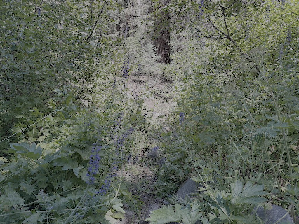
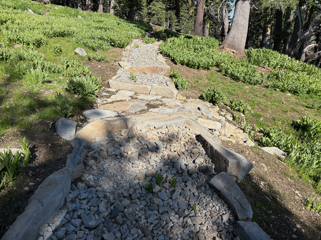
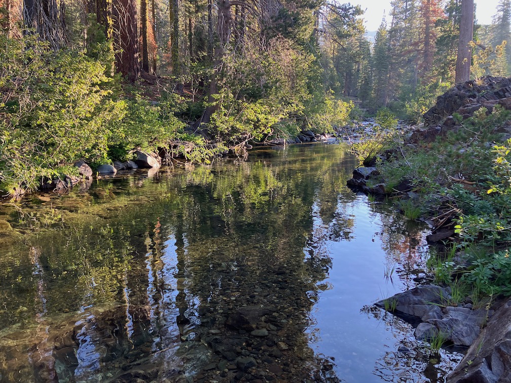
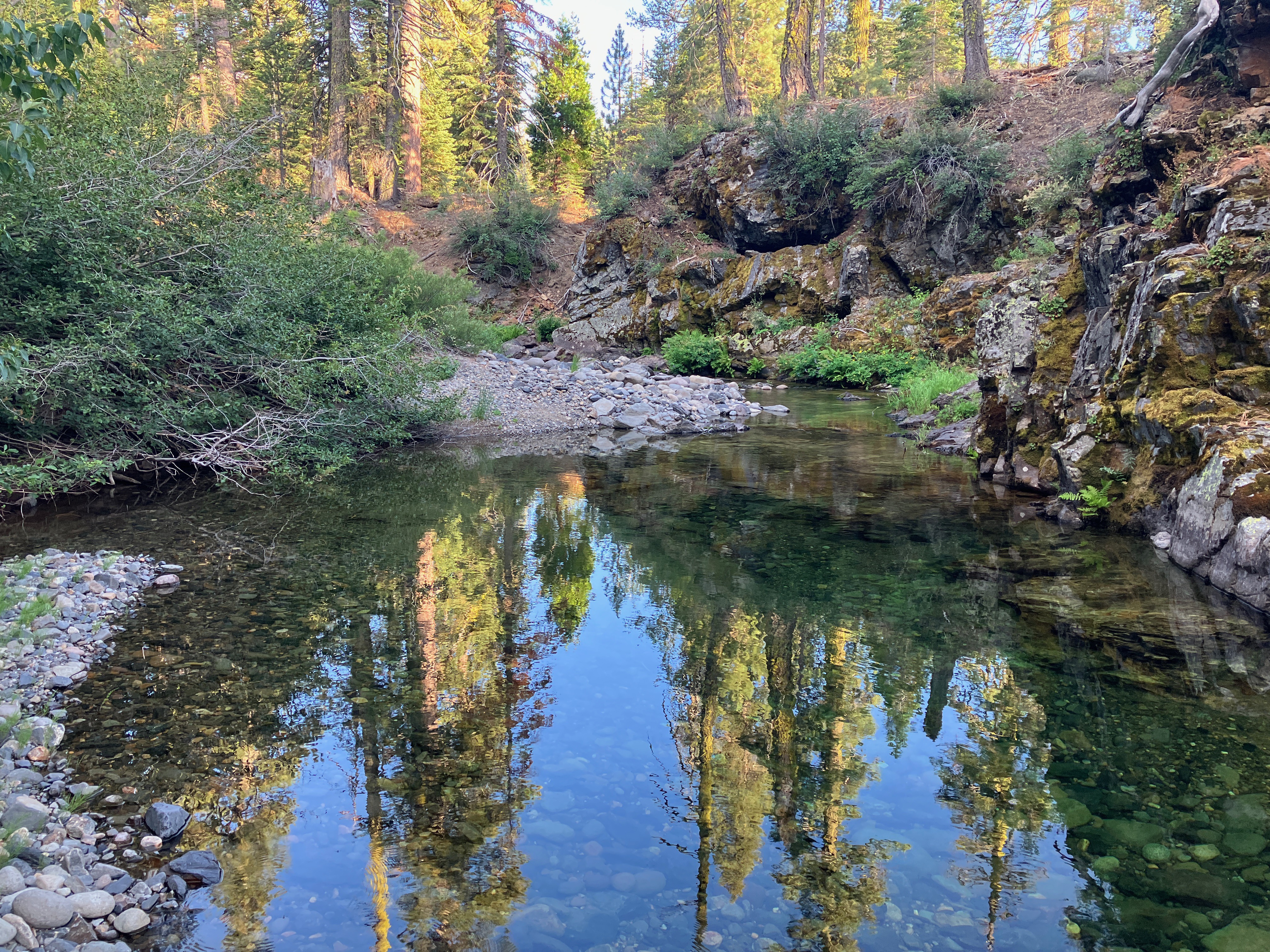
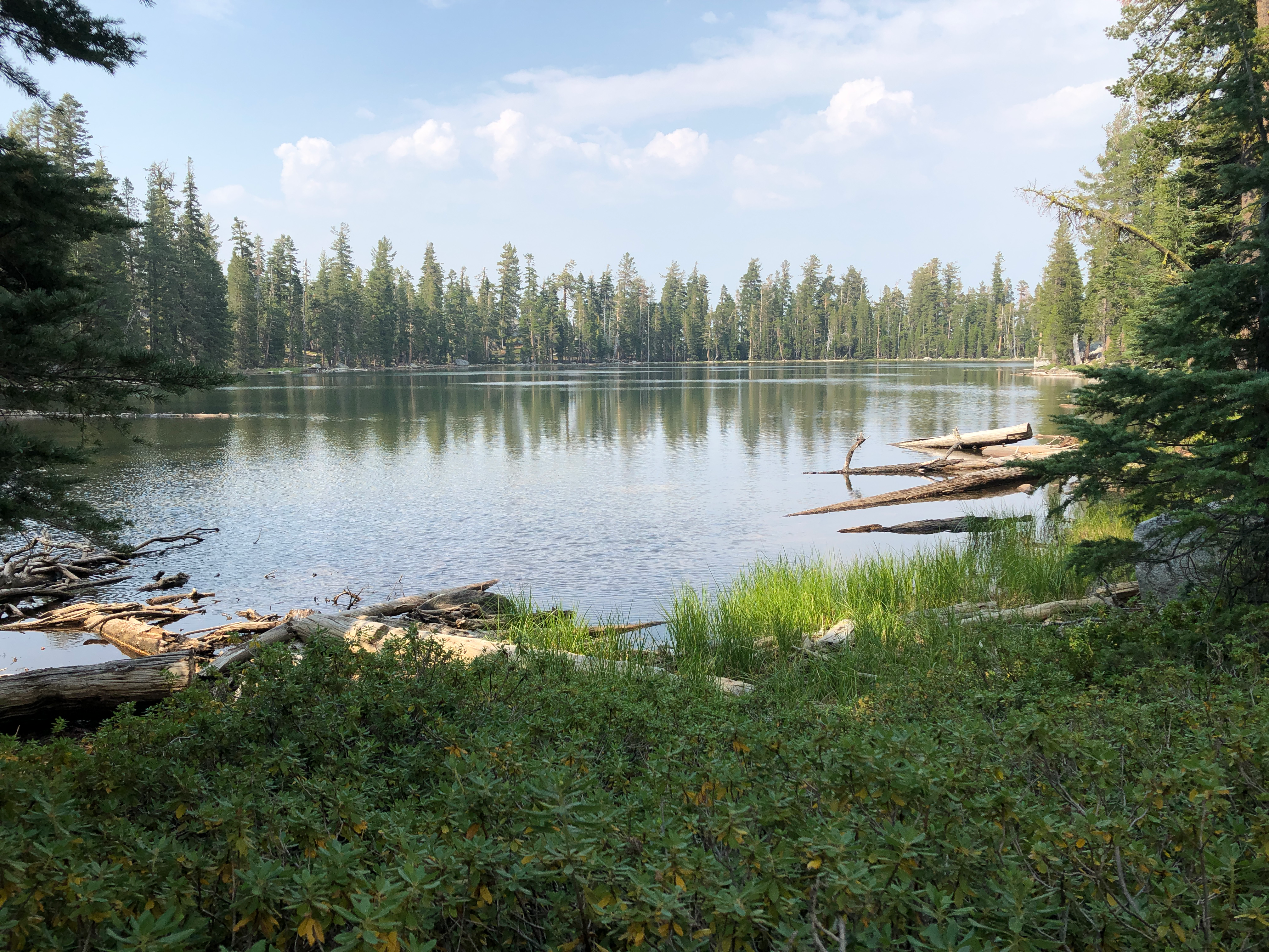
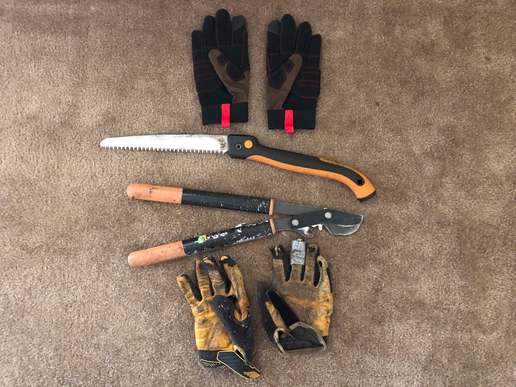
I completed trail work on the Five Lakes Creek Trail, from the creeklet crossing where I’d stopped last trip, to the Five Lakes Creek Trail & Big Spring Trail north junction, and then on the Big Springs Trail down to the crossing of Five Lakes Creek. There remain about 14 down trees, too big for me to cut, but I created either good climb-overs or bypasses, and in one case, a duck-under of a hanging tree. Also removed winter debris and brushed several sections, though there was less debris and brush on this second part. The trail on the west side of the crossing of Five Lakes Creek was brushed in with alder and willow, and I cleared that. At current creek levels, there is a rock-hop crossing, but at higher levels one must go upstream or downstream, which means fighting alder thickets. I was expecting the work to take two days, but it only took one, so I had a free day, and used it to re-survey the Western States Trail in Olympic Valley.

Western States Trail (Olympic Valley)

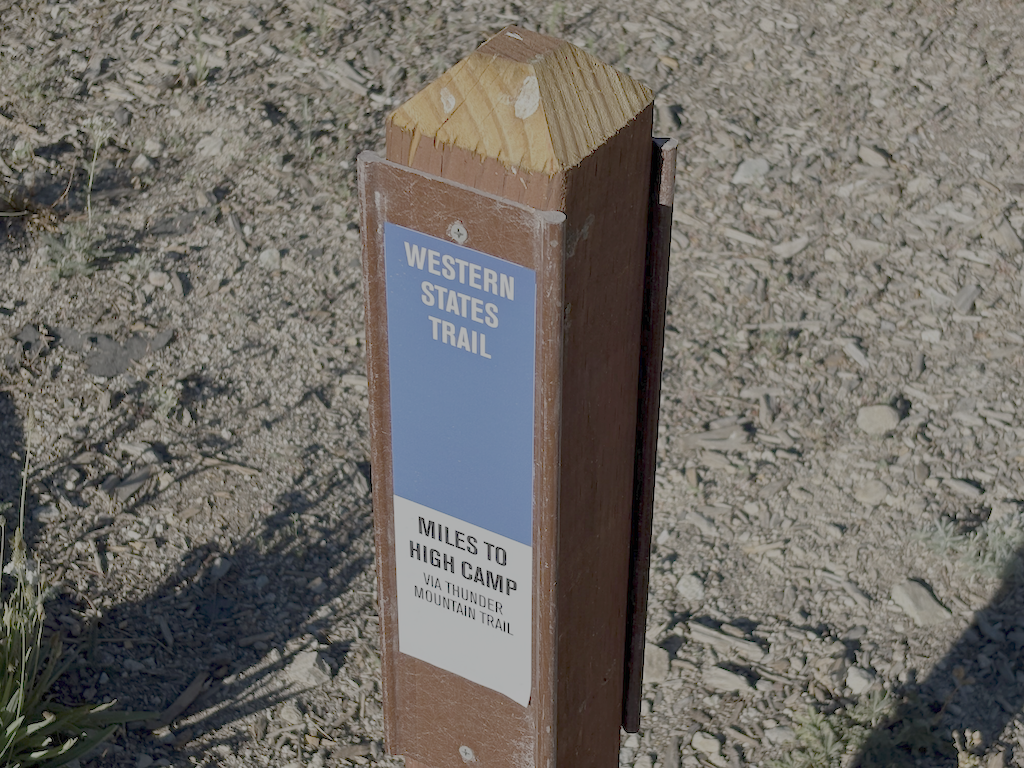
I realized after looking at my old trail track for the Western States Trail, that I had been off-route for much of my survey trip in early June. So I backpacked from Whiskey Creek where I’d camped north on the PCT, and then the Western States Trail to Watson Monument on the ridge above Olympic Valley. From that point, the trail goes south a short distance along the ridge, and then down a trail across the ski area. None of these upper trails are signed, including where it uses a short distance of road. The trail stays as high along the north-facing slope of the valley as is possible. I have no idea where the original, historic Western States trail went, if it was even in the Olympic Valley at all, but the existing designated trail is quite nice, and avoids as much of the ski area infrastructure as it can. Before Alterra bought ‘Squaw’, the old Ski Corp groomed slopes with bulldozers and dynamite, built roads wherever a bulldozer could, and maximized disturbance of the natural environment. It was a terrible company. Alterra is not perfect, but it is far better.

Where the trail crosses ski area roads, of which there are an abundance, it is usually not signed at all. There are signs, here and there, but not at every crossing or junction, and they are often not obvious, sometimes small signs high up in trees, or very old wood signs. Every time you get to a trail junction or road crossing, it is worth pausing and orienting, or you will likely end up on the wrong route.

The most confusing location, for me, was where the correct trail stays high under a cliff, and does not descend on the more used and obvious trails. On my GaiaGPS maps, I’ve marked this waypoint as ‘Jct WS stay high’. A side trail, from the marked junction ‘Jct WS access’ is signed as Western States Trail, but it is not.

When I got above Palisades Tahoe village, I broke off the trail and descended to the village, for Friday music and some rest. I was tired! The remained of the trail east to the trailhead on Hwy 89 is correct and not very confusing. And better maintained.

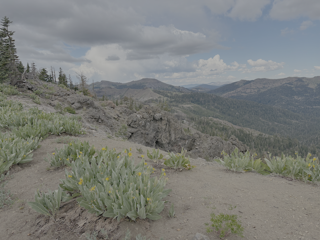
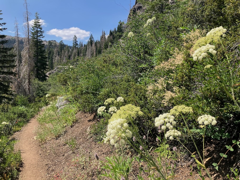
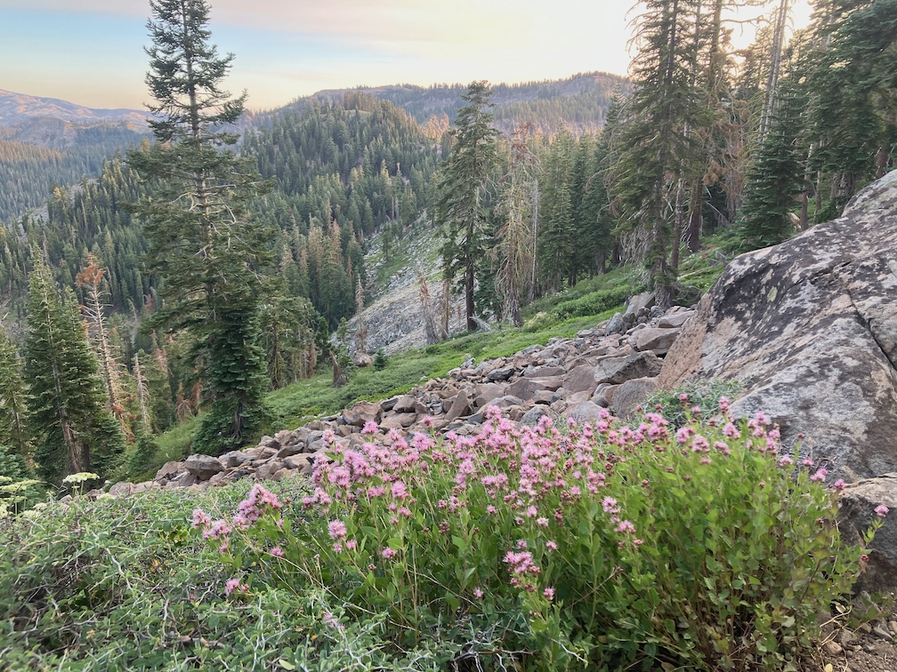
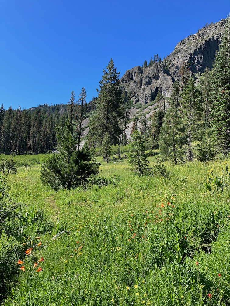
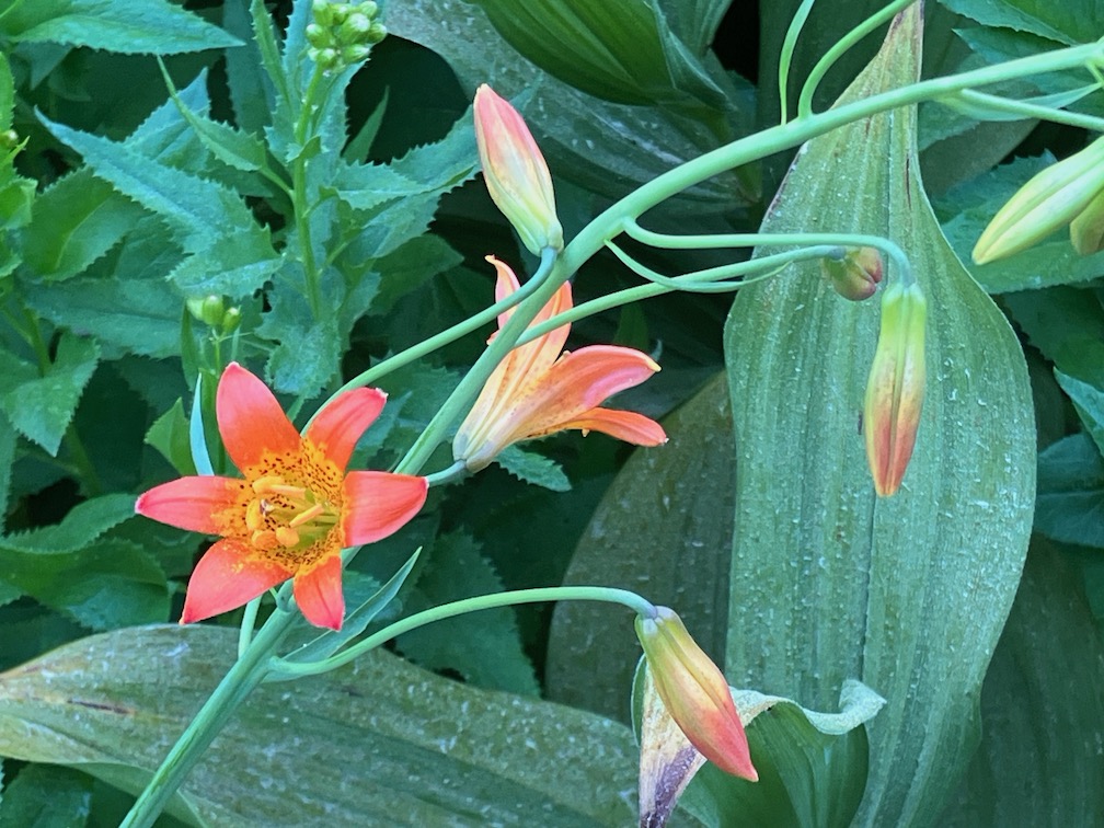
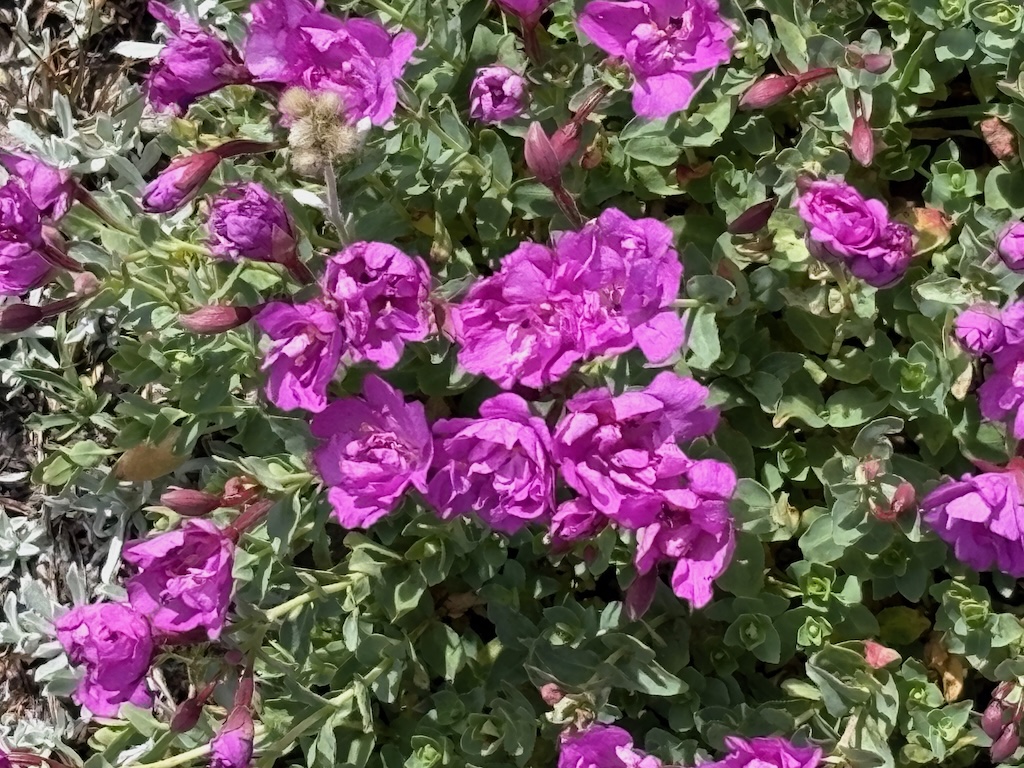
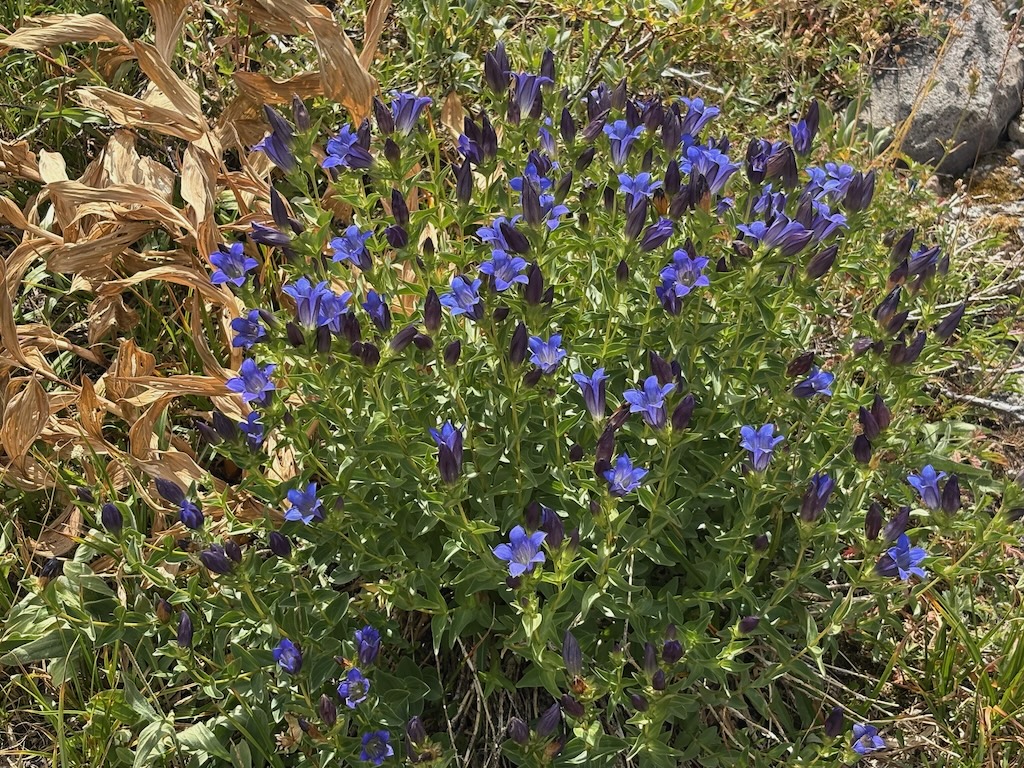
So, is this trail worth the challenge of following? Absolutely. The north-facing slope of the valley is sometimes bare rock or scree slopes, but it is also host to beautiful flower fields and clusters of trees. There are whole fields of brilliant pink rock fringe (Epilobium obcordatum, Onagraceae), which are fairly rare in this part of the Sierra crest. Gentian, probably explorer’s gentian (Gentiana calycosa, Gentianaceae), with its bright blue flowers is common, and again rare in this part of the crest.

photo of rockfringe, Epilobium obcordatum (Onagraceae)
rockfringe, Epilobium obcordatum (Onagraceae)
photo of explorer gentian, Gentiana calycosa (Gentianaceae)?
explorer gentian, Gentiana calycosa (Gentianaceae)?

There is only one water source along this entire trail, at this time of year, a spring that may or may not be year-round. When I passed it, a dog was luxuriating in the cool shallow water, so I passed it up as a water source. Earlier in the year, there are many creeklets that cross the trail.

GaiaGPS and Open Street Map

Part way through my effort to make sure I had an accurate route for the Western States Trail through Olympic Valley, I realized why I was having a hard time. GaiaGPS has mis-labeled other trails as the Western States Trail, though they are not.

Which led to a closer look at GaiaGPS. The company, now owned by Outside, claims that they update from Open Street Map (OSM) on a regular basis, and if there are errors that have been corrected in OSM, they will be corrected in GaiaGPS. This is false. There are trails in GaiaGPS that have not been in OSM in years, if ever. I’m sure some of the trails are remnants from Forest Service maps, which include mistakes 20 or more years old. It may be that new information is added, but old, incorrect information is not deleted. Though I selected GaiaGPS over a number of other field mapping apps, years ago now, I’m becoming increasingly unhappy with it. Since it was bought by Outside, it has noticeable deteriorated.

I’m at work correctly labeling the Western States Trail (Olympic Valley) in OSM, but it is going slowly because I have a lot to learn about OSM and how to make edits. When I get the segments right, I’ll combine them into what is called a ‘relation’, for the whole trail from the trailhead on Hwy 89 to the junction with the Pacific Crest Trail.

Granite Chief 2025-08-05 trail work

My fifth trip of the season was primarily for trail work. As I do when I can, I attended Palisades Tahoe Bluesday on Tuesday evening, camped out on the Granite Chief Trail, and next morning headed up the trail, south on the PCT, and into the wilderness. I’ve been walking a lot on the PCT, and have ignored the needed trail maintenance. I realized that I don’t consider it my responsibility any more. There are plenty of other trails that no one else would work, and the PCT should really be maintained by people who have done the PCT, to give back to the trail that provided them their experience. The wave of PCT thru hikers has passed, but a few are still struggling northward.

Wooley Mules Ears are starting to yellow- and brown-out for the fall, while the less common Arrowleaf Balsamroot turns a brighter yellow. Here and there are touches of fall color.

I checked out the route to Little Needle Lake and basin. This trail was partly maintained and heavily used by the CCC trail crew last summer, so is now easy to follow. The junction with PCT is just south of the Middle Fork Trail junction, and is not obvious. It is not an official trail, so probably won’t ever have a trail sign. Passing the Whiskey Creek meadow, a blond and brown black bear was tearing up a dead log, apparently finding morsels to eat, but ran off when it noticed me. I’ve seen quite a number of grouse, and some quail, in addition to the ubiquitous juncos.

I camped at Whiskey Creek camp. Two other backpackers were in, using my favorite camp site. I talked a while with them, and noted that this area used to get a lot more use. I would almost always see families camped there on weekends, and others during the week. No more.

I spent the next two days working on the Five Lakes Creek Trail, south from Whiskey Creek. I brushed, removed winter debris, defined bypasses or climb-overs of large down trees, and cut a few smaller down trees and leaners. I did 1.4km, to the creeklet crossing, about 2/3 of the way to the Big Spring trail junction. My objective was to the junction, but the work was slow, particularly working snowberry which has to be taken out by the roots to keep it from bushing out the next year and blocking the trail, and gooseberry with its sharp prickles on stems and seeds. Whitethorn is past its gentle early summer phase and extract blood. The photo below is approaching the creeklet crossing. Doesn’t look like much, but it was an impenetrable thicket of alder and yearly growth before.

photo of cleared Five Lakes Creek Trail creeklet crossing
cleared Five Lakes Creek Trail creeklet crossing

A dirt bike has been ridden on the Five Lakes Creek Trail, damaging the trail tread and scarring some meadow areas. I don’t know who this is, it has happened at times I’m not in the wilderness. It may have even been a Forest Service person, as there are rogue employees who do this sort of thing. I was a wilderness ranger for years, and this deeply offends me. If I ever catch them, there will be hell to pay. The linear tracks of a dirt bike become conduits for water erosion during thunderstorms and snow melt.

I camped at ‘Squaw’ Saddle above the ‘Squaw’ Saddle Trail, overlooking Olympic Valley so I had cell phone reception to prepare for a Saturday Zoom meeting. I decided to go out through Olympic Valley to avoid walking Alpine Meadows Road from the Five Lakes Trailhead to the bus stop at River Ranch. In the morning, I followed the old ‘Squaw’ Saddle Trail down the hill. It is steep and severely eroded most of the way down to the Western States (Olympic Valley) Trail, but that trail is in good condition. I realized that on my 2025-07-01 trip, I veered off the Western States Trail, missed a trail junction, so my description of the upper part of that trail is in error. Once on the trail, I began to remember having walked this section years before. It is still not signed, but is clearly the correct trail. My route on GaiaGPS is correct, more or less. Ironically, the one Western States Trail sign provided by the ski area is incorrect, it is NOT on the WS Trail, but on an access trail to the WS. Shown below.

I have surveyed all the significant trails of the wilderness this season, except Hell Hole Trail and the related complex of paths at the bottom of the Hell Hole Trail, along Five Lakes Creek and the Rubicon River. This survey awaits a stretch of cooler weather. It was uncomfortably warm along the Five Lakes Creek Trail, 600 meters higher than Hell Hole.

photo of Western States Trail sign at the WRONG location
Western States Trail sign at the WRONG location

Granite Chief 2025-07-22 trail survey and trail work

My fourth Granite Chief trip of the season was a trail condition survey, and then work with a trail reroute group. I surveyed three of the trails which I had not done this season, the Greyhorse Trail and Shanks Cove Trail. And then joined a Western States Endurance Run trail work crew working on the Tevis Cup reroute.

I entered the wilderness from Five Lakes Trailhead (formerly Alpine Meadows Trailhead) and camped at Whiskey Creek Camp. Heading down Five Lakes Creek Trail the next day, I was able to follow the trail from north Big Spring Trail to Shanks Cove Trail, which I’d lost on my previous trip. 38 down trees, and heavy debris in many areas, but the trail can be followed with a close eye.

The southern leg of the Shanks Cove Trail, from the Five Lakes Creek Trail to the junction with Greyhorse Trail on the ridge, has not been maintained since 2009, and it shows. Many, many down trees, dating from those 16 years. Since the trail is seldom used, the lower crossing of Shanks Cove Creek is completely filled in with alder and willow, so you’ll have to find your own way. Across the creek is a deep pile of down trees and debris, obscuring the trail. It is hard to find where it starts up the rocky slope through brush, but once found, is not hard to follow. After the upper crossing of the creek, the trail climbs up the headwall to the ridge, sometimes steeply and sometimes switchbacks. Again, many down trees and areas of heavy debris. At the top of the ridge, the junction with Greyhorse Trail is signed and obvious. Enjoy the views!

I descended the Greyhorse Trail to the trailhead, which seems to have been renamed the Shanks Cove Trailhead. The trail is not too hard to follow, no worse then when I last walked it in 2008. About one-third of the down trees have been chainsawed. I’ve come to terms with accepting chain sawing by private individuals since the Forest Service has long given up on trail maintenance, but it looks as though the person who cut was riding a dirt bike, sometimes on the trail and sometimes off. More about chain saw use in a future post. The official trailhead signing is gone, but there is a user-made trailhead sign. I think the trail name is still Greyhorse, and the number 15E13, but the trailhead has apparently been renamed to Shanks Cove Trailhead on the Forest Service and other maps.

Back on the ridge, I headed on the north leg of the Shanks Cove Trail, going to the Western States Trail. There are a few down trees on the ridge, but other than one stretch through a dry meadow where the trail starts to head off the side of the ridge, easy to follow. And great views into Picayune Valley. The trail down across the volcanic bedrock is sketchy but acceptable. It drops steeply down a gully to the valley where an early season creek runs. Then up the other side, though down trees and brush fields, but the trail can be followed with care.

photo of view east from Shanks Cove Trail north section
view east from Shanks Cove Trail north section

I walked back on Western States to Whiskey Creek Camp, and slept. A long day, 27km on unmaintained trails.

The next day I went up Whiskey Creek Trail and north along the PCT. Sadly, there were bicycles ridden on the PCT the day before. At the junction with what I formerly called the Tevis Connector, and am for now calling the Middle Fork Trail, I headed down to the dry meadow beside Middle Fork American River, and set camp. With time left in the day, I explored the Tevis Cup reroute. The Middle Fork trail was worked last year and is in good condition, with two down trees. Where is meets the existing Tevis Cup Trail, there is no sign, just some ribbon. When the reroute is complete, the Middle Fork Trail will follow the old trail eastward, to a completed but hidden switchback to connect to the reroute.

I walked west on the reroute to the end of work, where the Great Basin Institute (GBI) trail crew was building switchbacks down through a mules ear meadow to eventual connection with the old Tevis Cup Trail, west of the difficult riparian and bog areas. My thought was that the Forest Service had given up on ever completing the full reroute, and was connecting to the old trail short of that, but got clarification from the WSER leaders on Saturday.

WSER Tevis Cup Reroute Project

I had signed up for a trail crew session with the Western State Endurance Run (WSER) organization. This is the lead private organization working on the reroute. I met the group of 14 at the PCT-Tevis Cup junction, and went to the work site, which is primarily the rock causeway through a wet area. Photo below, from an earlier trip. I worked on a pan through to carry a tiny creeklet, which turned out to be just the surface part of a considerable below-ground flow. A muddy mess, but the pan was build, and the beginning of the causeway extension beyond. Early afternoon the thunder boomed, it got very dark, and it rained and hailed for about two hours. The work crew set tents on tiny pieces of flat ground and waited it out, but my tent was on the Middle Fork, so I head back there. The sun came out, and I had four hours of sun to dry things, and the crew got more work done. Next morning I headed up to rejoin them and continued the work. Most of the crew was finding large rocks for the causeway, breaking up rocks into small pieces to fill the causeway and gaps, and sawing logs along the trail.

In the middle afternoon we hiked east on the unfinished reroute, then up to Watson Monument, down to High Camp, rode the tram down to the village, and ate dinner together.

I quite enjoyed working with this group of people. I had last worked with a trail crew on the Tahoe Rim Trail, about 15 years ago, and was nervous about working with people instead of by myself, but the group was welcoming and fun. They are all runners, both on the Western State and other runs, so they live in a different world than I, but are good people, and the crew supervisors were great, low key but with high expectations.

Some info about the reroute:

  • A Forest Service crew has drilled both the roughly blasted area at the east end of the reroute and many other spots to the west, and will blast sometime this season.
  • There will be two trails, the switchbacks down to the old trail, being worked by GBI, will be the horse route. The hope is that it will be complete for use next year.
  • A runner reroute will stay high all the way to Lyon Saddle, where Road 51 comes up to a trailhead. I formerly called this Foresthill Saddle, and it is on Foresthill Divide, but Lyon Saddle makes much more sense. It will take at least two more years to complete the runner route.
  • California Conservation Corps is not working this year, which will slow down the project.
  • When the reroute is complete, the trails may receive different names, hopefully less confusing.
photo of Tevis Cup reroute rock causeway

Granite Chief 2024-08 smoked out!

This was a ‘didn’t go as planned’ trip. My plan was to do a lot of trail work on the Powderhorn Trail.

Train to Truckee, bus to Tahoe City and then Barker Pass Rd. I had hoped to hitch-hike to Barker Pass, but it was a weekday in the afternoon, and all the vehicles were going out, not up, so after a short hitch to the campground, I walked up the jeep road to the pass and then to Powderhorn trailhead. On my way up on the train, people were commenting on the smoke plume to the south, which turned out to be the Crozier fire north of Placerville. When I got to Powderhorn saddle, the plume was quite visible and spectacular, overhead. I started down into the canyon, but in short order the smoke descended into the canyon, reducing visibility to less than a quarter of a mile. I went back up to the saddle and camped there, where the air quality was a little better.

Crozier fire smoke plume

In the morning, smoke was filling Powderhorn, so I waited, and walked west on the old logging road to the creek, refilled water, and then back along the Barker Pass Rd to the saddle. The air cleared mid-morning, so I headed down and started my trail work. I have a new folding saw, which I’ll say more about next post, that allowed me to cut some down trees that I’ve always had to bypass, plus a little spot brushing. And then the smoke descended again, worse than before. So I headed out, and went to Barker Pass where the air was better, camped, and waited to see what would happen. Both the Rubicon drainage to the west and the Tahoe basin to the east were socked in with smoke in the morning. I realized that the only thing to do was head south on the PCT, away from the smoke plume. I was surprised by the number of PCT thru-hikers I saw, seems late in the season for them to be here.

By Richardson Lake, the air was good, and continued to get better on the PCT south. Looking back north, I could see that the smoke had descended into the valleys again, so if I’d tried again, I would have gotten smoked out again. There are a few patches of snow in the Crystal Range, but much less than two weeks ago. I spent time at my favorite juniper along the PCT, and then headed down into the General Creek drainage.

The connecting trail from PCT down to Genevieve Trail (which used to be called the General Creek Trail) is not really a trail. It was never constructed, has a lot of down trees, and is very hard to follow in places. This time of the season General Creek is just large pools with no flow, so is easy to cross, but I’ve had problems with that earlier in the season. I camped near the trail junction. This is a seldom used area. In the morning I headed over to Genevieve Lake, on a trail in decent shape with some down trees but easy to follow.

The Meeks Creek Trail (also called Tahoe Yosemite Trail on many maps, but it is a relict name) is a different world, only wilderness in name. Suddenly a whole lot of people, and more and more heading down Meeks Creek and out to the trailhead near Meeks Bay Resort. After iced tea, to Sugar Pine Point SP for a shower, then on to Tahoe City and Truckee, and the Amtrak bus home.

Photos on Flickr:

Powderhorn trail work 2024-07

I started this trip at Granite Chief Trail in Olympic Valley, as it is the most convenient trailhead. The evening before I attended the Palisades Tahoe Bluesday concert in the village. A lot of people there, many from the Reno area, and the Reno blues group is one of the event sponsors. Camped out at a favorite spot part way up and off of the trail after the concert, and then headed up the trail early morning. My break was at a juniper tree about half way up, where I have often stopped, but someone has made a nice bench out of a dead juniper trunk, just below the tree. There have been helicopters up all morning, but over the ridge south, in the Alpine Meadows / Bear Creek valley. Probably a lightning strike tree.

Thunderstorms were building over the Mt Rose area northeast of Tahoe, but I don’t know if rain came of it. Someone at the concert was mentioning heavy rain that afternoon, but I didn’t catch where. As with last trip, there is zero precipitation in the forecast, but the reality is different. But I had no rain on this trip, and one full day of completely clear skies.

photo of 
Angelica lineariloba, Apiaceae

I headed south on the PCT and then to Whiskey Creek Camp. There are a lot more PCT thru hikers than I would expect at the end of July. A few of them may make Canada. Then down Five Lakes Creek Trail, which raises my frustration level, climbing over down trees for long stretches. I took the main trail, not through Big Spring Meadow, and it appears to be unused until it rejoins the meadow trail. I lost it several times before and after the junction with Shanks Cove Trail. I walked a short distance on Shanks Cove, at it also appears unused. The few people who use Five Lakes Creek Trail go through Big Spring Meadow, which is understandable, it is a beautiful place. And the spring, though hard to access, is wonderful water. I camped at my common site beside Five Lakes Creek, off the trail near Diamond Crossing.

I did two and a half days of work on Powderhorn Trail. Though I had done the lower one-third last year, there were new down trees and winter debris, so I re-worked that section. I had laboriously cleared a bypass of the slide-under tree, safe for at least backcountry-wise horses. But a tree came down on the bypass, so the Powderhorn is again not accessible for equestrians. I then tackled the part I’ve not maintained in many years, the middle third. I made good though slow progress, completing up through the postpile meadow to the creeklet. This is about another 1/6, leaving 1/6 yet to do. And that 1/6 is largely a mess, about 1 km of down trees and winter debris, including one tree fallen directly on the trail.

I saw eight backpackers and two day hikers on the Powderhorn, which is a little surprising for a difficult trail that seems to be not much used. So maybe my work is worthwhile. It is certainly a pleasant experience on some parts of the trail, and if I can make is so, it is worthwhile.

photo of Ageratina occidentalis, Asteraceae
Ageratina occidentalis, Asteraceae

I explored the Hell Hole Trail from the Diamond Crossing junction to Five Lakes Creek. It is hard to follow through the seasonal growth and dry grass. There are duck markers but they aren’t all inter-visible. The most recent trail alignment is very hard to follow as it approaches Five Lakes Creek, though the alder thickets. Someone has partly ducked an alternative route that stays north of the dry drainage and comes out on the gravel bar just upstream of the crossing. It is also not well marked, but may be a better alignment. The ducks/cairins that I had set up two years ago are all gone, washed away or fallen over, but the crossing is upstream of the log jam across the creek. It may be a little hard to find the trail on the west side of the creek, but once found, it should be pretty easy to follow. I’ve spent a lot of time finding and clearing this trail, all the way to the bottom near Hell Hole Reservoir. Of course, as with every trail, it has a lot of down trees.

After a half day of trail work, I headed out Powderhorn Trail, FR 3 to Barker Pass, north to the PCT-TRT trail junction, and then down the TRT into Ward Creek, and camped at a small site beside a creeklet. Though I hadn’t really needed my inner tent for mosquitos on this trip, I did here, ample mosquitos. All day there had been a strange overcast, which turned out to be smoke aloft from the Park Fire. Nothing at ground level, where the smoke is going north and east, but smoke aloft was coming south.

Next day I walk out to the road and down Ward Creek to Sunnyside, and caught the bus into Tahoe City. Went to the Commons Beach concert, and camped in the forest nearby, then morning TART bus to Truckee and the Amtrak bus home.

An update on my inflatable sleeping pad. After patching some small leaks, it was still deflating during the night at an accelerated rate. So after seven years of good use, it is retired. I bought a Nemo Tensor inflatable sleeping pad as a replacement. Slightly more weight and slightly bigger, but in the same range.

Photos on Flickr:

Powderhorn trail maintenance 2023-09

Finally, a trip without rain! The weather was perfect. Cool mornings, warm afternoons, fair weather cumulus clouds in the afternoon, clear skies at night with a new moon and incredible stars.

I camped four nights beside Five Lakes Creek, in a gentle area below the gorge but above where the Hell Hole Trail crosses. There is no trail to this place, but I found it in my explorations and it has become a favorite.

I went back to Powderhorn Trail to do maintenance. The horrible condition of this trail gnaws at me. Very few people used this trail this year, and I am afraid that people will just stop using the trail completely. The bears, of course, still use it, but even they seem to be using it less.

I worked the bottom part of the trail for three days. The first 1.5 miles from Diamond Crossing are now in good condition, other than the down trees. I spend a lot of time cutting back and thinning the fir trees which encroach on the trail. Most young trees die, the larger trees you see a the result of a long process of natural thinning. But in the meanwhile, the live trees crowd the trail, and both live trees and dead trees lean over into the trail. Along this section of the trail, traditional brushing is not the main work.

The upper 1.4 miles of trail is in acceptable condition. It needs some brushing and winter debris removal, but is quite usable. That leaves the middle section of the trail, about one mile, which, still, sucks (see my earlier post Powderhorn Trail maintenance 2023-07). In this section there is heavy winter debris on about half the trail, firs are crowding the trail, a lot of live and dead firs are leaning into the trail, and there is some brush. This section includes the postpile meadow, where the alders are beginning to crowd in but are not too bad yet.

One down tree on the trail presents a barrier to equestrian use. This is an off-the-ground tree that hikers and backpackers can slide under, but there is no safe bypass for equestrians. One could be created, with a lot of work, but for now, it is not safe.

It is unlikely that I’ll get back to Powderhorn this year. In fact, this may be the last of my mountain backpacks for this year, as my next window is not until the second half of October. If fall is late, perhaps again. Otherwise, foothill and coast range backpack trips.

I did my usual Amtrak bus to Truckee, TART bus to Barker Pass Rd, hitched a ride to Barker Pass and walked to the Powderhorn trailhead. Coming out, I walked back to Barker Pass, then attempted to hitch down, but during the week and after Labor Day, there isn’t much traffic, so I walked more than half the way. Bus back to Tahoe City, and the next morning, bus to Truckee and the Amtrak California Zephyr home. The train was almost on time!. Several times this season and others, I’ve had to take the Amtrak bus instead because the train was many hours late.

Powderhorn Trail maintenance 2023-07

My second trip into the Granite Chief Wilderness this year was primarily to do trail maintenance on the Powderhorn Trail.

I take the TART bus to trailheads, or as close as it gets. There is a bus stop just north of Kaspian Campground and Barker Pass Rd. I walked up Barker Pass Rd and then the jeep trail to Barker Pass, camping there for the night. Next day I walked along Barker Pass Rd to the Powderhorn Trailhead.

palisades meadow and palisades in Powderhorn Canyon

My maintenance work is brushing, primarily whitethorn, and thinning back conifers from the trail, which otherwise grow to crowd out the trail. I did the patch of whitethorn as the beginning of the trail. There is not much brush until the trail breaks out of the trees into dry meadows in upper Powderhorn canyon. I worked down to a large tree that has been down for years.

The next two days I worked up from the bottom of the trail, camped near the meadow just short of the Powderhorn Creek crossing. This was mostly trimming back brush that was not yet blocking the trail, and cutting conifers. Most young conifers don’t survive, but while they are alive they crowd the trail with branches, and when they die, they lean over into the trail, as what I call spars, those hard points that rip clothes and skin. So cutting back young avoids crowding and reduces the spars. I also worked two patches where whitethorn was completely across the trail, and cleared out the crossing of the creeklet and was blocked by alders.

So, the upper 20% of the trail, perhaps, is in good shape except for.a few down trees, and the lower 25% is also in good shape, again with a few down trees. The section in between is, well, it sucks. There are 38 down trees on the Powderhorn Trail, most of them in this middle section. Additional issues are the heavy winter debris covering and in some cases obscuring the trail, and the brush and conifers encroaching on the trail. I can’t honestly recommend it, though Powderhorn is my second favorite area in the wilderness. I’m up in the air about whether I’ll do another trail maintenance trip here this year. Even if I do, it will just fix a small portion of what needs to be fixed.

I have been keeping track of down trees on this trail, for the last three years. In 2021, there were ten down trees, some of them had been down for years. Up until a few years ago, a horse group rode in through Powderhorn to Big Springs Meadow, and cleared most down trees, but that group has stopped visiting. The last Forest Service maintenance was about 15 years ago. In 2022, there were another ten down trees. And this year, there are another 18 down trees. The number of down trees is accelerating, and will continue to accelerate from this point on. Dead standing trees line the trail, in fact the entire canyon. Most of these are red firs, but white firs in the low section and a scattering of other species round it out.

Over the next few years, trails that are not actively being maintained will essentially be lost to hikers. And few trails are being maintained, just some in high use and high profile areas. The Truckee Trails organization has adopted the Granite Chief Trail and the Five Lakes Trail, and is decently maintaining them, but the organization does not have the capacity to adopt every trail. And the Forest Service essentially no longer does trail maintenance, instead spending all its budget putting out fires. They almost have to, because years of fire suppression has left overstocked forests, ready to burn. There are a number of locations in the Granite Chief Wilderness where single tree and small fires were actively suppressed. But fire delayed is fire that will be larger. Some of these fires could have been allowed to burn and clear out too-dense forests, but their natural function was prevented by the Forest Service.

This year has more Leopard Lilies than any I can remember. Three are wet areas with hundreds of flowers, and these areas are pretty common. In general, it is a good flower year, though late, but the lilies really stand out.

Leopard Lily, Lilium pardilinium

I walked out up Five Lakes Creek Trail to Whiskey Creek Camp, and then PCT and Five Lakes Trail out to Alpine Meadows trailhead. The Five Lakes Creek trail has many of the same issues, a large volume of down trees, including many from this year. Perhaps less brush. I’ve previous suggested to people that they use Powderhorn instead of Five Lakes Creek to access Diamond Crossing and beyond, but now the two trails are about equally bad.

Powderhorn 2022-08

My second trip of the season was in at Alpine Meadows trailhead, past Five Lakes, and camping near Whiskey Creek Camp. I did some brushing and winter debris removal on the Whiskey Creek Camp trail, and then headed down Five Lakes Creek trail. This trail is worse by the year, more down trees. Though backpackers can climb over or walk around all of the trees, not so for equestrians, because going around the down trees leads into thickets of down trees. I think this trail has to be considered closed to equestrians now, and will be, until and if the Forest Service eventually logs out the trail. I have given up on this trail, not doing any trail work on it. This is ironic since I’ve spent so much time working on the Hell Hole trail, for which the Five Lakes Creek trail was once the main access point. My trail work is brushing and winter debris removal. I have no capability to cut out down trees over about six inches.

Five Lakes Creek near Diamond Crossing

I camped near Five Lakes Creek below Diamond Crossing, where the creek pools below riffles. A beautiful spot to spend time. The next two days I worked on the Powderhorn trail, clearing winter debris, very heavy in spots, and cutting brush, not too bad but growing into the trail. Much of the trail has abundant white fir and red fir reproduction, so there are sprouts everywhere along the trail. A few of these will live, and crowd the trail, so I remove them when I can, keeping the trail corridor open. If I let them go, many grow to a point, and then die, leaning into the trail with what I call spars, waiting to rip clothing or skin. It is a lot of work pulling up young sprouts, nipping older sprouts, and fanno sawing young trees. My work only cleared about a half mile of trail, leaving a lot of trailwork for future trips.

The Powderhorn trail is similarly no longer accessible to equestrians. Though there are fewer trees, and easier bypasses than the Five Lake Creek trail, one down tree has no safe bypass. In the past an equestrian group went into Big Spring Meadows every year via the Powderhorn trail, and cut downed trees on their way in, but that group seems to have given up on the trips as more and more trees have come down.

It saddens me that the Forest Service has given up on keeping trails logged out and open. I realized they are being almost forced by political concerns to spend nearly the entire budget on fire fighting (meaning fire suppression). Years of fire suppression have left overly dense forests, and so the agency thinks it must continue to suppress fires. Of course, with fire, the question is not IF an area will burn, but WHEN. The Granite Chief Wilderness has overly dense forests, waiting for ignition. Of course the forest is gradually thinning itself in a natural way as large numbers of trees die off. But this will leave trails littered with down trees, and difficult to use or even unusable.

After the trailwork, I headed out the Powderhorn trail, walked the road to Barker Pass and went back in on the PCT/Tahoe Rim Trail, camping near the PCT/TRT junction on the crest. The last day I walked out the Tahoe Rim Trail to Ward Creek, which is being maintained and is in good condition. I walked out Ward Creek to the west shore and caught the bus into Tahoe City. Though I enjoy the Page Meadows section of the TRT in the spring with wildflowers and in the fall with aspens colors, it is boring during the summer.

PCT trailwork and exploring 2021-08

This is a trip from last year, that I forgot to post. It turned out to be the last backpack of the season for me, as fires closed the national forests and the two or more trips were not made. The trip from Monday, August 9 through Friday, August 14, 2021.

Duck Lake

I went in at Barker Pass, coming up to Truckee on the train, then bus to Tahoe City and down the west shore to Kaspian Campground, then walked up the paved and dirt road to the pass, and camped a bit north of the pass. The air was clearer both up on the ridge and down in the Tahoe basin than it had been.

The main purpose of my trip was to finish off a section of the PCT that needs brushing, and had last been worked about five years ago. It was not brushed closed, but was approaching that. Cutting brush usually goes fast, but hauling he cut brush off the trail take up more than half the time, depending on how long I have to carry or drag it to a good location. Many people who do light trail brushing just drop the cutting where they are, but over time that results in a wall of cut brush along the edge of the trail, which looks bad and blocks views. I haul the brush so that it is at least six feet off the trail, often more, and out of sight. It is interested when my brush stashes evolve over time as the brush gradually breaks down. The air was clearer up on the crest, but seemed to be getting worse down below.

Doing trail work on the ridge, I have to haul up water for my trip from one of the sources below. In this case, the springs in the north fork of Blackwood Canyon, down the switchbacks and back up, with about seven liters of water. Though the air was clear, there is a layer of smoke aloft and it seems to be descending towards the ridge. I finished the section of brushing late in the day, with a few drops of rain from increasing clouds. With this section, there are no places between Barker Pass and Granite Chief that really need brushing, though there are locations that could use some attention.

Next day I headed south along the PCT. The smoke is thick now, and I’m hiking with my KN-95 mask, and walking more slowly than usual. The smoke seems to be regional now, not just plumes from the fires. Water at the springs, and more water at the creek south of Barker Pass which is flowing cold and well, though everything else including Miller Creek is dry now. I continued on to Richardson Lake, where I camped along with eight other backpackers. I’ve noticed that all along the PCT there are more campsites, and the campsites are bigger, the result of the huge increase in the number of PCT thru hikers. I see about 40 thru hikers a day now, whereas in the pre-Wild (the book and movie) days, it was about 5. I took an afternoon walk to General Creek, tip-toeing carefully through abundant tiny frogs. Tree frogs, I think.

While around the lake, I saw a mustelidae that was moving too fast to clearly identify, many grouse, dragonflies with green and blue bodies and bright blue banded tails, bright green frogs in the grass at lake edge.

The next day I hiked on to Lost Lake, which is south of General Creek. There is a new trail, constructed by TAMBA, replacing the old road. The road had problems, but so does the new trail. It loses elevation for no good reason, and then climbs very steeply to make up for it, and winds almost a mile out of the way for a so-so view. I have never been fond of trails laid out by mountain bikers, too much like pump tracks and too little like trails, but this one is particularly bad. Trees were cut off at waist height rather than the ground, brush piles right beside the trail, very steep tread with no attempt at erosion control. But once reaching the lake, it is nice. I took a swim, walked around the lake, and watched the end of the day cloud color. I took a walk around Duck Lake, which is really a pond, shallow, but an interesting place not much visited except by ducks.

Last day I walked out the General Creek trail to Sugar Pine Point SP, and took the bus back to Tahoe City and then Truckee, and the train home.

The Caldor Fire started that day, though I was not aware of it on that day. The Tamarack Fire, southeast of Tahoe, was still going but not producing much smoke, and the Dixie fire was still going and contributing to a regional smoke.

Here in February 2022, I’m wondering when the snow will melt enough to head into the Granite Chief again. The fall storms brought deep snow, and it was looking like a very late year, but it hasn’t done much since, so who knows. I have started backpacking again, but in the bay area and Sierra foothills.

Photos on Flickr: https://www.flickr.com/photos/allisondan/albums/72157719722926893; Granite Chief collection on Flickr: https://www.flickr.com/photos/allisondan/collections/72157637640215275

more PCT trailwork 2021-07

This trip was mostly a trail maintenance trip, continuing the brushing between Twin Peaks and Ward Peak, particularly the very brushy section in the middle.

I went in at Barker Pass, walking up from Kaspian Campground to the ridge. Not the short way into the wilderness, but useful because the closest spring to my work area is along the PCT/TRT in North Fork Blackwood Canyon. Other springs are nearly dry, and streams are very low, but this one is still doing well, cold snowmelt water out of the talus slope below the ridge line.

I made progress on the brushing last trip, and this trip was able to fill the gaps between other short segments I’d done, leaving only the hardest part to do, the brushed-in ridge line switchback. So I feel good about the work accomplished, everything to the south done. But more to do. I replaced the cutting blade on my nippers before this trip, and it made a big difference. Below, the tools of the trade: nippers, folding saw, worn out gloves, and new gloves. The nippers and folding saw are both Fiskars, which make the best lightweight tools, about a pound each.

The majority of the brush I’m cutting is tobacco brush, Ceanothus velutinous, it grows faster than the others. Bitter cherry also crows fast, but the stems are easy to get to and cut easily. But even the slow growing pinemat manzanita and sagebrush do eventually encroach on the trail. The photos on Flickr (link below) show several of the brush species that I’m cutting, though not the most common tobacco brush. Huckleberry oak and white thorn are very common brush at somewhat lower elevations.

Chinquapin

With all the time up on the ridge, I of course had ample opportunities to watch the sunsets, and this section of the ridge is one of the best places. I also watched the patterns of smoke from the fires. Last trip was mostly smoke from the Tamarack Fire to the southeast, with the smoke mostly heading north well to the east. This trip was mostly smoke from the Dixie Fire, well to the north but producing a lot of smoke. Sometimes the Tahoe basin, to the east, was socked in with smoke, sometimes clear. Less often the west slope of the Sierra was smoked in. Fortunately, at least during these weather and fire conditions, the crest is free of smoke most of the time, just a hint of smoke smell from time to time. The smoke does produce some spectacular orange sunsets. Though there are good sunsets any time there are layered clouds to the west, not just layers of smoke.

The weather was also unusual. Monday night it rained off and on throughout and into the next morning. Never heavy, but still enough to require my tarp. This kind of weather is common summertime in some other mountain ranges, but not common in the Sierra. The rest of the week it rained at least once a day, but light rain from the edges of the thunderstorms. The storms were forming over the crest before moving east to the Carson Range, a reversal of the usual pattern. It has been a while since the forest smelled largely of dampness and humus, and it was enjoyable. But the rain was never enough to thoroughly wet the soil, and it is still dry below.

The woolly mules ears are drying to yellow and brown, but not quite dry enough to rattle in the wind, that sure sound of fall. The less common arrowleaf balsamroot, however, is dry and rattling.

Early one morning when walking through a mules ear meadow to my work site, a dark sleek animal dashed across the trail, going downhill and moving very fast. The glimpse was so brief I’m not certain what it was. Probably a weasel, but could also have been a marten or fisher (all are in the same family Mustelidae). I also saw a Clark’s Nutcracker hanging out on the ground. I usually only see them in flight between trees, or in trees, but this one provided a close up view.

Tomorrow I’m headed up to finish off the brushing, probably two solid days of work. Depends on the smoke, however. The crest is often free of smoke, but the hike into the crest from Lake Tahoe level is in the thick of smoke, at least today.