Tag Archives: Shanks Cove Trail

Granite Chief 2025-07-22 trail survey and trail work

My fourth Granite Chief trip of the season was a trail condition survey, and then work with a trail reroute group. I surveyed three of the trails which I had not done this season, the Greyhorse Trail and Shanks Cove Trail. And then joined a Western States Endurance Run trail work crew working on the Tevis Cup reroute.

I entered the wilderness from Five Lakes Trailhead (formerly Alpine Meadows Trailhead) and camped at Whiskey Creek Camp. Heading down Five Lakes Creek Trail the next day, I was able to follow the trail from north Big Spring Trail to Shanks Cove Trail, which I’d lost on my previous trip. 38 down trees, and heavy debris in many areas, but the trail can be followed with a close eye.

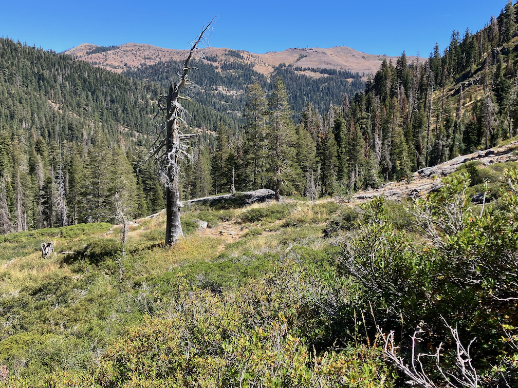
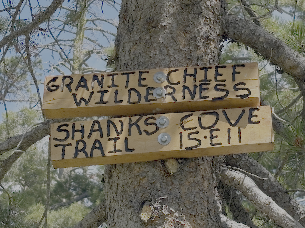
The southern leg of the Shanks Cove Trail, from the Five Lakes Creek Trail to the junction with Greyhorse Trail on the ridge, has not been maintained since 2009, and it shows. Many, many down trees, dating from those 16 years. Since the trail is seldom used, the lower crossing of Shanks Cove Creek is completely filled in with alder and willow, so you’ll have to find your own way. Across the creek is a deep pile of down trees and debris, obscuring the trail. It is hard to find where it starts up the rocky slope through brush, but once found, is not hard to follow. After the upper crossing of the creek, the trail climbs up the headwall to the ridge, sometimes steeply and sometimes switchbacks. Again, many down trees and areas of heavy debris. At the top of the ridge, the junction with Greyhorse Trail is signed and obvious. Enjoy the views!

I descended the Greyhorse Trail to the trailhead, which seems to have been renamed the Shanks Cove Trailhead. The trail is not too hard to follow, no worse then when I last walked it in 2008. About one-third of the down trees have been chainsawed. I’ve come to terms with accepting chain sawing by private individuals since the Forest Service has long given up on trail maintenance, but it looks as though the person who cut was riding a dirt bike, sometimes on the trail and sometimes off. More about chain saw use in a future post. The official trailhead signing is gone, but there is a user-made trailhead sign. I think the trail name is still Greyhorse, and the number 15E13, but the trailhead has apparently been renamed to Shanks Cove Trailhead on the Forest Service and other maps.

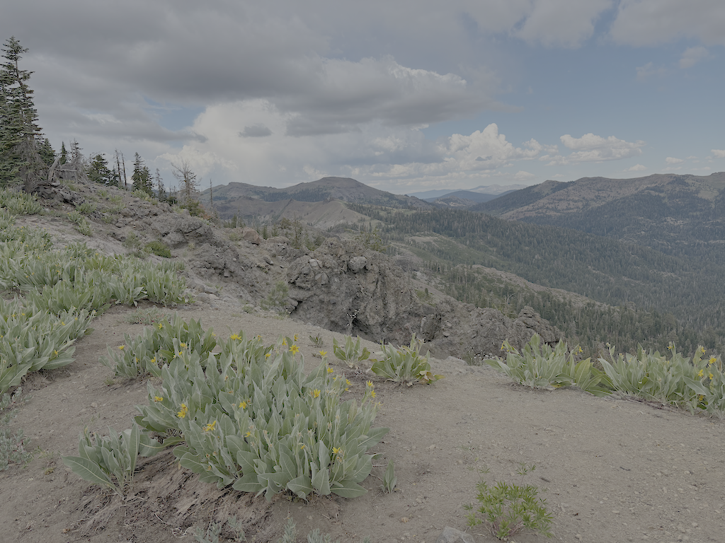
Back on the ridge, I headed on the north leg of the Shanks Cove Trail, going to the Western States Trail. There are a few down trees on the ridge, but other than one stretch through a dry meadow where the trail starts to head off the side of the ridge, easy to follow. And great views into Picayune Valley. The trail down across the volcanic bedrock is sketchy but acceptable. It drops steeply down a gully to the valley where an early season creek runs. Then up the other side, though down trees and brush fields, but the trail can be followed with care.

photo of view east from Shanks Cove Trail north section
view east from Shanks Cove Trail north section

I walked back on Western States to Whiskey Creek Camp, and slept. A long day, 27km on unmaintained trails.

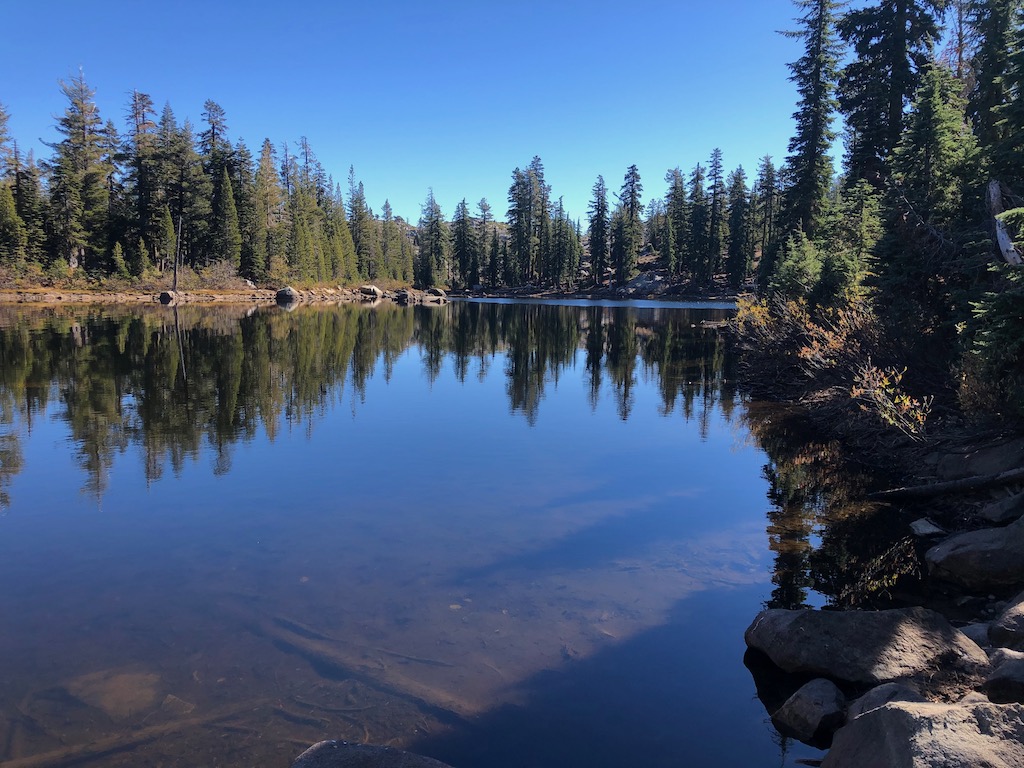
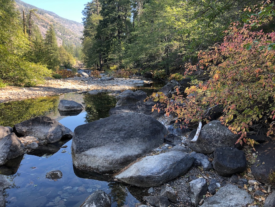
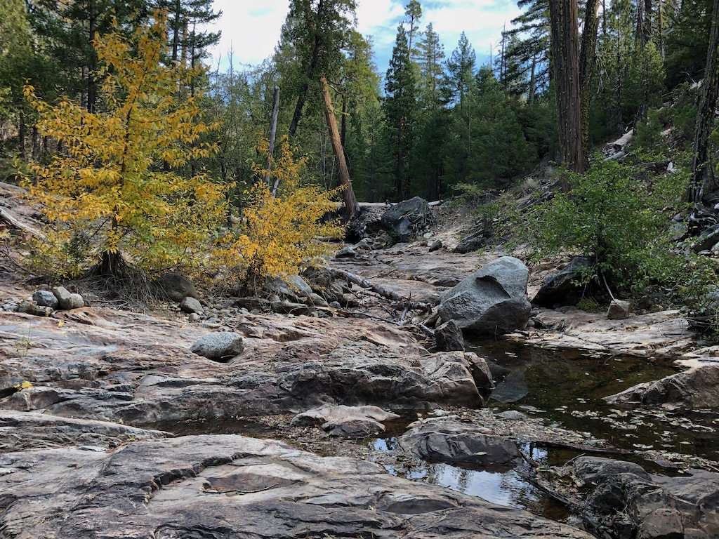
The next day I went up Whiskey Creek Trail and north along the PCT. Sadly, there were bicycles ridden on the PCT the day before. At the junction with what I formerly called the Tevis Connector, and am for now calling the Middle Fork Trail, I headed down to the dry meadow beside Middle Fork American River, and set camp. With time left in the day, I explored the Tevis Cup reroute. The Middle Fork trail was worked last year and is in good condition, with two down trees. Where is meets the existing Tevis Cup Trail, there is no sign, just some ribbon. When the reroute is complete, the Middle Fork Trail will follow the old trail eastward, to a completed but hidden switchback to connect to the reroute.

I walked west on the reroute to the end of work, where the Great Basin Institute (GBI) trail crew was building switchbacks down through a mules ear meadow to eventual connection with the old Tevis Cup Trail, west of the difficult riparian and bog areas. My thought was that the Forest Service had given up on ever completing the full reroute, and was connecting to the old trail short of that, but got clarification from the WSER leaders on Saturday.

WSER Tevis Cup Reroute Project

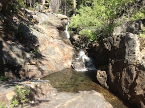
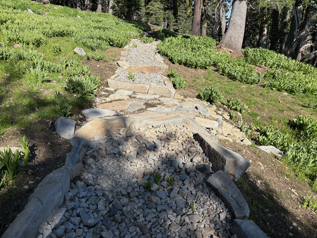
I had signed up for a trail crew session with the Western State Endurance Run (WSER) organization. This is the lead private organization working on the reroute. I met the group of 14 at the PCT-Tevis Cup junction, and went to the work site, which is primarily the rock causeway through a wet area. Photo below, from an earlier trip. I worked on a pan through to carry a tiny creeklet, which turned out to be just the surface part of a considerable below-ground flow. A muddy mess, but the pan was build, and the beginning of the causeway extension beyond. Early afternoon the thunder boomed, it got very dark, and it rained and hailed for about two hours. The work crew set tents on tiny pieces of flat ground and waited it out, but my tent was on the Middle Fork, so I head back there. The sun came out, and I had four hours of sun to dry things, and the crew got more work done. Next morning I headed up to rejoin them and continued the work. Most of the crew was finding large rocks for the causeway, breaking up rocks into small pieces to fill the causeway and gaps, and sawing logs along the trail.

In the middle afternoon we hiked east on the unfinished reroute, then up to Watson Monument, down to High Camp, rode the tram down to the village, and ate dinner together.

I quite enjoyed working with this group of people. I had last worked with a trail crew on the Tahoe Rim Trail, about 15 years ago, and was nervous about working with people instead of by myself, but the group was welcoming and fun. They are all runners, both on the Western State and other runs, so they live in a different world than I, but are good people, and the crew supervisors were great, low key but with high expectations.

Some info about the reroute:

  • A Forest Service crew has drilled both the roughly blasted area at the east end of the reroute and many other spots to the west, and will blast sometime this season.
  • There will be two trails, the switchbacks down to the old trail, being worked by GBI, will be the horse route. The hope is that it will be complete for use next year.
  • A runner reroute will stay high all the way to Lyon Saddle, where Road 51 comes up to a trailhead. I formerly called this Foresthill Saddle, and it is on Foresthill Divide, but Lyon Saddle makes much more sense. It will take at least two more years to complete the runner route.
  • California Conservation Corps is not working this year, which will slow down the project.
  • When the reroute is complete, the trails may receive different names, hopefully less confusing.
photo of Tevis Cup reroute rock causeway

trail work and Shanks Cove 2024-09

This backpack was September 10 to 14. More than a month ago, but when out of the wilderness, it is out of mind, and I forget that I haven’t posted trips. I’m planning one last backpack trip tomorrow (October 21), for Granite Chief. I backpack in the foothills and Bay Area during the winter.

My. trip up to Truckee on the California Zephyr was much delayed. A person was smoking in the bathroom and started a fire that smoked out that car and caused much consternation. My view of people who are so addicted to smoking that they can’t go without it, ought to try some other drug that ends their misery. He was hauled away in handcuffs by the county sheriff, but would be facing federal charges since Amtrak is a quasi-federal agency.

I went in at Five Lakes or Alpine Meadows trailhead (it gets referred to as both), and camped at Whiskey Creek Camp. I ran into a couple who had been doing light trailwork on the Five Lakes Creek Trail, and said they had been coming to the area since the 1970s, which was long before it was designated wilderness. I neglected to get their contact info, but it would be interesting to talk to them about their experience over the years. I don’t often run into people who have been going there longer than I have, but my first trip was 2002, I think.

I did trailwork on the Western States Trail, from Whiskey Creek Camp, but accomplished less than a kilometer of brushing, mostly whitethorn, which quickly encroaches on the trail. Early season whitethorn is pliable and doesn’t draw blood, but late in the season it is quite stiff and does draw blood.

Fall colors were well underway, casting a yellowish light, but the aspens had only just begun to turn, mostly a few branches but not whole trees. The air feels different, and sound carries differently. At twilight, two great horned owls were calling, for quite some while.

I hiked the Shanks Cove TraIl as far as Shanks Cove, which is an alder and willow filled wet area, which used to have some open meadow but has been filled in. The trail has at least 94 down trees, but the bigger challenge is following the trail through some patches of brush or alders, and I lost it four times. The crossing of Shanks Cove Creek is not obvious. There was a little maintenance here about ten years ago, but many of the down trees have been here far longer. The brush is not thick, except in a few places, but it would take a lot of work to clear. The creek was low except in bedrock sections. It’s a pretty canyon to hike, even if the trail is poor. I did not continue beyond Shanks Cove, so don’t know trail conditions for the climb to the ridge, and the other section that descends to the Western States Trail.

photo of crest from Shanks Cove Trail
crest from Shanks Cove Trail

I hiked the PCT north to Middle Fork American River and camps the night there, great stars. The creek is low but flowing. I continued north to the Granite Chief Trail and out to Palisades Tahoe. TART bus to Truckee. I’ve started going to Dark Horse Coffee, on River Street in Truckee. Used to go to CoffeeBar, but their service deteriorated, and Dark Horse still has good service. As always, a tea drinker and not a coffee drinker.

Overall, all the creeks were still flowing, but noticeable low with the fall season. As the creeks drop, it is more challenging to gather water from them. Of the creeklets which cross the trails in several places, most were dry, but surprisingly, some were flowing quite well. It was a strange year for water, very wet early in the season, particularly at higher elevations where there was above average snow, but the lower elevations where there was almost no snow were dry early.

Photos on Flickr:

Hell Hole and Barker Creek 2020-10

My late October to early November trip into the Granite Chief included the Shanks Cove and Greyhorse trails, which I’d not been on this year, the Hell Hole trail and explorations around there, and a off-trail hike up the Rubicon River and then out Barker Creek to Barker Pass.

On my trip up to the area, I slept out near Truckee, and it was very, very cold, well below freezing, so I guess I can call summer over. After tea and breakfast to warm up, I headed into the wilderness at Alpine Meadows TH, thence to Whiskey Creek Camp. I explored around Five Lakes lake, the largest one, which is the only one with significant water late in the year, which I’d not done in years. I generally avoid this most popular destination for day hikers, but it was early and on a weekday, so I figured correctly there would be few people. It is a beautiful lake, the only really alpine looking lake in the Granite Chief.

Five Lakes main lake

From Whiskey Creek Camp I followed the Western States (Picayune Valley) trail to the junction with Shanks Cove trail, and thence up to the ridge where I camped for the night. It was much warmer up there than it had been in Truckee, though I was 650 meters higher, since cold air drains away from the ridges and towards the valleys. In the morning I walked out the Greyhorse trail to the trailhead, which is no longer marked by anything, then back to the ridge and down Shanks Cove trail to the Five Lakes Creek trail. The Shanks Cove and Greyhorse trails have not been maintained in a long while, and there are many trees down, most easy to bypass but a few not. The winter debris (which this year came mostly from high winds in the fall) is thick in many places. And brush is encroaching on the trail in many spots. On the plus side, there were small flows of water in some of the little creeks that I was sure would be dry in this dry year.

I camped near Diamond Crossing and spent time just watching the creek and seeking out the brightest fall color trees. Then down the Hell Hole trail. The two forks of Buckskin Creek were flowing a little, but Steamboat Creek was completely dry. I explored downstream, where I have found water in the past, and did not find any, but I didn’t check upstream. Steamboat is always one of the earliest creeks to dry. Down the the bottom, where there is a vague junction with the trail coming from the 4WD road at Greyhorse Creek, with the route up canyon parallel to Five Lakes Creek. I have found and maintained about half this trail, but the other half is still uncertain, just wandering through forests and finding vague traces of trail here and there.

I continued my exploration of trails and routes in the Hell Hole and Rubicon River area, trying to make sense of how they fit together. I made some progress. I walked out the official 14E02 Hell Hole Trail to the dam and across. It is not marked in any way at the trailhead, but if going in that way, one would park at the boat trailer parking lot, walk down the steps, across the dam, and to the beginning of the trail on the south side. The dam is not open to vehicles but there is a hiker gate. This trail is not much used, but is surprisingly pleasant given how close it is to the reservoir, and is decently maintained. At a point just above the Upper Hell Hole Campground, which gets very heavy use by boat-in campers when the reservoir is up and the weather nice, a connector trail goes down through the old upper campground and to the east end of the lower campground. Continuing on the main trail, it gets harder and harder to follow, but traces of it exist and seem to lead to the Rubicon River just where it narrows in its first canyon. From the eastern-most campsite, a route marked with rock ducks heads along the ridge, then down to a crossing of the Rubicon at what I call huckleberry camp (there are more red huckleberry bushes in this area than one would expect at this elevation), then back up onto the ridge between the Rubicon and Five Lakes Creek, connecting with the route from Five Lakes Creek end of the Hell Hole trail and the route that goes down to the Rubicon at the same canyon point as the possible trail. With a better understanding of how the trails and route fit together, I have updated my tracks on GaiaGPS.

Rubicon River

I then spent half a day trying to figure out where the McKinstry trail goes, but at this I failed completely. There are little fragments of trail along the Rubicon River, but they don’t seem to connect. I know that when I walked the McKinstry trail years ago, it was not that hard to follow though not maintained, but now I can’t even seem to find the place where it climbs up out of the Rubicon Canyon. So, that remains for another trip, and I still don’t know what the condition of the McKinstry trail is.

Leaving the trail finding project behind, I ventured out on a no-trail trip up the Rubicon River and then Barker Creek. The river canyon was dark and cold, probably never getting direct sunlight at this time of year, so I decided against continuing up canyon, which is beautiful, and only possible in low fall water. Instead I headed up Barker Creek, which is incredibly beautiful. There are here and there traces of a route marked by rock ducks, but it pretty much is just walking up the bottom of the canyon, walking around pools and jumping the small creek. The canyon eventually gets too rough to follow and I climbed out alongside the canyon to the more gentle terrain above. From there cross-country, and along some of the OHV trails (fortunately empty on this day), and then the PCT/TRT up to Barker Pass. And then down to Blackwood campground for the night, and out to catch the TART bus in the morning to Tahoe City.

Barker Creek,cottonwoods

I bought some gloves from Alpenglow, which I had most unfortunately forgotten on this trip, and have only some heavy waterproof gloves at home, and spent the rest of the day just enjoying Tahoe City. The following morning to Truckee, and caught the Amtrak California Zephyr home to Sacramento.

This will be my last long backpack trip (nine days) and my last mountain backpack trip of the year, but I’ll continue shorter backpack trips in the Sierra foothills and the bay area throughout the winter and spring, until next summer backpack season in the Granite Chief.

Photos on Flick: https://www.flickr.com/photos/allisondan/albums/72157716780807318; Granite Chief collection on Flickr: https://www.flickr.com/photos/allisondan/collections/72157637640215275/.

Trail conditions 2018

I have not been on all the trails yet this season, but will report on ones I have been. The PCT is in good condition; the Granite Chief Trail is in good condition; Five Lakes Creek Trail is in decent condition, some down trees but nothing that can’t be bypassed; the Powderhorn Trail is becoming quite brushy and though I did some work here, there are many days left to do, and there is a tangle of down trees about 2/3 of the way from the top that could not be bypassed by horses due to the terrain; Western States Trail is in decent condition from Whiskey Creek Camp to the saddle, with some brushy sections and some down trees, but the section just below the saddle dropping into Picayune Vally is a mess of down trees and the trail hard to follow; the lower section of Western States in Picayune Valley has had some trail maintenance and is in good condition.

Dan McGee commented on the Shanks Cove Trail on the Trails and Maps post. I think I had reported the issues with that trail, but now can’t find it, and it certainly was not on the Trails page. A number of years ago there was a significant downfall of huge red fir trees in the gully just past the small seasonal drainage south of the Western States Trail junction. This has never been cleared, and has gotten worse by the year. As a result, the whole trail is becoming less used, and is brushy and obscure in other places. I don’t have anything to report about the south section of the trail, from Greyhorse Trail down to Five Lakes Creek Trail, but will after my next trip. Unless you are good at route finding and enjoy clambering up and down over huge trees, this is a section to avoid until the Forest Service clears the trail again.

Water is still moderately plentiful at the normal spots in the backcountry, however, the lower elevations are getting really dry and the higher elevations will dry soon. By the end of the season, I’d expect only the largest and most reliable sources to be running.

As always, your trip reports and trail condition comments are welcome. I no longer am able to get in early in the season and review all the trails, so I and others depend on YOU passing along information.

Trails and Maps

One of my purposes of my Picayune Valley and Shanks Cove trip earlier this year was to create GPS tracks for the Western States and Shanks Cove trails. In the area of the saddle between the Five Lakes Creek basin and Picayune Valley, the trail alignment shown on the National Geographic Trails Illustrated maps is incorrect. It turns out, now that Trimble Outdoors has added National Forest roads and trails as an available overlay in MyTopo Maps, that the Forest Service base maps are incorrect.

Continue reading

Picayune Valley and Shanks Cove

falls on the MIddle Fork American River

falls on the MIddle Fork American River

My first trip of 2013 in the Granite Chief did not come until past mid-July. This is despite the fact that with the early and mild winter, I could probably have started backpacking in May. But my life if busy.

I headed in at Alpine Meadows Trailhead, and walked over the saddle to Whiskey Creek Camp the first night. I’m amazed going in here how many people there are day hiking on this trail, even late into the evening. I’ve heard that busy summer days see 5000 people on this trail, almost all of them dayhikers and only a few backpackers. No one was at Whiskey Creek Camp, even though it was a Saturday night in mid-season.

Continue reading