Tag Archives: Powderhorn Trail

Granite Chief 2025-07-12 trail survey

My third trip of the season was intended to be a trail maintenance trip, continuing on the Western States Trail, but I got a day-late start and decided to do another trail survey trip instead.

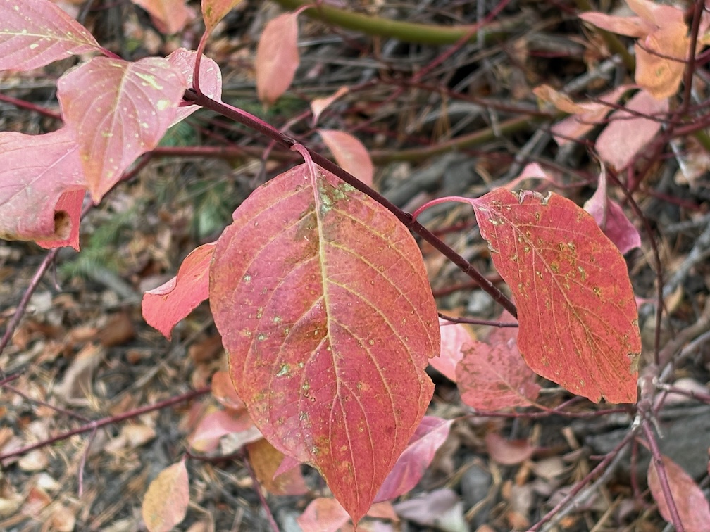
I walked in from Sunnyside on the road and Tahoe Rim Trail, and camped near the junction of the PCT and TRT. As previously reported, the TRT is in good condition, better than any of the other trails. After a mosquito filled night, I headed south on the PCT to Barker Pass. All of the springs and creeklets in North Fork Blackwood Creek and Blackwood Creek are flowing well. The trail has been logged out (TRTA?) and both brush and winter debris are pretty good. There were a few patches of snow, but nothing hard to cross. Some PCT thru-hikers I passed mentioned that there was a trail angel setup at Barker Pass, so I was envisioning the massive take-over of the trailhead area from two years ago, but fortunately it was small. I headed west on Barker Pass Rd/Forest Road 3 to the Powderhorn Trailhead.

photo of mountain heather
mountain heather

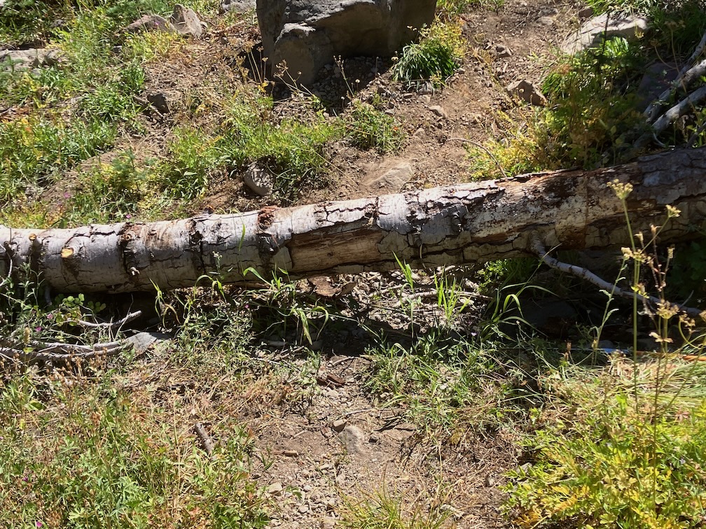
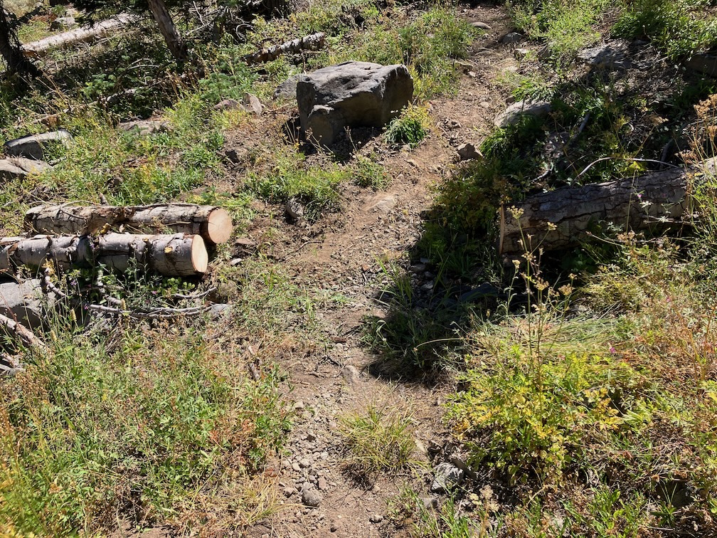
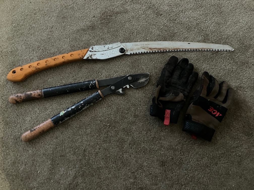
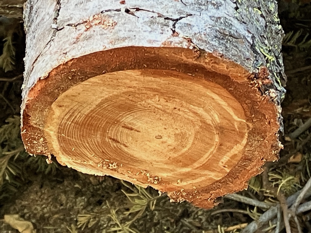
Powderhorn has 16 new down trees, joining the existing ones, for a total of 52. And a lot of winter debris, which surprised me given that I had cleared it last year. It is going to be difficult to keep Powderhorn open and useable over the next few years. Someone horse-mounted chainsawed a few down trees, and established a long but fairly safe bypass (to the creek side) at the slide-under tree. Though chainsaw use in the wilderness is illegal, I can’t fault people for doing this, as the trails would otherwise become unusable with the Forest Service absence of trail maintenance.

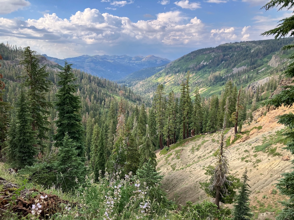
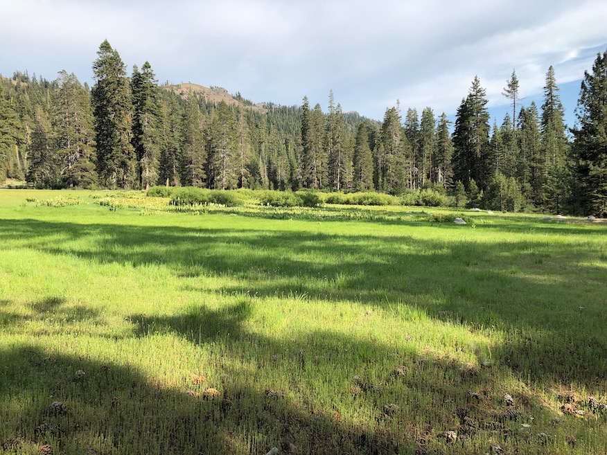
In the afternoon I hiked most of the Bear Pen Trail. The sign at the junction is on the ground. There are many down trees, and heavy winter debris in areas. The trail can be followed with a close eye, but a few riparian areas with willow and dogwood were challenging. I had not been on this trail since 2008, and it is not really that much worse than then. It is not much used by anyone. The trail route and distance shown on GaiaGPS maps, which are based on Open Street Map, are incorrect. The distance is not 2.2km, but about 4.4km, until the trail fades in the meadow.

I camped at Five Lakes Creek below Diamond Crossing, one of my favorite camp spots. Heading up Five Lakes Creek Trail north, and counted trees for the first time, using a clicker. 219 from Diamond Crossing to the north junction with Big Spring Trail, and 38 more from there to Whiskey Creek Camp. The tread is deeply eroded in several sections, as there has never been any water control installed on this part. The section between the south and north junctions with Big Spring Trail is now hard to find, and I lost it repeatedly. The few people who use this area seem to be using Big Spring Trail, not Five Lakes Creek Trail. At the junction with Shanks Cove Trail, the sign is on the ground.

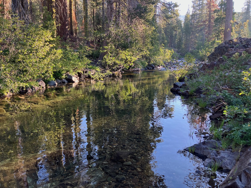
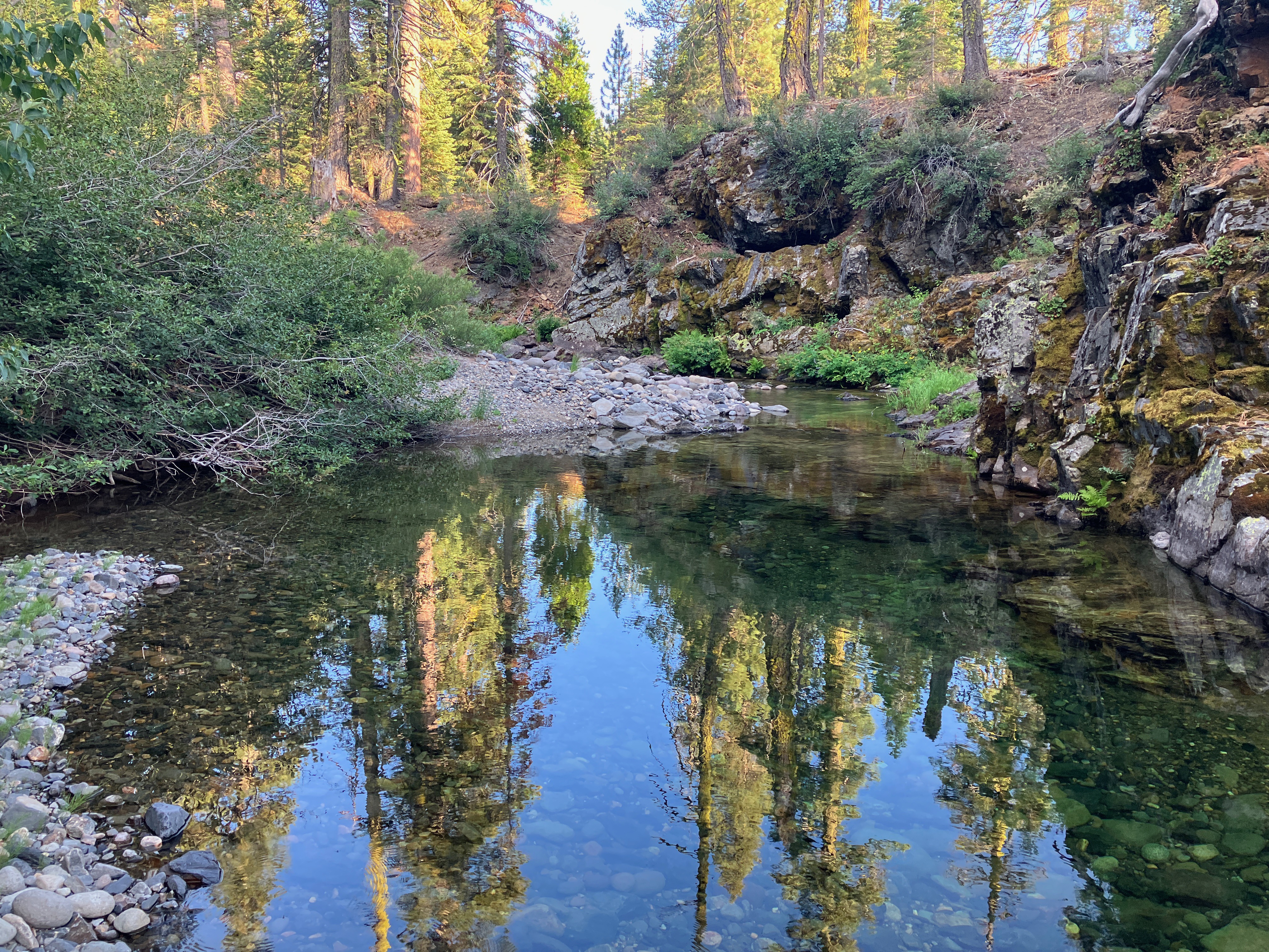
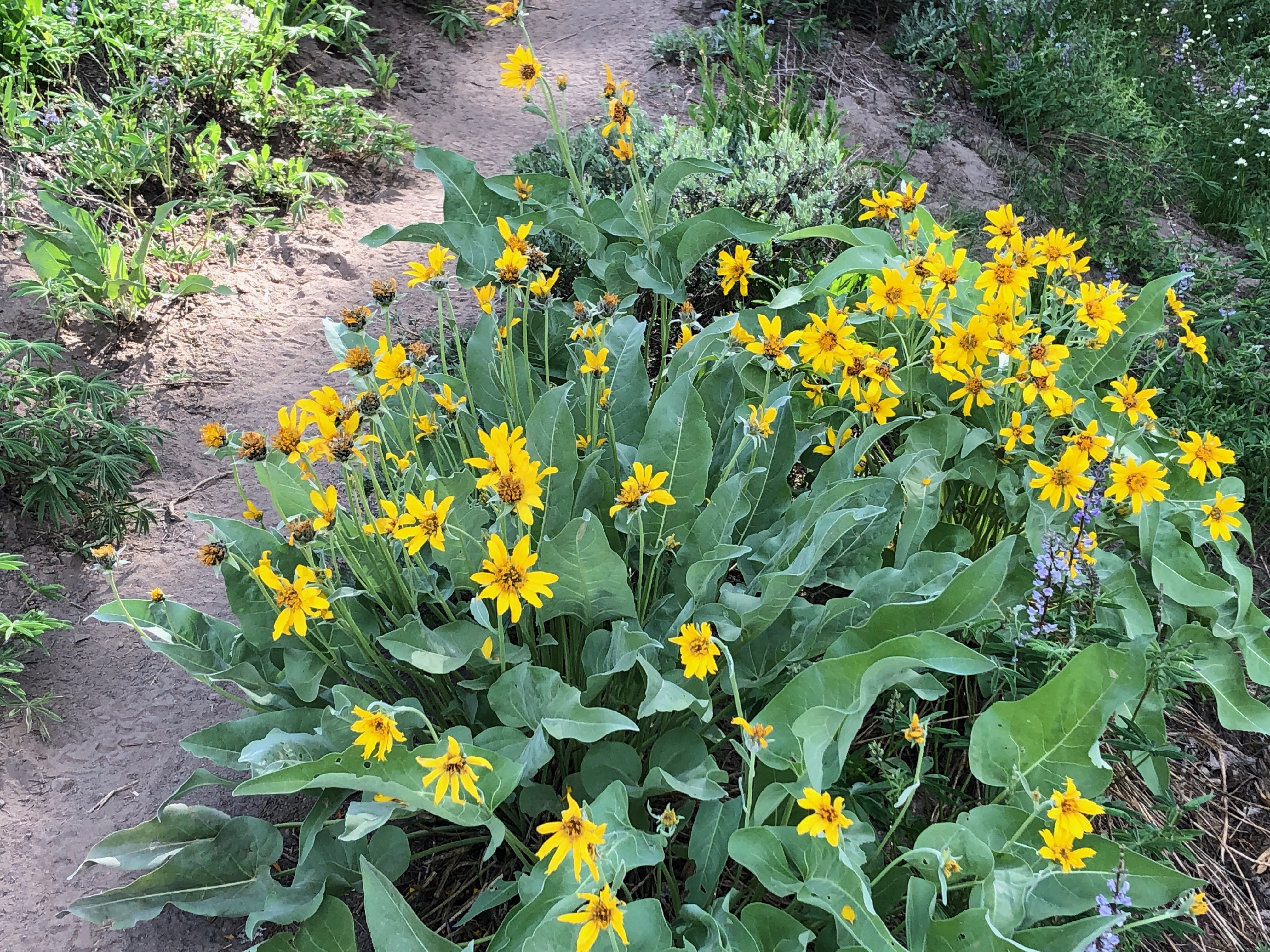
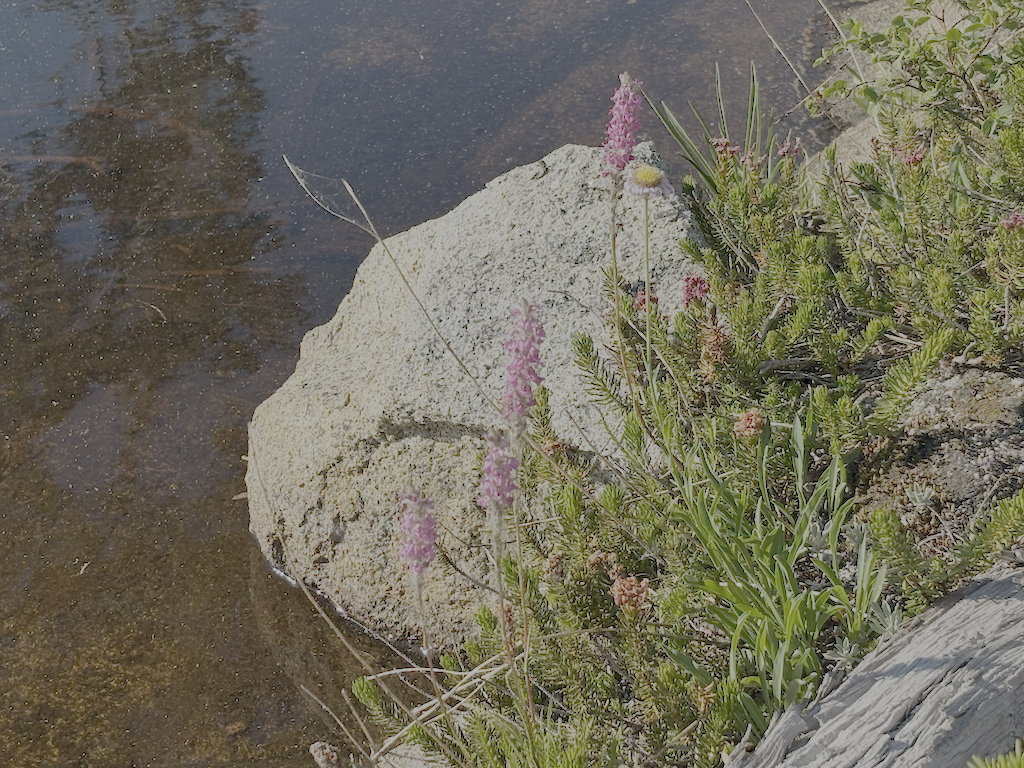
Big Spring Trail has 18 down trees, but overall is in acceptable condition, and easy to follow except in one dry meadow where you have to search for it when it goes back into the trees, in either direction. At the crossing of the dry or nearly dry creekbed just above the Big Spring, the trail into the meadow jogs up creek, and if you miss this, you’ll be ankle-deep in the spring marshy area. I hung out in the meadow, another of my favorite places.

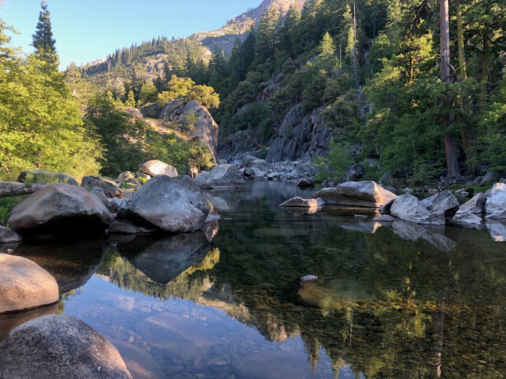
The trail crossings of Five Lakes Creek are probably still wet. One could find rock-hop crossings, but you get tangled up in brush and debris piles along the creek, so it is probably easiest to just wade across the creek.

The rest of the trail to Whiskey Creek Camp is somewhat better, probably mostly because it gets more use. I think a lot more people go just to Big Spring Meadow and not south from there, so the trail is more evident. This section of trail could be brought back, unlike the section to the south which is probably a lost cause.

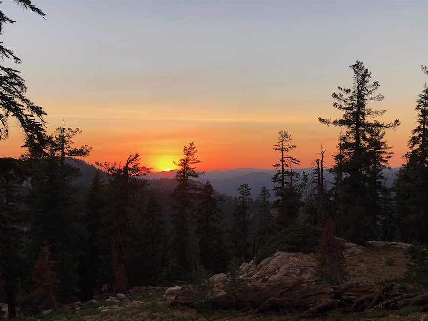
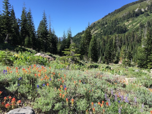
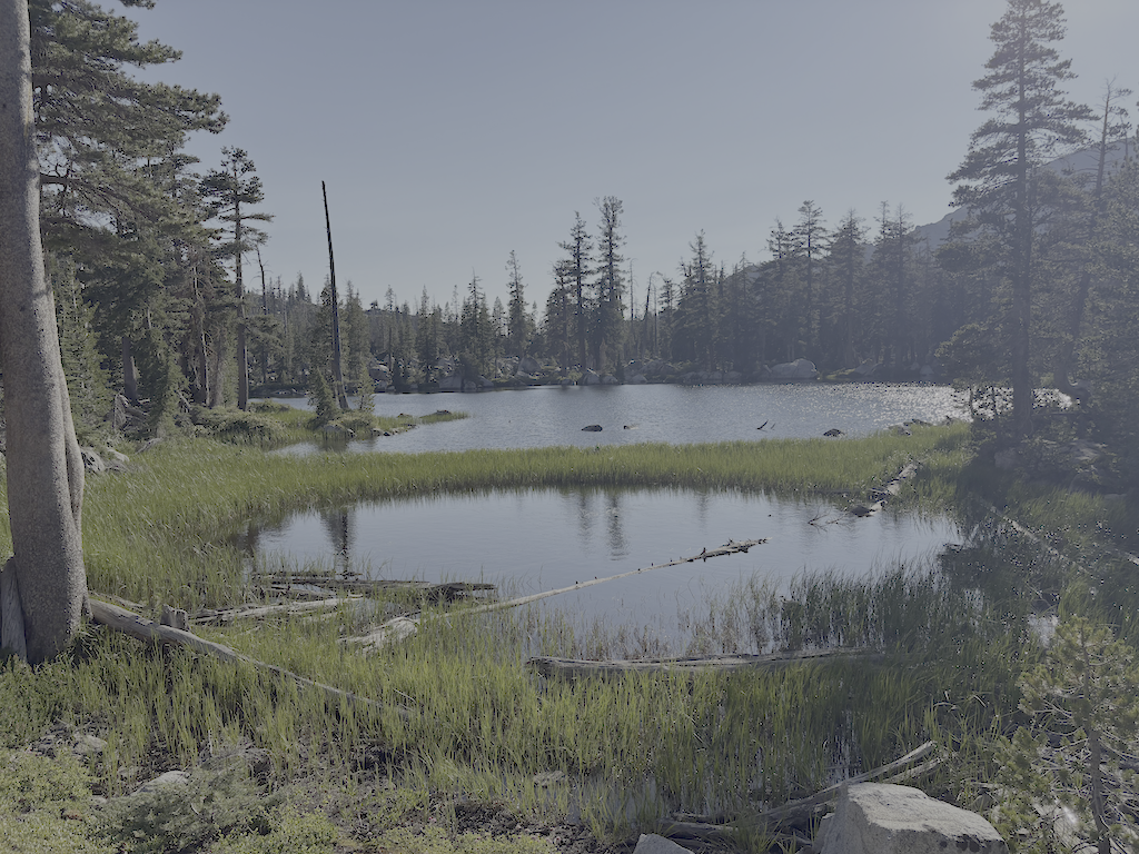
I camped at the cliff edge beyond the Five Lakes (which two are large lakes, the western one of which breaks into two with lower water, and a large number of small ponds), windy, but a nice place to watch the end of one day and the beginning of the next.

photo of Five Lakes second lake
Five Lakes second lake

Next morning out to River Ranch, TART bus to Truckee, morning at Dark Horse Coffee, and Amtrak bus home.

I’ve updated the Trail Conditions page with this survey trip. I am also gradually converting GPS tracks I’ve made over the years to routes, and providing links to them.

The trails I’ve not been on this season are Shanks Cove, Greyhorse, and Hell Hole. Maybe I’ll get there, maybe not, but as always, an invitation to anyone who does to submit a trip and trail conditions report.

upper Hell Hole Trail 2024-10

Yes, I did one last mountain backpack of the season in October, and no, I didn’t get around to posting until today.

photo of creek dogwood, Cornus sericea
Cornus sericia

I went up on the Amtrak bus, because I’d missed the California Zephyr, TART to Tahoe City, and then walked to Kaspian Campground (TART west shore ends earlier in the day) and slept there (closed after Labor Day). I missed the Zephyr because I was looking over possible trans-Sierra routes that might have been used by a horseback break-off from the Stephens-Townsend-Murphy party in 1844. A person named Bob Crowley is investigating, and it captured my attention. Apparently they ended up on the Middle Fork American on the west side, which reduces likely routes.

Up Blackwood Canyon the cottonwoods were a brilliant yellow. I think Blackwood might be named for these black cottonwoods (Populus trichocarpa). The aspens were beginning to turn, but not bright, and I suspect this will be a mild color year for aspens. Creek dogwoods (Cornus sericea) were pale red to bright red. Forest thinning has been going on all summer and still in Blackwood Canyon, and the buzz of chain saws is constant.

Most creeks are still flowing. I’ve noticed that if a creek makes it through the end of the summer, it will continue, whereas if it does not, it will not recover in the fall. Shorter and cooler days, and lessened evapotranspiration free more water to the creeks.

I crossed Barker Pass and walked to the Powderhorn trailhead, then down Powderhorn to Diamond Crossing. There are some new trees down on Powderhorn since my last trailwork September, and more debris. This will be a constant for years. There was a light dusting of snow in shady areas, from a storm a few days before.

I camped at my common spot along Five Lakes Creek below Diamond Crossing.

I intended to walk the whole Hell Hole Trail to the bottom, but short days and a late start meant that I only did the upper trail, a bit beyond Steamboat Creek. The creek is dry, as it almost always is in the fall; it is an early season creek only in most years. Both forks of Buckskin Creek were flowing, though low. The trail has a lot of debris, which surprised me until I remembered that it had been four years since I’d done work including debris clearing on this trail. There are a few new trees down, and a lot of leaners and spars, which I can take care of next year with a folding saw. It will take at least two trips to clear debris again and the small cutting. Though not as bad as the red fir forest, this forest will continue to need maintenance. There is relatively little brush on this trail, compared to many. As with most trails in the Granite Chief, there is more maintenance by bears and deer than by people.

The black oaks (Quercus kelloggii) fall colors were mostly yellow, but with spots of red and orange. A wonderful time of year at this elevation (1800 m, 5900 feet).

GaiaGPS Gaia Topo layer shows two trails descending to the Rubicon, neither of which are on the alignment of the trail I’ve been maintaining. They may or may not exist, I’ll check on a future trip. Also shown is a road from the current end at Grayhorse Creek all the way around the head of Hell Hole Reservoir. I doubt that it exists, or ever existed, but again, will check it out. All of the ‘trails’ in the Hell Hole area a old non-maintained trails or use routes, except for the trail along the south side of the reservoir to the campground, which has been constructed though not much maintained. Most people access the campground by boat, not trail.

The next day I hike out, same route as in, up Powderhorn, over Barker Pass, down Blackwood Canyon, out to Kaspian Campground. The forecast was for a very cold night that night, particularly in Truckee which is often colder than Tahoe City, so I caught the TART bus and took Greyhound home. The Greyhound is the last bus of the day westbound, after the Amtrak buses.

That’s it for this year! I’ll be back to the Granite Chief in June or July, depending on snow melt.

Powderhorn trail work complete! 2024-08

This backpack trip was just for doing trail work on the Powderhorn Trail, to make up for two aborted or shortened trail work trips earlier this year. And I completed the trail! Yay!

There is a real pleasure to walking a well-maintained trail.

Of course trail work is never really complete. While doing trail work, things are growing, and dying, and falling. The upper section of the trail is noticeably needing brushing and removing conifer encroachment, developing in the time since I worked that section.

I was curious about my history with the trail, so looked back at earlier posts.

  • 2009: The trail was logged out by the Forest Service. This is the last time the FS worked on this trail, 15 years ago, so far as I know. All of the older, rotted and aged and often large down trees, were cut at this time. I don’t know if any other work was done at the time.
  • 2010-2017?: A horse group rode in every year to Big Spring Meadow for a long camp. On their way in, they cut enough of the trees to keep the trail open and useable. I don’t know whether their plans changed or they gave up on the trail and went elsewhere.
  • 2018: My first trail work, spot brushing and removing conifer sprouts (mostly red fir) that were closing in on the trail.
  • 2021: My first focus on Powderhorn, including marking the location of down trees. At that time I was still hoping that the Forest Service would log out the trail again, and so relayed to them the size, nature, and location of the trees. Though they thanked me for this year, they ignored later submissions, so I stopped sending them.
  • 2022: Continuing work on the trail, mostly the upper third.
  • 2023: Continuing work on the trail, mostly the lower third.
  • 2024: Continuing work on the trail, mostly the middle third.

I recently bought a new trail tool, a Silky Big Boy 2000 15-inch folding saw, to replace my Fiskars 10-inch folding saw. What a difference! The length has allowed me to cut many smaller down trees that I had always had to ignore before. The saw easily cuts 9-inch logs, and at a stretch 12-inch logs, though 12 inches is slow going. Radius SQUARED really makes a difference. And being new, the saw is sharp and cuts well on the pull stroke (it is designed to cut on the pull and won’t work pushing). There were quite a number of new down trees this year over last year, but with cutting the smaller stuff, the overall number of down trees is now less than last year. For those wanting to know the details, my GaiaGPS folder ‘down-tree‘ shows all of them on the Powderhorn Trail.

photo of tools of the trade: new Silky Big Boy folding saw, Fiskars nippers, and gloves
tools of the trade: new Silky Big Boy folding saw, Fiskars nippers, and gloves

If you like the Powderhorn Trail, or have been thinking about going there, now is the time! By next year there will be new down trees. About half the red fir trees are dead, though it varies from nearly all to very few. Of course there are abundant sprouts crowding the trail. Some of these will die and become what I call spars (similar to snags, but I use snags for large standing dead trees) and lean into the trail, ready to snag your clothes or skin. A significant percentage of young red firs develop a lean, hanging into the trail. I call them leaners. The standing dead have prominent white mushroom bodies all over the trunks, so they are already rotting while standing, and will fall. It used to take a high wind year with saturated soils to being down trees, but they are now falling year-round.

One of the down trees far too large for me to cut, I worked on the approach to the tree so that people could climb over or slide under. This red fir has the most dense wood I’ve ever experienced. A five-foot cut section of branch was so heavy I could hardly lift it. This must have been a very old and very slow growing tree. I’m unsure whether it died and fell, or was knocked down by another tree.

photo of dense red fir rings
dense red fir rings

The trail has at least two down trees that cannot be passed by horses, so it must be considered closed and dangerous to equestrians. One is the slide-under tree, where backpackers can slide under the down tree. I had roughed out a bypass two years ago, but a new tree fell directly on the bypass, closing it. Another down tree would be a challenge to all but very trail-wise horses, and there is no bypass.

Sometime earlier this summer, someone rode a dirt bike into the wilderness and about a mile down the trail before giving up at a large down tree with no bypass. That person did quite a bit of trail damage and left ruts that will erode next spring. The power of internal combustion engines causes brain damage and immorality.

Five Lakes Creek is flowing but noticeable low. Same for Powderhorn Creek. The creeklet that crosses the trail is barely flowing and may be dry soon.

I have often done a trail condition survey trip early in the summer, but did not do so this year, so know nothing about trail conditions except the PCT, good condition, Whiskey Creek Trail, good condition, Five Lakes Trail, good condition, and Five Lakes Creek Trail, horrible condition. I may get to the other trails on my next trip.

Photos on Flickr:

Powderhorn trail work 2024-07

I started this trip at Granite Chief Trail in Olympic Valley, as it is the most convenient trailhead. The evening before I attended the Palisades Tahoe Bluesday concert in the village. A lot of people there, many from the Reno area, and the Reno blues group is one of the event sponsors. Camped out at a favorite spot part way up and off of the trail after the concert, and then headed up the trail early morning. My break was at a juniper tree about half way up, where I have often stopped, but someone has made a nice bench out of a dead juniper trunk, just below the tree. There have been helicopters up all morning, but over the ridge south, in the Alpine Meadows / Bear Creek valley. Probably a lightning strike tree.

Thunderstorms were building over the Mt Rose area northeast of Tahoe, but I don’t know if rain came of it. Someone at the concert was mentioning heavy rain that afternoon, but I didn’t catch where. As with last trip, there is zero precipitation in the forecast, but the reality is different. But I had no rain on this trip, and one full day of completely clear skies.

photo of 
Angelica lineariloba, Apiaceae

I headed south on the PCT and then to Whiskey Creek Camp. There are a lot more PCT thru hikers than I would expect at the end of July. A few of them may make Canada. Then down Five Lakes Creek Trail, which raises my frustration level, climbing over down trees for long stretches. I took the main trail, not through Big Spring Meadow, and it appears to be unused until it rejoins the meadow trail. I lost it several times before and after the junction with Shanks Cove Trail. I walked a short distance on Shanks Cove, at it also appears unused. The few people who use Five Lakes Creek Trail go through Big Spring Meadow, which is understandable, it is a beautiful place. And the spring, though hard to access, is wonderful water. I camped at my common site beside Five Lakes Creek, off the trail near Diamond Crossing.

I did two and a half days of work on Powderhorn Trail. Though I had done the lower one-third last year, there were new down trees and winter debris, so I re-worked that section. I had laboriously cleared a bypass of the slide-under tree, safe for at least backcountry-wise horses. But a tree came down on the bypass, so the Powderhorn is again not accessible for equestrians. I then tackled the part I’ve not maintained in many years, the middle third. I made good though slow progress, completing up through the postpile meadow to the creeklet. This is about another 1/6, leaving 1/6 yet to do. And that 1/6 is largely a mess, about 1 km of down trees and winter debris, including one tree fallen directly on the trail.

I saw eight backpackers and two day hikers on the Powderhorn, which is a little surprising for a difficult trail that seems to be not much used. So maybe my work is worthwhile. It is certainly a pleasant experience on some parts of the trail, and if I can make is so, it is worthwhile.

photo of Ageratina occidentalis, Asteraceae
Ageratina occidentalis, Asteraceae

I explored the Hell Hole Trail from the Diamond Crossing junction to Five Lakes Creek. It is hard to follow through the seasonal growth and dry grass. There are duck markers but they aren’t all inter-visible. The most recent trail alignment is very hard to follow as it approaches Five Lakes Creek, though the alder thickets. Someone has partly ducked an alternative route that stays north of the dry drainage and comes out on the gravel bar just upstream of the crossing. It is also not well marked, but may be a better alignment. The ducks/cairins that I had set up two years ago are all gone, washed away or fallen over, but the crossing is upstream of the log jam across the creek. It may be a little hard to find the trail on the west side of the creek, but once found, it should be pretty easy to follow. I’ve spent a lot of time finding and clearing this trail, all the way to the bottom near Hell Hole Reservoir. Of course, as with every trail, it has a lot of down trees.

After a half day of trail work, I headed out Powderhorn Trail, FR 3 to Barker Pass, north to the PCT-TRT trail junction, and then down the TRT into Ward Creek, and camped at a small site beside a creeklet. Though I hadn’t really needed my inner tent for mosquitos on this trip, I did here, ample mosquitos. All day there had been a strange overcast, which turned out to be smoke aloft from the Park Fire. Nothing at ground level, where the smoke is going north and east, but smoke aloft was coming south.

Next day I walk out to the road and down Ward Creek to Sunnyside, and caught the bus into Tahoe City. Went to the Commons Beach concert, and camped in the forest nearby, then morning TART bus to Truckee and the Amtrak bus home.

An update on my inflatable sleeping pad. After patching some small leaks, it was still deflating during the night at an accelerated rate. So after seven years of good use, it is retired. I bought a Nemo Tensor inflatable sleeping pad as a replacement. Slightly more weight and slightly bigger, but in the same range.

Photos on Flickr:

Granite Chief 2024-07

For my second trip to the Granite Chief, I took the Amtrak bus up to Truckee, then TART to Palisades Tahoe. Attended Bluesday, the weekly blues music. The band was Mark Hummel, famous, so the event was packed. I camped off the old Granite Chief Trail at a place that I’ve settled in on for sleeping out after the music. In response to getting chewed by mosquitos on my last trip, I brought my inner tent with mosquito netting, though the mosquito clouds had fallen off to some degree.

As always, I checked the weather forecast for Tahoe City when deciding what to take. The forecast was zero percent chance of rain. But while going from Granite Chief Trail to Whiskey Creek Camp, it rained for about two hours, moderate rain, from a thunderstorm with lightning and thunder. It stopped late afternoon, and I was able to stay somewhat dry by sheltering in a hollow dead tree. There was a preview when it rained lightly for a short time the night before. In fact, it rained a bit every night on the trip, while every day the forecast was the same, zero percent chance of rain. Either these thunderstorms were happening just over the ridges, not over weather stations, or the weather forecasting has failed.

On this trip I had several negative interactions with trail runners. The rule, though not the law, is that downhill people yield to uphill people. But runners seem to think they have the right of way over everyone else. One runner actually ran into me and knocked me off the trail. Several other runners said I should get out of their way. So I’ve adopted a new policy for myself: I don’t yield to trail runners. If they insist on having a negative physical interaction with me, I’ll knock them off the trail.

The morning after the thunderstorm, there were helicopters up with water buckets, first a small helicopter, and then a heavy-lift dual rotor helicopter. I’m not sure whether they were fighting a single location or more than one, because the fire was over the ridge from me.

The Forest Service, with this suppression-at-all-costs policy, is harming the wilderness ecosystem. Every fire that gets put out the same day is a fire that cannot reduce the fuel build=up. The wilderness will burn, that is inevitable, and when it burns, it will be a catastrophic, forest-clearing fire. Why? Because the Forest Service has suppressed fire and allowed fuel to build up to a completely unnatural level. Fire is part of the natural environment. I realize that it may be necessary for fires close to towns to be suppressed, and the fuel reduction function replaced by mechanical reduction, but the fire being suppressed was in the middle of the wilderness, not close to any human habitation. There have been trends over the years towards letting wilderness fires burn, and away from that, and the last few years there was a trend toward fire, but for some reason this year, all that progress has reversed and we are back to suppression-at-all-costs. The Forest Service, and the wilderness, will regret that.

Wyethia mollis, Asteraceae

I worked the Whiskey Creek Camp trail, the short segment between the PCT and the camp, brushing and removing winter debris. This is the time of year to be cutting whitethorn, as it is soft with winter moisture. When it dries out more later in the season, it becomes hard and stiff, and draws a lot of blood from trail workers.

I still call the branches on the trail winter debris because it used to fall almost entirely during the winter and show up at snow melt, but in a sense it is a misnomer now, because dead red firs are coming down year-round now. In the Granite Chief, there are areas where more than half the red firs are dead, and other areas in which only a few are. Though not current, and focused on the northwest, the article Massive die-off hits fir trees across Pacific Northwest has some information. Apparently the die-off is not from a single cause, but a variety of factors. In any case, red firs are falling and will continue to fall, the trunks laying across trails and the dead branches scattered everywhere. Fire is not common in the red fir forest, so I can’t say whether suppression is contributing the the die-off or not.

I headed down Five Lakes Creek Trail to Diamond Crossing. This trail is worse every time I use it. It has not been logged out in more than 12 years, and there are more down trees every year, in some places I have to scramble up and down over several trees in a row, and the tread in between is covered with branches from the fallen trees. I get very frustrated by this trail and every time I use it, I wonder why I even try. I’ve not counted down trees recently, but it must be over 100. Use of this trail has dropped off over the years as other people abandon it as well. There are some footprints, but fewer every year.

I camped at my favorite spot beside Five Lakes Creek.

Powderhorn Canyon
Powderhorn Canyon

Next day I did a half day of trail maintenance on the Powderhorn Trail. I’d planned on more, but ran out of motivation and energy. As I said last year, the upper third and lower third of the trail are in decent shape, but the middle third is in poor condition and getting worse. My tool set is nippers and a fanno saw, but by Fiskars, so quality and fairly lightweight. But I have no tools to tackle down trees larger than about four inches, so anything large gets ignored. Sometimes I can clear a path to and from the down tree, so at least it is easy to step over without getting feet tangled in debris. One large tree, that has been down for years, is a slide-under tree. I had built a bypass of this tree last year, useable by trail-wise stock, but a red fir fell directly on the bypass and it is beyond me to clear it again. So the trail is yet again closed to equestrian use.

I hiked out to the Powderhorn Trailhead, then to Barker Pass, down the jeep road to Blackwood Canyon, and out the next morning to catch the TART bus to the Amtrak bus to home.

Water is abundant so far this year. In addition to the larger creeks, many smaller creeks and creeklets that are not year-round are still carrying water.

My Thermarest NeoAir sleeping pad has been deflating during the night for quite a while. I’ve got to find the leak and fix it.

Photos on Flickr:

Powderhorn trail maintenance 2023-09

Finally, a trip without rain! The weather was perfect. Cool mornings, warm afternoons, fair weather cumulus clouds in the afternoon, clear skies at night with a new moon and incredible stars.

I camped four nights beside Five Lakes Creek, in a gentle area below the gorge but above where the Hell Hole Trail crosses. There is no trail to this place, but I found it in my explorations and it has become a favorite.

I went back to Powderhorn Trail to do maintenance. The horrible condition of this trail gnaws at me. Very few people used this trail this year, and I am afraid that people will just stop using the trail completely. The bears, of course, still use it, but even they seem to be using it less.

I worked the bottom part of the trail for three days. The first 1.5 miles from Diamond Crossing are now in good condition, other than the down trees. I spend a lot of time cutting back and thinning the fir trees which encroach on the trail. Most young trees die, the larger trees you see a the result of a long process of natural thinning. But in the meanwhile, the live trees crowd the trail, and both live trees and dead trees lean over into the trail. Along this section of the trail, traditional brushing is not the main work.

The upper 1.4 miles of trail is in acceptable condition. It needs some brushing and winter debris removal, but is quite usable. That leaves the middle section of the trail, about one mile, which, still, sucks (see my earlier post Powderhorn Trail maintenance 2023-07). In this section there is heavy winter debris on about half the trail, firs are crowding the trail, a lot of live and dead firs are leaning into the trail, and there is some brush. This section includes the postpile meadow, where the alders are beginning to crowd in but are not too bad yet.

One down tree on the trail presents a barrier to equestrian use. This is an off-the-ground tree that hikers and backpackers can slide under, but there is no safe bypass for equestrians. One could be created, with a lot of work, but for now, it is not safe.

It is unlikely that I’ll get back to Powderhorn this year. In fact, this may be the last of my mountain backpacks for this year, as my next window is not until the second half of October. If fall is late, perhaps again. Otherwise, foothill and coast range backpack trips.

I did my usual Amtrak bus to Truckee, TART bus to Barker Pass Rd, hitched a ride to Barker Pass and walked to the Powderhorn trailhead. Coming out, I walked back to Barker Pass, then attempted to hitch down, but during the week and after Labor Day, there isn’t much traffic, so I walked more than half the way. Bus back to Tahoe City, and the next morning, bus to Truckee and the Amtrak California Zephyr home. The train was almost on time!. Several times this season and others, I’ve had to take the Amtrak bus instead because the train was many hours late.

Powderhorn 2022-08

My second trip of the season was in at Alpine Meadows trailhead, past Five Lakes, and camping near Whiskey Creek Camp. I did some brushing and winter debris removal on the Whiskey Creek Camp trail, and then headed down Five Lakes Creek trail. This trail is worse by the year, more down trees. Though backpackers can climb over or walk around all of the trees, not so for equestrians, because going around the down trees leads into thickets of down trees. I think this trail has to be considered closed to equestrians now, and will be, until and if the Forest Service eventually logs out the trail. I have given up on this trail, not doing any trail work on it. This is ironic since I’ve spent so much time working on the Hell Hole trail, for which the Five Lakes Creek trail was once the main access point. My trail work is brushing and winter debris removal. I have no capability to cut out down trees over about six inches.

Five Lakes Creek near Diamond Crossing

I camped near Five Lakes Creek below Diamond Crossing, where the creek pools below riffles. A beautiful spot to spend time. The next two days I worked on the Powderhorn trail, clearing winter debris, very heavy in spots, and cutting brush, not too bad but growing into the trail. Much of the trail has abundant white fir and red fir reproduction, so there are sprouts everywhere along the trail. A few of these will live, and crowd the trail, so I remove them when I can, keeping the trail corridor open. If I let them go, many grow to a point, and then die, leaning into the trail with what I call spars, waiting to rip clothing or skin. It is a lot of work pulling up young sprouts, nipping older sprouts, and fanno sawing young trees. My work only cleared about a half mile of trail, leaving a lot of trailwork for future trips.

The Powderhorn trail is similarly no longer accessible to equestrians. Though there are fewer trees, and easier bypasses than the Five Lake Creek trail, one down tree has no safe bypass. In the past an equestrian group went into Big Spring Meadows every year via the Powderhorn trail, and cut downed trees on their way in, but that group seems to have given up on the trips as more and more trees have come down.

It saddens me that the Forest Service has given up on keeping trails logged out and open. I realized they are being almost forced by political concerns to spend nearly the entire budget on fire fighting (meaning fire suppression). Years of fire suppression have left overly dense forests, and so the agency thinks it must continue to suppress fires. Of course, with fire, the question is not IF an area will burn, but WHEN. The Granite Chief Wilderness has overly dense forests, waiting for ignition. Of course the forest is gradually thinning itself in a natural way as large numbers of trees die off. But this will leave trails littered with down trees, and difficult to use or even unusable.

After the trailwork, I headed out the Powderhorn trail, walked the road to Barker Pass and went back in on the PCT/Tahoe Rim Trail, camping near the PCT/TRT junction on the crest. The last day I walked out the Tahoe Rim Trail to Ward Creek, which is being maintained and is in good condition. I walked out Ward Creek to the west shore and caught the bus into Tahoe City. Though I enjoy the Page Meadows section of the TRT in the spring with wildflowers and in the fall with aspens colors, it is boring during the summer.

PCT & Powderhorn 2021-06

The Granite Chief Trail, up from Squaw Valley to the PCT, is in good condition. A sign indicates it has been adopted by the Truckee Trails Association, so this is one trail I probably won’t have to maintain again. Yay!

I camped just off the PCT, looking down the North Fork American River canyon, with a good sunset and sunrise, probably in part due to some fire smoke from fires to the north. There are still some patches of snow on the north side of Lyon Peak ridge (Foresthill Divide), but not much left. I walked the PCT south to the junction of the PCT and TRT, where there is a campsite well used by thru hikers and others. I’m seeing about 40 thru hikers a day, mostly in bunches but some solo. As is typical, about half look happy to be there and the other half clearly does not. It is a strange thing that people do.

sunset over North Fork American River

I headed south on the PCT to Barker Pass, then along Forest Highway 3 to Powderhorn trailhead, and down to Diamond Crossing. There are a number of trees down on this trail, though all but one were easy to go over or around, and it could definitely use brushing and cutting back of the doghair firs that crowd the trail.

I helped two dayhikers, in from Powderhorn, to find the pools along Five Lakes Creek near Diamond Crossing, which they would not likely have found on their own. The Five Lakes Creek Trail is in poor condition, many trees down, many of them down now for years. The Forest Service has not maintained this trail in at least six years, and it was being somewhat maintained by a horse group that headed into Big Spring meadow every year, but seems to have given up on using the trail, it is so bad.

I camped at Big Spring meadow, one of my favorite spots, a great place to watch the beginning of the day and the end of the day, and enjoy the huge pines. The meadow is drier than usual for this time of year, but not fall dry. The spring is flowing well, and I don’t think it ever dries up. I explored up the east side of Five Lakes Creek, finding the old trail which used to be on that side. Some parts are easy to see, in the wet areas with willow alder and willow thickets, not, and I did not find the place where it crosses over to the west side. I’ve also explored down from the PCT/Five Lakes junction, but haven’t yet connected the two.

Big Spring meadow

I hung out at Whiskey Creek Camp to meet Paul Vandervoort, who I’ve been emailing for several years but never met. He was leading a dayhiking group from Reno, going over into Picayune Valley and then climbing out to the Tevis Cup Trail, and back out.

I headed out the Five Lakes Creek Trail, PCT, and Five Lakes Trail, with some exploring around the Five Lakes area, which I usually zoom by on my way elsewhere. The lakes were low but most still had water. There are anywhere from three lakes to fifteen lakes, depending on the time of year. The largest lake, the one to the west, breaks into two lakes as the water level drops, and the one I call third lake gets smaller but I’ve not seen it dry.

From there I went up over the old Squaw Saddle Trail, no longer maintained, and into Squaw Valley. It joins the Western States Trail (one of the many alignments) and heads east along the south side of the valley. Where the trail is closed for construction of the new Alpine to Squaw gondola, I dropped down to Squaw Village and hung out there for a while.

I took the bus into Tahoe City, where I camp out for the night before going to Truckee in the morning to catch the train. It is far too noisy in Truckee to sleep out, due to Interstate 80 with its constant roar of truck traffic. Tahoe City is much quieter. While charging my phone at the plaza overlook, a band came and set up to play, so I stayed to enjoy there semi-reggae and talk to people.

I was wondering how the flowers would be in the drought year. At higher elevations, they actually don’t seem much different, except that they are about half the stature of a ‘normal’ year. Their abundance is about the same, though.

Arrowleaf Balsamroot (Balsamhoriza)

On this trip I did not take insect repellent, and did not take my inner tent with insect netting, so was quite bothered by mosquitoes. If it were cooler, I’d just hide in my sleeping bag and go to sleep, but the evenings were too warm to do that. They are not as thick as they used to be, but still…

I have some new hiking shoes. For years my toes have been turning, and as a result, I need a wider toe box, but my heel is not widening, so wide shoes don’t do it for me. I’m trying out Altra Lone Peak trail runner shoes. They have a wide toe box but normal width elsewhere. They aren’t really heavy enough for hiking shoes, so I probably won’t be doing any off-trail hiking in them, but I have to say, my toes were happy.

Photos on Flickr: https://www.flickr.com/photos/allisondan/albums/72157719601028882; Granite Chief collection on Flickr: https://www.flickr.com/photos/allisondan/collections/72157637640215275/

trail work 2020-07

My trip July 2-9 was mostly into the Hell Hole Trail area. I went in at Alpine Meadows trailhead, down Five Lakes Creek, to Hell Hole Trail and McKinstry Trail, and then back out via Powderhorn Trail, north along the PCT, and out at Alpine Meadows ski area.

The Five Lakes Creek Trail is in gradually deteriorating condition, with more down trees added to the existing ones, and more issues with tread erosion. The Hell Hole Trail is in decent shape though there are downed trees that have now been there for years, and a few more are added every year. I have been working on defining the tread, so the trail is becoming somewhat easier to follow, though some sections still have a lot of winter debris accumulation. The trail from Diamond Crossing down disappears as it approaches Five Lakes Creek, due to thick willows and downfall, but it is not too hard to find a way through. The trail from there to below Steamboat Creek (which was still flowing well) is in decent condition, though it requires close attention to follow. There are a large number of oak trees down over the trail switchbacks about 2/3 of the way down the hill to the lower end of the trail, but you can bypass them by paying close attention.

I did some more work on what I’ll call the McKinstry Trail, from the junction at the bottom of the Hell Hole Trail, so it is now defined from the point near Five Lakes Creek crossing to about a third the distance back to the junction. But the 2/3 closer to the junction is very hard to find, and I have not yet identified what the best route is. I’m sure the original trail just headed across the forested flats, but the helicopter logging that left all the debris, and a weakened forest generating downfall, has completely obscured these sections. Eventually I’ll figure and and define the best route, but for now, one just has to head in the right directly and hope to pick up the trail again.

After crossing lower Five Lakes Creek, the route again is lost in the forested flats. It shows up again where it climbs up on the ridge separating Five Lakes Creek drainage from the Rubicon River, and is marked with rock ducks to where it comes back down to the river. I have not been past the crossing of the Rubicon in years, so the condition of the rest of the McKinstry Trail is unknown to me. There are also use trails that follow the ridge between the two drainages down towards the reservoir, but I haven’t been on those in years either.

Heading back out, I took the Powderhorn Trail, which has more downed trees but is not in bad condition, walked the road to Barker Pass, and headed back north on the PCT. The PCT is in good condition from Barker to the PCT/TRT junction. After all these years, it seems the the Tahoe Rim Trail Association has finally reached the desired state of good repair: no downed trees, no brushy sections, tread in good condition. Thank you! North of that junction there are a few downed trees, and some areas needing brushing (which apparently only I do, but I haven’t done in about three years). I intended to go out through Five Lakes back to the trailhead, but realized there were going to be hundreds of people on that trail, so I went out through the Alpine Meadows ski area, which is no shorter than the trail, but I only saw one person.

Rubicon River near McKinstry Trail

I’m just about to head back into the same area, to do a little more trail work and a little more exploring.

Photos on Flickr: https://www.flickr.com/photos/allisondan/albums/72157715140370061

Powderhorn trail work 2018-06

For my first trip of the season I mostly did trail work on the Powderhorn Trail. Working down from the top, I cleared brush, of which there is not all that much, and cleared or thinned young conifer trees, of which there is an infinite supply. The conifer trees seem nice, but if they are within four feet of the trail, and grow up, their branches always encroach on the trail. When there is dense conifer seedlings on both sides, it often essentially closes the trail. And of course as a natural process of thinning, most of these would eventually die on their own, but that leaves a tearing dead tree that is much harder to cut and remove than it was when it was alive. When it is clear that one tree is growing faster than the others, therefore quicker to reach the point where branches are above trail level, I leave that one and remove all the shorter ones around it.

I completed the work from the top to the postpile meadow, about 1/3 of the 3.5 miles, and did a minor amount of work below that. There are many days of work left to go, so unless a trail crew goes in, it will be several years before the trail is in good condition again. But it is usable, if not for downed trees.

There were eight down trees, six of which an be bypassed easily, and two of which hikers can clambered over or around but horses cannot pass. There is a moderate amount of winter debris, the branches that fall during the winter and can be stepped over, but when removed make a much nicer walk.

On the Five Lakes Trail, there were about five downed trees, none hazardous and all easy to go around.

I walked in from Kaspian Campground on Hwy 89 (a nearby bus stop), up Barker Pass road and then the old jeep trail to Barker Pass (steep but quiet and beautiful), then along Forest Road 3 to Powderhorn trailhead, and in. From Diamond Crossing, the junction of the Powderhorn, Hell Hole, and Five Lakes Creek trails, I walked up Five Lakes Creek trail to Whiskey Camp and then out at Alpine Meadows trailhead and down to River Ranch on Hwy 89 (a nearby bus stop).

There are patches of snow along the ridges, but most snow is gone. Many of the tributary creeks and creeklets are still flowing, but low, and will probably dry by mid-July. The flowers are moderate, in some places it is still early season and flowers have not developed, and in other places they are fading already.