
I realized that I never posted on my third trip last season, in early September. My season was interrupted by COVID and smoke, and I never got back up to the mountains. I may or may not get to posting that trip, but here is my first trip of the 2023 season. A late start to the season, in mid-July, but there was still plenty of snow, so it was really early season.
I went in at Sugar Pine Point State Park, which is where the TART west shore bus route ends, and walked up the General Creek Trail. That trail is well maintained to the junction with Lost Lake Trail, but not thereafter. I crossed over to the old road and jeep road which leads up to Richardson Lake. There were quite a number of backpackers at Richardson, PCT thru-hikers I imagine, but I didn’t talk to them. I stayed at Ludlow Cabin because the mosquitos were thick and I would not have gotten to sleep, not having any of my tent with me. Mosquitos have been scarce the last few years of drought, and so I had stopped planning for them, but this year they seem to be back in former numbers.
From Richardson I headed north on the PCT. There are quite a number of down trees and, in places, a considerable amount of winter debris. I waded Miller Creek, as there is no dry crossing at the current water levels. The junction of the PCT with Rubicon jeep trail is now signed well, as it has not been for years. The Bear Creek Lake outlet creek was flowing well, and I waded it because my feet were already wet, but two backpackers managed a rock hop crossing.
There were no vehicles at Barker Pass TH, so I think most hikers have decided the trail north is not open yet. And that is sort of true. From the lake overlook north there are a lot of snow banks along the trail, including a continuous part in the headwaters of North Fork Blackwood Canyon. At the point where the trail crosses a steep north facing slope just before the wilderness boundary, a steep snowbank blocks the trail, but it is easy to head up to the ridge and bypass this. All of the sections of trail north of here in the trees had snow banks. The trail is not hard to follow, but involves a lot of clambering up one side and sliding down the other side of snowbanks.
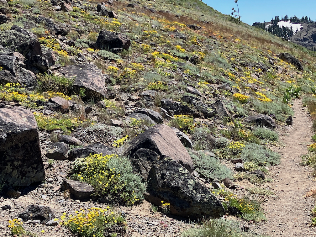
The worst part of the day for snow is mid-day, when there is a few inches of slush on top to hard packed snow, impossible to keep footing. Earlier, the snow is hard and steps can be kicked, and late afternoon, it is all slush. Some of the backpackers have step crampons, though those are only useful in the early morning before the slush layer develops, and most of them have hiking poles, which help, but I can tell from the slides down the far sides of snowbanks that these were not keeping everyone from falling. I fell more times on this day than I have fallen in the last ten years, so rather than continuing north on the PCT, I decided to go out at Five Lakes. The north facing switchbacks from Five Lake Creek to the ridge actually had less snow than many other sections, a surprise to me after the snow beforehand.
I camped at Squaw Saddle (so far as I know, this has not been renamed yet, but several other Squaw names such as the peak and creek are now Washeshu), and explored around Five Lakes basin in the morning. The main lake of the Five Lakes basin is full, so the two lakes are one, and the ponds are all full. There are probably about 10 lakes at the moment.
I walked out Five Lakes Trail to Alpine Meadows TH, and then followed the Bear Creek Trail out to near River Ranch. This trail climbs a great deal, but the surroundings and view are good, so worthwhile. From there, bus to Olympic Valley so I could catch music in the evening, slept out near there, and walked the bikeway to Tahoe City. A shower, and pizza and a movie, and slept out again. I caught the last bus on Sunday from Truckee back home to Sacramento, delayed as much as possible to miss the 100 degree days in Sacramento.
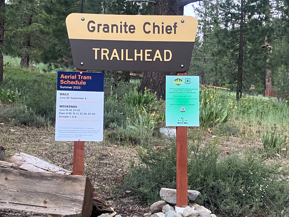
The trailhead for the Granite Chief Trail is no longer beside the fire station, but further up the road where there is a parking lot of the ropes challenge course.
- Photos on Flickr: https://www.flickr.com/photos/allisondan/albums/72177720309966082
- Granite Chief collection on Flickr: https://www.flickr.com/photos/allisondan/collections/72157637640215275
