
This was a ‘didn’t go as planned’ trip. My plan was to do a lot of trail work on the Powderhorn Trail.
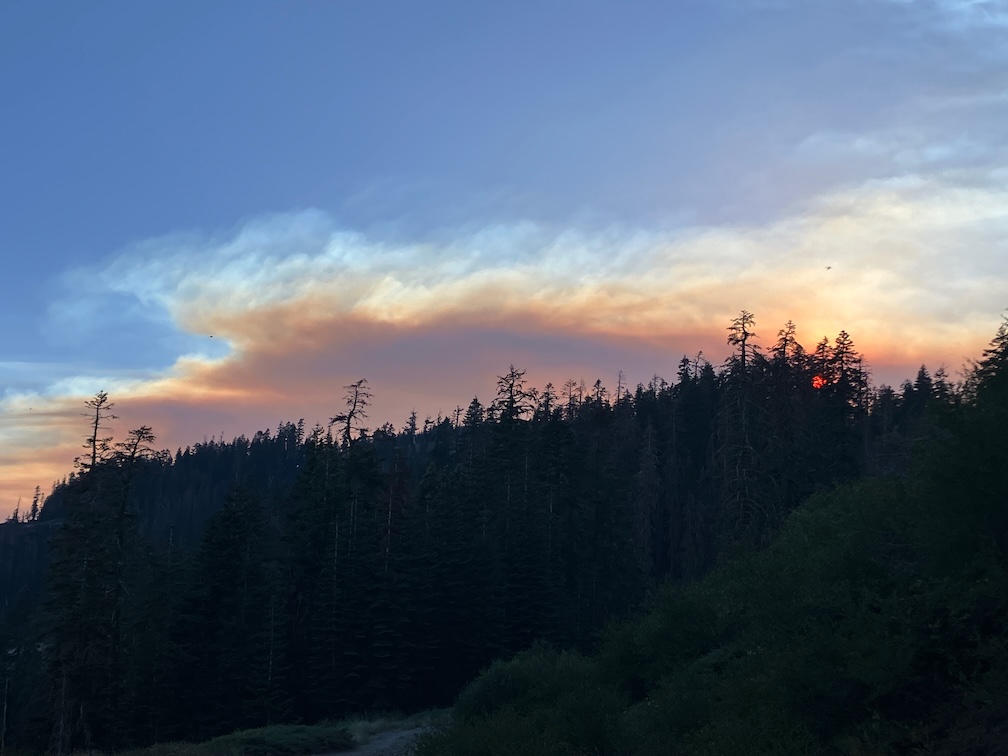
Train to Truckee, bus to Tahoe City and then Barker Pass Rd. I had hoped to hitch-hike to Barker Pass, but it was a weekday in the afternoon, and all the vehicles were going out, not up, so after a short hitch to the campground, I walked up the jeep road to the pass and then to Powderhorn trailhead. On my way up on the train, people were commenting on the smoke plume to the south, which turned out to be the Crozier fire north of Placerville. When I got to Powderhorn saddle, the plume was quite visible and spectacular, overhead. I started down into the canyon, but in short order the smoke descended into the canyon, reducing visibility to less than a quarter of a mile. I went back up to the saddle and camped there, where the air quality was a little better.
In the morning, smoke was filling Powderhorn, so I waited, and walked west on the old logging road to the creek, refilled water, and then back along the Barker Pass Rd to the saddle. The air cleared mid-morning, so I headed down and started my trail work. I have a new folding saw, which I’ll say more about next post, that allowed me to cut some down trees that I’ve always had to bypass, plus a little spot brushing. And then the smoke descended again, worse than before. So I headed out, and went to Barker Pass where the air was better, camped, and waited to see what would happen. Both the Rubicon drainage to the west and the Tahoe basin to the east were socked in with smoke in the morning. I realized that the only thing to do was head south on the PCT, away from the smoke plume. I was surprised by the number of PCT thru-hikers I saw, seems late in the season for them to be here.
By Richardson Lake, the air was good, and continued to get better on the PCT south. Looking back north, I could see that the smoke had descended into the valleys again, so if I’d tried again, I would have gotten smoked out again. There are a few patches of snow in the Crystal Range, but much less than two weeks ago. I spent time at my favorite juniper along the PCT, and then headed down into the General Creek drainage.
The connecting trail from PCT down to Genevieve Trail (which used to be called the General Creek Trail) is not really a trail. It was never constructed, has a lot of down trees, and is very hard to follow in places. This time of the season General Creek is just large pools with no flow, so is easy to cross, but I’ve had problems with that earlier in the season. I camped near the trail junction. This is a seldom used area. In the morning I headed over to Genevieve Lake, on a trail in decent shape with some down trees but easy to follow.
The Meeks Creek Trail (also called Tahoe Yosemite Trail on many maps, but it is a relict name) is a different world, only wilderness in name. Suddenly a whole lot of people, and more and more heading down Meeks Creek and out to the trailhead near Meeks Bay Resort. After iced tea, to Sugar Pine Point SP for a shower, then on to Tahoe City and Truckee, and the Amtrak bus home.
Photos on Flickr:
- Album: https://www.flickr.com/photos/allisondan/albums/72177720319577026
- Granite Chief Wilderness Collection: https://www.flickr.com/photos/allisondan/collections/72157637640215275/
