Tag Archives: brushing

PCT & Granite Chief 2024-07

Yes, I’m still here. I’ve been backpacking a bit in the bay foothills and Bay Area, but this is my first backpack of the season in the Sierra.

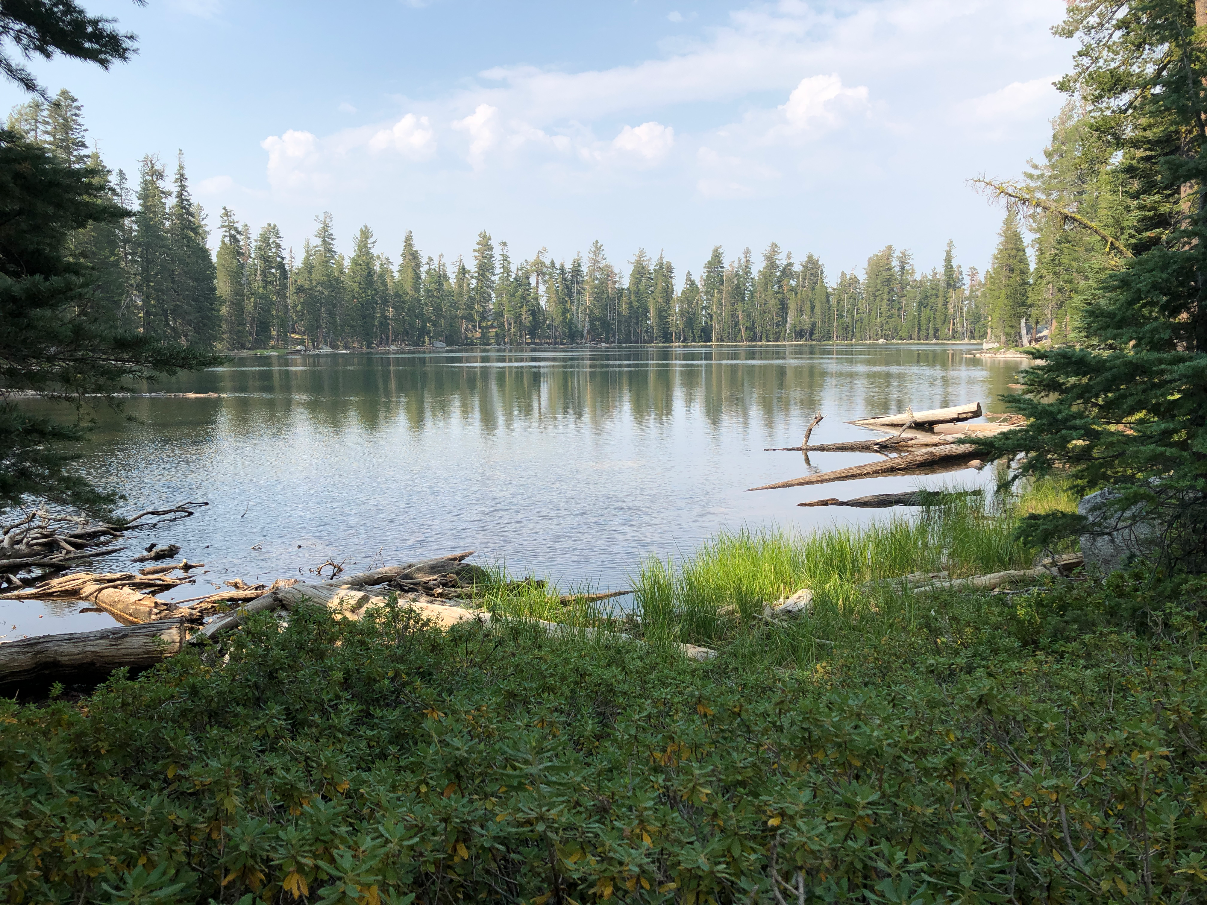
I took the TART bus to Sugar Pine Point State Park, which is the end of the route. It used to go a little further, to Meeks Bay, and there used to be a shuttle that went all the way to South Lake Tahoe, but no more. I hiked up the General Creek Trail, and then a side trip to Lost Lake where I camped the night. Lost Lakes gets bicyclists, but few backpackers. The trail was rerouted, and it needed it, but it was laid out by mountain bikers so is not that pleasant to hike. But the lake is beautiful and quiet.

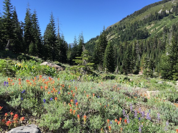
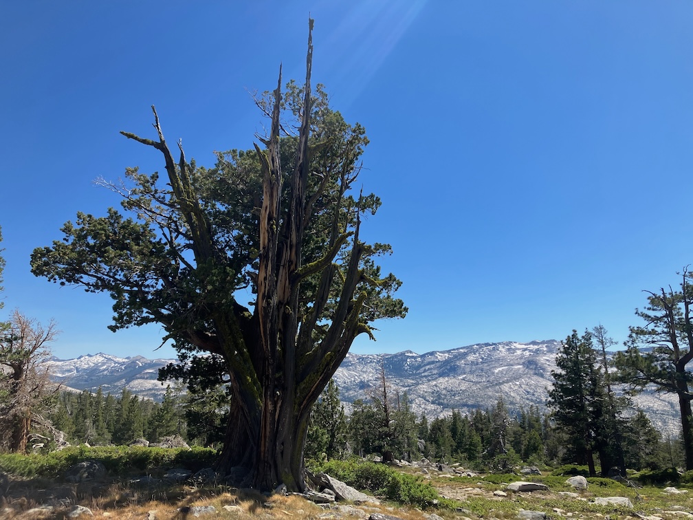
The next day I went south along General Creek. This used to be called the same General Creek Trail, but apparently has been renamed the Genevieve Trail. Last time I was there, years ago, the trail was impassible with down trees, but it has been maintained and there are only a few down trees now. The trail is easy to follow except in a few wet areas where the annual lush growth has obscured the trail. There is a steep connector trail heading west up to the PCT, where I turned north. I spent some time at my favorite tree, that I call The Juniper, and then continued north past Richardson Lake, across Miller Creek (still flowing in early July), and then up to Barker Pass where I camped the night. A long day!

photo of The Juniper along PCT
Juniperus occidentalis, Pinaceae

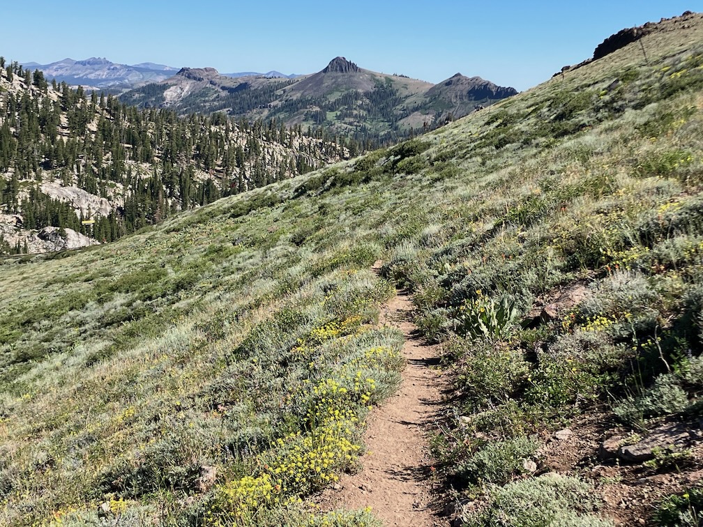
From Barker Pass I continued north along the PCT/TRT, and camp at Whiskey Creek Camp, and the next night near the Tevis Connector trail.

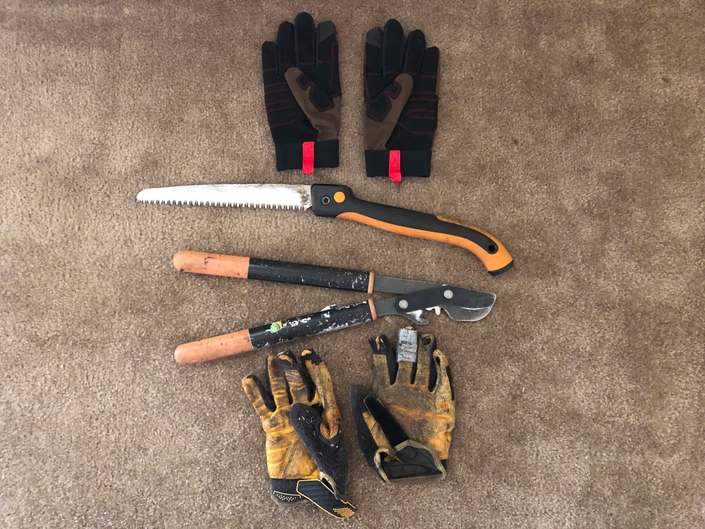
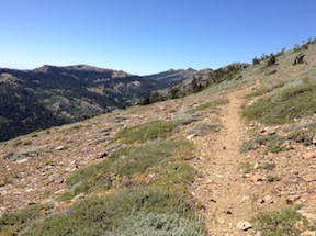
To my surprise, the PCT has been brushed from the PCT/TRT junction to the Middle Fork American River crossing south of Granite Chief (a small creek at this point near the headwaters). I don’t know who did the brushing, maybe Forest Service, maybe Pacific Crest Trail Assocation, but it was a professional job, not the rough work done by one-off volunteers crews. I had figured to spend at least a week, maybe two, brushing this section, so now I can focus on other trails. Trees were also cut, but there a a few new ones down.

I continued north and then down the Granite Chief Trail to Olympic Valley. Music at Palisades Tahoe in the evening, sleep out up the trail a ways, and catch the TART bus back to Truckee. The train was quite late, and I had a meeting to make, so I returned to Sacramento on the Amtrak bus rather than California Zephyr.

Water: Almost every creek is flowing well, so I was able to stay stocked up and hydrated with no problem. There were a few snowbanks left, on and adjacent to the trail.

Insects: This year is what used to be an average mosquito year, though we have not had an average year in many years. I did not have my inner tent, the mosquito netting, with me on this trip, so had to hide out under my shirt at night. At lower elevations there were more flies than mosquitos, some of them biting flies. While at Lost Lake I expected to see bats munching mosquitos, but did not see a single one. The ecosystem is out of whack in the Sierra.

PCT thru hikers: It is thru hiker season, and there are a lot of people on the trail, heading north to Canada, or as far as they make it. There were also a few TRT hikers, most heading south rather than north.

I am having difficulty getting to labeling photos and posting in between trips, so my trip reports may be erratic during the summer. One day back home is not enough to clean and repack, and post. And I’ve been taking some other trips in between, like San Francisco and Oakland this last weekend (July 20-21). Ah well.

photo of trail and crest to the north

Photos on Flickr:

PCT trailwork and exploring 2021-08

This is a trip from last year, that I forgot to post. It turned out to be the last backpack of the season for me, as fires closed the national forests and the two or more trips were not made. The trip from Monday, August 9 through Friday, August 14, 2021.

Duck Lake

I went in at Barker Pass, coming up to Truckee on the train, then bus to Tahoe City and down the west shore to Kaspian Campground, then walked up the paved and dirt road to the pass, and camped a bit north of the pass. The air was clearer both up on the ridge and down in the Tahoe basin than it had been.

The main purpose of my trip was to finish off a section of the PCT that needs brushing, and had last been worked about five years ago. It was not brushed closed, but was approaching that. Cutting brush usually goes fast, but hauling he cut brush off the trail take up more than half the time, depending on how long I have to carry or drag it to a good location. Many people who do light trail brushing just drop the cutting where they are, but over time that results in a wall of cut brush along the edge of the trail, which looks bad and blocks views. I haul the brush so that it is at least six feet off the trail, often more, and out of sight. It is interested when my brush stashes evolve over time as the brush gradually breaks down. The air was clearer up on the crest, but seemed to be getting worse down below.

Doing trail work on the ridge, I have to haul up water for my trip from one of the sources below. In this case, the springs in the north fork of Blackwood Canyon, down the switchbacks and back up, with about seven liters of water. Though the air was clear, there is a layer of smoke aloft and it seems to be descending towards the ridge. I finished the section of brushing late in the day, with a few drops of rain from increasing clouds. With this section, there are no places between Barker Pass and Granite Chief that really need brushing, though there are locations that could use some attention.

Next day I headed south along the PCT. The smoke is thick now, and I’m hiking with my KN-95 mask, and walking more slowly than usual. The smoke seems to be regional now, not just plumes from the fires. Water at the springs, and more water at the creek south of Barker Pass which is flowing cold and well, though everything else including Miller Creek is dry now. I continued on to Richardson Lake, where I camped along with eight other backpackers. I’ve noticed that all along the PCT there are more campsites, and the campsites are bigger, the result of the huge increase in the number of PCT thru hikers. I see about 40 thru hikers a day now, whereas in the pre-Wild (the book and movie) days, it was about 5. I took an afternoon walk to General Creek, tip-toeing carefully through abundant tiny frogs. Tree frogs, I think.

While around the lake, I saw a mustelidae that was moving too fast to clearly identify, many grouse, dragonflies with green and blue bodies and bright blue banded tails, bright green frogs in the grass at lake edge.

The next day I hiked on to Lost Lake, which is south of General Creek. There is a new trail, constructed by TAMBA, replacing the old road. The road had problems, but so does the new trail. It loses elevation for no good reason, and then climbs very steeply to make up for it, and winds almost a mile out of the way for a so-so view. I have never been fond of trails laid out by mountain bikers, too much like pump tracks and too little like trails, but this one is particularly bad. Trees were cut off at waist height rather than the ground, brush piles right beside the trail, very steep tread with no attempt at erosion control. But once reaching the lake, it is nice. I took a swim, walked around the lake, and watched the end of the day cloud color. I took a walk around Duck Lake, which is really a pond, shallow, but an interesting place not much visited except by ducks.

Last day I walked out the General Creek trail to Sugar Pine Point SP, and took the bus back to Tahoe City and then Truckee, and the train home.

The Caldor Fire started that day, though I was not aware of it on that day. The Tamarack Fire, southeast of Tahoe, was still going but not producing much smoke, and the Dixie fire was still going and contributing to a regional smoke.

Here in February 2022, I’m wondering when the snow will melt enough to head into the Granite Chief again. The fall storms brought deep snow, and it was looking like a very late year, but it hasn’t done much since, so who knows. I have started backpacking again, but in the bay area and Sierra foothills.

Photos on Flickr: https://www.flickr.com/photos/allisondan/albums/72157719722926893; Granite Chief collection on Flickr: https://www.flickr.com/photos/allisondan/collections/72157637640215275

more PCT trailwork 2021-07

This trip was mostly a trail maintenance trip, continuing the brushing between Twin Peaks and Ward Peak, particularly the very brushy section in the middle.

I went in at Barker Pass, walking up from Kaspian Campground to the ridge. Not the short way into the wilderness, but useful because the closest spring to my work area is along the PCT/TRT in North Fork Blackwood Canyon. Other springs are nearly dry, and streams are very low, but this one is still doing well, cold snowmelt water out of the talus slope below the ridge line.

I made progress on the brushing last trip, and this trip was able to fill the gaps between other short segments I’d done, leaving only the hardest part to do, the brushed-in ridge line switchback. So I feel good about the work accomplished, everything to the south done. But more to do. I replaced the cutting blade on my nippers before this trip, and it made a big difference. Below, the tools of the trade: nippers, folding saw, worn out gloves, and new gloves. The nippers and folding saw are both Fiskars, which make the best lightweight tools, about a pound each.

The majority of the brush I’m cutting is tobacco brush, Ceanothus velutinous, it grows faster than the others. Bitter cherry also crows fast, but the stems are easy to get to and cut easily. But even the slow growing pinemat manzanita and sagebrush do eventually encroach on the trail. The photos on Flickr (link below) show several of the brush species that I’m cutting, though not the most common tobacco brush. Huckleberry oak and white thorn are very common brush at somewhat lower elevations.

Chinquapin

With all the time up on the ridge, I of course had ample opportunities to watch the sunsets, and this section of the ridge is one of the best places. I also watched the patterns of smoke from the fires. Last trip was mostly smoke from the Tamarack Fire to the southeast, with the smoke mostly heading north well to the east. This trip was mostly smoke from the Dixie Fire, well to the north but producing a lot of smoke. Sometimes the Tahoe basin, to the east, was socked in with smoke, sometimes clear. Less often the west slope of the Sierra was smoked in. Fortunately, at least during these weather and fire conditions, the crest is free of smoke most of the time, just a hint of smoke smell from time to time. The smoke does produce some spectacular orange sunsets. Though there are good sunsets any time there are layered clouds to the west, not just layers of smoke.

The weather was also unusual. Monday night it rained off and on throughout and into the next morning. Never heavy, but still enough to require my tarp. This kind of weather is common summertime in some other mountain ranges, but not common in the Sierra. The rest of the week it rained at least once a day, but light rain from the edges of the thunderstorms. The storms were forming over the crest before moving east to the Carson Range, a reversal of the usual pattern. It has been a while since the forest smelled largely of dampness and humus, and it was enjoyable. But the rain was never enough to thoroughly wet the soil, and it is still dry below.

The woolly mules ears are drying to yellow and brown, but not quite dry enough to rattle in the wind, that sure sound of fall. The less common arrowleaf balsamroot, however, is dry and rattling.

Early one morning when walking through a mules ear meadow to my work site, a dark sleek animal dashed across the trail, going downhill and moving very fast. The glimpse was so brief I’m not certain what it was. Probably a weasel, but could also have been a marten or fisher (all are in the same family Mustelidae). I also saw a Clark’s Nutcracker hanging out on the ground. I usually only see them in flight between trees, or in trees, but this one provided a close up view.

Tomorrow I’m headed up to finish off the brushing, probably two solid days of work. Depends on the smoke, however. The crest is often free of smoke, but the hike into the crest from Lake Tahoe level is in the thick of smoke, at least today.

Powderhorn trail work 2018-06

For my first trip of the season I mostly did trail work on the Powderhorn Trail. Working down from the top, I cleared brush, of which there is not all that much, and cleared or thinned young conifer trees, of which there is an infinite supply. The conifer trees seem nice, but if they are within four feet of the trail, and grow up, their branches always encroach on the trail. When there is dense conifer seedlings on both sides, it often essentially closes the trail. And of course as a natural process of thinning, most of these would eventually die on their own, but that leaves a tearing dead tree that is much harder to cut and remove than it was when it was alive. When it is clear that one tree is growing faster than the others, therefore quicker to reach the point where branches are above trail level, I leave that one and remove all the shorter ones around it.

I completed the work from the top to the postpile meadow, about 1/3 of the 3.5 miles, and did a minor amount of work below that. There are many days of work left to go, so unless a trail crew goes in, it will be several years before the trail is in good condition again. But it is usable, if not for downed trees.

There were eight down trees, six of which an be bypassed easily, and two of which hikers can clambered over or around but horses cannot pass. There is a moderate amount of winter debris, the branches that fall during the winter and can be stepped over, but when removed make a much nicer walk.

On the Five Lakes Trail, there were about five downed trees, none hazardous and all easy to go around.

I walked in from Kaspian Campground on Hwy 89 (a nearby bus stop), up Barker Pass road and then the old jeep trail to Barker Pass (steep but quiet and beautiful), then along Forest Road 3 to Powderhorn trailhead, and in. From Diamond Crossing, the junction of the Powderhorn, Hell Hole, and Five Lakes Creek trails, I walked up Five Lakes Creek trail to Whiskey Camp and then out at Alpine Meadows trailhead and down to River Ranch on Hwy 89 (a nearby bus stop).

There are patches of snow along the ridges, but most snow is gone. Many of the tributary creeks and creeklets are still flowing, but low, and will probably dry by mid-July. The flowers are moderate, in some places it is still early season and flowers have not developed, and in other places they are fading already.

short PCT and brushing

GCW_PCT-ridge-north

north along the PCT across Whiskey Creek basin

A short three-day trip into the Granite Chief Wilderness this week. I went in at Squaw Valley on the Granite Chief Trail, which is the most convenient entry point for me because the TART bus stops a hundred yards from the trailhead. I’m glad to have completed brushing on this trail last year, as it makes for a nice walk. The trail has been logged out, so is in good shape, but there are erosion problems on some of it that make it rocky going. I turned south on the PCT where there is a new trail sign to replace the one that had deteriorated and eventually disappeared. Two small creeks still cross the trail here, but both are small and will probably dry soon.

Continue reading