Tag Archives: Barker Pass

Powderhorn Trail maintenance 2023-07

My second trip into the Granite Chief Wilderness this year was primarily to do trail maintenance on the Powderhorn Trail.

I take the TART bus to trailheads, or as close as it gets. There is a bus stop just north of Kaspian Campground and Barker Pass Rd. I walked up Barker Pass Rd and then the jeep trail to Barker Pass, camping there for the night. Next day I walked along Barker Pass Rd to the Powderhorn Trailhead.

palisades meadow and palisades in Powderhorn Canyon

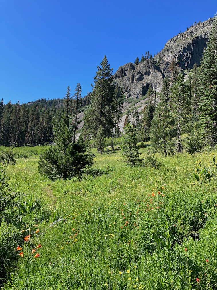
My maintenance work is brushing, primarily whitethorn, and thinning back conifers from the trail, which otherwise grow to crowd out the trail. I did the patch of whitethorn as the beginning of the trail. There is not much brush until the trail breaks out of the trees into dry meadows in upper Powderhorn canyon. I worked down to a large tree that has been down for years.

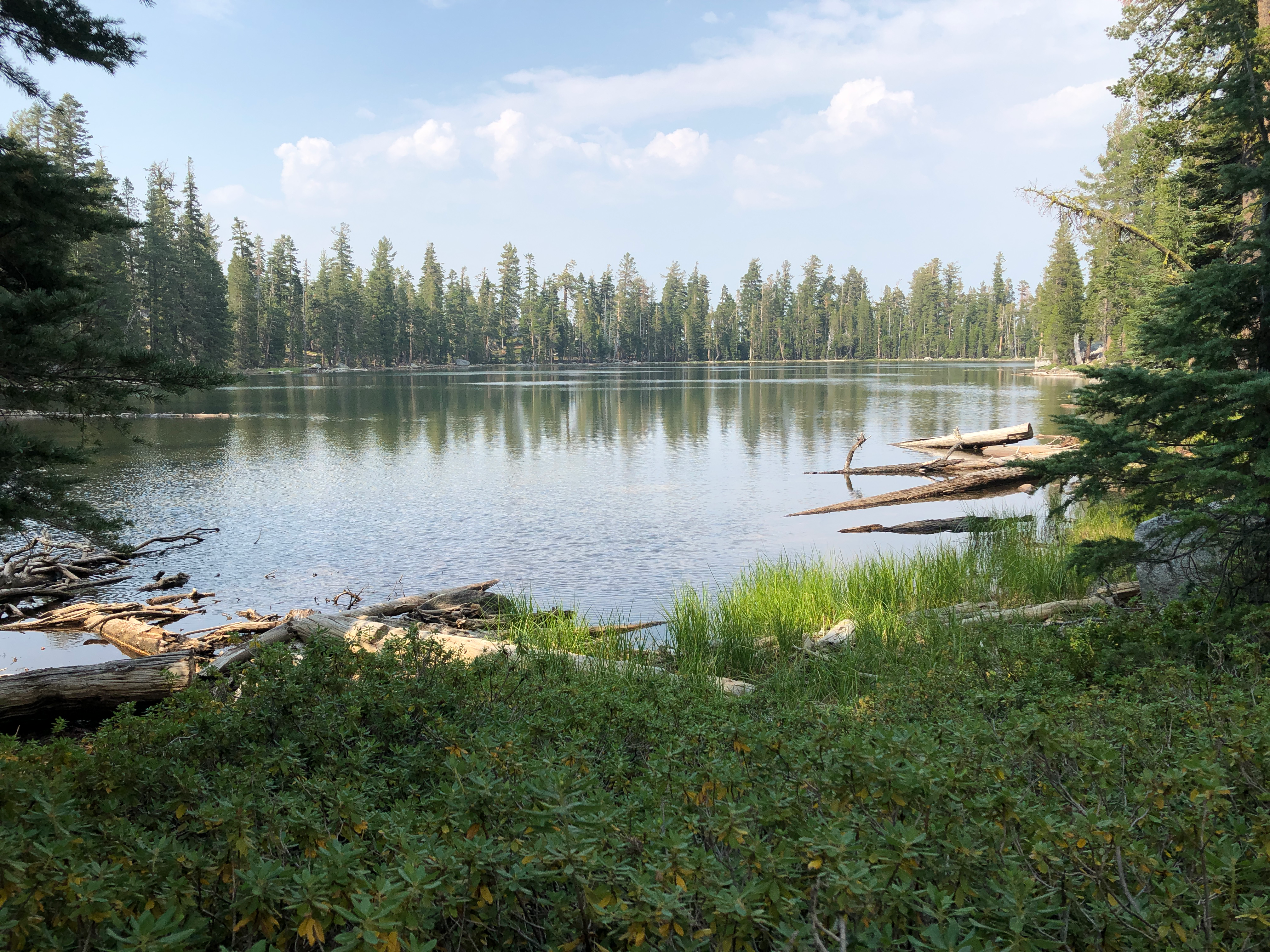
The next two days I worked up from the bottom of the trail, camped near the meadow just short of the Powderhorn Creek crossing. This was mostly trimming back brush that was not yet blocking the trail, and cutting conifers. Most young conifers don’t survive, but while they are alive they crowd the trail with branches, and when they die, they lean over into the trail, as what I call spars, those hard points that rip clothes and skin. So cutting back young avoids crowding and reduces the spars. I also worked two patches where whitethorn was completely across the trail, and cleared out the crossing of the creeklet and was blocked by alders.

So, the upper 20% of the trail, perhaps, is in good shape except for.a few down trees, and the lower 25% is also in good shape, again with a few down trees. The section in between is, well, it sucks. There are 38 down trees on the Powderhorn Trail, most of them in this middle section. Additional issues are the heavy winter debris covering and in some cases obscuring the trail, and the brush and conifers encroaching on the trail. I can’t honestly recommend it, though Powderhorn is my second favorite area in the wilderness. I’m up in the air about whether I’ll do another trail maintenance trip here this year. Even if I do, it will just fix a small portion of what needs to be fixed.

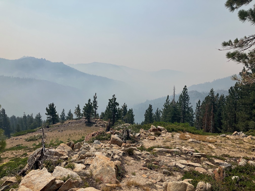
I have been keeping track of down trees on this trail, for the last three years. In 2021, there were ten down trees, some of them had been down for years. Up until a few years ago, a horse group rode in through Powderhorn to Big Springs Meadow, and cleared most down trees, but that group has stopped visiting. The last Forest Service maintenance was about 15 years ago. In 2022, there were another ten down trees. And this year, there are another 18 down trees. The number of down trees is accelerating, and will continue to accelerate from this point on. Dead standing trees line the trail, in fact the entire canyon. Most of these are red firs, but white firs in the low section and a scattering of other species round it out.

Over the next few years, trails that are not actively being maintained will essentially be lost to hikers. And few trails are being maintained, just some in high use and high profile areas. The Truckee Trails organization has adopted the Granite Chief Trail and the Five Lakes Trail, and is decently maintaining them, but the organization does not have the capacity to adopt every trail. And the Forest Service essentially no longer does trail maintenance, instead spending all its budget putting out fires. They almost have to, because years of fire suppression has left overstocked forests, ready to burn. There are a number of locations in the Granite Chief Wilderness where single tree and small fires were actively suppressed. But fire delayed is fire that will be larger. Some of these fires could have been allowed to burn and clear out too-dense forests, but their natural function was prevented by the Forest Service.

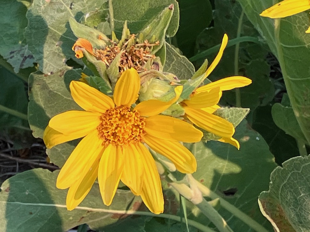
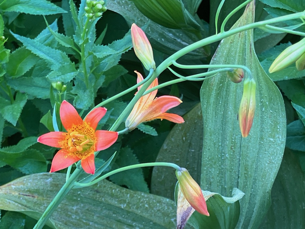
This year has more Leopard Lilies than any I can remember. Three are wet areas with hundreds of flowers, and these areas are pretty common. In general, it is a good flower year, though late, but the lilies really stand out.

Leopard Lily, Lilium pardilinium

I walked out up Five Lakes Creek Trail to Whiskey Creek Camp, and then PCT and Five Lakes Trail out to Alpine Meadows trailhead. The Five Lakes Creek trail has many of the same issues, a large volume of down trees, including many from this year. Perhaps less brush. I’ve previous suggested to people that they use Powderhorn instead of Five Lakes Creek to access Diamond Crossing and beyond, but now the two trails are about equally bad.

PCT & Picayune 2022-07

This was my first trip of the season, probably the latest I’ve ever started. I had been doing a lot of short backpack trips along the Bay Area Ridge Trail, intending to complete that trail in a single year, but now taking a break because it is just too hot there. And I’ve been traveling and dancing a bit, which left shorter periods of few days for backpacking in the Sierra.

I went in at Palisades Tahoe on the Granite Chief Trail. This trail has been adopted by Truckee Trails, and is being appropriately maintained, so I’m scratching that one off my list of trails that I need to maintain. I headed south along the Pacific Crest Trail (PCT), over Granite Chief saddle and down Whiskey Creek drainage. I camped near Whiskey Creek Camp, and had a nice long conversation with five people camped there, parents, two children on their first backpack trip, and a friend from Chicago.

The next morning it was a little smokey, so I hung out and it didn’t seem to be getting worse, so I headed out the Western States Trail toward Picayune Valley. And then the smoke really came in! The Five Lakes Creek drainage was completely filled with dense smoke, and the ridgelines barely visible. So I sat it out for quite a while. When it thinned a little, I headed to Picayune Valley, wearing my N-95 mask, to one of my favorite camp spots.

smoke in Five Lakes Creek basin

The smoke mostly cleared in the evening, and the stars were good. Next morning I walked the rest of the trail down to Talbot trailhead. The wet meadows and seep areas along the trail were chock-full of flowers. Because the trail is not getting much use, the soft vegetation crowds in and obscures the trail tread, but is easy to push through.

I had partly headed to Picayune in an effort to get away from the smoke, which I figured might be less further west, if the smoke plume location was correct. But the next day was mostly clear, so I went back out and back to Whiskey Creek Camp area. The smoke was from the Oak Fire in Mariposa County.

Next day I continued my way south on the PCT to Barker Pass. Though I’d seen very few PCT thru hikers previously, that day there were a more ‘normal’ number, about 70. I headed down the Blackwood Canyon jeep trail and camped near Blackwood Campground. The campground is no longer free ($17/night for a campground without water and trash service!), and the Lake Tahoe Basin has outlawed backcountry camping. Not sure what the rationale is, but the effect is to discriminate against people of low and moderate income. Of course I believe that people have a right to travel over the earth, and to camp where they need to camp, and that is what I do no matter what the bureaucrat bean-counters think.

There are alot of red firs (Abies magnifica) dead, sometimes in clusters, and sometimes individuals. They seem to die branch by branch until they are completely dead. It looks as though middle aged trees and the most susceptible, not so much young trees and very old ones. Though there are also dead white firs, the red firs are particularly noticeable because of the intense reddish brown of the needles. The primary cause seems to be prolonged drought and over-abundance of trees (due to fire suppression). Once weakened by drought, they are susceptible to root rot, mistletoe, fungus, and bark beetles.

Small and seasonal creeks are dry. Medium creeks are low but still flowing well. Wet meadow and seep areas are still green and wet, but drier ridge areas and crispy dry. Flowers are abundant in wet or moist areas, but long gone in drier areas. The two most common species of flowers are pennyroyal and yampah.

The trails I walked on this trip are in pretty good condition. Light to moderate winter debris. A few down trees, almost all easy to step over or bypass. The one tree that might not be able to be bypassed by equestrians is on the switchback down from the saddle into Picayune Valley. There are a few places that could use spot brushing, though the alder wet area on the PCT at the crossing of the Middle Fork really needs brushing.

I did something on this trip that I’d not done in years – I took a paperback novel to read. I’ve listened to books, with Audible, but my iPhone battery runs down pretty quickly. I rather enjoyed hold a book in my hands!

I’ve had for a couple of years the idea of creating a digital presentation or book on the flowers of the wilderness. So I took a lot of flower photos on this trip. Not everything, and of course missed the early season flowers. I’m better labeling them than I have before, with common name (if I can figure it out), species name, and plant family. I’m hoping that when I get to the project, that will make it easier. I’m using primarily Sierra Nevada Wildflowers, Karen Wiese, Falcon Press (Kindle edition); and Wildflowers of Nevada and Placer Counties, California, Redbud Chapter of California Native Plant Society. macOS Photos app now makes suggestions for photos that contain one flower. Sometimes the suggestion are exactly right, sometimes they are good to the genus level, and sometimes they are completely wrong. It is interesting to check, but the lookup is rather slow.

Mule Ears, Wyethia mollis, Asteraceae

Back in tomorrow!

PCT trailwork and exploring 2021-08

This is a trip from last year, that I forgot to post. It turned out to be the last backpack of the season for me, as fires closed the national forests and the two or more trips were not made. The trip from Monday, August 9 through Friday, August 14, 2021.

Duck Lake

I went in at Barker Pass, coming up to Truckee on the train, then bus to Tahoe City and down the west shore to Kaspian Campground, then walked up the paved and dirt road to the pass, and camped a bit north of the pass. The air was clearer both up on the ridge and down in the Tahoe basin than it had been.

The main purpose of my trip was to finish off a section of the PCT that needs brushing, and had last been worked about five years ago. It was not brushed closed, but was approaching that. Cutting brush usually goes fast, but hauling he cut brush off the trail take up more than half the time, depending on how long I have to carry or drag it to a good location. Many people who do light trail brushing just drop the cutting where they are, but over time that results in a wall of cut brush along the edge of the trail, which looks bad and blocks views. I haul the brush so that it is at least six feet off the trail, often more, and out of sight. It is interested when my brush stashes evolve over time as the brush gradually breaks down. The air was clearer up on the crest, but seemed to be getting worse down below.

Doing trail work on the ridge, I have to haul up water for my trip from one of the sources below. In this case, the springs in the north fork of Blackwood Canyon, down the switchbacks and back up, with about seven liters of water. Though the air was clear, there is a layer of smoke aloft and it seems to be descending towards the ridge. I finished the section of brushing late in the day, with a few drops of rain from increasing clouds. With this section, there are no places between Barker Pass and Granite Chief that really need brushing, though there are locations that could use some attention.

Next day I headed south along the PCT. The smoke is thick now, and I’m hiking with my KN-95 mask, and walking more slowly than usual. The smoke seems to be regional now, not just plumes from the fires. Water at the springs, and more water at the creek south of Barker Pass which is flowing cold and well, though everything else including Miller Creek is dry now. I continued on to Richardson Lake, where I camped along with eight other backpackers. I’ve noticed that all along the PCT there are more campsites, and the campsites are bigger, the result of the huge increase in the number of PCT thru hikers. I see about 40 thru hikers a day now, whereas in the pre-Wild (the book and movie) days, it was about 5. I took an afternoon walk to General Creek, tip-toeing carefully through abundant tiny frogs. Tree frogs, I think.

While around the lake, I saw a mustelidae that was moving too fast to clearly identify, many grouse, dragonflies with green and blue bodies and bright blue banded tails, bright green frogs in the grass at lake edge.

The next day I hiked on to Lost Lake, which is south of General Creek. There is a new trail, constructed by TAMBA, replacing the old road. The road had problems, but so does the new trail. It loses elevation for no good reason, and then climbs very steeply to make up for it, and winds almost a mile out of the way for a so-so view. I have never been fond of trails laid out by mountain bikers, too much like pump tracks and too little like trails, but this one is particularly bad. Trees were cut off at waist height rather than the ground, brush piles right beside the trail, very steep tread with no attempt at erosion control. But once reaching the lake, it is nice. I took a swim, walked around the lake, and watched the end of the day cloud color. I took a walk around Duck Lake, which is really a pond, shallow, but an interesting place not much visited except by ducks.

Last day I walked out the General Creek trail to Sugar Pine Point SP, and took the bus back to Tahoe City and then Truckee, and the train home.

The Caldor Fire started that day, though I was not aware of it on that day. The Tamarack Fire, southeast of Tahoe, was still going but not producing much smoke, and the Dixie fire was still going and contributing to a regional smoke.

Here in February 2022, I’m wondering when the snow will melt enough to head into the Granite Chief again. The fall storms brought deep snow, and it was looking like a very late year, but it hasn’t done much since, so who knows. I have started backpacking again, but in the bay area and Sierra foothills.

Photos on Flickr: https://www.flickr.com/photos/allisondan/albums/72157719722926893; Granite Chief collection on Flickr: https://www.flickr.com/photos/allisondan/collections/72157637640215275