Trails and Maps

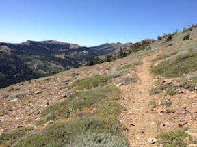
One of my purposes of my Picayune Valley and Shanks Cove trip earlier this year was to create GPS tracks for the Western States and Shanks Cove trails. In the area of the saddle between the Five Lakes Creek basin and Picayune Valley, the trail alignment shown on the National Geographic Trails Illustrated maps is incorrect. It turns out, now that Trimble Outdoors has added National Forest roads and trails as an available overlay in MyTopo Maps, that the Forest Service base maps are incorrect.

Continue reading

short PCT and brushing

GCW_PCT-ridge-north

north along the PCT across Whiskey Creek basin

A short three-day trip into the Granite Chief Wilderness this week. I went in at Squaw Valley on the Granite Chief Trail, which is the most convenient entry point for me because the TART bus stops a hundred yards from the trailhead. I’m glad to have completed brushing on this trail last year, as it makes for a nice walk. The trail has been logged out, so is in good shape, but there are erosion problems on some of it that make it rocky going. I turned south on the PCT where there is a new trail sign to replace the one that had deteriorated and eventually disappeared. Two small creeks still cross the trail here, but both are small and will probably dry soon.

Continue reading

Picayune Valley and Shanks Cove

falls on the MIddle Fork American River

falls on the MIddle Fork American River

My first trip of 2013 in the Granite Chief did not come until past mid-July. This is despite the fact that with the early and mild winter, I could probably have started backpacking in May. But my life if busy.

I headed in at Alpine Meadows Trailhead, and walked over the saddle to Whiskey Creek Camp the first night. I’m amazed going in here how many people there are day hiking on this trail, even late into the evening. I’ve heard that busy summer days see 5000 people on this trail, almost all of them dayhikers and only a few backpackers. No one was at Whiskey Creek Camp, even though it was a Saturday night in mid-season.

Continue reading

missing 2012 trips

sunset from Granite Chief peak

sunset from Granite Chief peak

I never seem to get all my trips posted. Not only did I not post my 10-day trip into the Mokelumne Wilderness, the highlight of the summer, I did not get around to posting on next two trips into the Granite Chief Wilderness.

Trail Maintenance and Powderhorn

The first missing trip was seven days in July. I went in at Granite Chief trailhead, and in fact spent several days completing brushing trail work on that trail. Once that was done, I headed south and camped on the top of Granite Chief peak, a spectacular place to sleep. When the air of the central valley is reasonably clear, it is easy to see details of the coast ranges, and at night, the lights of the valley cities and towns.

Continue reading

First trip 2012-06

jetstream clouds at sunset

I did my first trip through the wilderness June 24-27. How much difference a year makes! Last year, a month later, I was crossing regular patches of snow on the trail, and sometimes walking on snow for long distances, but this year I only crossed a couple of patches. Last year the creeks were so high that they were difficult or impossible to cross, this year all were easily crossed.

I went in at Granite Chief Trail, and did an afternoon’s work brushing the trail, and then much of the next day. I’ve completed the portion to about half way up where the trail crosses a creek near a mules ears meadow. Probably another day’s work yet to do to finish it off to the top. Huckleberry oak, white thorn, and pine mat manzanita have died back in a number of places along the trail. Is it from too much snow last year, or too little this year, or some other reason? I camped out on a granite ledge that hangs over Squaw Creek canyon, but slept very little with the wind howling all night.

Continue reading

A lost trip

Tiger Lily along Five Lakes Creek

I thought that I’d wrapped everything up this morning, and then this afternoon I was going through photos of other trips to upload them, and discovered set of photos I’d not labeled or uploaded. They were named TRT, but it was actually a much bigger trip, from Donner Summit to Spooner Summit. Once I found the photos, I also found the section of my journal, where I’d taken fairly detailed notes on the trip.

For the Granite Chief Wilderness portion, I came in on the north side from the PCT, went to Whiskey Creek Camp, walked out to the head of Picayune Valley but didn’t go down, explored Five Lakes, went down Five Lakes Creek to Diamond Crossing, and then out Powderhorn Canyon to Barker Pass. I backtracked to Twin Peaks and went out Stanford Rock Trail to Tahoe.

So THIS was my first trip of 2011 into the Granite Chief. Or maybe there are more yet to discover!

photos on Flickr

back to WordPress

I have moved all the information from granitechief.org to this blog. The website had a certain elegance of organization and design that are not possible on a hosted blog, but it will be easier for me to maintain. There may be some missing pieces and broken links, and if you notice anything, please let me know. The domain will now redirect to this blog.

These changes are to make it easier for me to maintain the information in a timely manner. I expect to be backpacking most of this coming summer, with only brief visits to town for a shower and resupply, so I need to be able to quickly update the blog without spending time on it.

Trip History

view into Bear Pen from PCT

view into Bear Pen from PCT

My first trip into the Granite Chief was in 2006, but the adventure started several years earlier when I was walking the Tahoe Rim Trail. There is a little overlook just off the trail as the TRT climbs out of North Fork Blackwood Canyon, south of Twin Peaks, where there is a view north down a valley. I was intrigued, and started looking at maps to see where this might be and how I could get there. This canyon is Bear Pen, with the Five Lakes Creek and Whiskey Creek basins beyond. Continue reading

Cairns and ducks

I have some strong feelings about cairns and ducks along trails. Cairns are large piles of rocks, and ducks are small piles of rock (three or so), both meant to mark trails or routes that may be difficult to follow without them. The problem is, they are often put in place by people who are either partially or completely lost. I don’t understand the psychology of building rock piles just at the time when you are becoming unsure that you know where you are, but I have years of experience with rock piles to say that is exactly what happens.

Continue reading