Category Archives: Trip Reports

First trip, down Five Lakes Creek

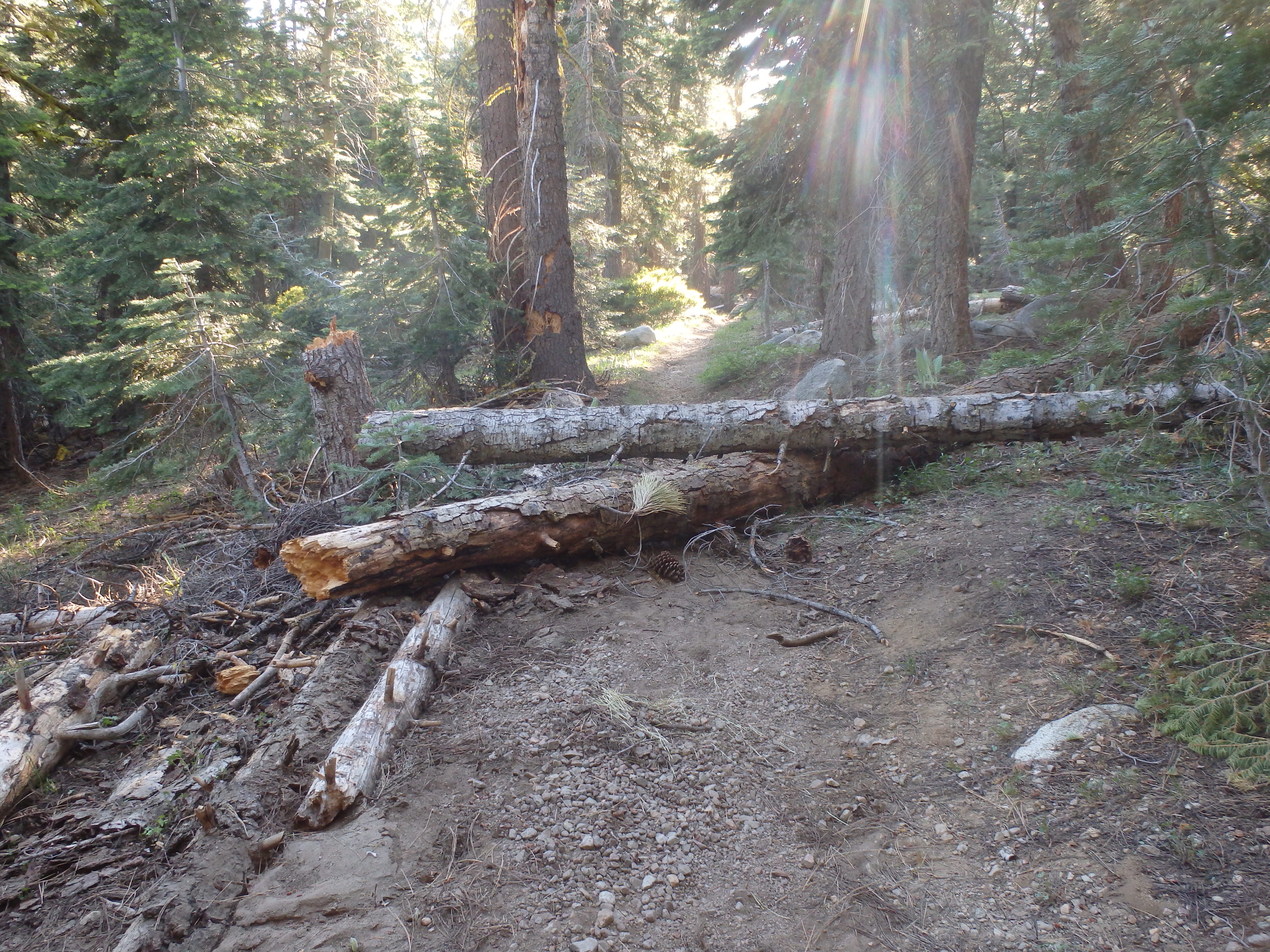
For my first trip of the season, July 4-10, much later than recent years, I headed in at the Five Lakes trailhead and went down Five Lakes Creek. There were only snow patches on the trails, and they would be gone by now. There are a few trees down as far as Whiskey Creek Camp, and a moderate amount of winter debris, the branches that come down over the winter and can be throw off if one has the time. From Whiskey Creek Camp southward, there are more trees and more debris, with the biggest issue being young firs bent over the trail. More snow than usual at these middle elevations bent these trees.

From Diamond Crossing south to Steamboat Creek, there are a lot of trees down, and a lot of winter debris. In fact, this trail segment has become quite difficult to follow. When you leave the trail to go above or below a fallen tree, it is very challenging to see the trail and get back on it, being so covered with debris that it looks just like the rest of the forest floor. If this trail doesn’t receive some maintenance within a couple of years, it is done for. Bears provide a lot of the trail maintenance on these lesser-used trails, and there is evidence that the bears are starting to prefer other, easier routes over the old trail, and if so, that is the beginning of the end. 

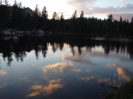
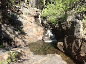
All of the named creek crossings were wet ones. Some are probably rock jumps now, but some may still be wet. The snow melt has created tread erosion in a number of places. No surprise. When you combine an almost complete lack of water control structures on the trails with a wetter winter, erosion is the result. 

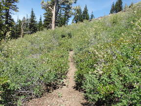
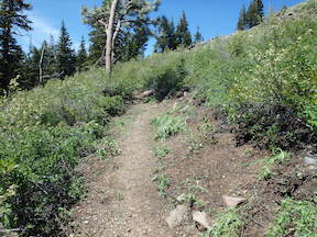
I spent two days doing maintenance on the lower third of the Powderhorn Trail. The doghair fir is pushing into the trail, so the hiker has to push through it. I cut those back, so the trail is in good condition, with a bypass around one down tree. However, another down tree that can be bypassed by hikers may well be a barrier for equestrians since it is on a steep side slope in a dense forest. The real issues on the Powderhorn are in the middle third section, where doghair fir and whitethorn brush have essentially closed the trail. Though the alder section below the postpile formation has been an issue in the past, I’m guessing that it is still passable. I did not have time to work on the middle third, so good luck if you go there. 

I met a Forest Service wilderness ranger, Nathaniel, on the Five Lakes trail. This is the first time in many years that the Granite Chief has had dedicated staff, so I’m looking forward to more attention being paid. 

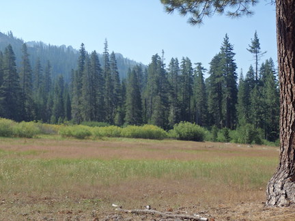
The flower show is just developing, with pentstemons, mules ears,and a few others. 

I did not go north or south on the PCT, nor any of the other trails in the wilderness, so have nothing to report on them. As always, I welcome comments from others on trail conditions, creek crossings, and water sources. 

Photos on Flickr

trail work on the PCT 2014-07

gcw_fivelakes-2

Five Lakes sunset reflection

Another missed trip.

This one was primarily a trail maintenance trip for the Pacific Crest Trail (PCT) along the ridge between Five Lakes and Twin Peaks. I went in at Alpine Meadows. Waiting until the next morning I had a chance to explore around Five Lakes which I’d not done in years, and do some brushing on the switchbacks up to the crest.

I planned on several days of trail work along the PCT between Five Lakes Creek and Twin Peaks, a section that doesn’t get maintained and tends to brush in. Ceanothus velutinus, commonly called tobacco brush, is the fastest growing brush, but other plants do their part. When I do brushing up on the crest I have to carry up enough water to camp with, so the trip up from the creek is heavy and slow. Unfortunately the blade on my loppers broke on the second day, and then on the third day the handle on my folding saw broke. These Fiskars tools are generally very reliable, lightweight, and easy to use, so this was unusual. But after completing only a portion of the work I’d hoped to, I just had to take off backpacking.

The springs in Blackwood Creek were lower than I’ve ever seen them at this time of year. I walked out Blackwood through some aspen restorations projects that seem to be having the desired effect, and caught the bus to Tahoe City. Overnighting there, I ran into a friend Jan Ellis who I’d not seen in years. Then breakfast in Truckee and home on the train.

Flickr: Granite Chief 2014-07-28

Rubicon & Desolation 2014-08

Big Meadow

Big Meadow

I missed posting about a trip last summer, so here it is. I did not notice until I was catching up on posting photos to my Flickr site that I had an entire trip not yet labeled and uploaded. I must have been waiting until the photos were up before I wrote a post, and then forgot about both.

I went in at Alpine Meadows trailhead, walking up from the TART bus on the highway. There had been thunderstorms during the day, but nothing by the time I got in. There were footprints and a few people between the trailhead and Whiskey Creek Camp, but nothing and no one past there. I camped the first night at Big Meadow, always a favorite campsite.

Continue reading

brushing and strange weather 2014-06

I spent two days last week brushing part of the Pacific Crest Trail that runs through Granite Chief Wilderness. This section, north of the PCT-Tahoe Rim Trail junction by Twin Peaks, is one that I started working on in 2006, when I discovered that that trail was brushed closed and people were getting lost. The part I just did was nearly but not quite brushed closed again. Brushing by myself goes very slowly, particularly when I come to an area that has a lot of small stems instead of a few big ones. I finished about 200 feet of trail. There is about a half mile of trail remaining to do. Some plants get bushy when trimmed back, others grow again in the same pattern of a few large stems that can be pretty easily cut. I realized last year that unless I spent much more of my summers brushing than I wanted, I was not going to keep up with this brushy section. Nevertheless, I like doing the work and will continue to do some every summer.

PCT before brushing

PCT after brushing PCT before and after brushing

Continue reading

walking the ridges 2014-06

Last week I walked the ridges to the north and south of the Middle Fork American River. I’d looked at these ridges for years, thinking the scenery would be pretty cool, but had never gotten in a trip.

Lyon Peak Ridge, looking west from Granite Chief

Lyon Peak Ridge, looking west from Granite Chief

I went in at the Granite Chief TH in Squaw Valley, and walked the Granite Chief Trail and Pacific Crest Trail to the saddle beside Granite Chief. I walked up over the peak and continued west, past Needle Peak, over Lyon Peak, and on out the ridge to the saddle between Talbot Creek and Soda Springs. Though the ridge is not called Foresthill Divide in this section, it is a topographic extension of that feature that separates the North Fork American River from the Middle Fork. There is a clear use trail from Granite Chief to the saddle above Needle Lake, so I assume the destination for many is the lake. Again, there is a prominent use trail, part on old logging roads, from the Foresthill Divide saddle east on the ridge. But in between, the trail is vague, indicating that not many people walk the entire length. Though it is somewhat rough, there is nothing too challenging. I skipped going up Needle Peak due to the wind. The wind was blowing at least 30 mph the entire day, with gusts to 50 mph, and one gust that knocked me to the ground and prevented me from getting back up was at least 60 mph. The south wind, and the cold that came with it, was not in the forecast. It was an intense day, with the constant roar of wind in my ears and the need to re-balance with every step to keep from falling. And it was exhilarating!

Continue reading

Greyhorse Valley report

head of Greyhorse Valley

head of Greyhorse Valley

A trip report and photos from Keith Wootton on the Greyhorse TH and trail.

Like your website, and love granite chief wilderness. Here is the latest on Greyhorse Creek.  Rode motorcycle in, 10 miles of dirt road, no road markers and it is possible to take some wrong turns.  Seven miles of the road have water bars about every 100 yards, and some trees and large rocks on road. Lots of rock up to baby head size, and the water bars are high, not something to take a car on.  High clearance vehicle, bike, horse, or motorcycle are good. It took me about an hour to get to the trailhead, from French Meadows, which has a Granite Chief map but no other designation. Road beyond trailhead gets worse, and steeper, and I decided I really didn’t need to go to roads-end and another trailhead, although i could have made it, just slow going. Any other method of travel would take more time than motorcycle (i rode up from Foresthill).

Shanks Cove and towards Five Lake Creek

Shanks Cove and towards Five Lake Creek

Trail starts out faint for the first 100 yards, then runs into a sprawling mass of large uprooted  trees that make the trail hard to follow, as you cross a melt water creek and push your way thru a willow thicket. Trees are recently blown over and all from the north, some have root balls 15 feet tall!  I dont think there is any way a horse is going to make it thru. After that trail becomes much better as it switchbacks up between two meltwater creeks. About 2/3 way up hill, trail gets faint, then lost. Working up and to north towards bare rock outcrop with out crossing creek until you get close to rock will reward you with an easy to follow trail tread to the trail fork at the saddle. I continued north, and trail was easy to follow as it climbs, then drops down into Picayune Valley, though there were many more blown down trees.  All with drying needles, and all from the north.

I gave up before reaching the valley, I got a late start, travel time was more than I thought, and it took some time to find my way thru all the down trees. I did do some exploring around, and think next time I will cross the saddle at the top of Greyhorse Valley, get a better look at the Johnson monument, and continue towards Mildred Peak and lakes.

report from Daniel Nasaw

Daniel Nasaw sent this brief post-trip update back in July:

Our trip was really fantastic, despite some early trouble.  We lost the Powderhorn trail almost right away and ended up bushwhacking down the west-facing slope almost a quarter mile to the west of the Powderhorn Creek.  When we got to the bottom of the ravine we whacked north-eastward and eventually found the trail right where it comes down out of the woods and into that small meadow before it crosses the creek.

We now think what happened is we followed the logging road, just as you warned not to, instead of the trail.  We think this happened right toward the beginning where there’s that large clearing with a huge stump right in the middle and the old sawn logs off to the right of the trail.  The logging road continues up to the left, while the trail continues directly ahead.  So we probably lost about an hour and missed out on a lot of beautiful views — and I got plenty spooked that first night.

But after that, we had no trouble at all, and followed the trails all the way north to Whiskey Creek and back the following day, and took the Powderhorn trail back up to the trailhead and our vehicle the day after that.

An amazing trip!  Thanks so much for your help!

short PCT and brushing

GCW_PCT-ridge-north

north along the PCT across Whiskey Creek basin

A short three-day trip into the Granite Chief Wilderness this week. I went in at Squaw Valley on the Granite Chief Trail, which is the most convenient entry point for me because the TART bus stops a hundred yards from the trailhead. I’m glad to have completed brushing on this trail last year, as it makes for a nice walk. The trail has been logged out, so is in good shape, but there are erosion problems on some of it that make it rocky going. I turned south on the PCT where there is a new trail sign to replace the one that had deteriorated and eventually disappeared. Two small creeks still cross the trail here, but both are small and will probably dry soon.

Continue reading

Picayune Valley and Shanks Cove

falls on the MIddle Fork American River

falls on the MIddle Fork American River

My first trip of 2013 in the Granite Chief did not come until past mid-July. This is despite the fact that with the early and mild winter, I could probably have started backpacking in May. But my life if busy.

I headed in at Alpine Meadows Trailhead, and walked over the saddle to Whiskey Creek Camp the first night. I’m amazed going in here how many people there are day hiking on this trail, even late into the evening. I’ve heard that busy summer days see 5000 people on this trail, almost all of them dayhikers and only a few backpackers. No one was at Whiskey Creek Camp, even though it was a Saturday night in mid-season.

Continue reading

missing 2012 trips

sunset from Granite Chief peak

sunset from Granite Chief peak

I never seem to get all my trips posted. Not only did I not post my 10-day trip into the Mokelumne Wilderness, the highlight of the summer, I did not get around to posting on next two trips into the Granite Chief Wilderness.

Trail Maintenance and Powderhorn

The first missing trip was seven days in July. I went in at Granite Chief trailhead, and in fact spent several days completing brushing trail work on that trail. Once that was done, I headed south and camped on the top of Granite Chief peak, a spectacular place to sleep. When the air of the central valley is reasonably clear, it is easy to see details of the coast ranges, and at night, the lights of the valley cities and towns.

Continue reading