For my second trip to the Granite Chief, I took the Amtrak bus up to Truckee, then TART to Palisades Tahoe. Attended Bluesday, the weekly blues music. The band was Mark Hummel, famous, so the event was packed. I camped off the old Granite Chief Trail at a place that I’ve settled in on for sleeping out after the music. In response to getting chewed by mosquitos on my last trip, I brought my inner tent with mosquito netting, though the mosquito clouds had fallen off to some degree.
As always, I checked the weather forecast for Tahoe City when deciding what to take. The forecast was zero percent chance of rain. But while going from Granite Chief Trail to Whiskey Creek Camp, it rained for about two hours, moderate rain, from a thunderstorm with lightning and thunder. It stopped late afternoon, and I was able to stay somewhat dry by sheltering in a hollow dead tree. There was a preview when it rained lightly for a short time the night before. In fact, it rained a bit every night on the trip, while every day the forecast was the same, zero percent chance of rain. Either these thunderstorms were happening just over the ridges, not over weather stations, or the weather forecasting has failed.
On this trip I had several negative interactions with trail runners. The rule, though not the law, is that downhill people yield to uphill people. But runners seem to think they have the right of way over everyone else. One runner actually ran into me and knocked me off the trail. Several other runners said I should get out of their way. So I’ve adopted a new policy for myself: I don’t yield to trail runners. If they insist on having a negative physical interaction with me, I’ll knock them off the trail.
The morning after the thunderstorm, there were helicopters up with water buckets, first a small helicopter, and then a heavy-lift dual rotor helicopter. I’m not sure whether they were fighting a single location or more than one, because the fire was over the ridge from me.
The Forest Service, with this suppression-at-all-costs policy, is harming the wilderness ecosystem. Every fire that gets put out the same day is a fire that cannot reduce the fuel build=up. The wilderness will burn, that is inevitable, and when it burns, it will be a catastrophic, forest-clearing fire. Why? Because the Forest Service has suppressed fire and allowed fuel to build up to a completely unnatural level. Fire is part of the natural environment. I realize that it may be necessary for fires close to towns to be suppressed, and the fuel reduction function replaced by mechanical reduction, but the fire being suppressed was in the middle of the wilderness, not close to any human habitation. There have been trends over the years towards letting wilderness fires burn, and away from that, and the last few years there was a trend toward fire, but for some reason this year, all that progress has reversed and we are back to suppression-at-all-costs. The Forest Service, and the wilderness, will regret that.
I worked the Whiskey Creek Camp trail, the short segment between the PCT and the camp, brushing and removing winter debris. This is the time of year to be cutting whitethorn, as it is soft with winter moisture. When it dries out more later in the season, it becomes hard and stiff, and draws a lot of blood from trail workers.
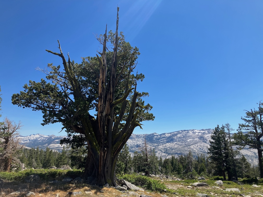
I still call the branches on the trail winter debris because it used to fall almost entirely during the winter and show up at snow melt, but in a sense it is a misnomer now, because dead red firs are coming down year-round now. In the Granite Chief, there are areas where more than half the red firs are dead, and other areas in which only a few are. Though not current, and focused on the northwest, the article Massive die-off hits fir trees across Pacific Northwest has some information. Apparently the die-off is not from a single cause, but a variety of factors. In any case, red firs are falling and will continue to fall, the trunks laying across trails and the dead branches scattered everywhere. Fire is not common in the red fir forest, so I can’t say whether suppression is contributing the the die-off or not.
I headed down Five Lakes Creek Trail to Diamond Crossing. This trail is worse every time I use it. It has not been logged out in more than 12 years, and there are more down trees every year, in some places I have to scramble up and down over several trees in a row, and the tread in between is covered with branches from the fallen trees. I get very frustrated by this trail and every time I use it, I wonder why I even try. I’ve not counted down trees recently, but it must be over 100. Use of this trail has dropped off over the years as other people abandon it as well. There are some footprints, but fewer every year.
I camped at my favorite spot beside Five Lakes Creek.
Next day I did a half day of trail maintenance on the Powderhorn Trail. I’d planned on more, but ran out of motivation and energy. As I said last year, the upper third and lower third of the trail are in decent shape, but the middle third is in poor condition and getting worse. My tool set is nippers and a fanno saw, but by Fiskars, so quality and fairly lightweight. But I have no tools to tackle down trees larger than about four inches, so anything large gets ignored. Sometimes I can clear a path to and from the down tree, so at least it is easy to step over without getting feet tangled in debris. One large tree, that has been down for years, is a slide-under tree. I had built a bypass of this tree last year, useable by trail-wise stock, but a red fir fell directly on the bypass and it is beyond me to clear it again. So the trail is yet again closed to equestrian use.
I hiked out to the Powderhorn Trailhead, then to Barker Pass, down the jeep road to Blackwood Canyon, and out the next morning to catch the TART bus to the Amtrak bus to home.
Water is abundant so far this year. In addition to the larger creeks, many smaller creeks and creeklets that are not year-round are still carrying water.
My Thermarest NeoAir sleeping pad has been deflating during the night for quite a while. I’ve got to find the leak and fix it.
Photos on Flickr:
- Album: https://www.flickr.com/photos/allisondan/albums/72177720319054780/
- Granite Chief Wilderness Collection: https://www.flickr.com/photos/allisondan/collections/72157637640215275/