
My September trip into the Granite Chief was to Picayune Valley, my favorite, and then north along the PCT to Donner Summit, and Truckee, running from the smoke.
I went in at Squaw Valley on the Granite Chief Trail, and camped just a bit north of the junction with the PCT. The air was reasonably clear up high, but very smoky below and in the Tahoe basin. The creeks crossed on the way up were either dry or very nearly dry.
Next day I headed south on the PCT, and took a side trip to the top of Granite Chief, which I’ve not done in a while. The smoke was thick in the valleys, and there were streaks of smoke aloft, but at this level the air was quite clear and I could see Sierra Buttes to the northwest. Also took a side trip to Little Needle Lake, which has a vague use trial leading from the junction of the Tevis Connector. The meadow has been grazed down, probably by bears, but the lake is still pretty full, sitting in a granite basin surrounded by volcanics.
I went by Whiskey Creek Camp, where there were a LOT of people, not surprising for Labor Day weekend. I headed over the Western States Trail to Picayune Valley. Late in the afternoon, a huge dark red smoke cloud towered overhead from the south, I assumed then from a nearby fire. But later found out it was just the smoke from the Creek Fire way south. The smoke in the valley came and went, but was mostly overhead and not ground level.
I explored all the way down Picayune to Talbot campground, and a ways up the Talbot Creek Trail, looking for possible shortcuts from that trail to the Middle Fork, rather than the long way around down the road. I followed out several old logging roads, but none went through. There is one more significant logging road to check, but for another time. Some maps show a trail paralleling Talbot Creek, but I was unable to find even traces of a trail going up along the creek, so I think this is false.
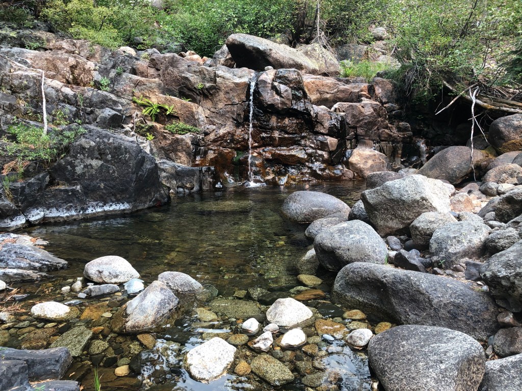
In Picayune, I also explored the benches between the trail and Picayune Creek, looking for petroglyphs that I’d been shown several years before on a American River Conservancy backpack. I found some of them, but not all. The trail is in good condition the entire way, someone has been maintaining it. Both Picayune Creek and the Middle Fork are quite low but still flowing. I camped near my usual spot, just above the creek in the area where the trail first switchbacks down toward the upper waterfall.
I spent the morning exploring the ledges south of the creek, fascinated as always by the micro variety of the metamorphic rock pattens and textures, but the air quality got worse and worse during the day, so I decided to head north in an attempt to get away from the smoke. So, back out of Picayune, to Whiskey Creek Camp, and north on the PCT. I camped at Granite Chief saddle, initially in a cold breeze that ascended through the night to a howling wind, and shifted from west to east.
In the morning, the crest was clear, and by mid-morning, it was completely clear to the east, all of the smoke being blown back into California. The wind increased with gusts to about 60 mph, and it was very hard to walk the ridge between Tinkers Knob and Anderson Peak, taking tiny steps and re-balancing after each one. The air east became the clearest I’ve ever seen during the summer, revealing mountain ranges across Nevada, which were later obscured by dust rather than smoke.
Seeking shelter from the wind, which I knew would not allow me to sleep that night if I were out in the open, I stayed at Benson Hut, a Sierra Club sponsored hut on the PCT that is supposed to be for winter use and emergencies, but I decided that gusts of 60 were sort of an emergency. The high winds also blew up existing fires, and the Bear Fire to the northwest produced huge streaks of smoke and cumulus clouds, and the winds aloft blew that south, initially missing the crest but eventually coming back eastward.
I continued north to Donner Summit (Hwy 80), and then west on the Donner Lake Rim Trail. To be honest, I hate this trail, at least the newer part of it. It was clearly laid out by bicyclists. There are looping switchbacks that lose maybe 10 feet over a quarter mile, adding unnecessary length to the trail. Ack! I am so tired of trails designed to keep bicyclists entertained, with no consideration for hikers. The switchback turns are deep dust pits as the bikers swoop around them and pulverize the tread. I am one of those people who believe we can’t “all just get along” on the trails. Mountain bikers need to have their own trails, which they build and pay for.
At any rate, I camped along the trail, and saw good stars for part of the night, but then the smoke descended and I was in heavy smoke the rest of the way into Truckee. Headed home on the Amtrak bus, as the train was more than five hours late, and seeming likely to lose more time before it got to Truckee.
Photos on Flickr: https://www.flickr.com/photos/allisondan/albums/72157715976003121
