
As is not unusual, I forgot to complete my post on the final trip of the 2019 season. I only had two trips in 2019 because deep snow kept me out of the mountains until mid-July, so instead I backpacked parts of the Bay Area Ridge Trail. And was back at work in mid-August, with my long weekends otherwise occupied.
This was another trip into the Hell Hole Trail for maintenance and trail finding. I have tried many times over the years to create a single track for the Hell Hole Trail from Steamboat Creek down to the intersection with the McKinstry Trail, but failed. This time I finally succeeded, but it took two days of walking up and down, and some editing of the resulting GPS track when I got off track despite all my prior explorations. The trail is now available on GaiaGPS in my Granite Chief folder, labeled as ‘Granite Chief HellHoleTrail lower’. I spent some time working on the least obvious spots, but the trail is still hard to follow and I’d not be surprised if others lost the trail. The gully section is marked with cairns (rock piles of three or more large rocks), but unfortunately so are many of the less than desirable routes. In 2020 I hope go back and define the trail better. I cleared and defined the trail from Steamboat Creek to where it first comes into the gully, which stays higher on the slope than many of the other routes. I think this may actually be a bear trail rather than the official route, but it works better than the others, so it is the one I’ve used. I’ve changed the track color to yellow, which means a route rather than a trail, since much of it is still hard to follow. This trail is not safe for horses. Most of it is, but there are three cruxes where the trail has slipped away and the tread is too precarious. Though, long ago, this was definitely a horse trail. I’ve wondered if the gully was similar when the horse trail was still usable, or if it developed afterwards and is why it is no longer horse-usable. Don’t know.
I also worked the trail section from the jeep road to Grayhorse Creek to the junction with the lower trail (above) and the route that heads up Five Lakes Creek and sort of connects to the McKinstry Trail. This 4WD, high clearance most of the way until it starts dropping into Grayhorse Creek, take off from FR 24 near the Hell Hole Guard Station (not in use). The part from the trailhead, which is unmarked, to Grayhorse Creek was well overgrown in many places, but is now followable. If you are coming down the jeep road, the trail starts at a little grassy bench just before the last very steep road down to the reservoir. Early in the season, Grayhorse Creek roars down its gorge and may be impossible to cross at the trail. I did some work on the remainder from the creek to the trail junction, but it is not as clear and may be hard to follow in places. If the reservoir is down, you can also follow the shoreline from the base of the 4WD road and informal camping area, to the old mining road, and thence up to the trail crossing. The junction with the Hell Hole Trail lower is not obvious, but is on top of a ridge just beyond a bouldery dry creek. This section is available in GaiaGPS as ‘Granite Chief HellHole connector’, orange on the map. Note that this is the same Grayhorse Creek that the Grayhorse Trail follows, but the two sections are about four miles from each other.
I’ve done a little bit of work on the trail section east of the junction, but can pretty much guarantee you won’t be able to follow it. In fact, there are several vague routes, which don’t always connect with each other. It will be many days work to find, and then make obvious, that trail. Nevertheless, there are many wonderful things to be seen along lower Five Lakes Creek and the Rubicon River, so if you are adventurous, don’t let the lack of a trail keep you out. You might even run into the fragments of trail I have worked.
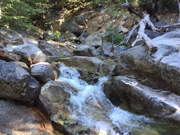
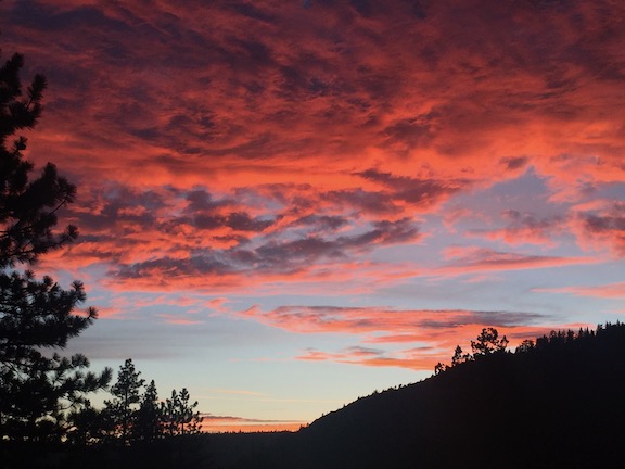
While doing trail work, I camped on the granite ridge which overlooks the Rubicon canyon, just south of Steamboat Creek. It is a great place to watch sunrises and sunsets, and the stars through the night. As I’ve stated elsewhere, Steamboat Creek is seasonal at the trail crossing, but it was still flowing for this trip. If it is dry at the crossing, either explore up or down the creek to find water, or just pick up water at Buckeye Creek on your way there. If you are coming up from the bottom, carry enough water to make Buckeye Creek in case Steamboat is dry. There are some small seeps in the gully, but I think they are seasonal as well.
In my previous Hell Hole Trail post, I had noted an old trail sign and wondered if it marked the old Buckeye Trail (no longer a trail) junction, and yes, it does. I followed the trail for a half mile, and it is clear that it was at one time, long ago, constructed, though I don’t know whether it an be followed further. Another exploration for another trip!
Photos on Flickr: https://www.flickr.com/photos/allisondan/albums/72157710205332747
Trails on GaiaGPS: https://www.gaiagps.com/datasummary/folder/5b4e23c555d0dc5fd992f16948fb09de/
